The best MTB trails around Angolo Terme
4.4
(1159)
6,994
riders
231
rides
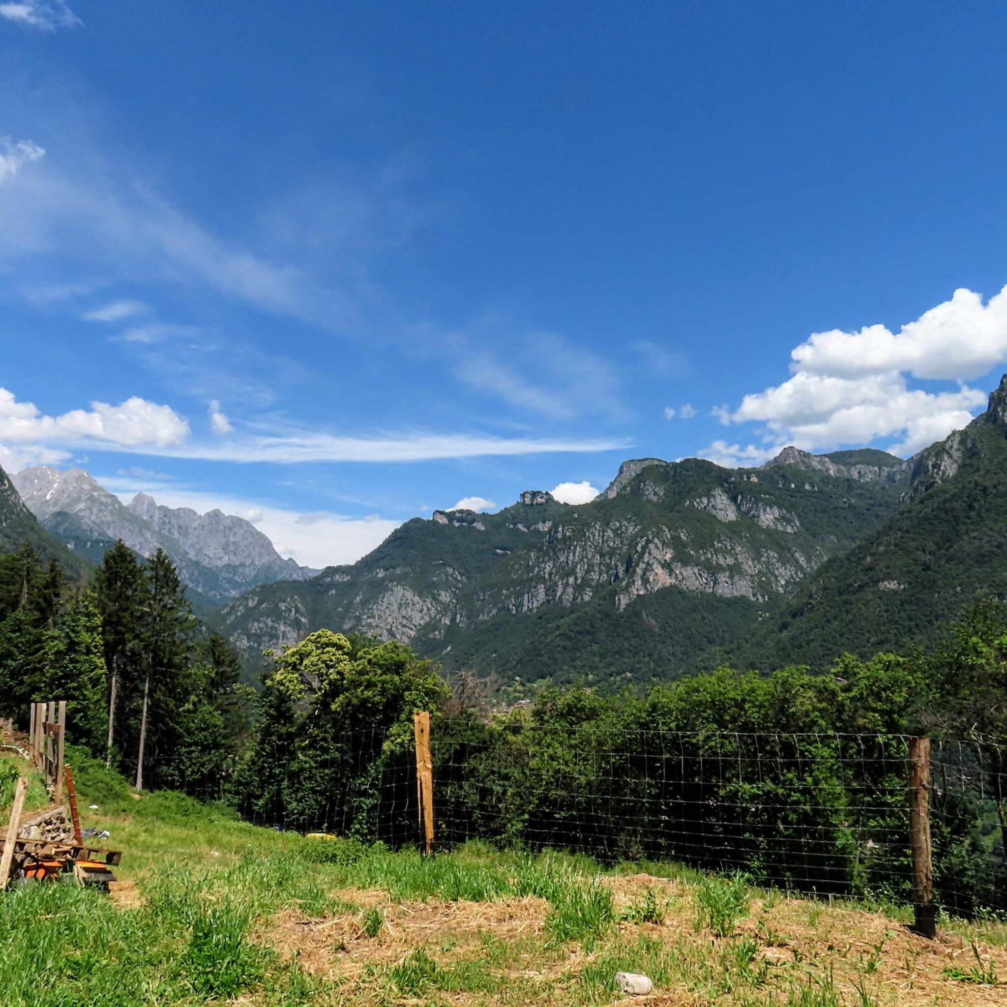
Mountain bike trails around Angolo Terme are set within the diverse landscapes of Val Camonica, characterized by mountain scenery, valleys, and natural paths. The region features varied terrain, including asphalt, gravel, dirt roads, and natural trails, catering to different riding styles. Riders can explore dense forests, open pastures, and routes offering views of Lake Iseo and the Adamello mountain range. This area provides a range of mountain biking opportunities suitable for various skill levels.
Best mountain bike trails around Angolo…
Last updated: July 6, 2026
1.0
(3)
3
riders
12.9km
01:30
650m
650m
Moderate mountain bike ride. Good fitness required. Suitable for all skill levels.
4.7
(32)
114
riders
39.9km
05:01
1,660m
1,660m
Hard mountain bike ride. Very good fitness required. Advanced riding skills necessary. Some portions of the route may require you to push your bike.

Sign up for free
4.1
(17)
69
riders
27.5km
02:11
720m
720m
Moderate mountain bike ride. Good fitness required. Advanced riding skills necessary.
4.7
(7)
71
riders
Easy mountain bike ride. Great for any fitness level. Suitable for all skill levels.
31
riders
25.8km
02:46
1,040m
1,040m
Hard mountain bike ride. Very good fitness required. Advanced riding skills necessary.
Get access to more routes and recommendations from other explorers.
Sign up for free
Already have an account?
Our route recommendations are based on thousands of hikes, rides, and runs completed by other people on komoot.
Start today with a free account
Your next adventure awaits.
Login or Signup


Other adventures around Angolo Terme

Tips from the Community

I have an unpleasant memory at the spa, a colleague had run out of water and was denied access (even from the tap) because they said they were closed and he couldn't use the cash register... then it was resolved at the Magnolini.
0
0

Costa Volpino is composed of the term Costa, which indicates the union of the hamlets of Corti, Branico, Qualino, Flaccanico and Ceratello, which arise on the coast above Lovere, and Volpino, the homonymous hamlet furthest north of the town, a historic strategic military garrison for controlling the entrance to the Volle Camonica.
0
0
Years of collaboration between organizations distributed along the Oglio River, the "backbone" of the route, have led to the development of a route approximately 280 km long that crosses Lombardy from north to south, crossing the provinces of Brescia, Bergamo, Cremona, and Mantua. The start is at the Tonale Pass, at an altitude of 1,883 meters in the heart of the Adamello Park mountains, while the finish is at an altitude of 21 meters, at the Ponte di Barche in San Matteo delle Chiaviche: the elevation gain is 1,862 meters along a route that is 80% asphalt and 20% dirt. The prestigious recognition of “most beautiful cycle path in Italy” for 2019 was awarded by the jury of experts of the Italian Green Road Award, presented in February 2019 during the Cosmobike Show event, held at the Verona Fair.
0
0
Along the Oglio cycle path there are many benches placed in strategic positions
0
0

Wide bridge with a beautiful bottom and a splendid view of the Oglio
0
0

Perfect for driving. Beautiful panorama.
0
1

Spectacular place with breathtaking view
0
0

Complete menu for a lunch worthy of the best restaurant at reasonable prices. The tagliata and cakes made by the restaurateurs are very good. Efficient family management with the possibility of having lunch both inside (better to book), but also in the equipped outdoor area. Congratulations!
1
0
Frequently Asked Questions
How many mountain bike trails are available around Angolo Terme?
Angolo Terme offers a wide selection of mountain bike trails, with over 240 routes available. These trails cater to various preferences, ranging from easy rides to challenging ascents through the diverse landscapes of Val Camonica.
Are there mountain bike trails suitable for beginners or families in Angolo Terme?
Yes, Angolo Terme provides trails for all skill levels. There are 33 easy routes perfect for beginners or families. The region research also highlights routes around Passo della Presolana as suitable for families, even with child seats. For a moderate option that is popular, consider the Lago Moro da Darfo Boario — Giro ad anello, which offers scenic views.
What kind of terrain can I expect on the mountain bike trails in Angolo Terme?
The mountain bike trails around Angolo Terme feature a diverse range of terrain, including asphalt, gravel, dirt roads, and natural paths. You'll ride through dense forests, open pastures, and along valleys, with some routes offering significant elevation changes.
Are there any circular mountain bike routes in the area?
Yes, many routes around Angolo Terme are designed as loops, allowing you to start and finish in the same location. Examples include the popular Lago Moro da Darfo Boario — Giro ad anello and the more challenging Baita Termen – L.L. Magnolini Hut loop from Passo della Presolana.
What natural features or landmarks can I see along the mountain bike trails?
The trails offer stunning mountain scenery, including views of the Adamello mountain range and the Presolana mountains. You can also enjoy picturesque valleys like Val Camonica and the Valle di S. Giovanni. Some routes provide views towards Lake Iseo. Notable attractions include the historical Gleno Dam and Lake, and the area is rich in forests and pastures. You might also encounter highlights such as the Pagani Cave or the Büs dei Ladrù (Thieves' Hole) Gorge.
Are there any challenging mountain bike routes for experienced riders?
Absolutely. For experienced riders seeking a challenge, Angolo Terme offers 119 difficult routes. A notable option is the Baita Termen – L.L. Magnolini Hut loop from Passo della Presolana, a 40 km path with significant elevation gain. Another demanding route is the Colma di Marucolo Pass – Dosso Rotondo Hut loop from Darfo-Corna, covering over 56 km with substantial climbing.
What do other mountain bikers enjoy most about the trails in Angolo Terme?
The komoot community highly rates the mountain bike trails in Angolo Terme, with an average score of 4.4 stars from over 1,400 reviews. Riders often praise the diverse landscapes, the stunning mountain scenery, and the variety of routes that cater to different skill levels, from easy family rides to challenging ascents.
Is it possible to bring my dog on the mountain bike trails?
While specific dog-friendly designations for each trail are not always listed, many natural paths and forest roads in the Angolo Terme region are generally suitable for well-behaved dogs on a leash. Always ensure your dog is accustomed to longer rides and be mindful of local regulations and other trail users.
Are there places to eat or refresh along the mountain bike routes?
Yes, particularly around Passo della Presolana and Monte Pora, you can find convenient refreshment points. These include barbecue areas, farmsteads, mountain huts, and alpine pastures, offering opportunities to refuel during your ride.
What is the best time of year to go mountain biking in Angolo Terme?
The spring and autumn months are generally ideal for mountain biking in Angolo Terme, offering pleasant temperatures and vibrant scenery. Summer can also be good, especially for higher-altitude routes, though some lower trails might be warmer. Winter typically brings snow to higher elevations, making many trails unsuitable for mountain biking.
Where can I park when accessing mountain bike trails in Angolo Terme?
Parking is generally available at common starting points for trails, such as near Passo della Presolana or in towns like Darfo-Corna, which serve as access points for routes like the Colma di Marucolo Pass – Dosso Rotondo Hut loop. Specific parking information can often be found on individual route pages on komoot.
Can I reach the mountain bike trailheads using public transport?
Angolo Terme is situated in Val Camonica, which has some public transport options. While direct access to every trailhead by public transport might be limited, major towns like Darfo-Corna, which are starting points for several routes, are generally accessible. It's advisable to check local bus schedules for connections to specific areas or trailheads.
Most popular routes around Angolo Terme
Most popular attractions around Angolo Terme

Get inspired with the komoot mobile app


Explore more
Browse the best MTB trails in other regions.
