The best road cycling routes around Barcis
4.3
(111)
3,349
riders
59
rides
Road cycling routes around Barcis are situated in a mountainous region of Friuli-Venezia Giulia, characterized by the clear waters of Lake Barcis and surrounding peaks. The terrain features significant elevation changes, offering challenging climbs and descents through valleys and along lake shores. The area includes a mix of open roads and sections passing through forested areas, providing varied cycling environments.
Best road cycling routes around Barcis
- The most popular road cycling route is Ascent to Monte Cesen – Piancavallo climb…
Last updated: October 9, 2026
4.3
(4)
199
riders
29.8km
02:12
1,150m
1,150m
Hard road ride. Very good fitness required. Mostly well-paved surfaces and easy to ride.
4.5
(6)
92
riders
Hard road ride. Very good fitness required. Mostly well-paved surfaces and easy to ride.

3.0
(1)
52
riders
39.9km
02:24
910m
910m
Hard road ride. Very good fitness required. Mostly well-paved surfaces and easy to ride.
4.5
(4)
48
riders
52.7km
02:36
720m
720m
Moderate road ride. Good fitness required. Mostly well-paved surfaces and easy to ride.
5.0
(3)
26
riders
46.5km
02:17
680m
680m
Moderate road ride. Good fitness required. Mostly well-paved surfaces and easy to ride.
Get access to more routes and recommendations from other explorers.
Already have an account?
Our route recommendations are based on thousands of hikes, rides, and runs completed by other people on komoot.
Start today with a free account
Your next adventure awaits.


Other adventures around Barcis

Tips from the Community

Maniago, located at the foot of the Carnic Prealps in the Pordenone foothills, is a Friulian town famous throughout the world for its centuries-old tradition in cutlery and ironworking. The beating heart of the historic center is Piazza Italia, one of the largest in the region, dominated by the 15th-century cathedral in Gothic-Renaissance style and surrounded by elegant buildings and historic fountains. Strolling through its streets, you can breathe in a hardworking and welcoming atmosphere, enriched by the presence of the Museum of Blacksmithing and Cutlery, which tells the story of the evolution of local artisanal ingenuity. Surrounded by unspoiled nature, Maniago also represents a gateway to the evocative surrounding valleys, offering a perfect blend of culture, industrial history, and alpine landscapes. A fascinating destination where artisanal knowledge meets the beauty of the territory.
0
0
The Ponte sul Cellina is an extraordinary feat of engineering and a striking viewpoint immersed in the wild nature of the Carnic Prealps. Suspended over the crystal-clear waters of the Cellina stream, the structure offers a spectacular passage along the famous Valcellina, connecting banks shaped by time and erosion. Its privileged position allows you to admire the imposing limestone gorges and the turquoise reflections of the river, offering visitors a visual experience of great emotional impact. Beyond its logistical and infrastructural function, the bridge represents a symbol of union between man and the territory, integrating harmoniously into a protected landscape of rare beauty. Crossing it means immersing yourself in an uncontaminated natural setting, where the contrast between constructive ingenuity and the power of nature creates a unique and unforgettable atmosphere.
0
0

Good sea view from a few spots.
2
0
The Rifugio Bornass is located at about 760 meters above sea level in the municipality of Aviano, nestled along the scenic road that climbs towards the well-known ski resort of Piancavallo. Immersed in the lush woods of the Carnic Prealps, this characteristic refreshment point offers a splendid view of the Pordenone plain and the Gulf of Trieste on clearer days. Hidden among the vegetation, the refuge is an ideal starting and ending point for hikers, cyclists, and trekking enthusiasts, thanks to the numerous trails that wind through the surrounding area. The interior environment is warm and welcoming, characterized by classic mountain hospitality, where you can taste typical dishes of the Friulian tradition and local zero-kilometer products. It represents a perfect stop for those seeking relaxation, unspoiled nature, and good food in an informal and regenerating atmosphere.
0
0

The new arch bridge over Lake Barcis, inaugurated in the early months of 2021, is a strategic infrastructure located near the Ponte Antoi dam. It is a single-span arch bridge, approximately 78 meters long with an overall width of 12.90 meters. It allows the transit of heavy vehicles — particularly those used for transporting inert materials during the basin's de-silting operations — avoiding passage over the historic dam or through the inhabited center of Barcis. https://www.fvgstrade.it/it/20585/fase-finale-varo-ponte-di-barcis
0
0
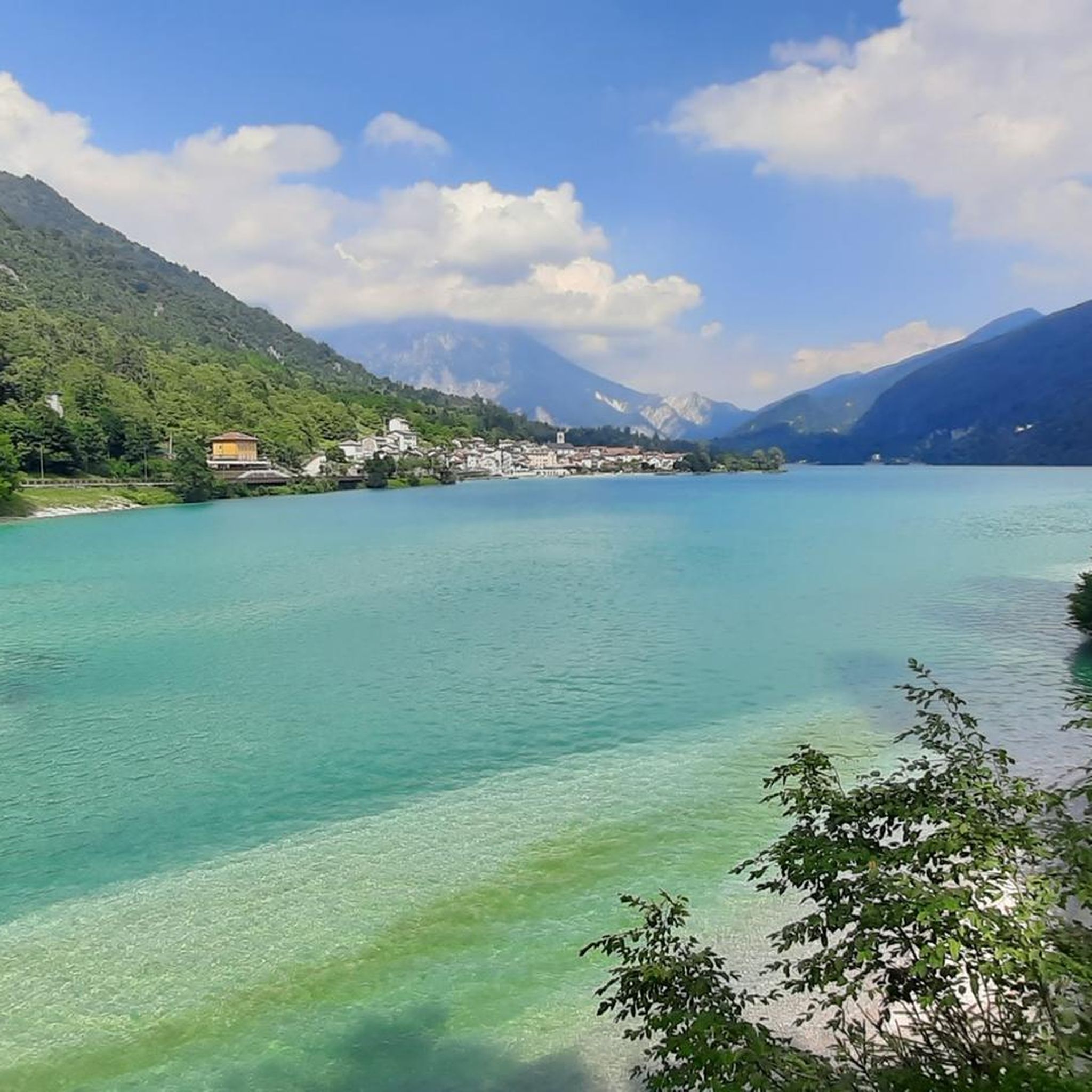
Lake Aprilis, better known as Lake Barcis, is an artificial basin created in 1954 by damming the Cellina stream near the Ponte Antoi gorge. It owes its characteristic brilliant green color to the combination of sunlight with minerals and calcareous sediments carried by the water. The presence of dense beech and fir forests along the banks accentuates the emerald green tones.
1
0
Lake Aprilis, better known as Lake Barcis, is an artificial basin created in 1954 by damming the Cellina stream near the Ponte Antoi gorge. Its characteristic brilliant green color is due to the combination of sunlight with minerals and calcareous sediments carried by the waters. The presence of dense beech and fir forests along the banks accentuates the emerald green tones.
1
0

The Tambre Clock Tower (Tambruz hamlet) is a charming historical point of interest and an important landmark for cycling and hiking enthusiasts. It is a monument and historical site located in the municipal territory of Tambre (Belluno), positioned along the routes leading up to the splendid natural setting of Cansiglio (Alpago).
0
0
Frequently Asked Questions
How many road cycling routes are available in the Barcis area?
The Barcis region offers a wide variety of road cycling routes, with over 60 tours available on komoot. These routes cater to different skill levels, from moderate loops to challenging mountain ascents.
Are there easy road cycling routes suitable for beginners in Barcis?
Yes, Barcis has options for less experienced road cyclists. There are 12 easy routes available, providing a gentler introduction to the region's beautiful scenery without overly demanding climbs.
Where can I find challenging road bike climbs in the Barcis region?
For experienced road cyclists seeking a challenge, Barcis offers 22 difficult routes with significant elevation gains. A notable option is the Ascent to Monte Cesen – Piancavallo climb loop from Piancavallo / Plancjaval, which features over 3,700 feet (1,100 meters) of climbing over 17.5 miles (28.1 km).
Are there long-distance road cycling routes around Barcis?
Yes, the Barcis area includes several longer road cycling routes. For instance, the Footbridge over Lake Barcis – Piancavallo climb loop from Barcis / Barce covers nearly 37 miles (59 km) with substantial climbing, offering a full day's adventure.
What do other cyclists say about road cycling in Barcis?
The road cycling routes in Barcis are highly regarded by the komoot community, holding an average rating of 4.6 stars from over 100 reviews. More than 3,000 road cyclists have explored the varied terrain, often praising the stunning lake views and challenging mountain sections.
Are there circular road bike routes around Barcis?
Many of the road cycling routes in Barcis are designed as loops, allowing you to start and finish in the same location. Examples include the Footbridge over Lake Barcis – Lake Barcis loop from Barcis / Barce, which takes you around the lake, and the Lake Barcis – Water Fountain loop from Piancavallo / Plancjaval.
What scenic viewpoints can I expect on Barcis cycling routes?
Road cycling routes around Barcis offer numerous scenic viewpoints, particularly those overlooking Lake Barcis and the surrounding peaks. The First Viewpoint (Skywalk del Dint) is a popular spot offering panoramic vistas. Routes often wind through valleys and along the lake shore, providing continuous picturesque scenery.
What is the best time of year for road biking in Barcis?
The mountainous terrain around Barcis means that spring, summer, and early autumn generally offer the most favorable conditions for road cycling. During these seasons, temperatures are milder, and the roads are typically clear of snow, allowing for comfortable rides and access to higher elevations.
Are there any interesting landmarks or attractions to see along the road cycling routes?
Yes, the Barcis region is rich in natural and cultural attractions. Cyclists can enjoy views of Lake Barcis itself, or pass by the Gorgazzo Spring. For those interested in mountain scenery, routes may offer glimpses of peaks like Manera Peak (Cimon del Cavallo).
Are there family-friendly road cycling routes in Barcis?
While many routes in Barcis feature significant elevation changes, there are easier options that can be more suitable for families or those looking for a relaxed ride. These routes tend to stick closer to the lake or lower valleys, avoiding the most strenuous climbs. Look for the 'easy' graded routes on komoot for suitable options.
How long does it typically take to cycle around Lake Barcis?
A popular route like the Footbridge over Lake Barcis – Lake Barcis loop from Barcis / Barce, which covers about 27.5 miles (44.2 km) around the lake region, is often completed in approximately 2 hours and 8 minutes, depending on your pace and stops.
Where can I find parking for road biking in Barcis?
Parking is generally available in and around the main town of Barcis, as well as at popular starting points for routes, such as Piancavallo / Plancjaval. It's advisable to check local signage for specific parking regulations and availability, especially during peak seasons.
Most popular attractions around Barcis

Get inspired with the komoot mobile app


Explore more
Browse the best Road cycling routes in other regions.
