The best mountain hikes around Barisciano
4.9
(73)
507
hikers
9
hikes
Mountaineering routes around Barisciano are situated within the Gran Sasso e Monti della Laga National Park, characterized by high-altitude plateaus, rugged peaks, and extensive limestone formations. The region features prominent summits, deep valleys, and alpine environments, offering challenging terrain for experienced mountaineers. Elevations in the area contribute to varied landscapes, from rocky slopes to open grasslands.
Best mountaineering routes around Barisciano
- The most popular mountaineering route is Campo Imperatore – Corno Grande loop from Campo Imperatore, a 6.7 miles…
Last updated: October 8, 2026
4.9
(37)
260
hikers
10.7km
05:22
770m
770m
Hard mountaineering route. Very good fitness required. Sure-footedness, sturdy shoes and alpine experience required.
5.0
(1)
12
hikers
Moderate mountaineering route. Great for any fitness level. Mostly accessible paths. Sure-footedness required.

5.0
(1)
17
hikers
8.52km
03:36
410m
410m
Hard mountaineering route. Good fitness required. Sure-footedness, sturdy shoes and alpine experience required.
8
hikers
9.94km
04:04
530m
530m
Hard mountaineering route. Good fitness required. Sure-footedness, sturdy shoes and alpine experience required.
5.0
(1)
12
hikers
11.4km
05:51
550m
550m
Hard mountaineering route. Very good fitness required. Sure-footedness, sturdy shoes and alpine experience required.
Get access to more routes and recommendations from other explorers.
Already have an account?
Our route recommendations are based on thousands of hikes, rides, and runs completed by other people on komoot.
Start today with a free account
Your next adventure awaits.
Tips from the Community

A beautiful way to see the Aquilano and Teramano sides of Gran Sasso without too much effort
0
0
The summit is easily reachable from the hotel in Campo Imperatore or from Vado di Corno. Suitable for those approaching the world of high-altitude hiking.
0
0

The panoramas once you climb from Campo Imperatore are all majestic
0
0
Built there because the night sky from up there touches the heart and relaxes the spirit. In any case, a welcome sight when you descend :)
0
0

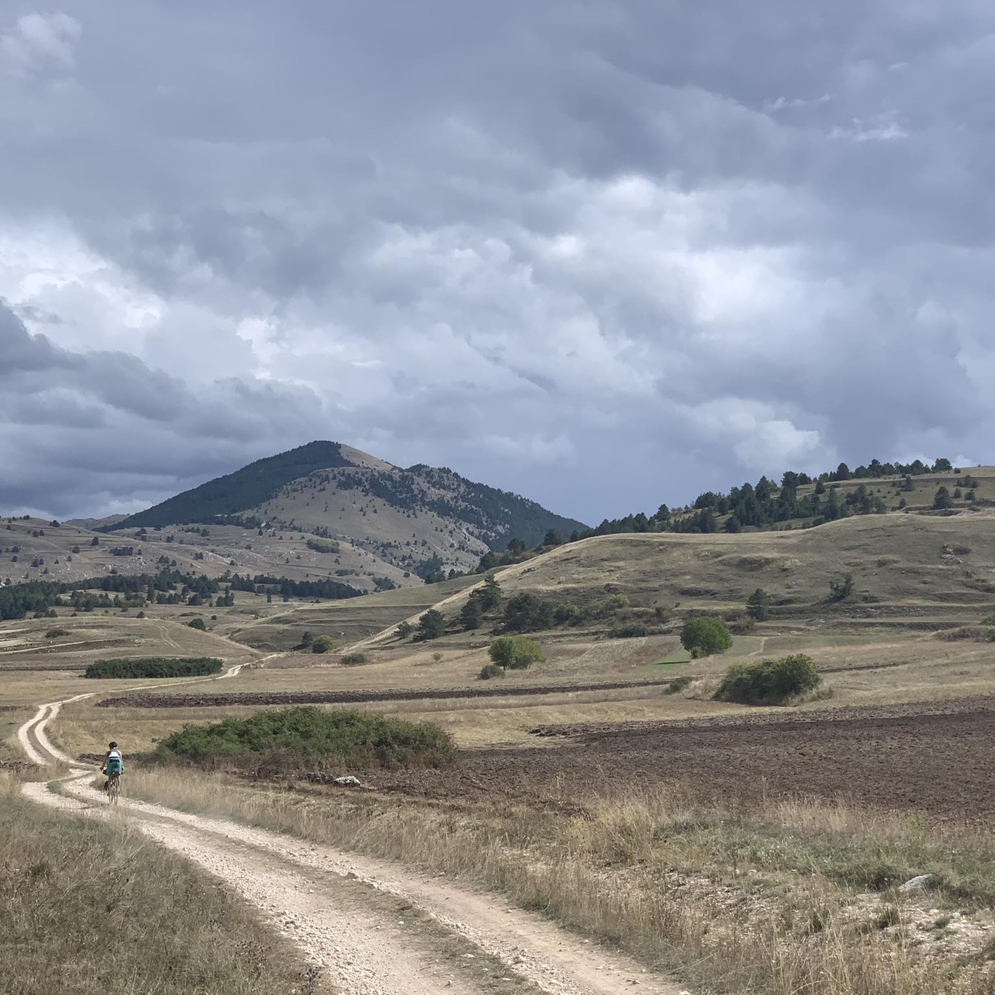
Campo Imperatore is an absolute must-see due to its otherworldly, vast mountain landscape, also known as 'Little Tibet' (Piccolo Tibet). It is one of the largest and highest plateaus in Europe (located at approx. 1,800 to 2,100 meters).
4
0
The endpoint by car is the large mountain square Piazzale di Campo Imperatore (2,130 meters). The breathtaking mountain road SS17bis leads you from the valley right up to the doors of the Hotel Campo Imperatore and the Astronomical Observatory. Why shouldn't you miss Campo Imperatore? Because here you are right in the middle of the high mountains without a strenuous climb. At an altitude of 2,130 meters, you are surrounded by impressive mountain peaks and begin one of the most beautiful hiking areas in the Apennines. The car journey there is an experience in itself: a winding road through the spectacular landscape of 'Little Tibet', where you often encounter horses, cows, and large flocks of sheep along the way. At the top, you will also find a unique mix of nature, history, and culture, with the historic hotel where Mussolini was imprisoned, the highest church in Italy, the astronomical observatory, and cozy food trucks where you can enjoy local specialties such as fresh pecorino and generously filled sandwiches.
5
0
The Funivia del Gran Sasso d'Italia (the cable car to Campo Imperatore) was originally opened in 1934 and was recently reopened on June 15, 2026, after a period of significant maintenance. The cable car connects the valley station in Fonte Cerreto (Assergi, at 1,117 meters) with the Campo Imperatore plateau (at 2,130 meters). The cable car to Campo Imperatore has a rich history. The first installation was built in 1934 during the reign of Benito Mussolini and was considered a technical masterpiece and one of the longest cable cars in the world at the time. It also played a role in the spectacular liberation of Mussolini during World War II. The original cabins remained in use until 1985. After a complete modernization, the current cable car was put into operation in 1988. With two cabins for 100 passengers each, it covers a distance of over 3 kilometers and an altitude difference of 1,013 meters in just seven minutes. Following extensive safety works, including the replacement of the support cables, the cable car has been fully operational again since June 2026. Opening hours: During the summer season (until the end of August 2026), the cable car to Campo Imperatore is open daily from 07:30 to 19:30. The cabins depart every 30 minutes. Please note that in case of strong winds or other extreme weather conditions, the cable car may be temporarily taken out of service to ensure the safety of travelers.
6
1
Campo Imperatore is one of Italy's most impressive natural areas. This vast, treeless high plain at an altitude of approximately 2,000 meters is not called 'Little Tibet' for nothing. Surrounded by the rugged peaks of the Gran Sasso massif, it offers a spectacular setting for hikers of all levels. From relaxed walks across the rolling plateau between grazing sheep and horses to challenging climbs of Monte Aquila, the Rifugio Duca degli Abruzzi, or even Corno Grande (2,912 m), the highest peak in the Apennines. Thanks to accessibility by car or cable car, you can start your hike right in the middle of the high mountains, with breathtaking panoramas along the way and a landscape that has served as a backdrop for countless films.
8
1
Frequently Asked Questions
What is the general difficulty level of mountaineering routes around Barisciano?
The mountaineering routes around Barisciano are primarily designed for experienced individuals. All 11 available routes are rated as difficult, featuring challenging ascents and traverses within the high-altitude Gran Sasso e Monti della Laga National Park.
Are there any family-friendly mountaineering options in Barisciano?
Given the challenging nature of the terrain and the fact that all routes are rated as difficult, mountaineering around Barisciano is generally not considered suitable for families with young children or those seeking easy walks. The routes involve significant elevation changes and rugged paths.
Can I bring my dog on the mountaineering trails near Barisciano?
While some trails in national parks may allow dogs, the mountaineering routes around Barisciano are difficult and traverse high-alpine environments. It's crucial to check specific regulations for the Gran Sasso e Monti della Laga National Park regarding dogs, especially in sensitive areas or during certain seasons. Always ensure your dog is fit for strenuous, high-altitude conditions and kept on a leash.
What is the best season for mountaineering in Barisciano?
The best season for mountaineering in Barisciano, particularly in the Gran Sasso e Monti della Laga National Park, is typically from late spring to early autumn (June to September). During these months, snow has generally melted from higher elevations, and weather conditions are more stable, making the challenging routes more accessible.
What are some notable natural attractions I might see near the mountaineering routes?
The region around Barisciano offers stunning natural beauty. You can explore impressive geological formations like the Scoppaturo Canyon or the dramatic Val Maone. For those interested in water features, the Stiffe Waterfall is also a significant highlight in the broader area.
Are there any circular mountaineering routes available?
Yes, several routes around Barisciano are circular. For instance, you can tackle the challenging Campo Imperatore – Corno Grande loop from Campo Imperatore, which takes you to the highest peak in the Apennines. Another excellent loop is the Campo Imperatore – Pizzo Cefalone loop from Campo Imperatore, offering expansive views.
What should I wear for mountaineering in Barisciano?
Given the high-altitude and rugged nature of the Gran Sasso e Monti della Laga National Park, it's essential to wear appropriate mountaineering gear. This includes sturdy hiking boots with good ankle support, layered clothing suitable for varying weather conditions, waterproof and windproof outer shells, and sun protection. Always carry enough water, snacks, and a first-aid kit.
What are the conditions like for winter mountaineering in Barisciano?
Winter mountaineering in Barisciano is extremely challenging and suitable only for highly experienced individuals with proper winter equipment (crampons, ice axe, avalanche safety gear) and knowledge. The high-altitude plateaus and peaks of Gran Sasso are prone to heavy snowfall, strong winds, and rapidly changing weather, significantly increasing avalanche risk and navigational difficulties.
Where can I find parking for the mountaineering trailheads?
Many of the mountaineering routes, such as those starting from Campo Imperatore, have designated parking areas. For example, routes like the Campo Imperatore – Rifugio Duca degli Abruzzi loop typically begin from accessible points with parking facilities. It's advisable to check specific trailhead information for each route on komoot for precise parking details.
Are there any longer distance mountaineering routes around Barisciano?
For those seeking longer challenges, the region offers routes like the Corno Pass – Mount Brancastello loop from Monte Aquila, which covers over 11 km and involves significant elevation gain, making it a substantial day out in the mountains.
What do other mountaineers enjoy most about the routes in Barisciano?
The mountaineering routes around Barisciano are highly rated by the komoot community, with an average score of 4.9 stars from over 40 reviews. Reviewers often praise the breathtaking panoramic views of the Gran Sasso massif, the challenging yet rewarding ascents, and the pristine alpine environments that define the region.
Is public transport available to reach the mountaineering trailheads?
Public transport options to the high-altitude trailheads, such as Campo Imperatore, can be limited, especially outside of peak tourist season. While some bus services might operate during summer, it's often more practical to reach these starting points by car. Always check local transport schedules in advance if you plan to rely on public transit.
Most popular attractions around Barisciano

Get inspired with the komoot mobile app


Explore more
Browse the best Mountain Hikes & Routes in other regions.
