The best walks and hikes around Carbognano
4.3
(749)
2,478
hikers
110
hikes
Hiking around Carbognano offers access to a landscape characterized by volcanic hills, dense beech forests, and the serene waters of Lake Vico. The region, situated in the Viterbo province of Italy, provides a variety of terrains for outdoor exploration. Trails often traverse ancient paths and offer views of the surrounding natural environment. This area is suitable for those seeking both gentle walks and more challenging ascents.
Best hiking trails around Carbognano
- The most popular hiking route is Monte Venere Loop…
Last updated: July 5, 2026
4.4
(43)
138
hikers
12.8km
04:05
530m
510m
Moderate hike. Good fitness required. Easily-accessible paths. Suitable for all skill levels.
4.2
(19)
83
hikers
4.58km
01:36
230m
230m
Easy hike. Great for any fitness level. Easily-accessible paths. Suitable for all skill levels.

Sign up for free
4.5
(24)
61
hikers
Moderate hike. Good fitness required. Easily-accessible paths. Suitable for all skill levels.
4.7
(18)
77
hikers
Moderate hike. Good fitness required. Easily-accessible paths. Suitable for all skill levels.
4.4
(9)
43
hikers
Moderate hike. Good fitness required. Easily-accessible paths. Suitable for all skill levels.
Get access to more routes and recommendations from other explorers.
Sign up for free
Already have an account?
Our route recommendations are based on thousands of hikes, rides, and runs completed by other people on komoot.
Start today with a free account
Your next adventure awaits.
Login or Signup

Tips from the Community

Bilious Monte Cimino towards Viterbo
0
0

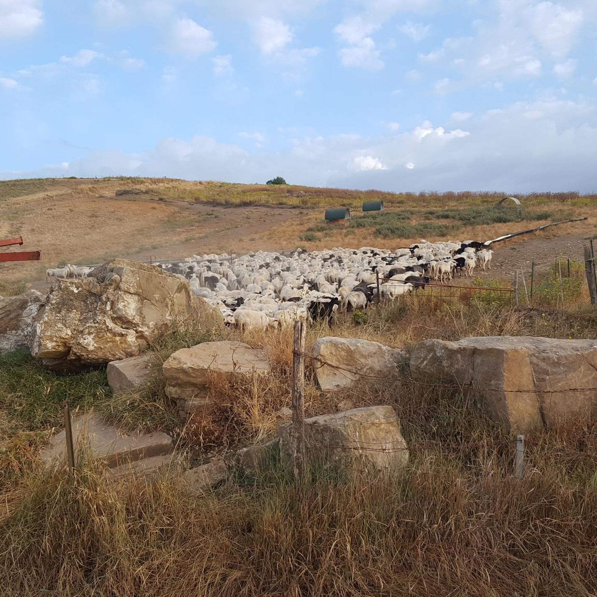
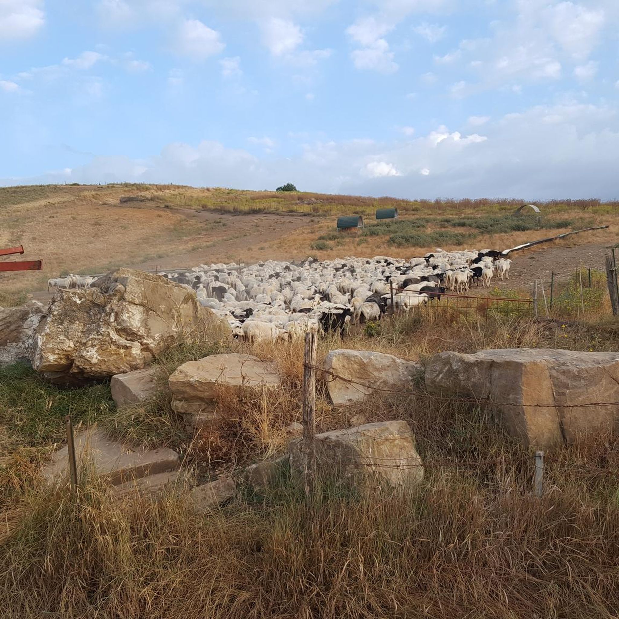
About halfway (when you're on the plain near the houses after the woods), be careful not to turn into the tall grass where the app tells you to go, but continue along the road alongside the houses. I encountered a Maremma Sheepdog that came toward me barking. Fortunately, when I calmly turned back, it stopped. Also be careful on the long stretch of dirt road immediately afterward; there are cattle and sheep, along with many dogs. Luckily, the shepherd was there to keep them in check.
0
0
Following this path, just before reaching the devil's well, it is not clear where to go, the path disappears and also the white and red signs. We had to go a bit by intuition and take a very steep climb in the woods to get there. Once we reach the well, the path continues easily until the end.
0
1

Be careful not to lean out!
0
0
Let yourself be enchanted by these centuries-old trees
0
0
The sun filtering through the beech leaves makes everything magical.
0
0
Be careful, as you may encounter wolves along the way.
0
0
My husband and I did this trail and a few others for a 13.5 km walk up and down Monte Venere. It was great. Watch out for pozzo del diavolo. My husband fell in, and now I'm looking for a new husband.
0
0
Frequently Asked Questions
How many hiking trails are available around Carbognano?
There are over 115 hiking routes around Carbognano, offering a wide range of options for all skill levels. These trails are highly rated by the komoot community, with an average score of 4.4 stars from over 700 reviews.
Are there easy hiking trails suitable for beginners or families in Carbognano?
Yes, Carbognano offers 44 easy hiking trails, many of which are suitable for families. An excellent choice is the Devil’s Well Cave loop from ZSC Monte Venere, an easy 2.8-mile (4.6 km) path that provides a shorter exploration around Monte Venere.
What are the options for challenging hikes near Carbognano?
For those seeking a more demanding experience, there are 11 difficult hiking routes around Carbognano. One such route is the Monte Venere Beech Forest – Beaches of Lake Vico loop from Riserva Naturale Regionale Lago di Vico, which covers nearly 20 km and features diverse terrain.
Are there any circular hiking routes in Carbognano?
Yes, many of the trails around Carbognano are circular, allowing you to start and end at the same point. A popular option is the Monte Venere Loop, a 7.9-mile (12.8 km) moderate trail that explores the slopes of Monte Venere.
What kind of natural attractions can I see along the hiking trails?
The trails around Carbognano often lead through volcanic hills, dense beech forests, and near the serene waters of Lake Vico. You can explore highlights such as the Devil’s Well Cave (Monte Venere) or enjoy views of Lake Vico. Some routes also pass by the Corchiano Waterfall.
What is the best time of year to go hiking in Carbognano?
The region around Carbognano is beautiful throughout much of the year. Spring and autumn offer pleasant temperatures and vibrant foliage, making them ideal for hiking. Summer can be warm, but trails through the dense beech forests provide welcome shade. Winter hiking is also possible, especially on lower elevation trails, though some higher routes might require more preparation.
Are there any historical or cultural landmarks to explore near the trails?
Absolutely. Beyond natural beauty, the area boasts historical sites. You can visit the Historic Center of Sutri or the Corchiano Historic Village and Gorges. Some trails also intersect with ancient paths like the Via Francigena.
How long do hikes in Carbognano typically take?
Hiking durations vary significantly depending on the route's length and difficulty. For example, the easy Devil’s Well Cave loop takes about 1 hour 35 minutes, while the moderate Monte Venere Beech Forest – Devil’s Well Cave loop is typically completed in about 3 hours 8 minutes.
What should I pack for a day hike in Carbognano?
For a day hike, it's advisable to pack essentials such as sufficient water, snacks, appropriate footwear for varied terrain, sun protection (hat, sunscreen), and a light jacket, as weather can change. A map or a GPS device is also recommended for navigation, especially on longer routes.
Are there less crowded hiking trails around Carbognano?
While popular routes like the Monte Venere loops can see more visitors, the extensive network of over 115 trails means you can often find quieter paths. Exploring some of the less-trafficked moderate or difficult routes, or hiking during off-peak hours, can lead to a more solitary experience.
Are there any trails that offer scenic viewpoints?
Yes, many trails provide stunning vistas of the surrounding landscape. Given the region's volcanic hills, you'll find elevated points offering panoramic views, particularly overlooking Lake Vico. Look for routes that ascend Monte Venere or other hills for the best viewpoints.
What is the general terrain like for hiking in Carbognano?
The terrain around Carbognano is characterized by volcanic hills, which means you can expect varied elevations, from gentle slopes to more challenging ascents. Trails often wind through dense beech forests and ancient paths, with some routes skirting the shores of Lake Vico, offering a mix of forest floor, dirt tracks, and sometimes rocky sections.
Most popular attractions around Carbognano

Get inspired with the komoot mobile app


Explore more
Browse the best Hikes in other regions.
