The best walks and hikes around Civitaluparella
3.9
(66)
356
hikers
19
hikes
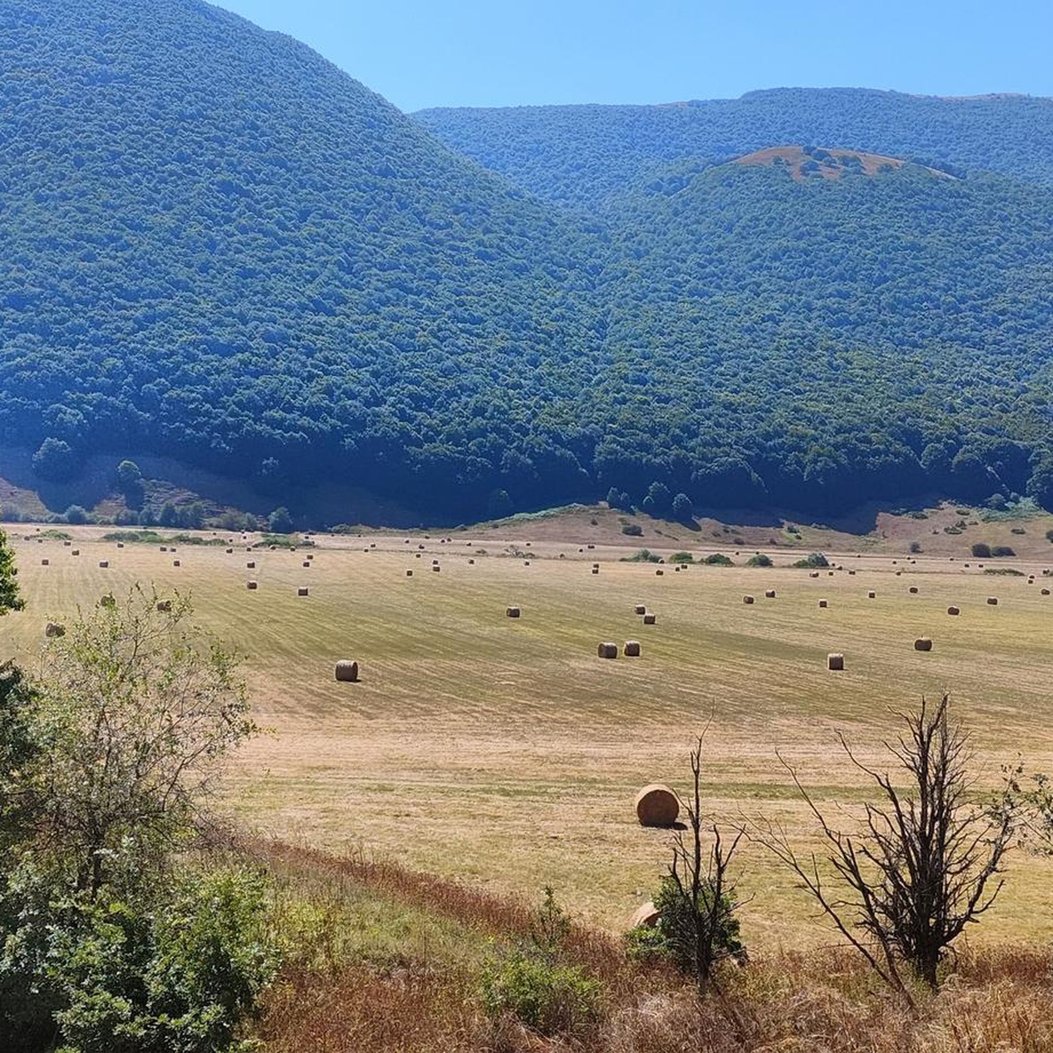
Hiking around Civitaluparella offers diverse terrain, situated on a limestone spur overlooking the Sangro River valley. The region is sheltered by the Maiella massif and features a blend of rugged landscapes and panoramic views. Hikers can explore several woodlands, including the Defense Forest and Cese Forest, which frame small lakes like Pantera Lake. The area is characterized by natural beauty, with features such as the Cascate del Verde Regional Natural Reserve.
Best hiking trails around Civitaluparella
- The most popular hiking route is Regional Natural Reserve Cascate del Verde, a 2.9 miles (4.7 km) trail that takes 1 hour 21 minutes to complete. This path leads to the waterfall formed by the Parello stream.
- Another top favourite among local hikers is Forest House loop from Rosello, a moderate 5.6 miles (9.0 km) path. This route immerses hikers in the region's dense woodlands, offering a natural setting.
- Local hikers also love the View of the Cascate del Verde loop from Borrello, a 3.1 miles (4.9 km) trail leading through the natural reserve, often completed in about 1 hour 29 minutes.
- Hiking around Civitaluparella is defined by river valleys, dense woodlands, and natural waterfalls. The network offers options for different ability levels, from easy walks to more challenging treks.
- The routes in Civitaluparella are highly rated by the komoot community with an average score of 4.0 stars from over 60 reviews. More than 290 hikers have used komoot to explore Civitaluparella's varied terrain.
Last updated: July 5, 2026
4.3
(3)
7
hikers
4.66km
01:22
120m
120m
Easy hike. Great for any fitness level. Easily-accessible paths. Suitable for all skill levels.
3.9
(9)
63
hikers
4.94km
01:29
150m
150m
Easy hike. Great for any fitness level. Easily-accessible paths. Suitable for all skill levels.

Sign up for free
4.3
(3)
13
hikers
9.05km
02:51
340m
340m
Moderate hike. Good fitness required. Easily-accessible paths. Suitable for all skill levels.
3.0
(5)
9
hikers
8.30km
02:34
310m
310m
Moderate hike. Good fitness required. Easily-accessible paths. Suitable for all skill levels.
7
hikers
10.8km
03:12
310m
320m
Moderate hike. Good fitness required. Easily-accessible paths. Suitable for all skill levels.
Get access to more routes and recommendations from other explorers.
Sign up for free
Already have an account?
Our route recommendations are based on thousands of hikes, rides, and runs completed by other people on komoot.
Start today with a free account
Your next adventure awaits.
Login or Signup


Tips from the Community

The excursion was done on June 16, 2024 and there was a total lack of water!
1
0

"The archaeological park of Iuvanum is one of those hidden places to discover. In the middle of the Abruzzo countryside, you don't expect to find a vast area rich in history, and you have the impression of entering a painting, a window about the past, where the important ruins stand out, surrounded by nature".
0
0

The Green Falls are located within a Special Area of Conservation (SAC), with the falls originating from the Rio Verde. The organic quality is remarkable, there are crayfish and river crab, the dipper and the yellow wagtail, as well as the peregrine falcon and the red kite.
2
0
The green waterfalls are the highest perennial natural waterfalls in the Apennines. In total they fall for over 200 meters before joining the Sangro River.
2
0

In addition to numerous small frogs and fish, this small water snake also lives in the Gola and presumably feeds on the former. Now, at the beginning of October, the waterfall is more of a small trickle. To do this, it can be easily reached from the parking lot at the entrance to the gorge after a few minutes of walking over round stones and mini climbing inserts over two slightly larger rocks with dry feet. Sturdy footwear is still advisable and, especially in bad weather, you should take the notice at the entrance to the gorge that you should only enter it with a helmet because of the risk of falling rocks.
0
0
Frequently Asked Questions
How many hiking trails are available around Civitaluparella?
There are over 14 hiking routes around Civitaluparella, offering a range of experiences from easy walks to more moderate treks through diverse landscapes.
What kind of landscapes can I expect to see while hiking near Civitaluparella?
Hiking around Civitaluparella offers a blend of rugged terrain and panoramic views, as the village is nestled on a calcareous rock spur overlooking the Sangro River valley. You'll encounter dense woodlands like the Defense Forest and Cese Forest, small lakes such as Pantera Lake, and the impressive Waterfall in Gola di Pennadomo.
What do other hikers enjoy most about the trails in Civitaluparella?
The routes in Civitaluparella are highly rated by the komoot community, with an average score of 4.0 stars from over 60 reviews. Hikers often praise the natural beauty, the variety of landscapes from river valleys to dense woodlands, and the presence of natural waterfalls.
Are there any hikes that feature waterfalls in the Civitaluparella area?
Yes, the region is home to the beautiful Cascate del Verde Regional Natural Reserve. You can explore this natural wonder on routes like the Regional Natural Reserve Cascate del Verde or the View of the Cascate del Verde – View of the Cascate del Verde loop from Borrello, which lead to the waterfall formed by the Parello stream.
Can I find trails that lead through forests or past lakes?
Absolutely. Civitaluparella is surrounded by enchanting woodlands, including the Defense Forest, Mount Pidocchio Forest, and the Cese Forest. These forests frame small lakes like Pantera Lake and Torretta Lake. The Forest House loop from Rosello is a great option to immerse yourself in these wooded landscapes.
Are there any historical or cultural sites I can visit while hiking?
Yes, the region offers a blend of nature and history. You can find the ruins of Caldora Castle on the highest part of Civitaluparella, offering evocative views. Just outside town, the Cese Cave is known for prehistoric rock engravings. Additionally, the Iuvanum Archaeological Park is a notable historical site in the wider area.
Are there any viewpoints offering panoramic views?
Many trails around Civitaluparella offer stunning vistas. The village itself provides sweeping views of the Sangro River valley. For specific viewpoints, consider visiting the View of the Cascate del Verde or the View of the Pescopennataro Crags, both offering impressive natural panoramas.
Are there easy hiking options suitable for families or beginners?
Yes, Civitaluparella offers several easy routes. For instance, the Regional Natural Reserve Cascate del Verde is an easy 2.9-mile trail, perfect for a leisurely walk to the waterfall. There are 4 easy trails in total, making the area accessible for various fitness levels.
Are the hiking trails around Civitaluparella suitable for dogs?
Many trails in the Abruzzo region are dog-friendly, allowing you to enjoy the outdoors with your canine companion. However, it's always advisable to keep dogs on a leash, especially in nature reserves like the Cascate del Verde Regional Natural Reserve, to protect wildlife and ensure a pleasant experience for all hikers. Check local signage for specific rules.
What is the best time of year to go hiking in Civitaluparella?
Abruzzo, being one of Italy's greenest regions, is beautiful throughout much of the year. Spring and autumn generally offer the most pleasant hiking conditions with mild temperatures and vibrant scenery. Summer can be warm, but higher elevation trails or shaded forest paths provide relief. Winter hiking is also possible, with some trails transforming from cross-country ski runs.
Are there circular hiking routes available?
Yes, there are several circular routes to enjoy. The View of the Cascate del Verde loop from Borrello is an easy circular option, and the Forest House loop from Rosello provides a moderate circular trek through dense woodlands.
Where can I find parking for the trailheads?
While specific parking information for each trailhead isn't always detailed, Civitaluparella and nearby villages like Borrello and Rosello typically offer parking areas. For popular spots like the Cascate del Verde Regional Natural Reserve, designated parking is usually available. It's recommended to check local maps or komoot tour details for specific starting points.
Are there any challenging hikes for experienced trekkers?
While Civitaluparella itself features mostly easy to moderate trails, the broader Abruzzo region, particularly around the Maiella massif, offers more challenging treks. Within the immediate area, routes like the View of Pennadomo – Waterfall in Gola di Pennadomo loop from Pennadomo are rated as moderate, providing a good workout with significant elevation changes.
Most popular attractions around Civitaluparella

Get inspired with the komoot mobile app


Explore more
Browse the best Hikes in other regions.
