The best road cycling routes around Dogliola
5.0
(3)
155
riders
14
rides
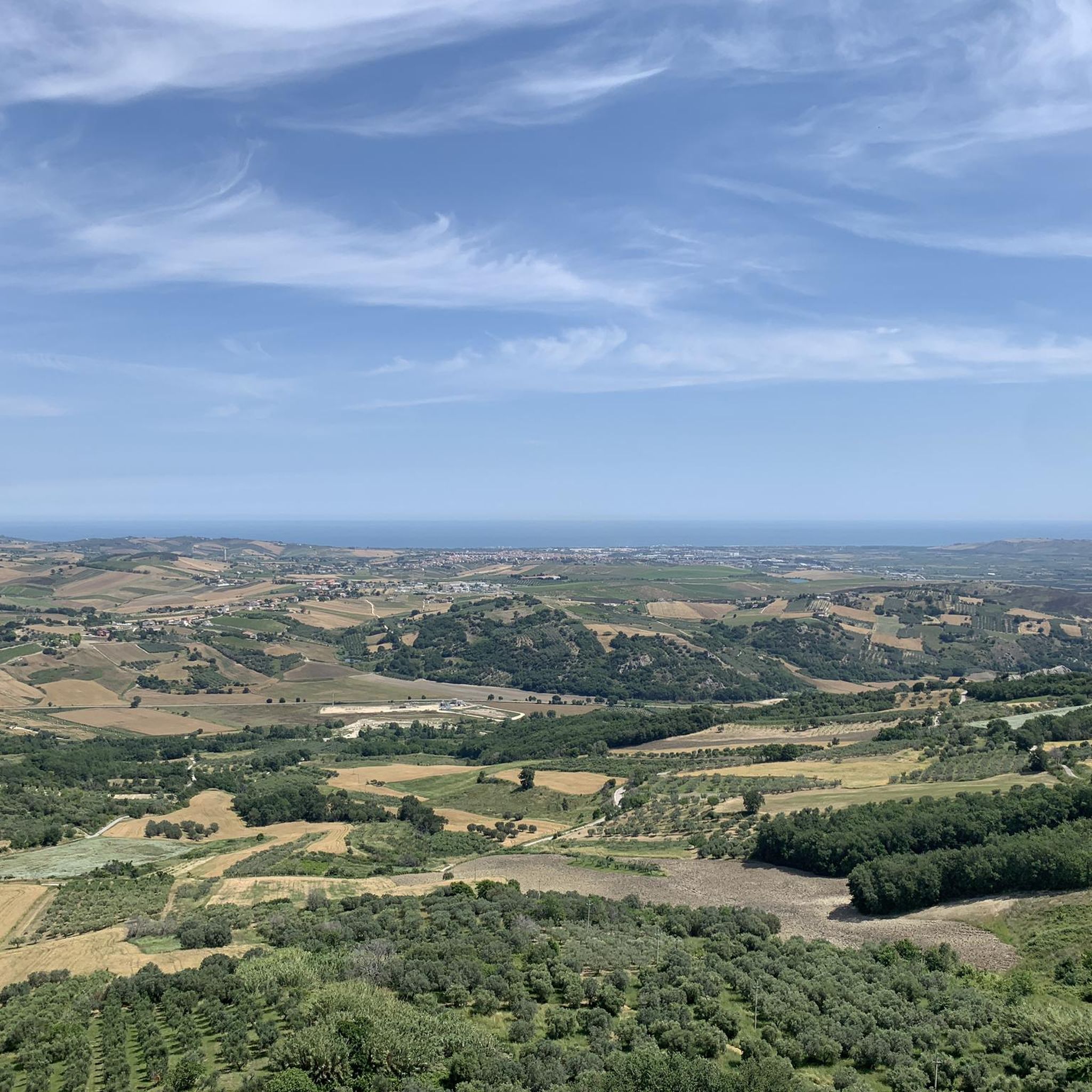
Road cycling routes around Dogliola are set in Italy's Abruzzo region, a landscape characterized by its varied terrain. Situated at an elevation of 445 meters, Dogliola offers undulating roads with both climbs and descents, overlooking the Trigno river valley. The area features unique geological formations like the Calanchi di Montenero and is located 25 kilometers from the Adriatic Sea, providing access to coastal routes. Roads in and around Dogliola are generally well-maintained, supporting diverse cycling experiences.
Best road cycling routes…
Last updated: July 5, 2026
44
riders
68.4km
03:28
1,120m
1,120m
Hard road ride. Very good fitness required. Mostly well-paved surfaces and easy to ride.
5.0
(1)
13
riders
Moderate road ride. Good fitness required. Some segments of this route may be unpaved and difficult to ride.

Sign up for free
5.0
(1)
5
riders
44.5km
02:15
650m
650m
Moderate road ride. Good fitness required. Mostly well-paved surfaces and easy to ride.
8
riders
31.7km
01:43
620m
620m
Moderate road ride. Good fitness required. Mostly well-paved surfaces and easy to ride.
9
riders
Hard road ride. Very good fitness required. Some segments of this route may be unpaved and difficult to ride.
Get access to more routes and recommendations from other explorers.
Sign up for free
Already have an account?
Our route recommendations are based on thousands of hikes, rides, and runs completed by other people on komoot.
Start today with a free account
Your next adventure awaits.
Login or Signup
Popular around Dogliola


Tips from the Community


The trail in the Petacciato Marina pine forest winds through shady trees and Mediterranean scents, offering a peaceful journey immersed in nature. Perfect for a relaxing stroll in the fresh air.
1
0

Palata is a municipality located in the province of Campobasso, Molise. It is known for its medieval streets, historic buildings and captivating natural scenery. Its history and culture are rooted in the rural environment, with an additional influence of the Croatian migrations of the 16th century.
0
0

the Via Verde, the cycle path that runs along one of the most evocative stretches of the Adriatic coast, a few meters from the sea, immersed in the nature of the Costa dei Trabocchi.
1
1

From this stretch of the provincial road you can enjoy the view towards the village of Montenero di Bisaccia and the Calanchi di Montenero, an area of about 120 hectares, where there are erosive forms created by the action of rainwater on the clayey soil. The area is a site of community interest (SIC), identified by the Ministry of the Environment for its naturalistic and landscape importance.
1
0
Montenero di Bisaccia is a town in Molise located on a hill 10 km from the sea and the Trigno river. It is possible to visit the Mother Church, the Municipal Palace and just outside the historic centre, the Sanctuary of Maria Santissima di Bisaccia.
1
0
From this stretch of the provincial road you can enjoy the view towards the village of Montenero di Bisaccia and the Calanchi di Montenero, an area of about 120 hectares, where there are erosive forms created by the action of rainwater on the clayey soil. The area is a site of community interest (SIC), identified by the Ministry of the Environment for its naturalistic and landscape importance.
3
1
Montenero di Bisaccia is a town in Molise located on a hill 10 km from the sea and the Trigno river. It is possible to visit the Mother Church, the Municipal Palace and just outside the historic centre, the Sanctuary of Maria Santissima di Bisaccia.
2
0
Frequently Asked Questions
What kind of terrain can I expect on road cycling routes around Dogliola?
Road cycling routes around Dogliola feature varied terrain, from undulating roads with climbs and descents overlooking the Trigno river valley to unique geological formations like the Calanchi di Montenero. The area is also just 25 kilometers from the Adriatic Sea, providing access to scenic coastal routes like the Ciclovia dei Trabocchi, which offers flatter rides.
How many road cycling routes are available in the Dogliola area?
There are over 10 road cycling routes around Dogliola, catering to various skill levels. You'll find a mix of moderate and difficult paths, with 9 routes classified as moderate and 4 as difficult.
Are there challenging road cycling routes for experienced riders?
Yes, for experienced riders seeking a challenge, Dogliola offers several difficult routes. One such route is the Church Tower of Palata – View of Montenero di Bisaccia loop from Mafalda, which covers 67.7 km with significant climbs. Another demanding option is the 105 km View of Montenero di Bisaccia loop from Mafalda, featuring over 1600 meters of elevation gain.
What are some scenic viewpoints or natural attractions along the cycling routes?
Cyclists can enjoy panoramic views of the Trigno river valley and the unique Calanchi di Montenero, an area of erosive clay formations. Routes also offer views towards Montenero di Bisaccia. The broader Abruzzo region, often called the 'wild heart of Italy,' provides unspoiled landscapes and a blend of mountains and sea.
What do other road cyclists enjoy most about cycling in Dogliola?
The road cycling routes around Dogliola are highly rated by the komoot community, with an average score of 4.8 stars from over 10 reviews. Cyclists often praise the varied terrain, from challenging climbs to scenic coastal paths, and the well-maintained provincial roads that make for a pleasant riding experience.
Can I find circular road cycling routes in the Dogliola area?
Yes, many of the routes around Dogliola are designed as loops, allowing you to start and end in the same location. Examples include the Monument to the Bather – View of Montenero di Bisaccia loop from Mafalda and the Lentella Village – Historic Center of Lentella loop from Campo Sportivo Comunale ''Alberto Cieri''.
What is the best time of year for road cycling in Dogliola?
The Abruzzo region generally offers pleasant cycling conditions from spring through autumn. Given Dogliola's elevation and proximity to the coast, you can expect mild temperatures, making late spring and early autumn ideal for road cycling to avoid the peak summer heat and enjoy comfortable riding weather.
Are there any historical sites or villages to explore along the routes?
Yes, Dogliola itself is a historic village with medieval origins, featuring fortified elements and ancient houses. Routes like the Lentella Village – Historic Center of Lentella loop from Campo Sportivo Comunale ''Alberto Cieri'' lead through rural villages and historic centers. The nearby town of Montenero di Bisaccia also offers cultural attractions like its Mother Church and the Sanctuary of Maria Santissima di Bisaccia.
Are the roads around Dogliola suitable for road bikes?
Yes, the roads in and around Dogliola are generally in good condition, making them suitable for road cycling. While some can be winding, they provide a pleasant riding experience without excessive concern for poor road surfaces.
Is it possible to combine inland cycling with coastal routes from Dogliola?
Absolutely. Dogliola's location, just 25 kilometers from Vasto and the Adriatic Sea, allows cyclists to easily access renowned coastal cycling paths. The 'Ciclovia dei Trabocchi,' built on a former railway line, offers flat, easy rides with sea breezes and views of traditional fishing structures, providing a stark contrast to the inland hills.
Are there any easy or beginner-friendly road cycling routes in the area?
While Dogliola's terrain is generally undulating, routes are available for various abilities. The guide lists 9 moderate routes, which could be suitable for beginners looking for a challenge or those with some cycling experience. For example, the View of Montenero di Bisaccia – View of the badlands loop from Mafalda is a moderate 31.7 km route with manageable elevation.
Most popular routes around Dogliola
Most popular attractions around Dogliola

Get inspired with the komoot mobile app


Explore more
Browse the best Road cycling routes in other regions.
