The best road cycling routes around Rosello
4.9
(8)
201
riders
22
rides
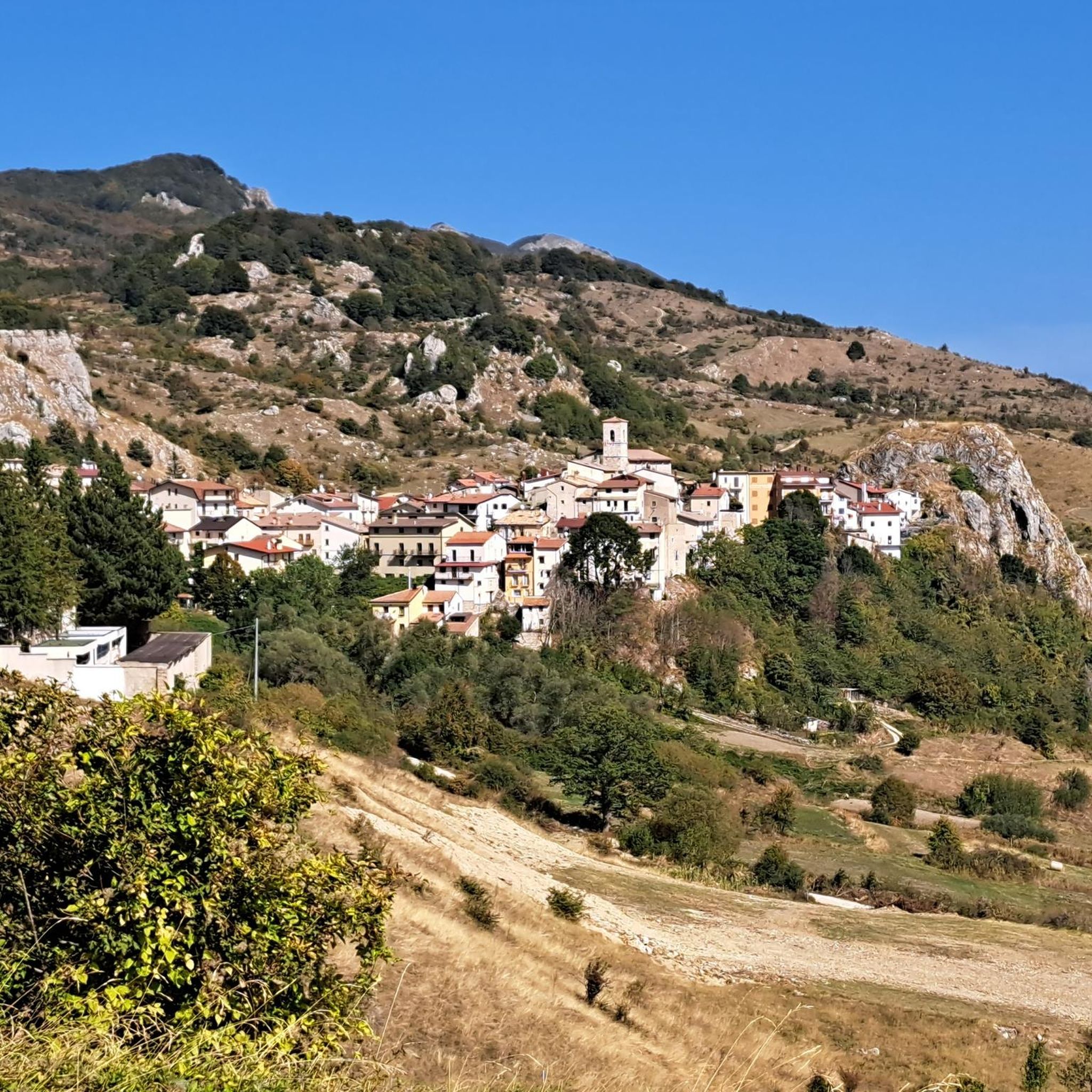
Road cycling routes around Rosello are situated in the Abruzzo region of Central Italy, a village perched on a cliff overlooking the Sangro Valley. The area is characterized by a mountainous and valley landscape, offering panoramic views and significant elevation changes. Surrounding natural features include the Verde and Turcano torrents, and the Abetina di Rosello Regional Natural Reserve, known for its silver fir forests.
Best road cycling routes around Rosello
- The most popular road cycling route is Quarto Grande Plateau…
Last updated: July 5, 2026
5.0
(1)
22
riders
82.7km
04:33
1,730m
1,730m
Hard road ride. Very good fitness required. Mostly well-paved surfaces and easy to ride.
11
riders
109km
06:01
2,310m
2,310m
Hard road ride. Very good fitness required. Mostly well-paved surfaces and easy to ride.

Sign up for free
5.0
(1)
19
riders
90.1km
04:48
1,050m
1,050m
Hard road ride. Very good fitness required. Some segments of this route may be unpaved and difficult to ride.
13
riders
103km
05:36
2,060m
2,060m
Hard road ride. Very good fitness required. Mostly well-paved surfaces and easy to ride.
10
riders
41.8km
02:20
900m
910m
Hard road ride. Very good fitness required. Mostly well-paved surfaces and easy to ride.
Get access to more routes and recommendations from other explorers.
Sign up for free
Already have an account?
Our route recommendations are based on thousands of hikes, rides, and runs completed by other people on komoot.
Start today with a free account
Your next adventure awaits.
Login or Signup



Tips from the Community

The Guado Liscia refuge is nestled in the woods of Alto Molise, on the pass connecting Agnone and Capracotta, practically on the border with Abruzzo. It's a popular stopping point for hikers, motorcyclists, and cyclists, offering traditional cuisine, a simple yet welcoming atmosphere, and good reviews for the quality of the food. It's open year-round, and in winter, it becomes a strategic shelter along the area's often snow-covered roads, offering refreshment amidst unspoiled nature and mountain views.
0
0
Agnone is a village in Upper Molise, an Orange Flag awarded to the region's most beautiful landscapes, perched at an altitude of approximately 830–840 meters on a hill overlooking the Verrino Valley. It is world-famous for the Marinelli Pontifical Bell Foundry and the Bell Museum, among the oldest foundries in Italy and the world. The historic center, with its Venetian quarter, historic buildings, and numerous churches, reflects a long artisan tradition, particularly in metalworking and quality cheesemaking.
0
0

The sanctuary of the Madonna in Saletta is a religious building located in the middle of a pine and fir forest, three kilometers away from the center of the municipality of Castel del Giudice, in the province of Isernia
1
0

spectacular places, lots of wind.
0
0

The Sangro river originates from Mount Turchio at 1,400 meters and flows into the Adriatic Sea. It is 122 kilometers long and has become quite famous in the world of sport fishing.
2
0

Pescopennataro is a village in upper Molise perched on a beautiful rocky ridge. The town offers enchanting views of the surrounding valleys. You can also enjoy a nature walk in the Pinocchio Park.
0
0

Passo Forchetta, connecting Roccaraso to Campo di Giove, offers a journey through a fresh and lush forest. The road, although the asphalt is not in perfect condition and subject to small landslides, offers a picturesque and fascinating driving experience.
1
0

You can get here by train with your bike and go for a ride.
8
0
Frequently Asked Questions
How challenging are the road cycling routes around Rosello?
Road cycling in Rosello is primarily defined by mountainous terrain and deep valleys, leading to significant elevation changes. Most routes, such as the Quarto Grande Plateau – Bar Stazione di Palena loop from Civitaluparella, are classified as difficult, featuring extensive climbs and sustained ascents and descents. The area is best suited for experienced cyclists.
What kind of scenery can I expect while road cycling in Rosello?
You can expect panoramic views of the Sangro Valley, situated between the Verde and Turcano torrents. The routes wind through mountainous landscapes and silver fir forests, offering a rugged and natural backdrop. The Abetina di Rosello Regional Natural Reserve, known for its ancient silver firs, is a prominent natural feature of the area.
Are there any notable natural attractions or landmarks along the cycling routes?
Yes, the region offers several natural attractions. You might encounter views of the Pescopennataro Crags or the Cascate del Verde. The Waterfall in Gola di Pennadomo and the Verrino Waterfall are also nearby natural monuments that add to the scenic beauty.
What is the best time of year for road cycling in Rosello?
Given the mountainous terrain and potential for significant elevation, the best seasons for road cycling in Rosello are typically spring and autumn. During these periods, temperatures are generally milder, and the natural scenery is vibrant, making for more comfortable and enjoyable rides. Summers can be hot, and winters may bring snow to higher elevations.
Are there any options for less experienced road cyclists in Rosello?
The road cycling routes around Rosello are predominantly challenging, with 15 out of 20 routes rated as difficult. While there are 5 routes classified as moderate, the overall character of the area, with its significant elevation changes, means that even moderate routes may require a good level of fitness. Beginners might find the terrain demanding.
Can I find circular road cycling routes in the Rosello area?
Yes, many of the routes around Rosello are designed as loops, allowing you to start and finish in the same location. Examples include the Sanctuary of Madonna in Saletta loop from Civitaluparella and the Capracotta – Hermitage of San Luca loop from Agnone, which offer comprehensive tours of the region's landscapes.
What are the typical distances and durations for road cycling routes here?
Routes vary in length, with some like the Capracotta – View of Monte Cavallerizzo loop from Pescopennataro covering about 42 miles (68 km) and taking around 3.5 hours. Longer routes, such as the Scenic Viewpoint – Pietraferrazzana Rock Spur loop from Borrello, can extend to over 30 miles (48 km) and take approximately 2.5 hours, depending on your pace and elevation gain.
Is public transport available to reach Rosello with a bike?
Rosello is a small village in a mountainous region of Abruzzo. While local bus services might connect to larger towns, direct public transport options specifically accommodating bicycles to Rosello may be limited. It is advisable to check regional transport schedules and policies regarding bike carriage in advance if you plan to use public transport.
Where can cyclists find accommodation or places to eat in Rosello?
Rosello, being a charming medieval village, offers some local hospitality. You can typically find small guesthouses, B&Bs, or agriturismi in and around the village. Local trattorias or cafes will provide opportunities for meals and refreshments, often featuring regional Abruzzese cuisine. For a wider selection, nearby larger towns might offer more options.
What makes road cycling in Rosello unique compared to other regions?
Road cycling in Rosello stands out due to its location in the Abruzzo region, offering a blend of rugged mountainous terrain, deep valleys, and pristine natural reserves like the Abetina di Rosello. The challenging elevation profiles provide a rewarding experience for cyclists seeking demanding climbs and descents, all set against a backdrop of unspoiled Italian landscapes and panoramic views of the Sangro Valley.
How many road cycling routes are available in the Rosello area?
There are over 20 road cycling routes available around Rosello, offering a variety of options for exploring the region's mountainous and valley landscapes. These routes are highly rated by the komoot community, with an average score of 4.8 stars.
What do other cyclists say about their experience road cycling in Rosello?
The road cycling routes in Rosello are highly rated by the komoot community, with an average score of 4.8 stars from over 9 reviews. Cyclists often praise the challenging terrain, the stunning panoramic views of the Sangro Valley, and the immersive experience of riding through the natural beauty of the Abruzzo mountains.
Are there any routes that pass by waterfalls?
While specific road cycling routes are not explicitly detailed as passing directly by waterfalls, the region is home to several notable ones. The Waterfall in Gola di Pennadomo and the Verrino Waterfall are natural monuments in the vicinity, suggesting that some routes may offer views or detours to these scenic spots.
Most popular attractions around Rosello

Get inspired with the komoot mobile app


Explore more
Browse the best Road cycling routes in other regions.
