The best walks and hikes around Sant'Agapito
4.4
(112)
367
hikers
36
hikes
Hiking around Sant'Agapito offers access to diverse landscapes within the Matese Regional Park and surrounding natural reserves. The terrain is characterized by a mix of hills, forested areas, and valleys, providing varied elevation changes. Hikers can explore paths leading through protected natural areas like Riserva Naturale Regionale Monte Patalecchia and Pesche Nature Reserve. The region's geography supports a range of hiking experiences, from moderate trails to more challenging ascents.
Best hiking trails around Sant'Agapito
- The most popular hiking route is…
Last updated: July 5, 2026
4.2
(5)
21
hikers
14.1km
04:21
470m
470m
Moderate hike. Good fitness required. Easily-accessible paths. Suitable for all skill levels.
3.6
(5)
18
hikers
Moderate hike. Good fitness required. Easily-accessible paths. Suitable for all skill levels.

Sign up for free
1
hikers
23.4km
07:03
730m
730m
Hard hike. Very good fitness required. Easily-accessible paths. Suitable for all skill levels.
4.7
(6)
13
hikers
8.62km
03:00
460m
460m
Moderate hike. Good fitness required. Easily-accessible paths. Suitable for all skill levels.
3.7
(3)
11
hikers
Moderate hike. Good fitness required. Easily-accessible paths. Suitable for all skill levels.
Get access to more routes and recommendations from other explorers.
Sign up for free
Already have an account?
Our route recommendations are based on thousands of hikes, rides, and runs completed by other people on komoot.
Start today with a free account
Your next adventure awaits.
Login or Signup


Tips from the Community

I am like everyone over the barrier
0
0

panoramic dirt road from Miranda towards Pesche
0
0

The section of trail E1 that passes over the dam is closed and marked with chains. You must turn off to the side, onto the road.
0
0


It was a flourishing Samnite city, capital of the Italic League and then Roman Municipality.
0
0

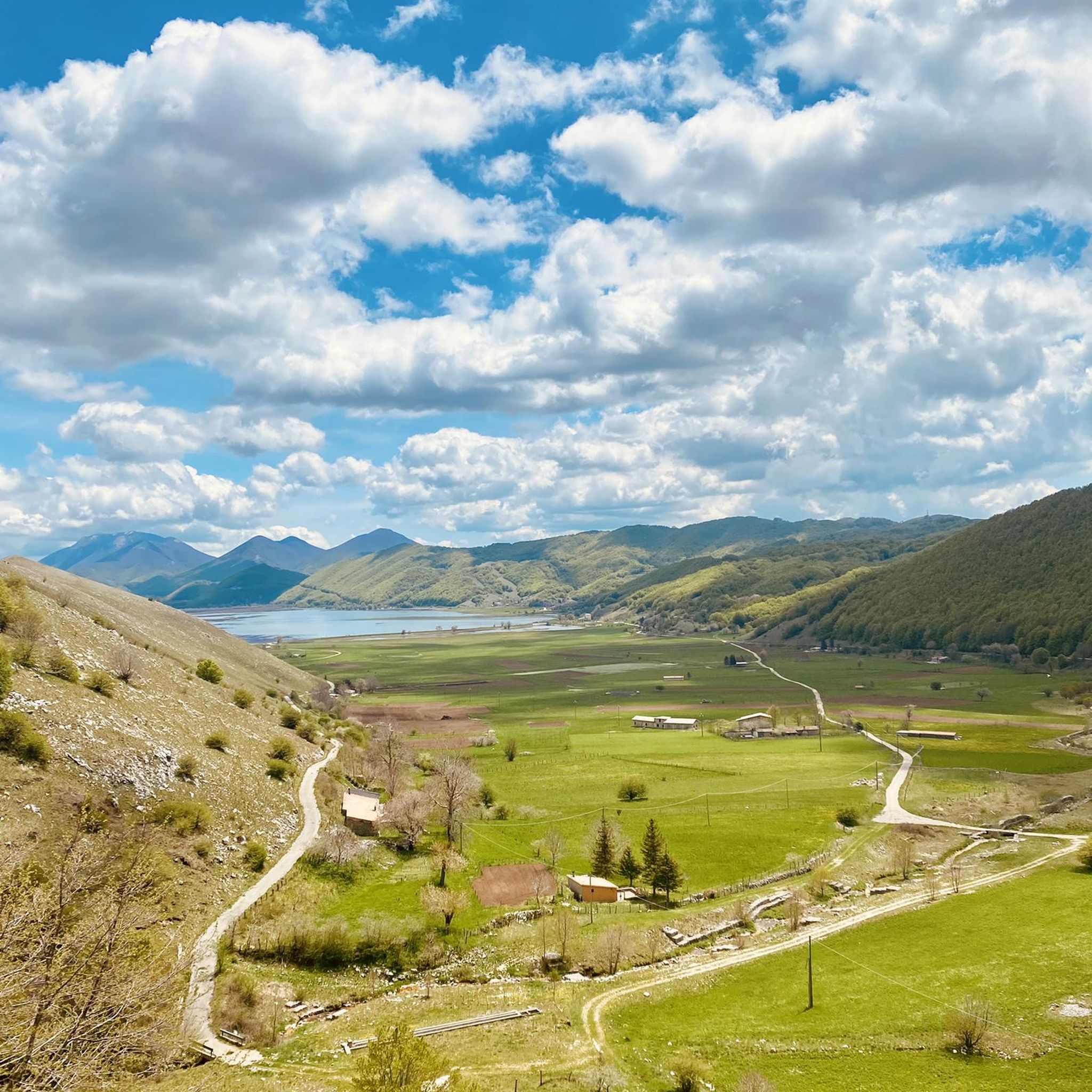
Lake Gallo is an artificial lake located in the Matese Regional Park. A dam powers the Capriati hydroelectric power plant in Volturno using the waters of the Sava river. The landscape around the lake is suggestive with the Matese massif as a backdrop.
0
0

Leaving the pine forest, all traces of the path are lost. Proceed in the tall grass following the GPS track
0
0

It is located above the locality of Pesche and it is an eighteenth-century source of water at an altitude of 925m. We are in a protected nature reserve. Nearby stands the refuge of the same name
0
0
Frequently Asked Questions
How many hiking trails are available around Sant'Agapito?
There are nearly 30 hiking trails around Sant'Agapito, offering a diverse range of experiences. These include 6 easy routes, 16 moderate paths, and 7 more challenging trails, catering to various fitness levels.
Are there any easy hiking routes suitable for beginners in Sant'Agapito?
Yes, Sant'Agapito offers 6 easy hiking routes perfect for beginners or those looking for a relaxed walk. These trails typically feature gentler terrain and shorter distances, allowing you to enjoy the natural beauty without significant effort.
Are there any circular hiking routes in the Sant'Agapito area?
Yes, several circular routes are available. For example, the Riserva Naturale Regionale Monte Patalecchia, Torrenti Lorda e Longaniello - loop from Santuario dell'Addolorata is a moderate 9.8-mile (15.7 km) circular path. Another option is the more challenging Monte Cimorre and Pesche Nature Reserve Loop, which covers 14.6 miles (23.4 km).
What kind of natural attractions can I see along the hiking trails near Sant'Agapito?
The region boasts beautiful natural attractions. You can discover stunning waterfalls like Cascata di Mille and Schioppo Waterfall. There are also picturesque lakes and ponds, including Campo Figliuolo Pond and Lake Gallo, often accompanied by scenic viewpoints such as the View of Lake Letino.
Are there any challenging hikes for experienced trekkers in Sant'Agapito?
Yes, for experienced trekkers, there are 7 difficult routes. One notable challenging option is the Monte Cimorre and Pesche Nature Reserve Loop, a 14.6-mile (23.4 km) trail that takes approximately 7 hours to complete and features significant elevation changes.
What do other hikers say about the trails in Sant'Agapito?
The trails around Sant'Agapito are highly regarded by the komoot community, with an average rating of 4.4 stars from over 80 reviews. Hikers frequently praise the diverse landscapes within the Matese Regional Park and the well-maintained paths through natural reserves.
Are there any historical or cultural landmarks to explore near the hiking routes?
Yes, beyond natural beauty, you can explore cultural landmarks. The Carpinone Historic Village offers a glimpse into local heritage, and the Sanctuary of Saint Mary of Sorrows provides a spiritual and architectural point of interest. There's even a unique Tibetan suspension bridge for an adventurous experience.
What is a good moderate hike to experience the Matese Regional Park?
A great moderate option to explore the Matese Regional Park is the Gallo Matese – Regional Park of Matese trail. This 8.8-mile (14.1 km) route takes about 4 hours 20 minutes and showcases the varied landscapes within the park.
Are there any trails that pass by lakes or ponds?
Yes, several trails offer views of or pass by water features. The View of Lake Gallo – Path of the Fairies loop from Gallo Matese is a moderate 12.2 km route that provides scenic lake views. Another option is the Path of the Fairies – Campo Figliuolo Pond loop from Gallo Matese, which includes the picturesque Campo Figliuolo Pond.
What kind of terrain can I expect on hikes around Sant'Agapito?
The terrain around Sant'Agapito is quite varied, characterized by a mix of hills, dense forested areas, and valleys. You can expect diverse elevation changes, from gentle slopes on easy trails to more significant ascents on difficult routes, all within the beautiful Matese Regional Park and surrounding natural reserves.
Are there any specific nature reserves I can explore through hiking?
Absolutely. The hiking trails in Sant'Agapito provide excellent access to protected natural areas. You can explore paths within the Riserva Naturale Regionale Monte Patalecchia and the Pesche Nature Reserve, both offering unique ecosystems and scenic beauty.
Most popular attractions around Sant'Agapito

Get inspired with the komoot mobile app


Explore more
Browse the best Hikes in other regions.
