The best road cycling routes around Santo Stefano Di Rogliano
4.5
(25)
359
riders
21
rides
Road cycling around Santo Stefano Di Rogliano features a landscape characterized by rolling hills and valleys, with routes often traversing through rural villages and offering views of the surrounding Calabrian countryside. The region includes significant elevation changes, particularly on routes extending towards the Sila mountains or areas like Lake Arvo. Road cyclists can expect a mix of challenging climbs and scenic descents, with routes connecting historical centers and natural landmarks.
Best road cycling routes around Santo Stefano Di Rogliano
- The…
Last updated: July 7, 2026
4.2
(5)
36
riders
49.1km
02:47
1,080m
1,080m
Hard road ride. Very good fitness required. Mostly well-paved surfaces and easy to ride.
4.3
(3)
27
riders
28.3km
01:22
390m
390m
Moderate road ride. Good fitness required. Mostly well-paved surfaces and easy to ride.

Sign up for free
40
riders
49.7km
02:32
810m
810m
Moderate road ride. Good fitness required. Mostly well-paved surfaces and easy to ride.
26
riders
61.3km
03:28
1,350m
1,350m
Hard road ride. Very good fitness required. Mostly well-paved surfaces and easy to ride.
15
riders
64.9km
03:38
1,370m
1,370m
Hard road ride. Very good fitness required. Mostly well-paved surfaces and easy to ride.
Get access to more routes and recommendations from other explorers.
Sign up for free
Already have an account?
Our route recommendations are based on thousands of hikes, rides, and runs completed by other people on komoot.
Start today with a free account
Your next adventure awaits.
Login or Signup
Popular around Santo Stefano Di Rogliano

Tips from the Community

Lorica, the pearl of Sila
0
0

There's a parking lot in front of the National Museum, which is a good starting point for exploring the old town. It also offers a great view of the mountains. A visit to the museum is also worthwhile.
0
0

Lorica, located right on the shore of the lake, is a convenient base for trips. It is a small town with several cafes and service points where you can take a break after a ride or walk. There are also several easy and well-marked hiking trails in the area, which allow for leisurely walks in the forest or along the shore.
1
0
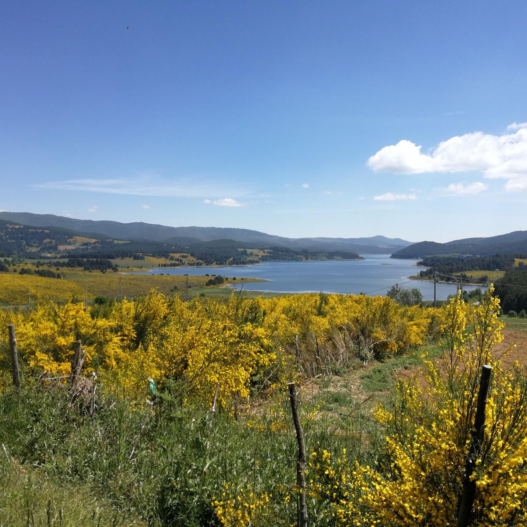
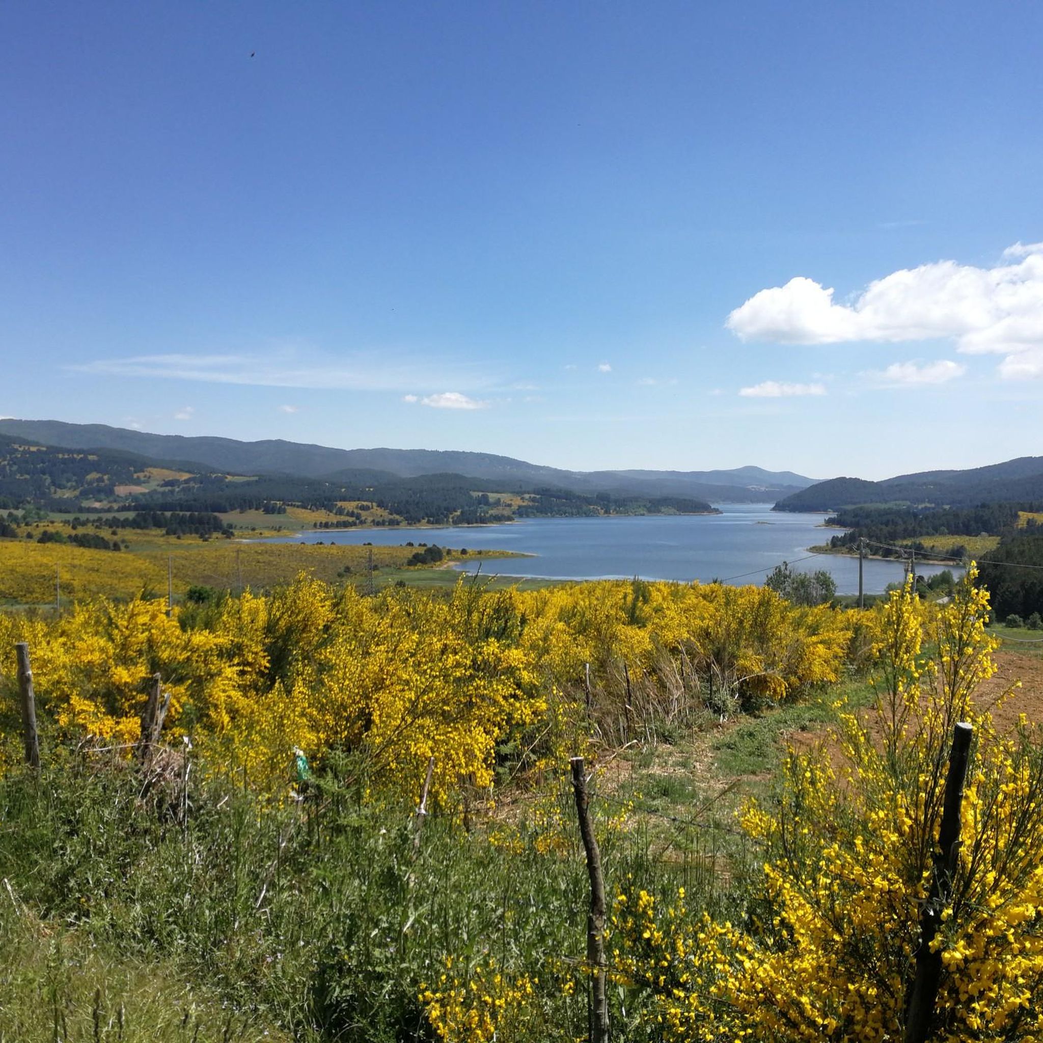
Lake Arvo is a natural centre of outdoor activities in the Sila National Park. Around the lake there are good quality asphalt roads, which are great for cycling - both recreational and more demanding. The routes are varied in length and difficulty, so everyone will find something for themselves. For example, the "Anello Lago Arvo" route is a classic loop recommended in local guides, recommended in spring and summer. Along the way you pass places such as: Camping Lago Arvo, the dam (Diga Nocelle), Rovale, Scarda, Pino Collito and other picturesque corners.
1
0

Starting point for many adventures, not only by bike
1
0

Tourist resort with its beautiful lake in the Sila national park. Not to be missed
0
0
Lorica comes alive especially in summer thanks to the many activities on the lake
2
0

Very pretty town, too bad everything was closed... mid-April!
3
0
Frequently Asked Questions
How many road cycling routes are available around Santo Stefano Di Rogliano?
There are 16 road cycling routes available around Santo Stefano Di Rogliano, offering a variety of experiences for different skill levels.
What do other road cyclists enjoy about road cycling in Santo Stefano Di Rogliano?
The area is highly rated by the komoot community, with an average score of 4.7 stars from over 20 reviews. Cyclists often praise the varied terrain, including scenic lake views, challenging climbs, and passages through historic villages.
Are there road cycling routes suitable for beginners or those looking for a moderate ride?
Yes, there are 4 moderate road cycling routes in the region. A good option is the Lake Arvo, Lorica – Lake Arvo and Lorica loop from Ceci, which is 28.1 km long and offers beautiful views of Lake Arvo.
What are some challenging road cycling routes for experienced cyclists in the Santo Stefano Di Rogliano area?
For experienced cyclists, there are 12 difficult routes. Consider the View of San Pietro in Guarano – San Pietro in Guarano Viaduct loop from Piane Crati, a 63 km path with substantial climbs, or the Casa Cantoniera loop from Piane Crati, which is 71.4 km long and features significant elevation changes.
Are there any long-distance road cycling routes in the region?
Yes, several routes offer longer distances. The Casa Cantoniera loop from Piane Crati spans 71.4 km, while the View of San Pietro in Guarano – San Pietro in Guarano Viaduct loop from Piane Crati covers 63 km, both providing extensive rides through the Calabrian countryside.
Can I find circular road cycling routes around Santo Stefano Di Rogliano?
Many of the routes in the area are circular. For example, the Pietrafitta Village loop from Piane Crati is a 47.4 km circular trail that takes you through rural landscapes and the village of Pietrafitta.
What kind of scenery can I expect on road cycling routes in Santo Stefano Di Rogliano?
Road cycling routes in this region offer diverse scenery, including rolling hills, valleys, rural villages, and views of the surrounding Calabrian countryside. Routes extending towards the Sila mountains or Lake Arvo provide particularly scenic vistas.
Are there any natural attractions or landmarks to see along the road cycling routes?
Yes, the region boasts several natural attractions. You can encounter Lorica and Lake Arvo, ride through the Winding Road Through the Sila Forest, or visit the Cannavina Waterfalls. Many routes also offer views of Monte Botte Donato.
What is the best season for road biking in Santo Stefano Di Rogliano?
The region's climate, characterized by rolling hills and proximity to the Sila mountains, suggests spring and autumn are ideal for road cycling. These seasons offer pleasant temperatures and vibrant landscapes, avoiding the peak heat of summer and potential winter snow at higher elevations.
Are there any routes that pass through historic villages or offer cultural points of interest?
Many routes traverse through rural and historic villages. The Historic Center of Cosenza loop from Piane Crati is a moderate 24.5 km route that allows you to explore the cultural heart of nearby Cosenza.
What are the typical weather conditions for road cycling in this area?
The weather conditions can vary, especially with significant elevation changes. Lower areas might be warmer, while routes extending towards the Sila mountains can be cooler. It's advisable to check local forecasts, particularly for routes with higher altitudes, to prepare for potential changes in temperature or precipitation.
Most popular attractions around Santo Stefano Di Rogliano

Get inspired with the komoot mobile app


Explore more
Browse the best Road cycling routes in other regions.
