The best running trails in Sierra De Las Nieves
4.3
(56)
2,658
runners
134
runs
Jogging in Sierra De Las Nieves offers a diverse landscape for runners. The region is characterized by its limestone formations, dense Mediterranean forests, and significant elevation changes, forming part of the Penibaetic System. It encompasses a national park, providing varied terrain from river valleys to higher mountain paths. This area is known for its natural beauty and protected ecosystems, making it a unique location for outdoor activities.
Best jogging routes in Sierra De Las Nieves
- The most popular jogging route…
Last updated: July 4, 2026
9
runners
7.25km
01:03
310m
310m
Hard run. Very good fitness required. Mostly paved surfaces. Suitable for all skill levels.
7
runners
Hard run. Very good fitness required. Sure-footedness, sturdy shoes and alpine experience required.

Sign up for free
3
runners
16.0km
02:13
600m
600m
Hard run. Very good fitness required. Mostly paved surfaces. Suitable for all skill levels.
3.0
(1)
4
runners
10.1km
01:34
530m
530m
Hard run. Very good fitness required. Mostly paved surfaces. Suitable for all skill levels.
5
runners
4.71km
00:32
40m
40m
Jog the easy 2.9-mile (4.7 km) Carril del Dique Trail in Sierra de las Nieves National Park, gaining 128 feet (39 metres) in about 32 minute
Get access to more routes and recommendations from other explorers.
Sign up for free
Already have an account?
Our route recommendations are based on thousands of hikes, rides, and runs completed by other people on komoot.
Start today with a free account
Your next adventure awaits.
Login or Signup

Tips from the Community

El Salto de la Rejía is the highest natural waterfall in the province of Málaga. It is not a single drop but three chained falls that cascade over the rocks. The best time to visit is autumn or spring, when the flow is at its peak. In summer the water dwindles considerably, although the surroundings are still worth a visit. A tip: approach the viewpoint on the trail before descending to the base, from above you get the most complete perspective of the three falls at once.
1
0
El Charco de la Virgen is a natural pool fed by an 18-meter waterfall in the bed of the río de los Caballos river. To reach the last section, you have to enter the riverbed itself and advance by jumping between rocks. In summer it is a very popular destination for swimming, although it should be noted that the place is shady and the water remains cold almost all year round. If the summer has been dry, the flow may be disappointing: the best time to see it with its full force is spring.
1
0

It's very beautiful there. It's tempting to swim.
1
0

If the weather is good: the perfect summit with a view! With a little scrambling it is also easy to climb, the easiest way is to go diagonally from the hiking trail near the Portuguese oak (southern flank) to the summit; if you want something more exciting: there are many beautiful climbing spots on the north side that lead to the summit
0
0

It is a fantastic viewpoint located next to the Tolox town hall. It offers magnificent views of the town and the Sierra de las Nieves. Don't forget to make a wish you are here!
1
0
The Saucillo pass is located at an altitude of 1,200 metres, and has a viewpoint that allows you to enjoy magnificent views of several Malaga mountain ranges and the coast. Framed in a setting dotted with pine trees, it is one of the gateways to the Torrecilla peak route.
3
0

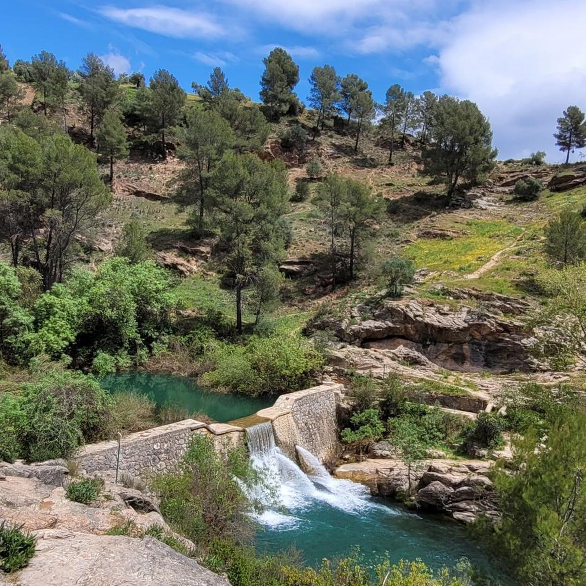
The dam is located on the Turón riverbed and its function is to regulate flow and sediments. Regardless of its use, the environment that surrounds it is very picturesque and highly visited by those who frequent the area. It is easily reached by following the path that goes along the river.
1
0
Wonderful at 1775 meters above sea level in the heart of the Sierra de las Nieves Park. Beautiful panoramic views of the entire park and the beautiful peaks.
1
0
Frequently Asked Questions
How many running routes are available in Sierra De Las Nieves?
Sierra De Las Nieves offers a wide variety of running routes, with over 140 trails to explore. These range from easy jogs to challenging long-distance runs, catering to all fitness levels.
Are there easy running routes suitable for beginners in Sierra De Las Nieves?
Yes, the region has several easy running routes perfect for beginners. You'll find 9 trails specifically categorized as easy, offering a gentle introduction to the beautiful landscapes of Sierra De Las Nieves.
What options are available for long-distance running in Sierra De Las Nieves?
For those seeking a challenge, Sierra De Las Nieves features numerous long-distance trails. An example is the difficult 15.7-mile (25.3 km) El Castillejo – Cerro de la Cierva loop from Tolox, which includes significant ascents through mountainous terrain.
Is parking available near the running trails in Sierra De Las Nieves?
Yes, many trailheads and villages within Sierra De Las Nieves offer parking facilities. For instance, the Fuenfria Alta loop starts from Área Recreativa Conejeras, which typically provides parking for visitors.
Can I reach the jogging routes in Sierra De Las Nieves using public transport?
Public transport access to some trailheads in Sierra De Las Nieves can be limited, as is common in national parks. However, larger villages like Tolox, which serve as starting points for routes such as the Charco de la Virgen loop, may have bus connections from nearby towns. It's advisable to check local bus schedules in advance.
Are there family-friendly running routes in Sierra De Las Nieves?
Absolutely. For families looking for a pleasant run, routes like the Charco de la Virgen Waterfall – Rejía Waterfall loop from Tolox offer a moderate 4.5-mile (7.2 km) path through forested areas and past waterfalls, suitable for active families.
Are dogs allowed on the running trails in Sierra De Las Nieves?
As a national park, dogs are generally permitted on trails in Sierra De Las Nieves, but they must be kept on a leash to protect wildlife and ensure the safety of other visitors. Always follow local regulations and clean up after your pet.
What is the best season for running in Sierra De Las Nieves?
The best seasons for running in Sierra De Las Nieves are typically spring and autumn, when temperatures are milder and the natural scenery is vibrant. Summers can be very hot, especially at lower elevations, while winters can bring cooler temperatures and occasional snow at higher altitudes.
What can I see along the running routes in Sierra De Las Nieves?
Running routes in Sierra De Las Nieves offer stunning natural sights. You can encounter beautiful waterfalls like the Charco de la Virgen Waterfall and the Charco del Canalón Waterfall. The trails also provide views of impressive limestone formations and dense Mediterranean forests, with opportunities to spot unique flora like the Candelabra Spanish Fir.
Are there any circular running routes in Sierra De Las Nieves?
Yes, many of the running routes in Sierra De Las Nieves are circular, allowing you to start and finish at the same point. Examples include the popular Charco de la Virgen loop from Tolox and the more challenging Peñón de los Enamorados – Puerto del Saucillo loop.
What do other runners enjoy the most about jogging in Sierra De Las Nieves?
The area is highly rated by the komoot community, with an average score of 4.25 stars from nearly 50 reviews. Reviewers often praise the diverse landscape, from scenic river sections to challenging mountain paths, and the opportunity to experience the region's protected natural beauty.
Are there any challenging running routes for experienced runners?
Experienced runners will find plenty of challenging options. Over 60 routes are classified as difficult, featuring significant elevation changes and rugged terrain. The El Castillejo – Cerro de la Cierva loop from Tolox is a prime example, offering a demanding 15.7-mile run with over 1200 meters of ascent.
Most popular routes in Sierra De Las Nieves
Most popular attractions in Sierra De Las Nieves

Get inspired with the komoot mobile app


Explore more
Browse the best Running Trails & Routes in other regions.
