The best walks and hikes in Sierra Crestellina
4.5
(700)
2,952
hikers
89
hikes
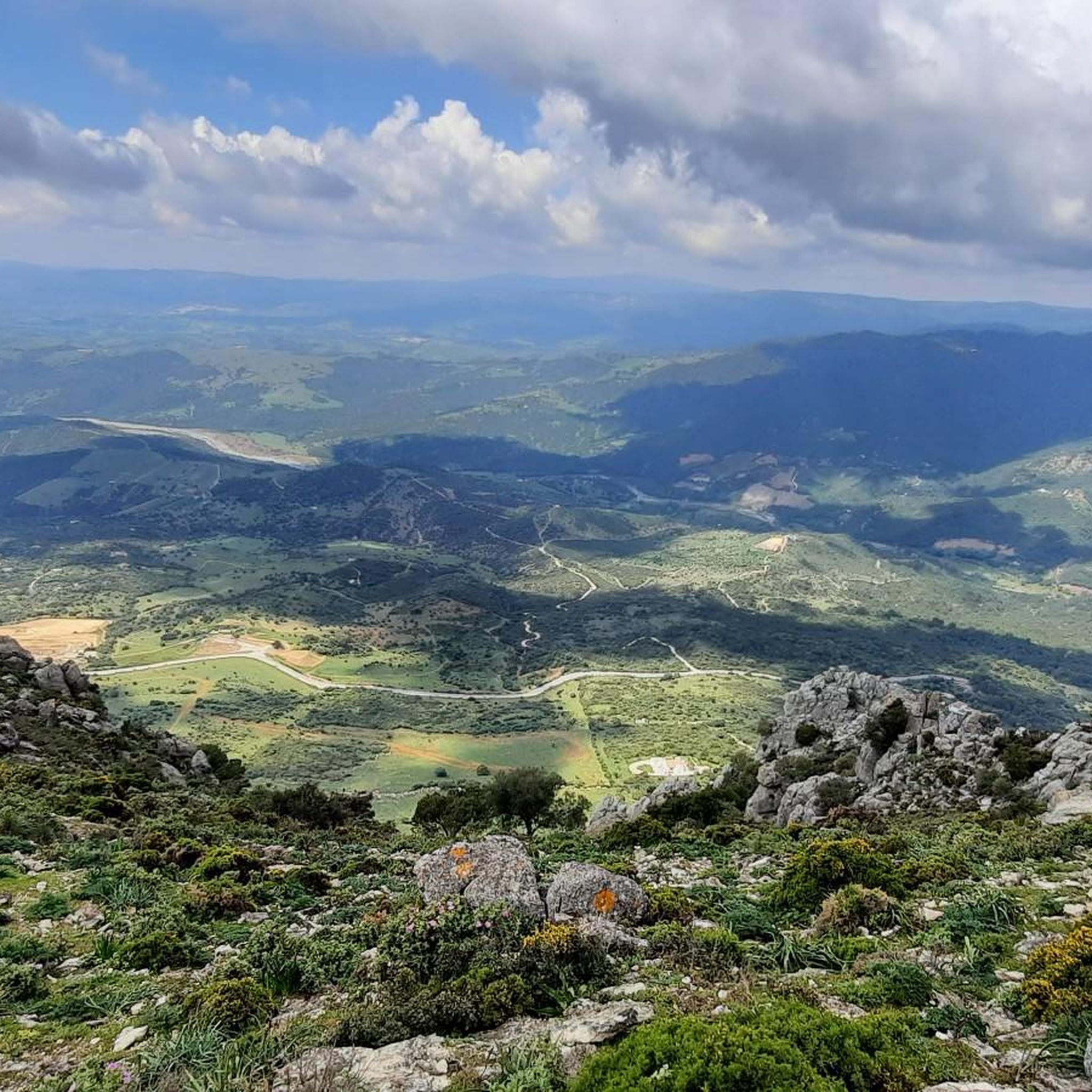
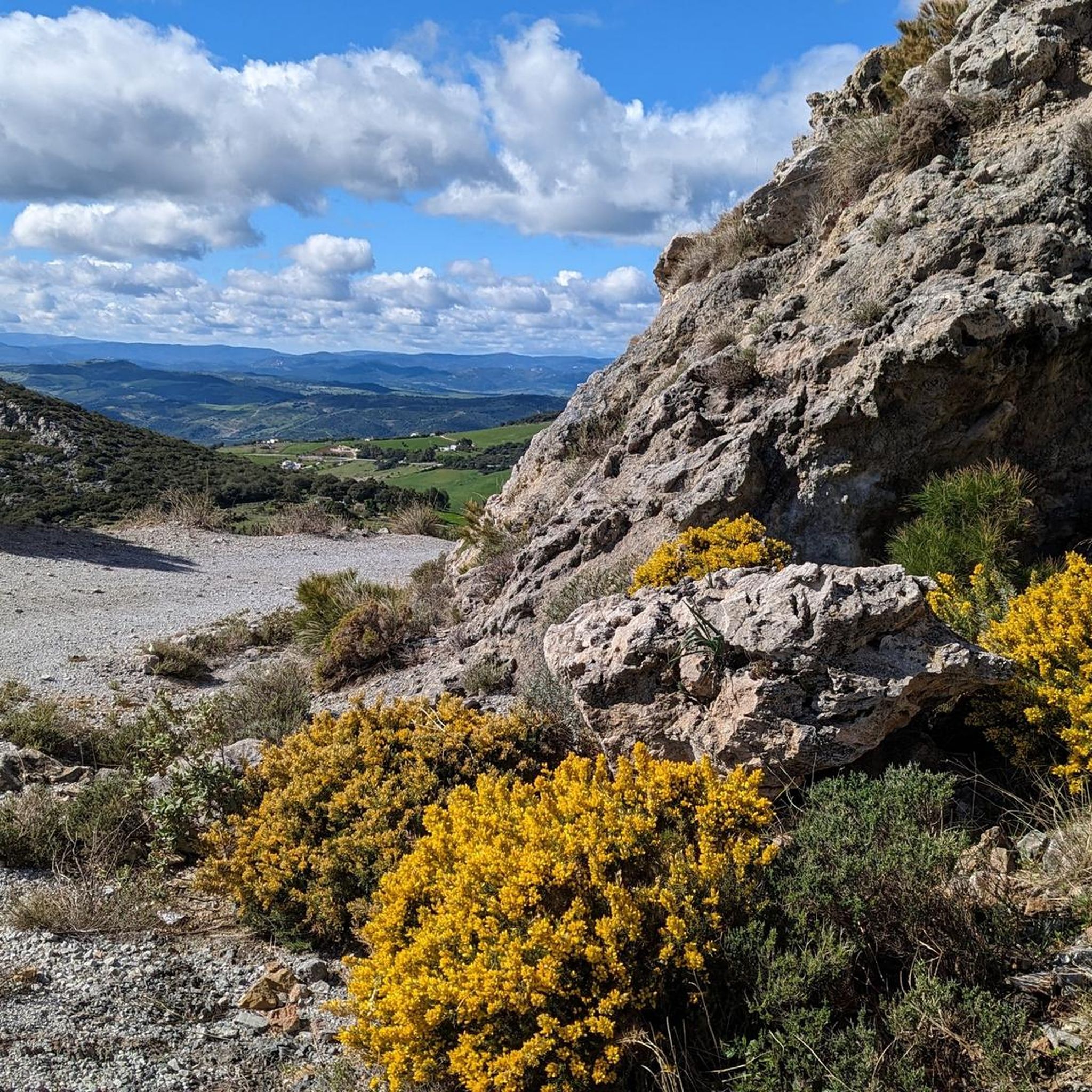
Hiking in Sierra Crestellina is characterized by its rugged topography, featuring steep crags of Jurassic limestone and medium-height mountains with crested peaks. The area supports diverse Mediterranean vegetation, including holm oaks, pine trees, and cork oak woods, adapting to varied sunlight and humidity. Watercourses like the La Albarrá Stream traverse the landscape, though flow may diminish in summer. This Protected Natural Area offers a range of trails through its unique geological formations and rich biodiversity.
Best hiking trails in Sierra…
Last updated: June 30, 2026
4.7
(66)
235
hikers
8.86km
02:52
340m
330m
Hard hike. Good fitness required. Sure-footedness, sturdy shoes and alpine experience required.
4.0
(3)
12
hikers
10.2km
04:28
620m
610m
Hard hike. Good fitness required. Sure-footedness, sturdy shoes and alpine experience required.

Sign up for free
4.3
(30)
82
hikers
9.31km
02:54
350m
350m
Moderate hike. Good fitness required. Easily-accessible paths. Suitable for all skill levels.
4.7
(21)
57
hikers
5.55km
01:44
190m
190m
Moderate hike. Great for any fitness level. Mostly accessible paths. Sure-footedness required.
4.6
(8)
40
hikers
5.29km
01:33
140m
140m
Easy hike. Great for any fitness level. Easily-accessible paths. Suitable for all skill levels.
Get access to more routes and recommendations from other explorers.
Sign up for free
Already have an account?
Our route recommendations are based on thousands of hikes, rides, and runs completed by other people on komoot.
Start today with a free account
Your next adventure awaits.
Login or Signup
Tips from the Community

For its multiple viewpoints and Andalusian history.
0
0

After what we experienced here, the tour is a real treat! 🤷♂️ Crossing the Rio with all its colorful boulders and the vibrant cliffs is particularly impressive. The total of 600 meters of elevation gain, according to Strava, is moderate… and it's definitely worth visiting the castle ruins and the churchyard in the village… the view today, stretching all the way to Italy and Gibraltar, was sensational… especially since the bearded vultures were circling overhead! 👍
0
0

Nice climb to Casares and a nice water fountain when you get there. Worth the effort.
1
0

Casares - a white village in Andalusia with 6500 inhabitants, very pretty
0
1

The small, idyllic white mountain village is located 430 meters above sea level, in the southwest of the province of Málaga, framed by the mountains of the Sierra Bermeja and the Sierra Crestellina.
3
0

Not recommended. You have to walk across several yards with stray guard dogs. Uncomfortable.
2
0

Frequently Asked Questions
How many hiking trails are available in Sierra Crestellina?
Sierra Crestellina offers a wide variety of hiking experiences, with nearly 90 trails to explore. These range from easy village loops to challenging mountain ascents, catering to different fitness levels.
What types of terrain can I expect on hikes in Sierra Crestellina?
The terrain in Sierra Crestellina is characterized by rugged topography, featuring steep crags of Jurassic limestone and medium-height mountains with distinctive crested peaks. Paths can be rocky and sometimes unstable, offering a rewarding challenge for hikers. You'll encounter diverse Mediterranean vegetation, including holm oaks, pine trees, and cork oak woods.
Are there any easy or family-friendly hiking options in Sierra Crestellina?
Yes, there are 23 easy trails suitable for families or those seeking a more relaxed walk. A good option is the Casares Village – View of Casares loop from Casares, an easy 5.2 km path that takes about 1 hour 33 minutes, offering pleasant views around the charming village.
What kind of wildlife can be seen while hiking in Sierra Crestellina?
Sierra Crestellina is renowned for its rich wildlife, especially its bird population. It hosts the largest colony of griffon vultures in Málaga province, which you can frequently observe soaring above. Other raptors like Bonelli's eagles and peregrine falcons are also present. Keep an eye out for mountain goats and small amphibians as well.
Are there any circular hiking routes in Sierra Crestellina?
Yes, many routes in Sierra Crestellina are circular, allowing you to start and end in the same location. For a challenging circular experience, consider the Puerto de las Viñas – circular from Casares via the Sierra Crestellina, a difficult 8.8 km trail with panoramic views.
What are the best viewpoints in Sierra Crestellina?
The sierra offers stunning panoramic viewpoints. From various spots, you can see the picturesque white village of Casares, the Costa del Sol, the Rock of Gibraltar, and on clear days, even the African coast and Los Alcornocales Nature Park. The Mirador de Catillon is particularly noted for its spectacular views.
What do other hikers enjoy most about hiking in Sierra Crestellina?
The area is highly rated by the komoot community, with an average score of 4.5 stars from over 600 reviews. Hikers often praise the dramatic limestone peaks, the diverse Mediterranean vegetation, and the expansive panoramic views that reward their efforts.
Is public transport available to reach the hiking trails in Sierra Crestellina?
While the region is easily accessible by car from the coastal N340 via the A377 road to Casares, public transport options directly to trailheads within the Sierra Crestellina Natural Area can be limited. It's advisable to check local bus schedules to Casares, and then plan for onward travel or walking to your chosen starting point.
Are there any specific natural features or landmarks to look out for?
Beyond the dramatic limestone formations and diverse flora, the La Albarrá Stream is the primary surface watercourse, though its flow diminishes in summer. The charming 'white village' of Casares itself is a Historic-Artistic Site and a significant landmark, with many routes starting from or passing through it, such as the Old Stone Bridge in Casares – Casares Village loop from Casares.
What is the best time of year to hike in Sierra Crestellina?
The Mediterranean climate means spring and autumn are generally the most pleasant seasons for hiking, with milder temperatures and lush landscapes. Summer can be very hot, making early morning or late afternoon hikes preferable. Winter offers cooler conditions, but some paths might be more challenging if wet.
Are there any particularly challenging routes for experienced hikers?
Yes, Sierra Crestellina offers 14 difficult routes for experienced hikers. The Cerro de las Chapas – circular by the Sierra Crestellina is a challenging 10.2 km path featuring significant elevation gain and diverse Mediterranean vegetation, taking approximately 4 hours 28 minutes to complete.
Where can I find information about parking for Sierra Crestellina hikes?
Many hiking routes, especially those starting or passing through Casares, offer parking opportunities within or on the outskirts of the village. For specific trailheads, it's recommended to check the individual route details on komoot, as parking availability can vary.

Get inspired with the komoot mobile app


Explore more
Browse the best Hikes in other regions.
