The best walks and hikes in Arroyo De Santiago, Salado De Morón Y Matabueyes/Garrapata
4.6
(77)
295
hikers
42
hikes
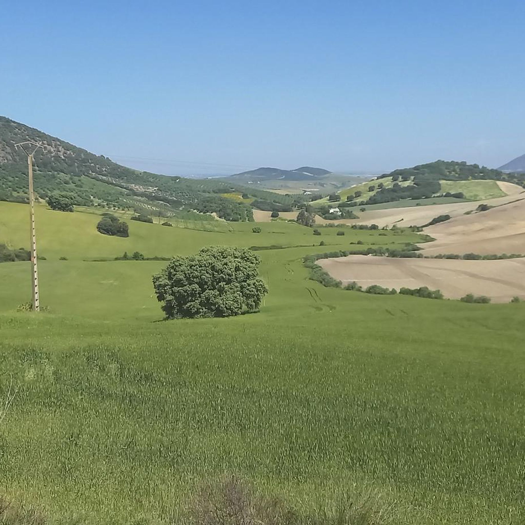
Hiking in Arroyo De Santiago, Salado De Morón Y Matabueyes/Garrapata offers routes through a landscape shaped by the Salado de Morón stream, which flows through the provinces of Cádiz and Seville. The area features well-preserved riparian woodlands with tamarisk and oleander, alongside patches of Mediterranean scrub. Geological formations like the Tajos del Mogarejo, rich in clay and gypsum, contribute to the varied terrain. This region is recognized for its ecological value and includes historical elements such as the Roman bridge…
Last updated: July 17, 2026
5.0
(1)
9
hikers
8.07km
02:35
330m
330m
Moderate hike. Good fitness required. Mostly accessible paths. Sure-footedness required.
8
hikers
17.2km
05:08
530m
530m
Hard hike. Very good fitness required. Easily-accessible paths. Suitable for all skill levels.

Sign up for free
3.0
(1)
6
hikers
4.68km
01:27
180m
180m
Easy hike. Great for any fitness level. Easily-accessible paths. Suitable for all skill levels.
4.0
(1)
16
hikers
Moderate hike. Good fitness required. Mostly accessible paths. Sure-footedness required.
5.0
(1)
8
hikers
7.25km
02:12
250m
250m
Moderate hike. Good fitness required. Easily-accessible paths. Suitable for all skill levels.
Get access to more routes and recommendations from other explorers.
Sign up for free
Already have an account?
Our route recommendations are based on thousands of hikes, rides, and runs completed by other people on komoot.
Start today with a free account
Your next adventure awaits.
Login or Signup
Popular around Arroyo De Santiago, Salado De Morón Y Matabueyes/Garrapata
Running Trails in Arroyo De Santiago, Salado De Morón Y Matabueyes/Garrapata
MTB Trails in Arroyo De Santiago, Salado De Morón Y Matabueyes/Garrapata
Road Cycling Routes in Arroyo De Santiago, Salado De Morón Y Matabueyes/Garrapata
Cycling in Arroyo De Santiago, Salado De Morón Y Matabueyes/Garrapata

Gravel biking in Arroyo De Santiago, Salado De Morón Y Matabueyes/Garrapata
Tips from the Community

This viewpoint is part of a hiking route that also includes the Mirador de la Cancha and the Castillo de Cote. The complete route is approximately 11.5 km and is circular.
6
0

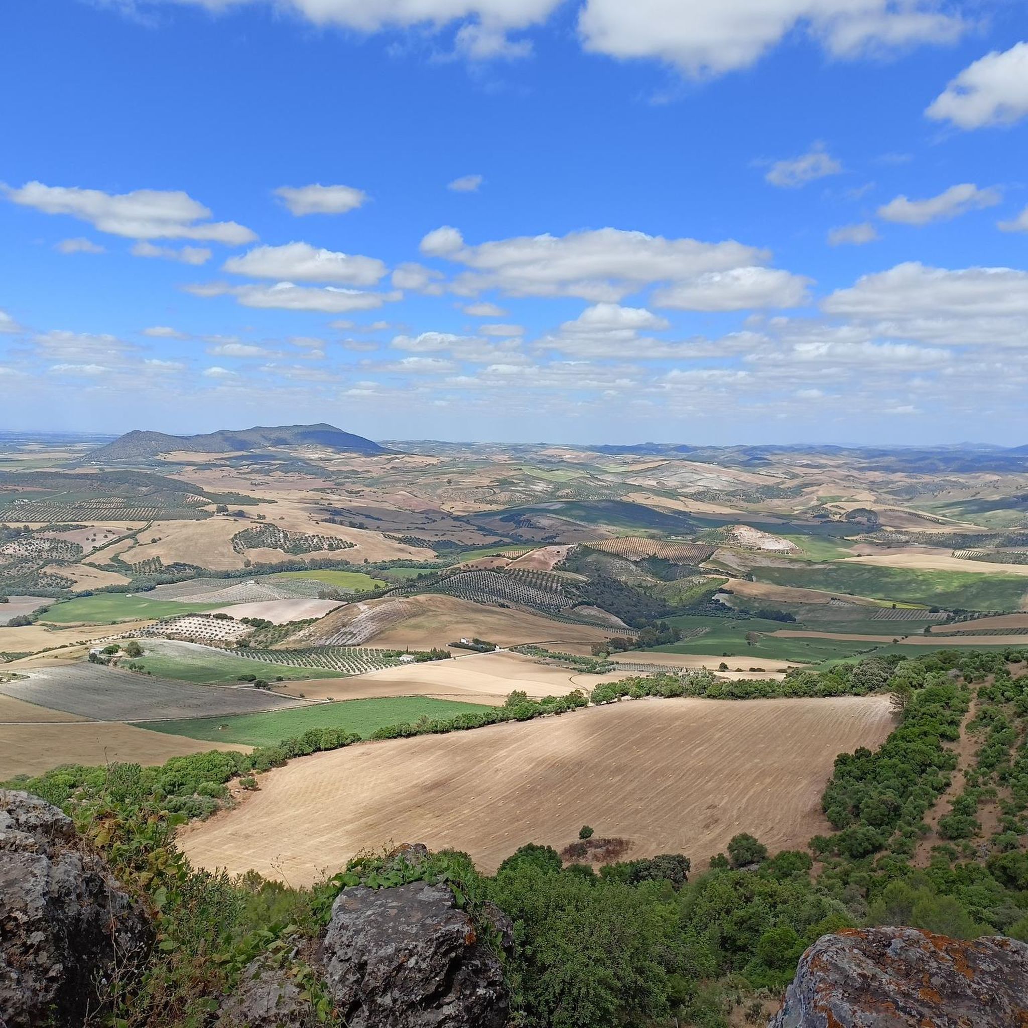
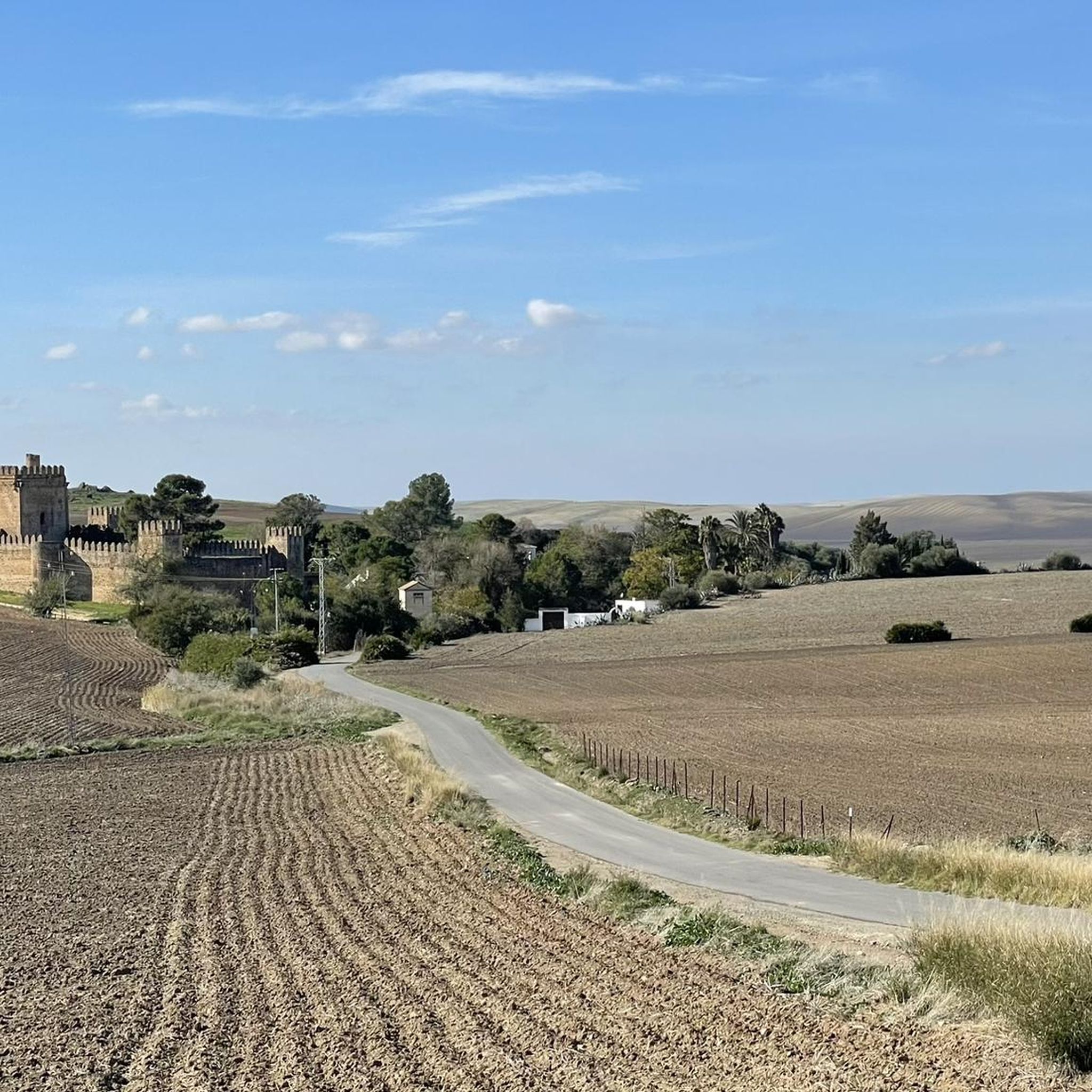
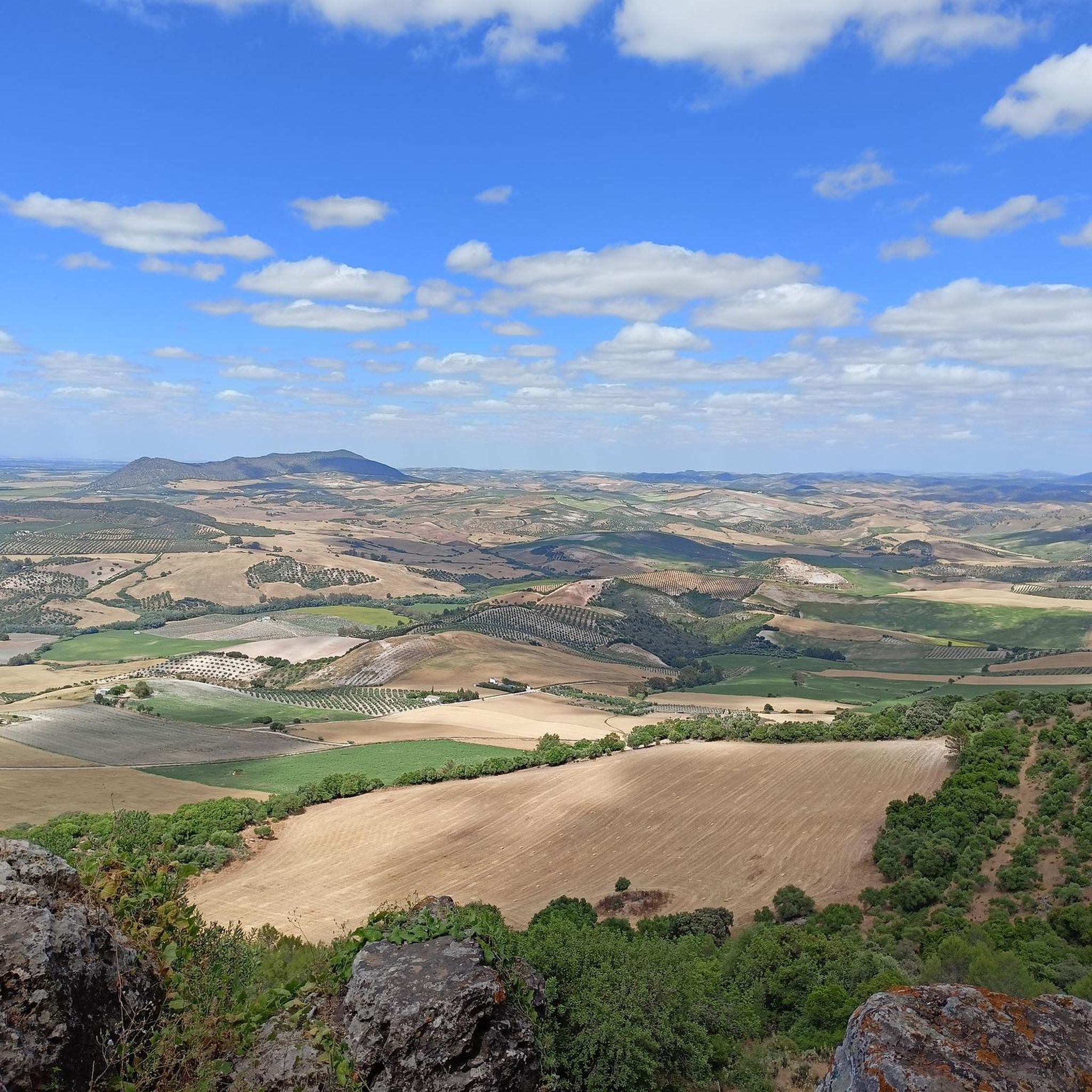
Viewpoint at the top of the Sierra de Montellano from where you can see spectacular views of the Castillo de Coto. All you have to do is turn around and see how the gray tower rises above the hill, in an idyllic picture from a postcard.
0
0
Its location explains its geostrategic relevance, in the place that the Arabs called Mont Aqut. Due to its architectural characteristics, it is considered unique in Spain, and there is a similar one in France and another in England. The Castle is located about 3.5 km. from the Sevillian town of Montellano
0
0
Lookout that offers views from the top of the Sierra de Montellano, at its northwest end. It is mandatory to stop at the viewpoint and observe the panorama that is around!!
0
0
Nice views to the east, highlights the Castillo de Cote, Peñón de Zaframago, Coripe, good access by various paths and trails.
1
0
The Castle of Cote is located about 3.5 km. from the Sevillian town of Montellano. Its location explains its geostrategic relevance, in the place that the Arabs called Mont Aqut. Due to its architectural characteristics, it is considered unique in Spain, and there is a similar one in France and another in England.
1
0
It is an impressive viewpoint to see the northern views of the Sierra de Montellano. Straight road but worth it!
1
0

Looking north you can see the Cote de Montellano Castle at the top. It is considered unique in Spain due to its architectural characteristics - there is a similar one in France and another in England. Built at the end of the 13th century, it is a good example of frontier military construction from that time.
2
0
Frequently Asked Questions
How many hiking trails are available in Arroyo De Santiago, Salado De Morón Y Matabueyes/Garrapata?
There are over two dozen hiking routes in Arroyo De Santiago, Salado De Morón Y Matabueyes/Garrapata. These trails offer a range of experiences, from easy strolls to more challenging moderate ascents, catering to various fitness levels.
What kind of terrain can I expect on hikes in this region?
The terrain in Arroyo De Santiago, Salado De Morón Y Matabueyes/Garrapata is diverse, shaped primarily by the Salado de Morón stream. You'll encounter well-preserved riparian woodlands, Mediterranean scrub, and geological formations like the Tajos del Mogarejo, which are rich in clay and gypsum deposits. Expect varied paths, some along the watercourse and others with moderate ascents.
Are there any easy or family-friendly hiking options?
Yes, there are easy routes suitable for families. For instance, the Castillo de Cote loop from Puerto de la Zorra is an easy 2.9 miles (4.7 km) path with a gentle ascent, typically completed in under 1.5 hours. This makes it a great option for a relaxed outing.
What are some notable natural features or landmarks to look out for?
The region is characterized by the Salado de Morón stream and its lush riparian woodland, featuring tamarisk, oleander, and reeds. You can also observe small patches of Mediterranean woodland with carob and palm hearts, especially near the geological formations of the Tajos de Mogarejo. The area is also recognized for its ecological value as a Site of Community Importance.
Are there any historical sites along the hiking routes?
Yes, the area holds historical significance. You can find the Roman bridge of Alcantarilla spanning the Salado de Morón stream, offering a glimpse into the region's past. Additionally, important archaeological remains, such as the Molino Pintado site and the Celtiberian settlement of Los Callenses, have been discovered near the stream.
What is the best time of year to go hiking in Arroyo De Santiago, Salado De Morón Y Matabueyes/Garrapata?
While specific seasonal recommendations aren't detailed, the presence of riparian woodlands suggests that spring and autumn would be ideal for hiking, offering pleasant temperatures and vibrant natural scenery. Summers can be hot in Andalusia, so early mornings or late afternoons might be preferable during those months.
Are there circular hiking routes available?
Yes, several circular routes are available. A popular choice is the Subida Castillo de Cote — circular by the Sierra de San Pablo, a moderate 5.0 miles (8.1 km) trail. Another option is the Sierra de San Pablo y Montellano — circular from the population of Montellano, which is 6.5 miles (10.5 km) long.
Where can I find parking for the trailheads?
Access to the area downstream from the Torre del Águila reservoir is possible via the A-8128 road towards Montellano. From there, country roads lead off, which typically provide access points and potential parking areas for hikers. Specific parking details may vary by trailhead.
What do other hikers enjoy the most about hiking in Arroyo De Santiago, Salado De Morón Y Matabueyes/Garrapata?
The area is highly rated by the komoot community, with an average score of 4.6 stars from over 37 reviews. Hikers often praise the diverse terrain, the well-preserved riparian woodlands, and the opportunities to explore both natural beauty and historical elements along the Salado de Morón stream.
Is it possible to spot wildlife while hiking here?
Yes, the region is recognized as a Site of Community Importance (SCI) for its ecological value. It serves as a habitat for protected species, specifically the Spanish toothcarp (Aphanius iberus) and the Iberian Painted Frog (Discoglossus galganoius). Keep an eye out for these and other local fauna, especially near the stream and in the riparian areas.
Are there any long-distance trails or routes for experienced hikers?
While the region offers a mix of easy and moderate routes, the Vía Verde de la Sierra Trail is a longer option at 11.3 miles (18.2 km), typically taking around 4 hours and 48 minutes to complete. This moderate route provides a more extended hiking experience through the landscape.
Most popular routes in Arroyo De Santiago, Salado De Morón Y Matabueyes/Garrapata

Get inspired with the komoot mobile app


Explore more
Browse the best Hikes in other regions.
