The best road cycling routes around Oberthulba
4.6
(461)
5,887
riders
343
rides
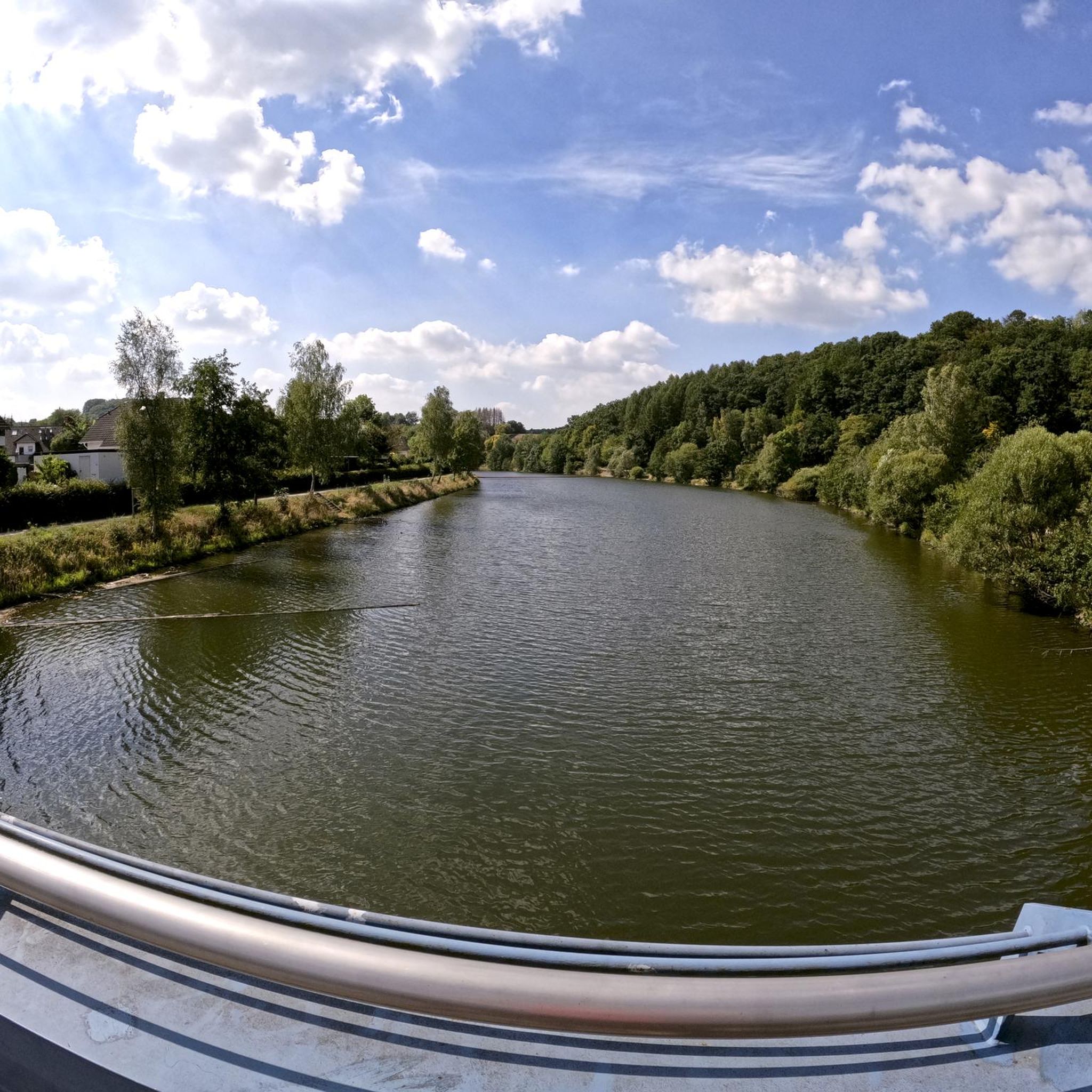
Road cycling around Oberthulba offers diverse landscapes characterized by rolling hills, expansive fields, and dense forests. The region features the Thulba Valley, with routes along the Thulba river, and is situated near the Rhön Nature Park. Cyclists can also find paths along the Franconian Saale river and through vineyards, providing varied terrain for different fitness levels. The area provides well-maintained routes, often on paved roads, suitable for road cycling.
Best road cycling routes around Oberthulba
- The most popular road cycling route is Thulba Cycle Path – Hammelburg Old Town loop from Thulba, a 22.8 miles (36.7 km) trail that takes 1 hour 41 minutes to complete. This moderate route follows the Thulba river towards Hammelburg Old Town.
- Another top favourite among local road cyclists is Thulba Cycle Path – View of the Rhön loop from Geiersnest Ost, a moderate 33.1 miles (53.3 km) path. This route offers views of the Rhön region.
- Local road cyclists also love the Kreuzberg Monastery – View of Arnsberg loop from Geiersnest Ost, a 37.4 miles (60.2 km) trail leading through varied terrain, often completed in about 3 hours 11 minutes.
- Road cycling around Oberthulba is defined by rolling hills, the Thulba Valley, and the Franconian Saale river. The network offers options for easy, moderate, and difficult routes.
- The routes in Oberthulba are highly rated by the komoot community with an average score of 4.6 stars from over 400 reviews. More than 5,000 road cyclists have used komoot to explore Oberthulba's varied terrain.
Last updated: July 1, 2026
3.8
(4)
59
riders
22.1km
00:59
80m
80m
Easy road ride. Great for any fitness level. Mostly well-paved surfaces and easy to ride.
5.0
(2)
36
riders
36.8km
01:42
190m
190m
Moderate road ride. Great for any fitness level. Some segments of this route may be unpaved and difficult to ride.

Sign up for free
4.0
(1)
29
riders
48.2km
02:16
580m
580m
Moderate road ride. Good fitness required. Some segments of this route may be unpaved and difficult to ride.
5.0
(5)
29
riders
53.3km
02:33
680m
680m
Moderate road ride. Good fitness required. Mostly well-paved surfaces and easy to ride.
20
riders
60.2km
03:12
1,160m
1,160m
Hard road ride. Very good fitness required. Mostly well-paved surfaces and easy to ride.
Get access to more routes and recommendations from other explorers.
Sign up for free
Already have an account?
Our route recommendations are based on thousands of hikes, rides, and runs completed by other people on komoot.
Start today with a free account
Your next adventure awaits.
Login or Signup



Tips from the Community

The Arnsberg is located northwest of the Kreuzberg in the Bavarian Rhön. It is a striking and widely visible mountain, 842 m high, which belongs to the natural region of the Hohe Rhön.
1
0

A really great castle in such a small town
0
0

A great view of the Arnsberg, which unfortunately isn't accessible by road bike. But there are other bikes and hiking boots available.
0
0
Beautiful views into the distance and of the nearby Kreuzberg and Arnsberg mountains. Anyone who still has the energy at this point should tackle the last few meters to the Kreuzberg summit. The path is paved all the way to the summit, making it suitable for road bikes.
0
0
The Rhönexpress Railway Cycle Path, brand new and completed in 2019, is a truly unique experience. The approximately 26 km long route runs from the Hessian border near Zeitlofs to the market town of Wildflecken along the former railway line. Source and further information about this beautiful cycle path can be found at: https://rhoenexpress.bayern/
0
0
The Rhönexpress Railway Cycle Path, brand new and completed in 2019, is a truly unique experience. The approximately 26 km long route runs from the Hessian border near Zeitlofs to the market town of Wildflecken along the former railway line. Source and further information about this beautiful cycle path can be found at: https://rhoenexpress.bayern/
0
0
Hammelburg has a beautiful, picturesque old town with many historic buildings around the market square. A quick stop on your bike tour is well worth it!
0
0
When entering Hammelburg, you immediately notice the roundabout, which is decorated in the middle with a Bocksbeutel sculpture, the traditional bottle shape of Franconian wine.
0
0
Frequently Asked Questions
How many road cycling routes are available around Oberthulba?
There are over 340 road cycling routes around Oberthulba, offering a wide range of options for different skill levels and preferences. The komoot community has explored these routes extensively, with over 5,000 road cyclists using komoot to discover the area.
What kind of terrain can I expect when road cycling in Oberthulba?
Oberthulba's road cycling terrain is characterized by rolling hills, expansive fields, and dense forests. You'll find routes along the picturesque Thulba river in the Thulba Valley, paths near the Franconian Saale river, and even routes through vineyards offering magnificent views. Many routes are predominantly on well-maintained paved roads, ensuring a smooth experience.
Are there routes suitable for beginners or those looking for an easy ride?
Yes, Oberthulba offers a good selection of easier road cycling routes. There are 37 routes classified as easy, perfect for beginners or those seeking a relaxed ride. These routes often follow flatter sections, such as along the Thulba river.
What about more challenging road cycling routes in the area?
For experienced cyclists seeking a challenge, Oberthulba has 99 difficult road cycling routes. These routes often feature significant elevation gains and cover longer distances, providing a demanding yet rewarding experience through the region's varied terrain, including views of the Rhön.
Are there any circular road cycling routes in Oberthulba?
Yes, many of the road cycling routes around Oberthulba are designed as loops, allowing you to start and end at the same point. An example is the Thulba Cycle Path loop from Hetzlos, which offers a moderate ride through the scenic Thulba Valley.
What natural features can I see while cycling in Oberthulba?
While cycling, you can enjoy the expansive fields, quiet forests, and picturesque countryside. The Thulba Valley offers routes along the Thulba river with impressive flora and fauna. You'll also find vineyards providing magnificent views and paths along the Franconian Saale river, all set against the backdrop of the Rhön Nature Park.
Are there any historical landmarks or points of interest along the routes?
Yes, you can integrate historical and cultural sights into your rides. Notable attractions include Thulba Castle and St. Peter and Paul Parish Church. Further afield, you might encounter Saaleck Castle, which offers breathtaking views, or the Würzburger Haus, a mountain hut ideal for a refreshment stop.
Can I find waterfalls along road cycling routes near Oberthulba?
While road cycling routes typically stick to paved roads, some areas near Oberthulba feature natural attractions like waterfalls that might be accessible with a short detour. For example, the Trettstein Waterfall and Waterfall in Naturpark Bayerische Rhön are highlights in the wider region that could be combined with a cycling trip.
Is Oberthulba suitable for family road cycling trips?
Oberthulba offers several easy and moderate routes that are suitable for families, especially those with older children comfortable on paved roads. The Thulba Cycle Path – Hammelburg Old Town loop from Thulba is a moderate option that follows the river, providing a relatively flat and scenic experience.
What do other road cyclists enjoy most about road cycling in Oberthulba?
The road cycling routes in Oberthulba are highly rated by the komoot community, with an average score of 4.6 stars from over 400 reviews. Cyclists often praise the diverse landscapes, well-maintained paved roads, and the variety of routes that cater to different fitness levels, from the tranquil Thulba Valley to challenging climbs with Rhön views.
Are there any routes that offer views of the Rhön region?
Absolutely. Several routes provide stunning vistas of the Rhön. For instance, the Thulba Cycle Path – View of the Rhön loop from Geiersnest Ost is a moderate 33.1-mile path specifically designed to offer beautiful views of the Rhön region while you cycle.
Can I find routes that pass through charming towns or villages?
Yes, many road cycling routes in Oberthulba connect charming towns and villages, allowing you to experience local culture and find refreshment stops. The Bench with a view of Trimburg – Hammelburg Old Town loop from Neuwirtshaus, for example, takes you towards Hammelburg Old Town, known for its historical charm.
Most popular routes around Oberthulba
Most popular attractions around Oberthulba

Get inspired with the komoot mobile app


Explore more
Browse the best Road cycling routes in other regions.
