The best walks and hikes around Oberrohrdorf
4.6
(532)
4,087
hikers
14
hikes
Hiking around Oberrohrdorf offers diverse landscapes, situated on the western flank of the Heitersberg, which provides varied topography and elevated routes. The region features the River Reuss, with paths following its course through forests, and the Egelsee, an idyllic natural lake located in a wooded hollow. A significant portion of Oberrohrdorf's area is forested, providing numerous shaded trails, alongside the gentle hills of the Freiamt.
Best hiking trails around Oberrohrdorf
- The most popular hiking route is Scenic Ridge Trail in…
Last updated: June 27, 2026
4.6
(32)
102
hikers
Easy hike. Great for any fitness level. Easily-accessible paths. Suitable for all skill levels.
4.8
(5)
28
hikers
14.9km
04:17
340m
340m
Moderate hike. Good fitness required. Easily-accessible paths. Suitable for all skill levels.

Sign up for free
5.0
(1)
19
hikers
17.2km
04:54
400m
400m
Moderate hike. Good fitness required. Easily-accessible paths. Suitable for all skill levels.
8
hikers
5.96km
01:46
180m
180m
Easy hike. Great for any fitness level. Easily-accessible paths. Suitable for all skill levels.
9
hikers
2.05km
00:34
40m
40m
Easy hike. Great for any fitness level. Easily-accessible paths. Suitable for all skill levels.
Get access to more routes and recommendations from other explorers.
Sign up for free
Already have an account?
Our route recommendations are based on thousands of hikes, rides, and runs completed by other people on komoot.
Start today with a free account
Your next adventure awaits.
Login or Signup

Tips from the Community

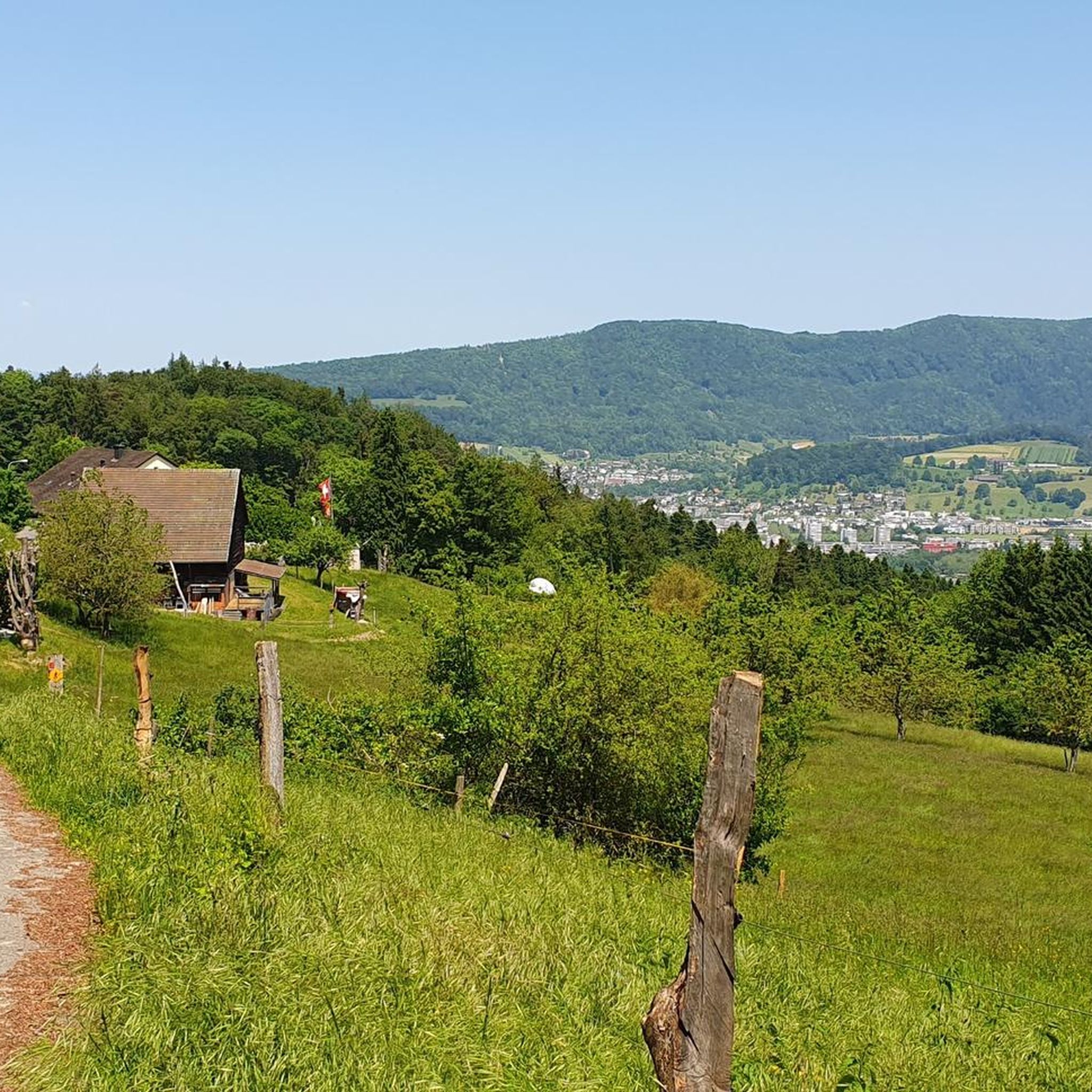
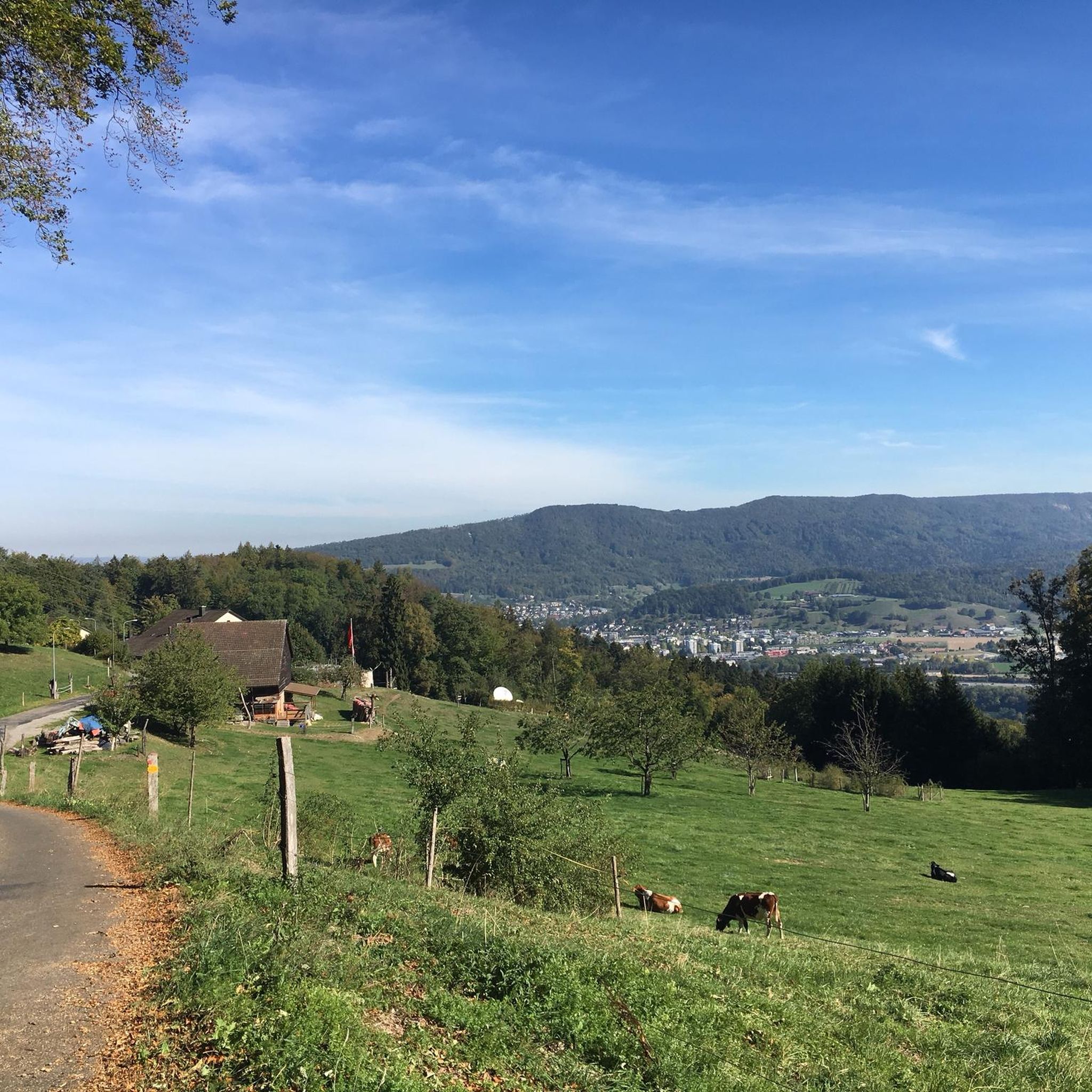
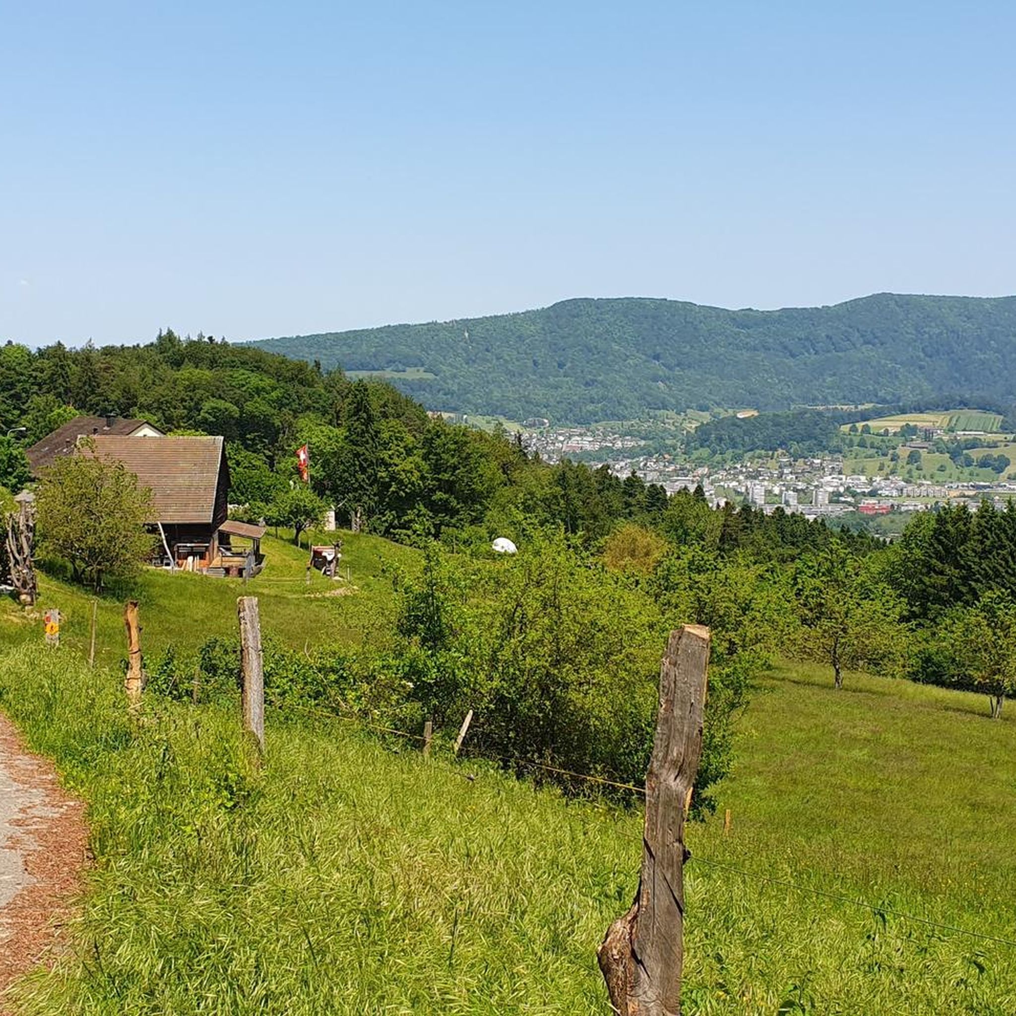
Suitable for a smaller group, right next to the forest path, a picnic spot that is very popular. Not only do you have everything you need for a picnic in the woods, but this dreamlike view of the Limmattahl is the crowning glory. Simply beautiful, even if only for a short break.
0
0

Beautiful section on the ridge trail with views towards Dietikon and Spreitenbach. Note: In summer, visibility is partially restricted by the dense foliage of the trees.
10
0
Quietly located lake in the middle of the forest, ideal for a short pause and a breath of fresh air. The Egelsee impresses with its natural atmosphere and is a beautiful intermediate point on the tour – a real feel-good spot, especially on warm days.
10
0
Popular jumping platform directly on the idyllic Egelsee – in summer a real attraction for a quick cool-down or simply to watch.
9
0
Quietly located picnic spot in the middle of the forest – ideal for a relaxing break along the way. Seating and the Drachenbrunnen make this place perfect for catching your breath, recharging, and enjoying nature.
9
0
The Hasenbergturm is climbed via 210 individually named steps – each bears the name of a sponsor or donor who supported the construction of the tower. At the top, an impressive 360-degree panoramic view awaits over the Mittelland to the Alps 🏔️.
8
0

Large square and few parking spaces available.
0
0

The forest and lake create an idyllic scene that shines with beauty 👍
4
0
Frequently Asked Questions
How many hiking trails are available around Oberrohrdorf?
Oberrohrdorf offers a selection of 16 hiking trails. These include 11 easy routes and 5 moderate paths, catering to various fitness levels.
What kind of terrain can I expect on hikes near Oberrohrdorf?
The terrain around Oberrohrdorf is quite varied. You'll find paths winding through extensive forests, along the scenic River Reuss, and over the gentle hills of the Freiamt. The region is situated on the western flank of the Heitersberg, providing elevated routes with diverse topography. For those seeking more adventure, the Lägerngrat offers a rocky ridge path with beautiful views.
Are there easy hiking options suitable for beginners in Oberrohrdorf?
Yes, Oberrohrdorf has several easy hiking options. For instance, the Scenic Ridge Trail in Aargau – View of the Aargau Valley loop from Neuenhof is an easy 3.2-mile (5.1 km) route that offers pleasant views. Another accessible option is the Hiking loop from Neuenhof, which is a shorter 2.0-mile (2.0 km) trail.
Can I find hikes that feature lakes or water bodies?
Absolutely. The idyllic Egelsee, a natural lake nestled in a wooded hollow, is a popular destination. You can explore it via routes like the Diving platform at Egelsee – Lake Egelsee (Bergdietikon) loop from Oberrohrdorf, a moderate 9.3-mile (14.9 km) path. The River Reuss also features prominently, with paths following its course through picturesque forests.
Are there any circular hiking routes around Oberrohrdorf?
Yes, many of the trails in the area are circular, allowing you to start and end at the same point. Examples include the Scenic Ridge Trail in Aargau – View of the Aargau Valley loop from Neuenhof and the Hiking loop from Oberrohrdorf, which is a 3.7-mile (6.0 km) trail through local terrain.
What natural landmarks or viewpoints can I discover on hikes?
Hikers can enjoy panoramic views from the Heitersberg. The Dominiloch Footbridge over the River Reuss offers magnificent vistas of the river and surrounding landscape. The Lägerngrat ridge trail provides beautiful views over the Mittelland, and the tranquil Egelsee is a natural highlight. You might also consider an excursion to the idyllic Linner Linde.
Are there any historical sites or castles to explore near the hiking trails?
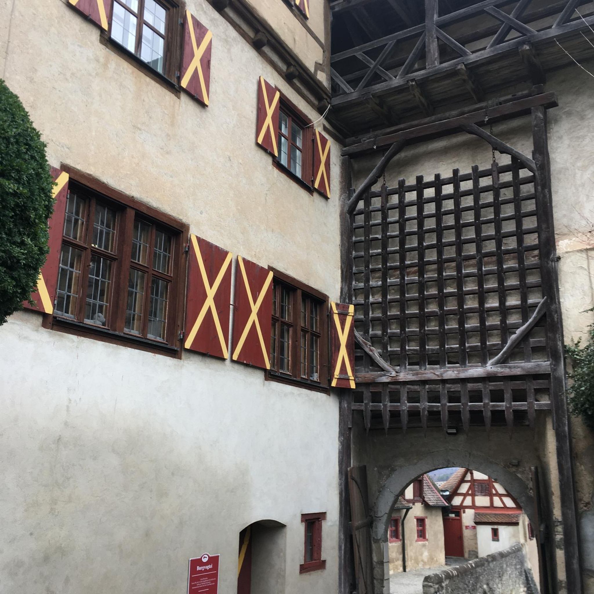
Yes, the region around Oberrohrdorf is rich in history. You can find several castles and ruins nearby. Notable examples include the Stein Castle Ruins Baden and the Lägern Castle Ruins. These can often be integrated into longer hiking excursions, adding a cultural element to your outdoor adventure.
What do other hikers enjoy the most about hiking in Oberrohrdorf?
The hiking routes in Oberrohrdorf are highly rated by the komoot community, with an average score of 4.6 stars from over 500 reviews. Hikers often praise the diverse landscapes, from quiet forested areas to scenic river paths and the tranquil Egelsee. The variety of trails, suitable for different ability levels, is also frequently highlighted.
Are there any gorges or ravines to explore in the area?
Yes, the area features some interesting geological formations. You can find highlights such as the The Aare Gorge in Brugg and the Wiesentäli above Weiningen. These offer unique natural experiences with narrow trails and exposed rock formations.
Are there any longer, more demanding hikes available?
While there are no trails classified as 'difficult' in our guide, some moderate routes offer a longer challenge. For example, the Lake Egelsee (Bergdietikon) – Diving platform at Egelsee loop from Oberrohrdorf is a moderate 10.7-mile (17.1 km) route with over 400 meters of elevation gain, providing a good workout and extended exploration of the Egelsee area.
Is Oberrohrdorf suitable for family-friendly hikes?
Yes, with a good number of easy trails and diverse natural features, Oberrohrdorf is suitable for families. The serene Egelsee is a popular spot, and the many forested paths provide shaded and enjoyable walks. Some routes, like those near Baden Old Town, can also be combined with cultural attractions, making for a varied family day out.
What is the best time of year to go hiking in Oberrohrdorf?
Oberrohrdorf offers hiking opportunities throughout much of the year. The Egelsee is particularly inviting during warm summer weekends for a refreshing dip. The extensive forested areas provide pleasant shade during hotter months, while the varied terrain offers scenic beauty in spring and autumn. Winter hikes are also possible, though conditions may vary.
Most popular routes around Oberrohrdorf
Most popular attractions around Oberrohrdorf

Get inspired with the komoot mobile app


Explore more
Browse the best Hikes in other regions.
