The best walks and hikes around Oberlascheid
4.5
(3610)
12,245
hikers
695
hikes
Hiking around Oberlascheid offers diverse landscapes within the Eifelkreis-Bitburg-Prüm region of Germany. The area is characterized by its location at the edge of the Our valley, providing views of surrounding hills and forests. Numerous streams, including the Alfbach, traverse the region, and many routes pass through the Hohes Venn-Eifel Nature Park. The broader Eifel region's volcanic past has also shaped the terrain, contributing to varied geological formations.
Best hiking trails around Oberlascheid
- The most popular hiking route is Westwallweg Bunker…
Last updated: October 14, 2026
4.6
(13)
48
hikers
Easy hike. Great for any fitness level. Easily-accessible paths. Suitable for all skill levels.
4.6
(8)
31
hikers
13.0km
03:37
230m
230m
Moderate hike. Good fitness required. Easily-accessible paths. Suitable for all skill levels.

3.8
(4)
20
hikers
Moderate hike. Good fitness required. Easily-accessible paths. Suitable for all skill levels.
4.8
(11)
23
hikers
7.08km
01:56
100m
100m
Easy hike. Great for any fitness level. Easily-accessible paths. Suitable for all skill levels.
4.0
(3)
15
hikers
Easy hike. Great for any fitness level. Easily-accessible paths. Suitable for all skill levels.
Get access to more routes and recommendations from other explorers.
Already have an account?
Our route recommendations are based on thousands of hikes, rides, and runs completed by other people on komoot.
Start today with a free account
Your next adventure awaits.


Tips from the Community

Make sure you wear waterproof, high-top walking shoes or boots in winter weather.
0
0

The bunkers were blown up after the war and are now only recognizable as rubble. Excellent biotopes for rare animals and plants have developed in the ruins. Wild cats and bats, rare mosses and lichens are conquering these moist habitats.
0
0
This section is the shortcut for the Schneifel Moore Trail
0
0

Very nice path through the forest
0
0

Great location, definitely worth a visit. If you look closely at the stone you can still see parts of the writing that was once there. Unfortunately the writing is almost illegible due to shrapnel etc.
1
0

In bad weather, hike with caution
1
0

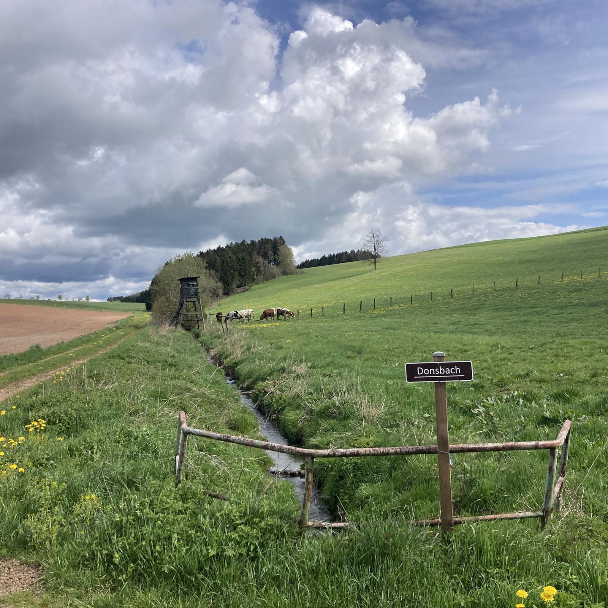
The Alfbach is a 22.3 km long, orographic right tributary of the Prüm in the Eifel district of Bitburg-Prüm in Rhineland-Palatinate. A new wooden bridge crosses the Alfbach at this point.
2
0
Frequently Asked Questions
How many hiking trails are available around Oberlascheid?
Oberlascheid offers a wide selection of hiking opportunities, with over 690 trails to explore. This includes a diverse range of routes suitable for various skill levels, from easy strolls to more challenging hikes.
Are there easy hiking trails suitable for beginners or families in Oberlascheid?
Yes, Oberlascheid has numerous easy trails, with over 300 routes classified as easy. Many of these follow the region's abundant streams, offering gentle paths through picturesque landscapes. A good option for an easy, family-friendly walk is The Richelsberg Ponds – Parish Church of Bleialf loop from Bleialf, which is just over 4 km long.
Can I find circular hiking routes in the Oberlascheid area?
Many of the hiking trails around Oberlascheid are designed as circular routes, allowing you to start and end at the same point without retracing your steps. For example, the The Richelsberg Ponds – Alfbach Footbridge loop from Oberlascheid offers a pleasant loop through the local scenery.
Are there any trails that feature historical sites or landmarks?
Yes, the region's history is woven into its landscape. Some trails incorporate old mining paths, and you can find remnants of the Westwall bunkers. Consider the Westwallweg Bunker Remains – Ruins of Westwall Bunker loop from Schlausenbach to explore historical bunker remains. The broader Eifel region also features historic sites like Malberg Castle and the 14th-century St. Nicholas Church.
What kind of natural features can I expect to see on hikes around Oberlascheid?
Oberlascheid's trails often traverse the Hohes Venn-Eifel Nature Park, characterized by abundant streams like the Alfbach, dense forests, and varied terrain shaped by the Eifel's volcanic past. You might encounter unique geological formations, lush meadows, and even evidence of wildlife like beavers along stream paths. The nearby Richelsberg Ponds are also a notable natural feature.
Are there any waterfalls or gorges to explore near Oberlascheid?
While Oberlascheid itself is known for its streams, the wider Eifel region offers dramatic natural sights. You can find impressive natural monuments like the "Teufelsschlucht" (Devil's Gorge) with its meter-high rock faces and the "Irreler Wasserfälle" (Irrel Waterfalls) which are worth exploring for their geological beauty.
What do other hikers say about the trails in Oberlascheid?
The hiking routes in Oberlascheid are highly regarded by the komoot community, with an average rating of 4.5 stars from over 3,100 reviews. Hikers often praise the diverse landscapes, the tranquility of the forests, and the well-maintained paths along the streams.
Are the hiking trails in Oberlascheid dog-friendly?
Generally, the natural trails and forest paths around Oberlascheid are suitable for dogs, provided they are kept on a leash, especially in nature protection areas or near wildlife. The numerous streams offer great opportunities for dogs to cool off. Always check local signage for specific restrictions.
What is the best time of year to go hiking in Oberlascheid?
The Eifel region, including Oberlascheid, is beautiful year-round. Spring brings blooming wildflowers, summer offers lush greenery, and autumn transforms the forests with vibrant colors. Even winter hiking can be rewarding, with serene, snow-covered landscapes, though conditions can be challenging and require appropriate gear.
Are there any scenic viewpoints along the hiking routes?
Many trails in Oberlascheid offer rewarding views, particularly those at the edge of the Our valley, providing expansive vistas of the surrounding hills and forests. Historically significant spots like Malberg Castle, though a short distance away, also offer notable viewpoints after a hike.
Are there any trails that follow streams or rivers?
Yes, the region is characterized by numerous streams, and many trails are designed to follow them. The "NaturWanderPark delux: Stream Path (Bleialf)" is a prime example, highlighting four streams and even evidence of beavers. Another excellent option is the Former Charcoal Burner's Site – Hiking trail along the Alfbach loop from Buchet, which leads through forested areas along the Alfbach stream.
What kind of wildlife might I encounter while hiking?
The diverse ecosystems of the Hohes Venn-Eifel Nature Park and surrounding forests support a variety of wildlife. Hikers might spot beavers along the stream paths, various bird species, and other forest animals. The region's rich biological diversity includes species-rich limestone grasslands and juniper heaths.
Most popular routes around Oberlascheid
Most popular attractions around Oberlascheid

Get inspired with the komoot mobile app


Explore more
Browse the best Hikes in other regions.
