The best walks and hikes around Niedernwöhren
4.6
(1279)
4,793
hikers
12
hikes
Hiking around Niedernwöhren offers access to diverse landscapes within the Schaumburger Land region. The area is characterized by the Schaumburger Wald, providing a natural setting with numerous trails. Routes often feature flat terrain along the Mittelland Canal and extend into varied natural landscapes. This combination of forest, canal, and open areas creates a compelling environment for outdoor activities.
Best hiking trails around Niedernwöhren
- The most popular hiking route is Pottstein Joy loop from Samtgemeinde Niedernwöhren, a 3.5 miles (5.7…
Last updated: August 28, 2026
4.3
(12)
47
hikers
Easy hike. Great for any fitness level. Easily-accessible paths. Suitable for all skill levels.
4.6
(7)
32
hikers
11.3km
02:51
20m
20m
Moderate hike. Good fitness required. Easily-accessible paths. Suitable for all skill levels.

Sign up for free
4.7
(9)
25
hikers
6.52km
01:40
20m
20m
Easy hike. Great for any fitness level. Easily-accessible paths. Suitable for all skill levels.
4.6
(7)
14
hikers
7.27km
01:51
20m
20m
Easy hike. Great for any fitness level. Easily-accessible paths. Suitable for all skill levels.
9
hikers
4.74km
01:13
20m
20m
Easy hike. Great for any fitness level. Easily-accessible paths. Suitable for all skill levels.
Get access to more routes and recommendations from other explorers.
Sign up for free
Already have an account?
Our route recommendations are based on thousands of hikes, rides, and runs completed by other people on komoot.
Start today with a free account
Your next adventure awaits.
Login or Signup
Tips from the Community

Nice natural products store in Mittelbrink.
1
0

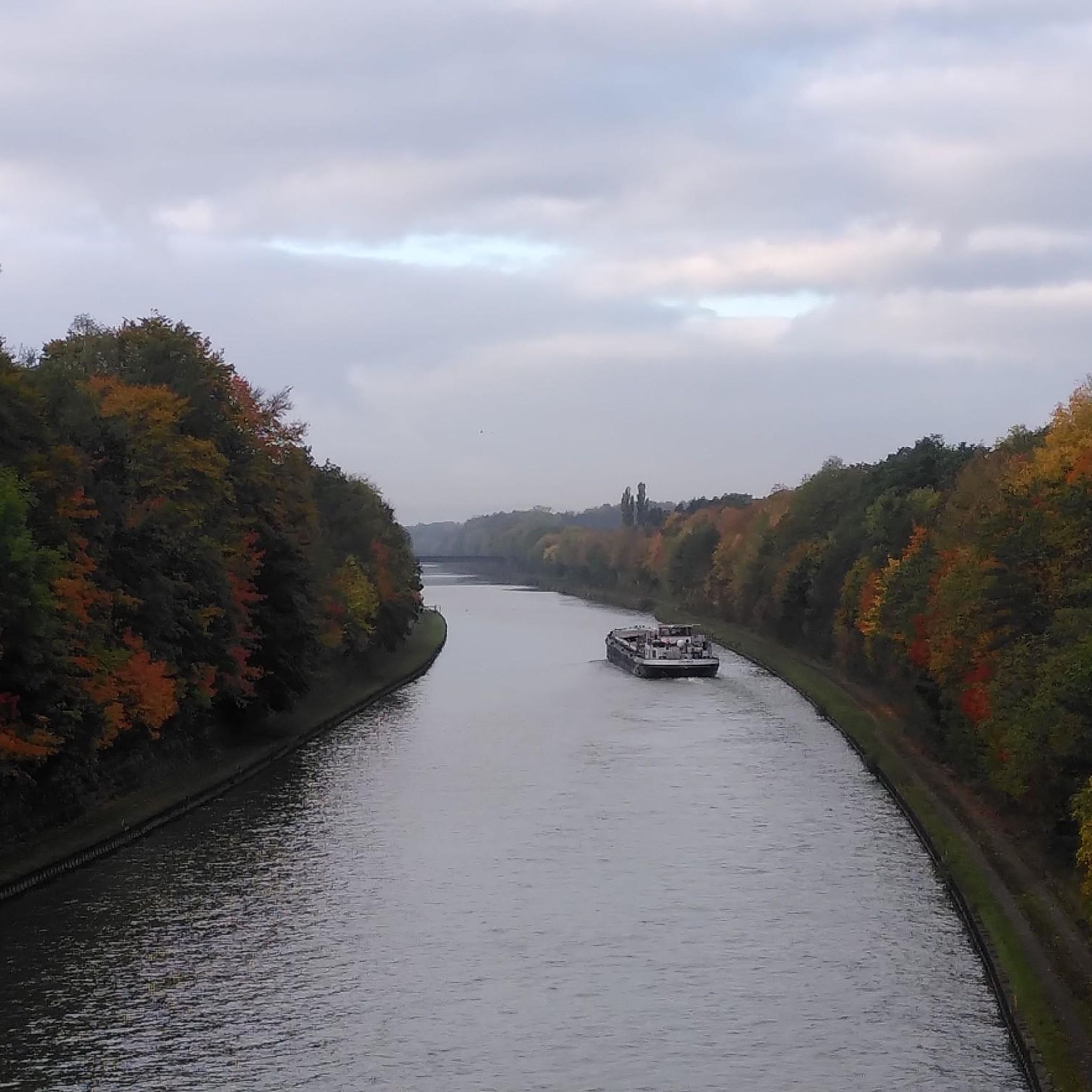
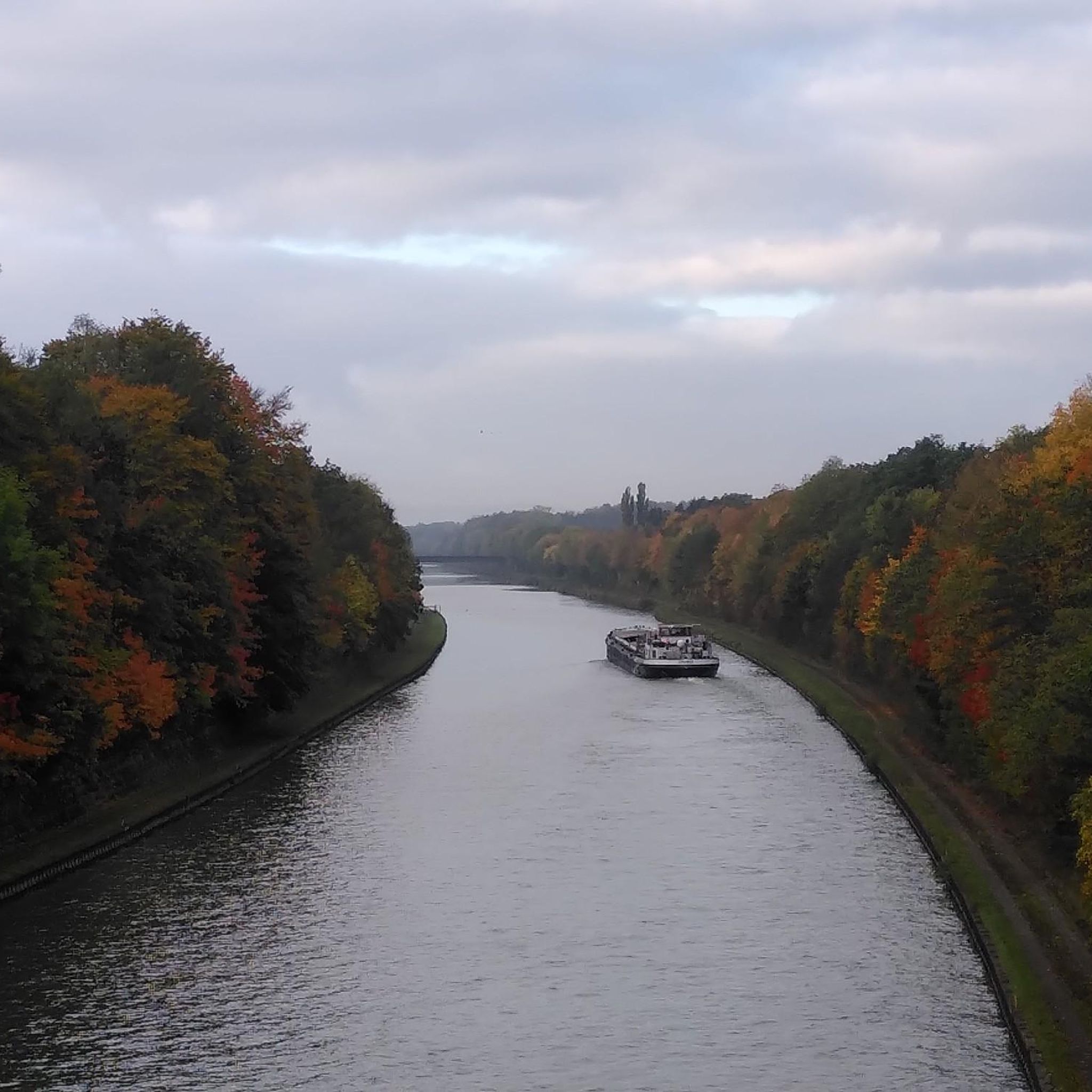
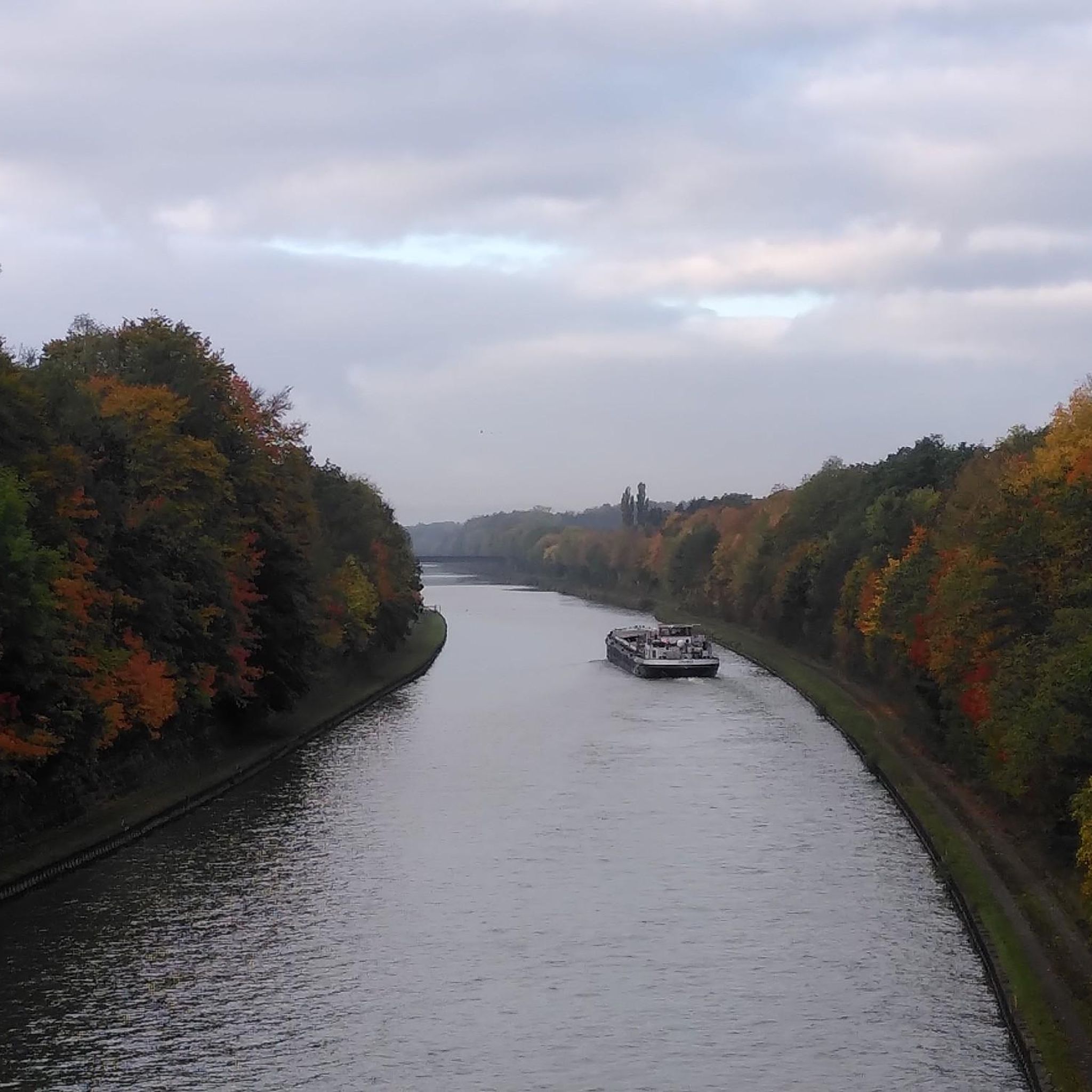
A beautiful view of the Mittelland Canal with the busy shipping traffic. The backdrop is the harbor of Pollhagen, the Pollhagen Church and the berth for yachts and ships.
0
0
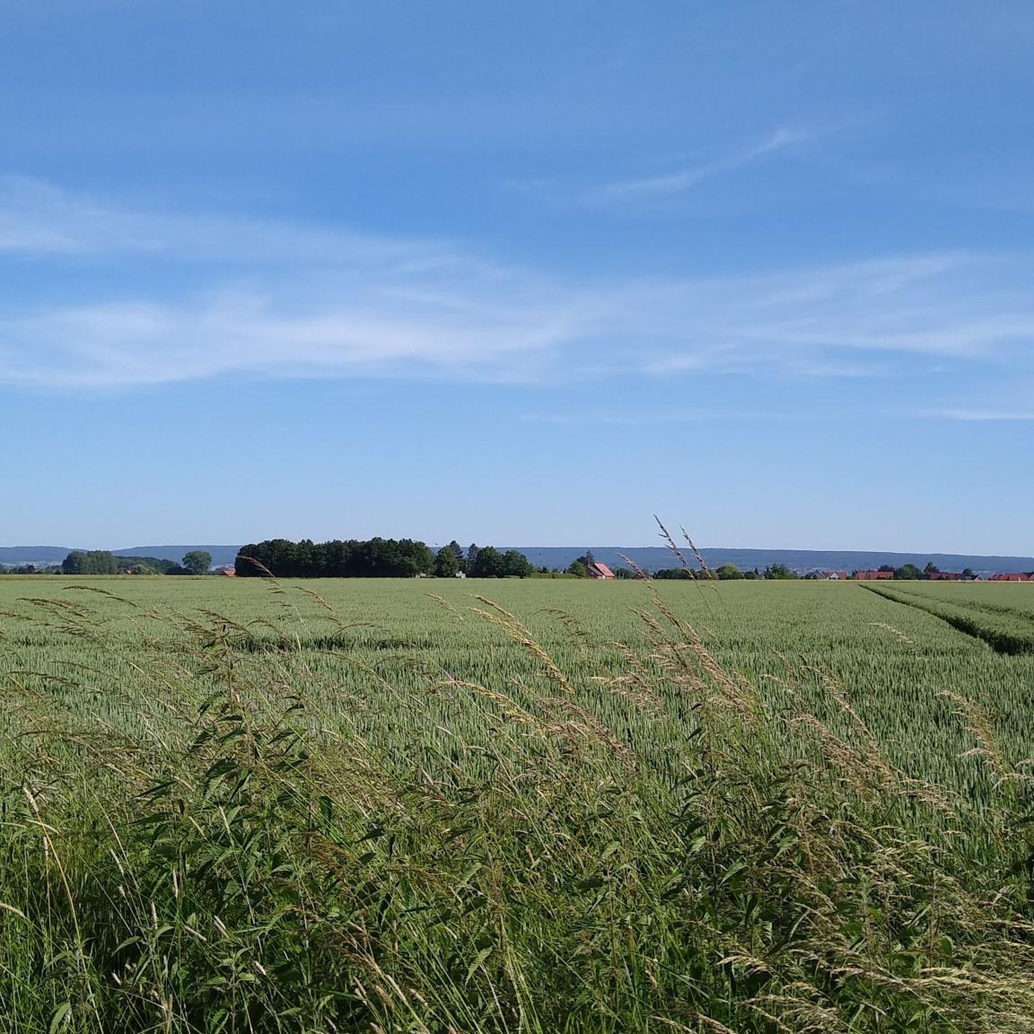
What's exciting about this vantage point isn't necessarily the view itself, as the small town of Wiedensahl is only faintly visible, but rather its historical connection to a celebrity: Wilhelm Busch grew up in Wiedensahl and made many drawings from his surroundings. That's probably exactly where he stood when he wrote down his view of his birthplace on paper.
0
0
On October 15, 1946, Friedrich Hitzemann was shot on the road to Pollhagen. He was on his bike to Pollhagen around 7 p.m. and was probably murdered by former Polish or Russian prisoners of war. His bike and his body, shot in the stomach, were found on the street the next day. His valuables were still there, only his ID was missing. Unfortunately, there will be no further information about this incident on site.
1
0

Cycling through the Schaumburg Forest is excellent. The forest used to mark the border between the Principality of Schaumburg-Lippe and the Kingdom of Hanover. Today you can roll freely through the forest and enjoy the beautiful nature.
1
0

The Schaumburg Forest is always worth a tour
1
1

Beautiful view. Cozy beer garden Bad Hiddenserborn
3
0

The Schaumburg Forest used to be a border forest between the Principality of Schaumburg-Lippe and the Kingdom of Hanover, from 1866 Prussia; today, parts of its western edge form sections of the state border with North Rhine-Westphalia. The Schaumburg Landwehr extends over a length of around 25 km in the Schaumburg Forest, which used to reach as far as Lake Steinhude and in the Middle Ages marked the border of the old county of Schaumburg and specifically the Welf areas of the Duchy of Brunswick-Lüneburg. The Schaumburg Forest is the north-western remnant of the historic Dülwald, which once stretched from Minden to the Steinhuder Meer and was a border forest of old Saxon districts. In the middle of the forest, on the Petershagen-Bückeburg connecting road, are the Baum hunting lodge and a small mausoleum, the final resting place of Count Wilhelm from Schaumburg and his family. Another mausoleum is located in the southern part of the Schaumburg Forest about a kilometer north of the connecting road from Meinsen to Cammer (both to Bückeburg). It contains the coffins of the founder of Bad Eilsen, Countess Juliane von Schaumburg-Lippe (1761–1799) and her mother. Juliane was widowed early, and the grave of her secret lover, the princely chief forester Clemens August von Kaas (1760-1832), is in a very hidden spot in the forest, east of Baum Castle. The Schaumburg Forest gained cultural-historical importance because Wilhelm Busch often painted and drew at the edges of the forest and on its forest meadows, because his birthplace Wiedensahl, where he often stayed later, is located close to the north-western edge of the Schaumburg Forest. https://de.wikipedia.org/wiki/Schaumburger_Wald
1
0
Frequently Asked Questions
How many hiking trails are available in Niedernwöhren?
Niedernwöhren offers a network of 12 hiking trails. These routes are evenly split between easy and moderate difficulty levels, ensuring options for various fitness levels.
Are there easy hiking routes suitable for beginners or families?
Yes, Niedernwöhren is well-suited for beginners and families, with 6 easy hiking routes available. An excellent option is the Jägerstein Memorial – Schaumburg Forest loop from Niedernwöhren, which is 6.5 km long and takes about 1 hour 39 minutes to complete through the tranquil Schaumburg Forest.
Can I find circular hiking routes around Niedernwöhren?
Many of the trails in Niedernwöhren are designed as circular routes, offering convenient starting and ending points. For example, the Schaumburger Forest – Mittelland Canal loop from Niedernwöhren is a moderate 11.3 km circular path that combines forest sections with views along the canal.
What kind of natural landscapes will I encounter on the trails?
The hiking trails in Niedernwöhren offer diverse natural landscapes. You'll primarily experience the lush Schaumburger Wald, providing tranquil wooded sections. Many routes also feature flat terrain along the Mittelland Canal, offering open views and a different character. The region blends these forest and canal environments with agricultural lands, creating varied scenery.
Are there any specific landmarks or attractions to see while hiking?
While hiking in the Niedernwöhren area, you can explore several interesting points. Consider visiting the Dinosaur Tracks in the Obernkirchen Sandstone Quarries, a natural monument with ancient traces. Another unique attraction is the Klostermühle Lahde (Combined Wind and Water Mill), a rare mill with both wind and water power.
What do other hikers say about the trails in Niedernwöhren?
The hiking trails in Niedernwöhren are highly rated by the komoot community, with an average score of 4.6 stars from over 1000 reviews. Hikers frequently praise the well-maintained paths, the peaceful atmosphere of the Schaumburg Forest, and the varied scenery that includes both wooded areas and the Mittelland Canal.
Are the hiking trails in Niedernwöhren suitable for dogs?
Yes, the natural landscapes and well-developed trail network in Niedernwöhren are generally suitable for dogs. The Schaumburger Wald offers plenty of shaded paths, and walks along the Mittelland Canal provide open spaces. Always ensure your dog is on a leash where required and respect local wildlife.
What is the typical duration for hikes in this region?
Hikes in Niedernwöhren vary in duration depending on the route and your pace. Easy trails like the Pottstein Joy loop from Samtgemeinde Niedernwöhren (5.7 km) typically take around 1 hour 26 minutes. Moderate routes, such as the Hiking loop from Niedernwöhren (7.3 km), might take approximately 1 hour 50 minutes.
Are there any challenging or advanced hiking trails in Niedernwöhren?
The hiking network around Niedernwöhren primarily features easy and moderate trails. There are no routes classified as difficult in this immediate area, making it ideal for relaxed walks and moderate excursions rather than strenuous climbs.
Is there public transport access to the hiking areas, or is parking available?
While specific public transport details for trailheads are best checked locally, Niedernwöhren is generally accessible. Parking is typically available near popular starting points for hiking trails. For more detailed information on local transport and parking, it's advisable to consult local tourist information or transport providers.
When is the best time of year to go hiking in Niedernwöhren?
The Schaumburger Land region, including Niedernwöhren, is enjoyable for hiking throughout much of the year. Spring and autumn offer pleasant temperatures and beautiful scenery with blooming flora or vibrant fall colors. Summer provides warm weather for longer excursions, while winter can offer peaceful, crisp walks, especially in the Schaumburg Forest, though some paths might be muddy or icy.
Are there options for refreshments or cafes near the hiking trails?
Yes, the region offers places for refreshments. For example, the Bad Hiddenser Born bridge with restaurant is a highlight that can be incorporated into some routes, providing an opportunity for a break and a meal.
Most popular routes around Niedernwöhren
Most popular attractions around Niedernwöhren

Get inspired with the komoot mobile app


Explore more
Browse the best Hikes in other regions.
