The best road cycling routes around Mayschoß
4.6
(341)
4,623
riders
136
rides
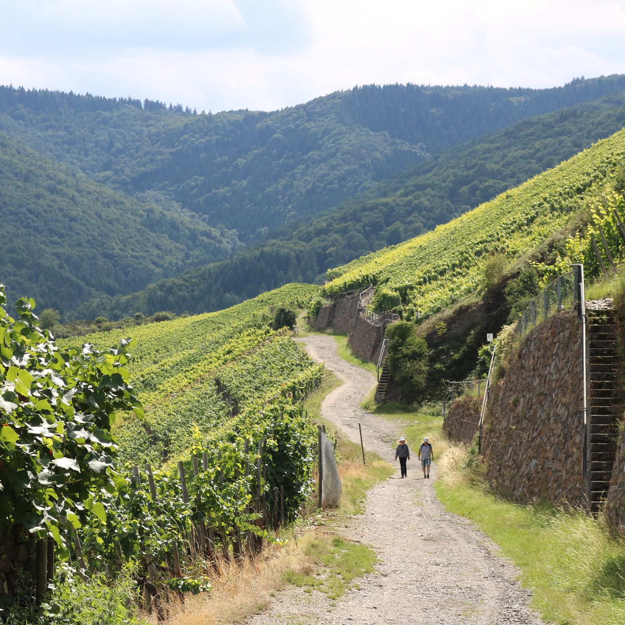
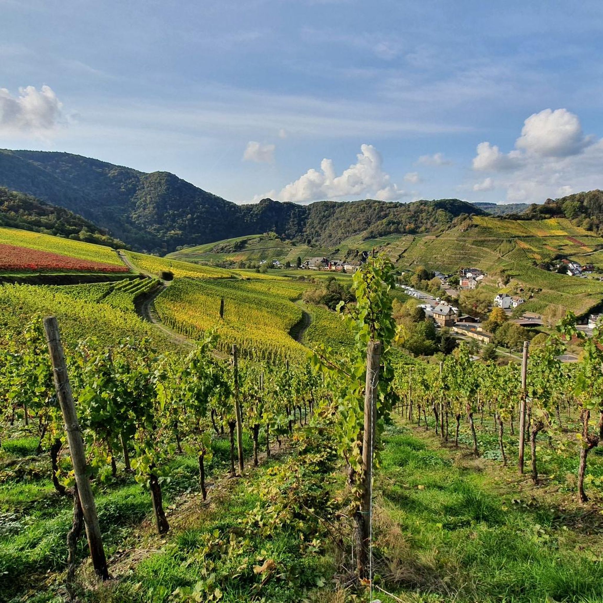
Road cycling routes around Mayschoß traverse the Ahr Valley, a region characterized by rolling hills, steep vineyards, and the Ahr River. The landscape features rocky passages and varied elevation profiles, offering diverse terrain for cyclists. Routes often follow the river's course or ascend through vineyards, providing a mix of flat sections and challenging climbs. This area combines natural features with historical attractions, making it suitable for varied road cycling experiences.
Best road cycling routes around Mayschoß
- The most popular road cycling route is Ahr loop near Mayschoss – Linder Höhe Pass from Brück loop from Mayschoß, a 49.5 miles (79.7 km) trail that takes 4 hours 0 minutes to complete. This difficult route features significant elevation gain through the Ahr Valley.
- Another top favourite among local road cyclists is View of Burg Kreuzberg – Sahrbach Valley Scenic Road loop from Altenahr, a moderate 29.8 miles (48.0 km) path. This route offers scenic views of the Ahr Valley and its surrounding landscapes.
- Local road cyclists also love the Steinerberghaus – View of Burg Kreuzberg loop from Dernau, a 55.3 miles (89.1 km) trail leading through varied terrain with views towards Burg Kreuzberg, often completed in about 4 hours 30 minutes.
- Road cycling around Mayschoß is defined by the Ahr River, extensive vineyards, and rolling hills. The network offers options for different ability levels, from easy rides along the river to challenging ascents through the vineyards.
- The routes in Mayschoß are highly rated by the komoot community with an average score of 4.7 stars from over 300 reviews. More than 4000 road cyclists have used komoot to explore Mayschoß's varied terrain.
Last updated: June 29, 2026
4.8
(10)
101
riders
79.8km
03:56
1,220m
1,220m
Hard road ride. Very good fitness required. Mostly well-paved surfaces and easy to ride.
5.0
(1)
60
riders
Moderate road ride. Good fitness required. Mostly well-paved surfaces and easy to ride.

Sign up for free
4.5
(2)
28
riders
90.1km
04:29
1,360m
1,360m
Hard road ride. Very good fitness required. Mostly well-paved surfaces and easy to ride.
4.0
(2)
117
riders
49.4km
02:03
240m
240m
Moderate road ride. Good fitness required. Mostly well-paved surfaces and easy to ride.
5.0
(1)
32
riders
136km
07:03
2,390m
2,390m
Hard road ride. Very good fitness required. Some segments of this route may be unpaved and difficult to ride.
Get access to more routes and recommendations from other explorers.
Sign up for free
Already have an account?
Our route recommendations are based on thousands of hikes, rides, and runs completed by other people on komoot.
Start today with a free account
Your next adventure awaits.
Login or Signup

Tips from the Community

At the moment the road to Altenahr is closed here
0
0

I immediately fell in love with this highlight. A fantastic valley road, fairly fresh ground, little traffic, lots of greenery, a few beautiful curves, a gentle downhill towards Altenahr, perfect for picking up the pace.
1
0
I immediately fell in love with this highlight. A fantastic valley road, fairly fresh ground, little traffic, lots of greenery, a few beautiful curves, a gentle downhill towards Altenahr, perfect for picking up the pace.
1
0

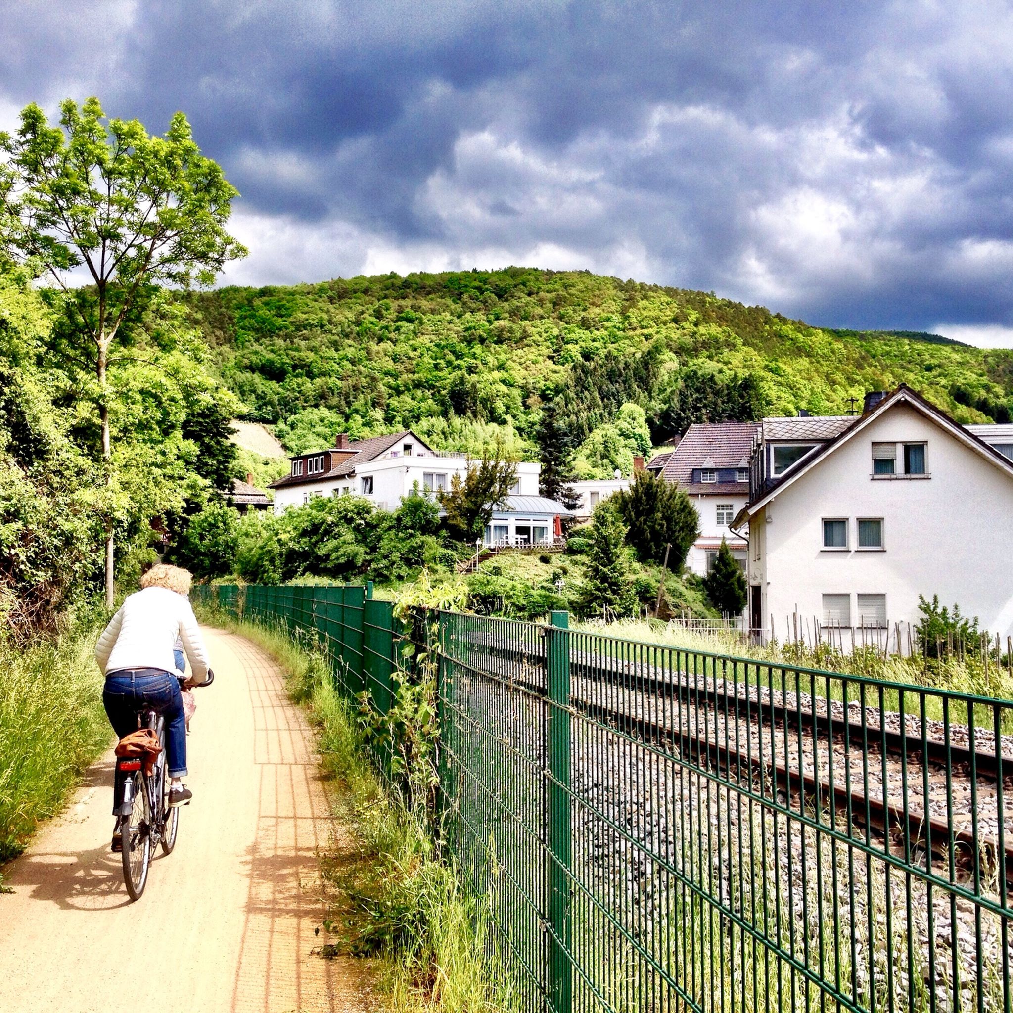
Nice change on the cycle path along the Ahr
0
0


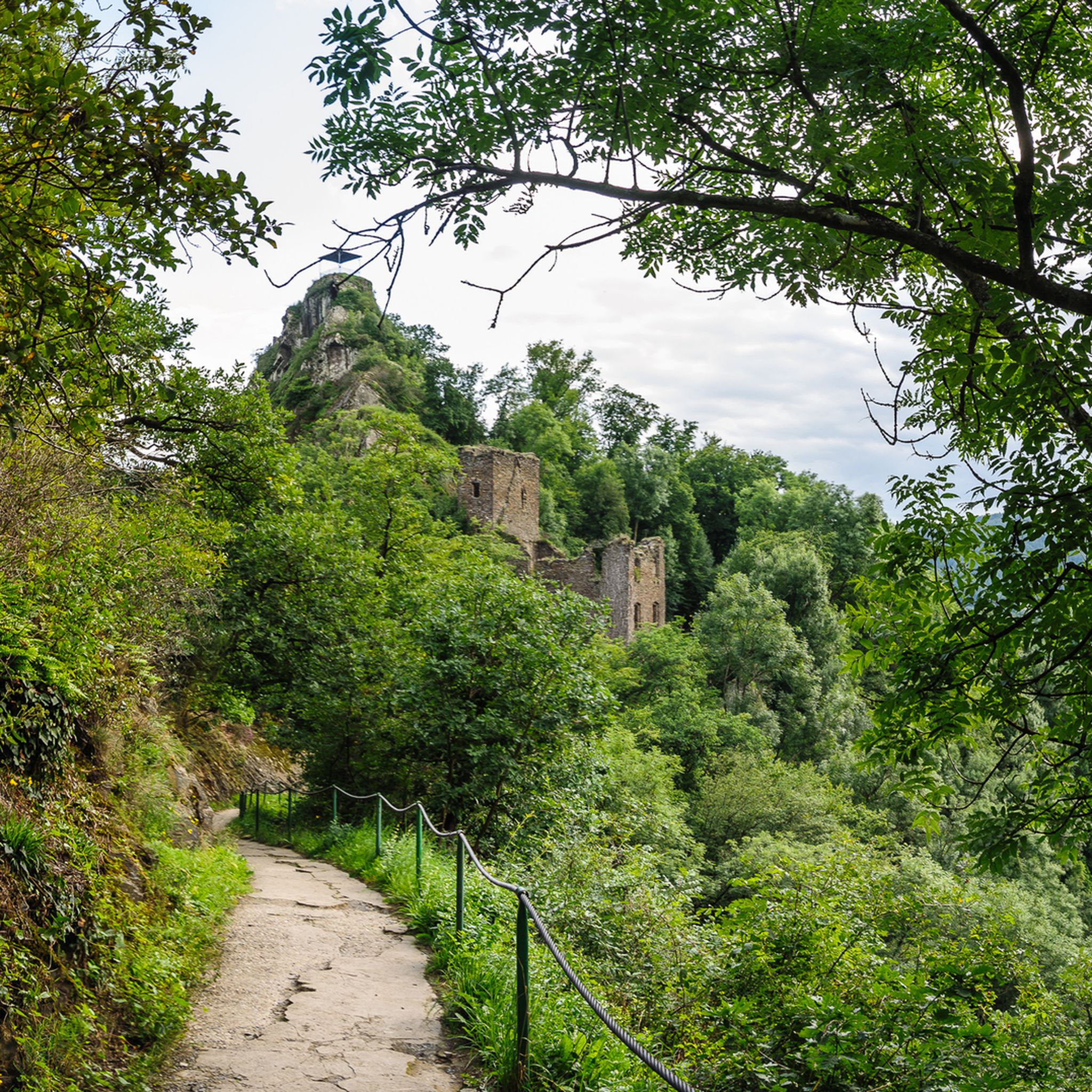
Directly after that the “ruin for eternity”
1
0

"Almost 60 percent of the Ahr Cycle Path was severely damaged or partially completely destroyed during the flood. The Ahr Cycle Path is currently open again on the section between Blankenheim and Ahrbrück and between Bad Neuenahr-Ahrweiler and Sinzig, with detours." Information on the reconstruction of the Ahr Cycle Path can be found at https://www.ahrtal.de/
3
0
Altenburg was also affected by the terrible flooding on the Ahr. Many people died, many lost their homes and all their belongings. The residents of the Ahr Valley need tourism even during the ongoing reconstruction and are particularly happy about the returning bicycle tourists.
3
0
Frequently Asked Questions
How many road cycling routes are available around Mayschoß?
There are over 140 road cycling routes around Mayschoß, offering a wide range of options for different skill levels and preferences. The komoot community has explored these routes over 4000 times, providing an average rating of 4.7 stars.
What is the best time of year for road cycling in Mayschoß?
Mayschoß is beautiful for road cycling from spring through autumn. The autumn months are particularly scenic as the vineyards transform into a vibrant sea of color, enhancing the 'wild romantic' feel of the Ahr Valley.
What are the general terrain and difficulty levels for road cycling in Mayschoß?
The terrain around Mayschoß is diverse, featuring rolling hills, steep vineyards, and the Ahr River. You'll find a mix of flat sections along the river and challenging ascents through the vineyards. Out of over 140 routes, 17 are considered easy, 78 moderate, and 49 difficult, catering to all experience levels.
What historical landmarks can I see along road cycling routes near Mayschoß?
Road cycling routes in Mayschoß often pass by significant historical sites. You can visit the ancient Saffenburg Castle Ruins, the oldest castle complex in the Ahr Valley, offering panoramic views. The picturesque Ruins of Marienthal Monastery also provide a charming spot for a break.
Are there any unique natural features to explore while cycling in Mayschoß?
Yes, the region boasts several unique natural features. The Devil's Hole (Teufelsloch) near Altenahr is a distinctive rock formation with local legends. The Ahr Valley itself is characterized by its dramatic rocky passages and extensive vineyards, especially vibrant during harvest season.
Are there any good viewpoints along the road cycling routes in Mayschoß?
Absolutely. Many routes offer stunning vistas. The Saffenburg Castle Ruins provide magnificent panoramic views of Mayschoß and the entire Ahr Valley. Other notable viewpoints include Altenahrer Eck and the unique View of Mayschoss Through the Welcome Door.
What do other road cyclists appreciate most about Mayschoß?
The komoot community rates road cycling in Mayschoß highly, with an average score of 4.7 stars. Cyclists frequently praise the region's varied terrain, from scenic river paths to challenging vineyard climbs, and the beautiful combination of natural landscapes with historical and wine culture attractions.
Are there easy road cycling routes suitable for beginners in Mayschoß?
Yes, Mayschoß offers 17 easy road cycling routes, many of which follow the Ahr River. These routes provide a gentler experience, allowing beginners to enjoy the scenic Ahr Valley without significant elevation challenges. An example of a moderate route with less elevation is the Ahr loop near Mayschoss – Steinbergs Bridge Dernau loop from Altenahr.
Can I find challenging road cycling routes with significant elevation gain?
For experienced cyclists seeking a challenge, Mayschoß has 49 difficult routes with substantial elevation gain. Routes like the Linder Höhe Pass from Brück – Insul Tunnel loop from Dernau feature over 2300 meters of ascent, traversing broad meadow plateaus and steep vineyard climbs for an 'alpine-feeling' experience.
Are there circular road cycling routes starting from Mayschoß?
Yes, many road cycling routes in Mayschoß are designed as loops, allowing you to start and end in the same location. A popular difficult option is the Ahr loop near Mayschoss – Linder Höhe Pass from Brück loop from Mayschoß, which is nearly 80 km long.
What is the current status of the Ahr Cycle Path for road cyclists?
While parts of the Ahr Cycle Path were impacted by the 2021 flood, sections between Blankenheim and Ahrbrück, and between Bad Neuenahr-Ahrweiler and Sinzig, are currently passable. Cyclists can still enjoy significant portions of this scenic path along the Ahr River.
Are there family-friendly road cycling options in Mayschoß?
For families, the easier routes along the Ahr River are generally suitable, offering flatter terrain and picturesque views. These paths allow for a relaxed cycling experience away from heavy traffic, perfect for enjoying the landscape together.
Where can I find parking for my bike and car in Mayschoß?
Mayschoß, being a popular starting point for outdoor activities, offers various parking options. Look for designated parking areas within the village, especially near the main attractions or trailheads, which are typically well-signposted for visitors.
Most popular routes around Mayschoß
Most popular attractions around Mayschoß

Get inspired with the komoot mobile app


Explore more
Browse the best Road cycling routes in other regions.
