The best walks and hikes around Montpreveyres
4.5
(729)
5,761
hikers
322
hikes
Hiking around Montpreveyres offers a network of trails through the Jorat region, characterized by its extensive forests and gentle hills. The landscape features varied terrain, including wooded paths, open areas, and viewpoints. Elevation changes are generally moderate, making the area accessible for a range of hiking abilities.
Best hiking trails around Montpreveyres
- The most popular hiking route is A walk in the heart of Haut Jorat - Parc Naturel du Jorat, a 3.4 miles (5.4 km) trail that takes…
Last updated: October 9, 2026
1.0
(1)
9
hikers
5.40km
01:30
100m
100m
Easy hike. Great for any fitness level. Easily-accessible paths. Suitable for all skill levels.
5.0
(1)
10
hikers
9.92km
02:47
190m
190m
Moderate hike. Good fitness required. Easily-accessible paths. Suitable for all skill levels.

6
hikers
7.01km
01:59
150m
150m
Easy hike. Great for any fitness level. Easily-accessible paths. Suitable for all skill levels.
4.0
(2)
10
hikers
Moderate hike. Good fitness required. Easily-accessible paths. Suitable for all skill levels.
4
hikers
9.07km
02:29
140m
150m
Moderate hike. Good fitness required. Easily-accessible paths. Suitable for all skill levels.
Get access to more routes and recommendations from other explorers.
Already have an account?
Our route recommendations are based on thousands of hikes, rides, and runs completed by other people on komoot.
Start today with a free account
Your next adventure awaits.

Tips from the Community

The trail takes you into the heart of the forest. The Jorat is the largest single forest massif in the Swiss Plateau, and here you can benefit from its great biodiversity.
0
0
Small shelter in the forest, ideal for picnicking in bad weather. A parking lot is located right next door.
0
0

The triangular section tripoint terminal of the Trois Jorats was sculpted by Milo Martin and erected on October 23, 1929. It replaces a large molasse terminal emblazoned with the Bear of Berne which was degraded. Inscription: JORAT DE L’EVEQUE arms of Montpreveyres MONTPREVEYRES 8| JORAT DE LA CITY arms of Lausanne LAUSANNE | JORAT OF ECHALLENS arms of Échallens FROIDEVILLE BORNE DES TROIS JORATS 1928 ALT 893 https://sketchfab.com/3d-models/borne-des-trois-jorats-41e11ddffdd748e0a64312e6ce79b2b6 Credit: clwacker
0
1

"Historical" separation of the territories of Jorat
0
0
Nice for a picnic or a barbecue, 30 m from the (small) road. Very easy to access for people with reduced mobility
0
0
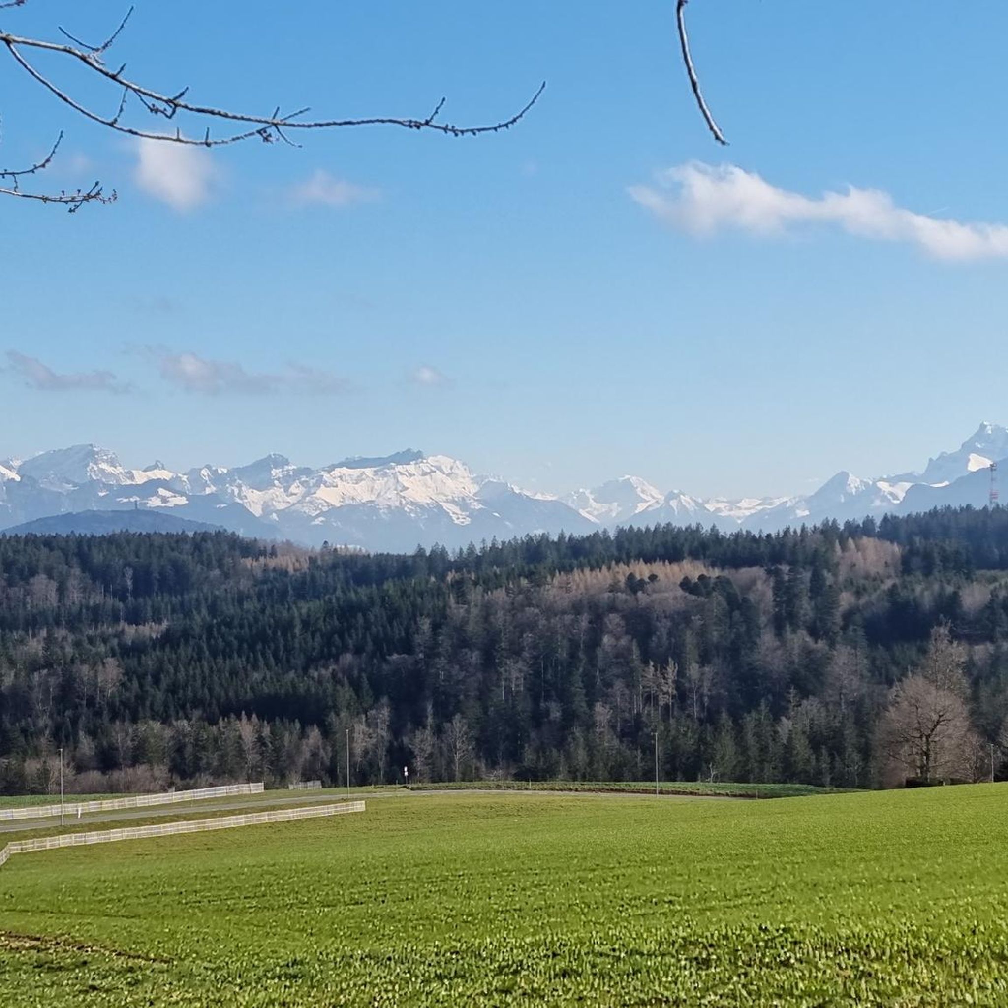
Beautiful view of the Pre-Alps and the Dents du Midi.
1
0

Nice descent with roots. Can be quick and technical. As desired.
0
0
Sloping passage, with 1 nice jump in the middle of the path. Fast if good pedal stroke. Be careful of horses and humans with their dogs. Lots of mud in the hollows.
0
0
Frequently Asked Questions
How many hiking trails are available around Montpreveyres?
There are over 300 hiking routes around Montpreveyres, offering a wide variety of options. Approximately half of these are considered easy, with a significant number of moderate trails and a few more challenging options for experienced hikers.
What kind of terrain can I expect on hikes near Montpreveyres?
The hiking trails around Montpreveyres primarily traverse the Jorat region, characterized by extensive forests and gentle hills. You'll find varied terrain, including wooded paths, open areas, and scenic viewpoints. Elevation changes are generally moderate, making the area accessible for a range of hiking abilities.
Are there easy hiking trails suitable for beginners or families in Montpreveyres?
Yes, Montpreveyres offers many easy routes perfect for beginners and families. For example, A walk in the heart of Haut Jorat - Parc Naturel du Jorat is an easy 3.4-mile (5.4 km) trail that takes about 1 hour 30 minutes to complete, winding through the natural park.
Are there any circular hiking routes around Montpreveyres?
Many of the trails around Montpreveyres are designed as circular routes, allowing you to start and end at the same point. An example is the moderate Riau Graubon Viewpoint – Forest Picnic Area loop from Montpreveyres, which is 6.1 miles (9.8 km) long and includes a viewpoint and a picnic area.
What are the best seasons for hiking in Montpreveyres?
The Jorat region around Montpreveyres is beautiful year-round. Spring brings lush greenery and blooming flora, while autumn offers stunning fall colors in the extensive forests. Summer is ideal for longer hikes, and even winter can be enjoyed with appropriate gear, as the gentle slopes are suitable for snowshoeing or winter walks.
Are dogs allowed on the hiking trails in Montpreveyres?
Generally, dogs are welcome on the hiking trails around Montpreveyres. It's always recommended to keep your dog on a leash, especially in forested areas or near wildlife, and to clean up after them. Be mindful of local regulations, particularly in nature reserve sections of the Jorat Natural Park.
Are there any viewpoints or scenic spots along the trails?
Yes, several routes offer scenic viewpoints. The Riau Graubon Viewpoint – Forest Picnic Area loop from Montpreveyres and the Riau Graubon Viewpoint loop from Bois du Jorat both feature the Riau Graubon Viewpoint, providing lovely vistas over the surrounding landscape.
What can I see along the hiking trails besides natural scenery?
Beyond the natural beauty of the Jorat forests, you can discover interesting landmarks. For instance, the Around Les Cullayes – Lion Enclosure loop from Montpreveyres passes by the Lion Enclosure. You can also explore nearby castles like Château Saint-Maire or Château de Montagny, or visit charming huts such as Refuge des Charbonnières.
Are there places to eat or have a picnic along the hiking routes?
Yes, some trails incorporate picnic areas. The Riau Graubon Viewpoint – Forest Picnic Area loop from Montpreveyres includes a dedicated forest picnic area. Additionally, you might find huts or inns like the Chalet-des-Enfants Inn near some routes, offering refreshments.
What do other hikers enjoy most about the trails in Montpreveyres?
The trails in Montpreveyres are highly rated by the komoot community, with an average score of 4.5 stars from over 590 reviews. Hikers often praise the quiet woodlands, the well-maintained paths, and the peaceful atmosphere of the Jorat region.
Are there any challenging hikes for experienced hikers in Montpreveyres?
While Montpreveyres is known for its gentle slopes, there are a few more challenging routes available for those seeking a greater workout. These typically feature longer distances or slightly steeper ascents, though the overall elevation changes remain moderate compared to mountainous regions. You can filter for 'difficult' routes on komoot to find these options.
How long do hikes in Montpreveyres typically take?
The duration of hikes in Montpreveyres varies greatly depending on the route's length and your pace. Shorter, easy trails like A walk in the heart of Haut Jorat - Parc Naturel du Jorat can be completed in about 1 hour 30 minutes, while longer moderate loops such as the Gentle Forest Slope – Root Path loop from Montpreveyres might take around 2 hours 15 minutes.
Most popular routes around Montpreveyres
Most popular attractions around Montpreveyres

Get inspired with the komoot mobile app


Explore more
Browse the best Hikes in other regions.
