The best traffic-free bike rides around La Iruela
5.0
(2)
39
riders
2
rides
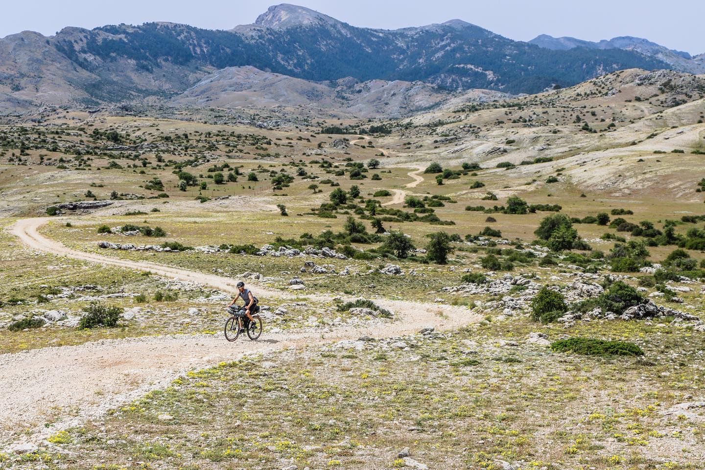
Gravel biking around La Iruela offers access to the vast Sierras de Cazorla, Segura y Las Villas Natural Park, characterized by an orographic labyrinth of valleys, limestone plateaus, gorges, and mountains. The region features a diverse terrain with well-maintained forest tracks, 4WD trails, and some rocky sections, providing varied riding experiences. Significant elevation changes are common, with routes traversing from approximately 1,600 feet (500 meters) to over 6,800 feet (2,100 meters). This area is also hydrologically important, being the source…
Last updated: July 11, 2026
15
riders
61.5km
04:55
1,510m
1,510m
Hard gravel ride. Very good fitness required. Mostly paved surfaces. Suitable for all skill levels.
1
riders
72.0km
06:17
2,020m
2,010m
Hard gravel ride. Very good fitness required. Mostly paved surfaces. Suitable for all skill levels.

Sign up for free
6
riders
28.5km
02:34
680m
680m
Hard gravel ride. Very good fitness required. Mostly paved surfaces. Suitable for all skill levels.
Our route recommendations are based on thousands of hikes, rides, and runs completed by other people on komoot.
Start today with a free account
Your next adventure awaits.
Login or Signup





Tips from the Community

From this viewpoint, we will have the opportunity to contemplate a beautiful panorama in which the castle of Las Cinco Esquinas stands out on the left, located on the Loma del Castillo. In front is the castle of La Yedra together with the urban center of Cazorla. And to the right, Pollos de la Escaleruela, Cerro de la Laguna, and Peña de los Halcones can be seen.
0
0
El Refugio del Collado Zamora (often associated with the route to Gilillo) is a rehabilitated forest refuge located in the Sierra de Cazorla, key to the GR-247 trail. It is frequently used as a starting point or stopover to ascend to Gilillo or connect to areas such as Cuerda del Gilillo.
0
0

Added to the collection: https://www.komoot.com/de-de/collection/3600632/-naturdenkmaeler-besondere-baeume-und-weitere-schaetze-der-natur
0
0


This rest area is located just 200 metres from the source of the Guadalquivir River, and in addition to a small spring where you can drink water, there are also benches and shade where you can rest.
11
0
This is the most characteristic point from which you can see the entire valley of the Guadalquivir River, and all the human settlements that currently exist such as Arroyo Frío, El Chaparral or Loma de María Ángela. It is located at an altitude of 1241 meters above sea level.
14
0
This is one of the most important tributaries that provide water to the Bolera reservoir (or swamp) with a variable but almost constant flow, except in situations of prolonged drought. This bridge facilitates the passage to the cart ford continuing along the Fisherman's Path.
15
0
At this intersection is where the Hornico nature classroom is located, dependent on the Department of the Environment of the Government of Andalusia, and it is from where courses are taught mainly to schoolchildren who come from various points of our geography.
13
0
Frequently Asked Questions
How many no-traffic gravel bike trails are featured in this guide for La Iruela?
This guide highlights three challenging no-traffic gravel bike routes around La Iruela, all rated as difficult. However, the wider Sierras de Cazorla, Segura y Las Villas Natural Park offers an extensive network of tracks and trails, providing countless opportunities for traffic-free gravel biking beyond these specific recommendations.
What kind of terrain can I expect on no-traffic gravel bike trails near La Iruela?
The region around La Iruela, particularly within the Sierras de Cazorla, Segura y Las Villas Natural Park, offers a diverse mix of terrain. You'll encounter well-maintained forest tracks and 4WD trails, alongside more challenging rocky sections. Expect significant elevation changes, with routes climbing from around 500 meters to over 2,100 meters, providing both demanding ascents and exhilarating descents.
Are there any circular no-traffic gravel bike routes available?
Yes, this guide includes several circular routes designed for gravel biking with minimal traffic. For example, the challenging Cazorla – Collado Zamora Refuge loop from Cazorza covers over 61 km with significant elevation, offering a full day's adventure. Another option is the Pine of the Crosses – Guazalamanco Waterfall loop from Nava de Don Antonio, which is even longer and more demanding.
What natural features or landmarks can I see along these no-traffic gravel routes?
The no-traffic gravel routes in this region pass through the stunning Sierras de Cazorla, Segura y Las Villas Natural Park, offering numerous natural highlights. You might encounter dramatic canyons like the Elías Gorge, or scenic viewpoints such as Riogazas Viewpoint. The park is also known for its hydrological importance, being the source of rivers like the Guadalquivir, and features unique 'lunar landscapes' on its high mountain plateaus.
Are there any waterfalls accessible from the no-traffic gravel bike trails?
Yes, the region is home to spectacular waterfalls. The Pine of the Crosses – Guazalamanco Waterfall loop from Nava de Don Antonio specifically leads to the Guazalamanco Waterfall. The famous Salto de los Órganos Waterfall, a dramatic 170-meter cascade, is also within the natural park and can be accessed via challenging trails, though it may require a short hike from a suitable bike parking spot.
What is the best time of year for gravel biking in La Iruela to avoid traffic?
The Sierras de Cazorla, Segura y Las Villas Natural Park generally offers excellent conditions for gravel biking outside of peak summer heat (July-August) and potential winter snow at higher elevations. Spring (April-June) and Autumn (September-November) are ideal, with pleasant temperatures and lush landscapes. These periods also tend to have fewer visitors than the height of summer, further ensuring a peaceful, traffic-free experience on the trails.
Are there any facilities or refuges along the no-traffic gravel routes?
Yes, some routes pass by or near mountain refuges. For instance, the Cazorla – Collado Zamora Refuge loop from Cazorza includes the Collado Zamora Refuge. Other facilities like Rambla Seca Shelter and Fuente de Acero Refuge are also located within the natural park, offering potential rest stops or overnight options for bikepackers.
What do other gravel bikers say about the no-traffic trails in La Iruela?
The komoot community highly rates the gravel biking experience in this region, with an average score of 5.0 stars. Riders often praise the stunning natural beauty, the challenging yet rewarding terrain, and the immersive feeling of being deep within Europe's largest protected natural space, far from traffic.
Are there options for less experienced riders looking for traffic-free gravel trails?
While the routes specifically featured in this guide are rated as difficult due to significant elevation and distance, the broader network of tracks within the Sierras de Cazorla, Segura y Las Villas Natural Park includes a variety of surfaces. Less experienced riders might find smoother, flatter sections of forest tracks, particularly around areas like El Tranco Reservoir, which offer enjoyable sinuous gravel riding with minimal traffic. It's recommended to consult detailed maps and route profiles to identify easier sections.
Can I find places to eat or stay in traditional villages near the gravel trails?
Absolutely. The natural park is dotted with small, whitewashed Andalusian villages. These traditional settlements offer opportunities to experience local culture, enjoy authentic cuisine, and find welcoming tapas bars. Many also provide accommodation options, making them perfect bases for exploring the surrounding no-traffic gravel trails.
Is public transport an option for accessing these gravel bike trails from La Iruela?
While La Iruela is a gateway to the natural park, public transport options directly to the trailheads within the park can be limited. It's generally more convenient to use a car to reach starting points, especially for routes that begin deeper within the park. However, some routes might be accessible by cycling directly from La Iruela itself, connecting to the extensive network of tracks.
Are there any specific viewpoints worth seeking out on the no-traffic gravel routes?
The mountainous terrain of the Sierras de Cazorla offers numerous breathtaking panoramic views. The Riogazas Viewpoint is a notable spot featured in one of the routes. Additionally, Puerto de las Palomas provides stunning vistas over the Guadalquivir Valley and is excellent for birdwatching. Many high points along the trails will offer spectacular scenery of the 'orographic labyrinth' of valleys, gorges, and mountains.
Most popular attractions around La Iruela

Get inspired with the komoot mobile app


Explore more
Browse the best Gravel rides in other regions.
