The best traffic-free bike rides around Yunquera
4.3
(21)
979
riders
3
rides
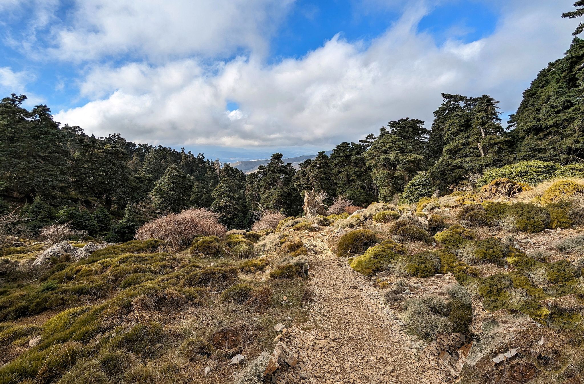
No traffic road cycling routes around Yunquera navigate the diverse landscapes at the gateway to the Sierra de las Nieves Natural Park in southern Spain. The region is characterized by significant elevation changes, offering both consistent climbs and varied terrain. Cyclists encounter smooth asphalt roads that lead through areas with minimal traffic, particularly as routes ascend into the mountains. This setting provides a range of options for building endurance and experiencing the natural environment.
Best no traffic road cycling routes…
Last updated: July 11, 2026
24
riders
72.2km
04:09
1,530m
1,520m
Hard road ride. Very good fitness required. Some segments of this route may be unpaved and difficult to ride.
5
riders
Hard road ride. Very good fitness required. Mostly well-paved surfaces and easy to ride.

Sign up for free
5
riders
Moderate road ride. Good fitness required. Mostly well-paved surfaces and easy to ride.
Our route recommendations are based on thousands of hikes, rides, and runs completed by other people on komoot.
Start today with a free account
Your next adventure awaits.
Login or Signup
Other adventures around Yunquera

Tips from the Community

The Conde de Guadalhorce reservoir is nestled in a picturesque mountain landscape near El Chorro and impresses with turquoise water, steep rock faces and tranquil nature, making it a particularly idyllic destination for tours.
1
0

A magnificent viewpoint with a unique natural setting. The water of the reservoirs shimmers a truly turquoise color, offering incredible views. There is a parking lot not far away. Mirador de los Tres Embalses (Viewpoint of the Three Reservoirs): Located at the confluence of the Turón, Guadalteba, and Guadalhorce reservoirs, the viewpoint offers a panoramic view of the various dams and hydroelectric power plants of the El Chorro water network. This viewpoint was originally built as a topographical checkpoint during construction in the early 20th century.
7
0

At the end of the loop, we climb towards the lookout surrounded by wooden barriers. This is the end of the loop: Return by road, no longer marked GR path.
2
0
Great photo point! The Embalse del Conde de Guadalhorce is one of the most famous and picturesque reservoirs in the province of Málaga. It is located in the Ardales region and is part of a network of reservoirs that contribute to the water supply and irrigation in the area. Together with the neighboring Guadalteba and Gaitanejo reservoirs, it forms the so-called Pantano del Chorro. The reservoir has an impressive body of water surrounded by dense pine forests and rocky landscapes. It is used for water supply, irrigation and partly for generating electricity. There are hiking and cycling trails around the reservoir that lead through the beautiful nature and pine forests. There are numerous picnic areas.
11
2

An excursion on foot that is absolutely worth doing
1
1


The entire route is a dream route with mostly decent asphalt, a magnificent view and great climbs, mostly well below 12%.
0
0

A magnificent viewpoint between the 3 adjoining reservoirs: Guadalhorce, Guadalteba and Conde de Guadalhorce
1
0
Frequently Asked Questions
How many no-traffic road cycling routes are available in Yunquera?
There are 3 dedicated no-traffic road cycling routes around Yunquera featured in this guide. These routes are specifically curated to offer a serene cycling experience away from heavy vehicle traffic, allowing you to fully immerse yourself in the stunning landscapes of the Sierra de las Nieves Natural Park.
What is the best time of year for traffic-free road cycling in Yunquera?
The mild temperatures in spring and autumn make these seasons particularly ideal for outdoor activities, including traffic-free road cycling, in Yunquera. The weather is generally pleasant, offering comfortable conditions for longer rides and enjoying the scenic views.
Are there any beginner-friendly no-traffic road cycling routes?
Yes, for those looking for a more accessible ride, the View of Casarabonela – View of Canillas de Aceituno loop from Casarabonela is rated as moderate. This route covers 11.6 km with 315 meters of elevation gain, providing a great option to experience the region's beauty without excessive challenge.
What kind of views can I expect on these traffic-free routes?
The routes offer diverse and breathtaking views, ranging from the majestic karst formations and dense Spanish fir forests of the Sierra de las Nieves National Park to panoramic vistas over the surrounding valleys. You'll encounter stunning natural features and picturesque landscapes throughout your ride. Many routes, like the View of Canillas de Aceituno – Three Reservoirs Viewpoint loop from Casarabonela, are named for their exceptional viewpoints.
Are there any challenging no-traffic road cycling routes for advanced riders?
Absolutely. For experienced cyclists seeking a challenge, routes like the View of Canillas de Aceituno – Three Reservoirs Viewpoint loop from Casarabonela offer significant elevation gains and longer distances. This particular route spans over 72 km with more than 1500 meters of climbing, providing an excellent test of endurance and power on smooth, quiet roads.
Can I find circular no-traffic road bike trails in Yunquera?
Yes, all the no-traffic road cycling routes highlighted in this guide are circular loops. This means you'll start and finish at the same point, making logistics simpler and allowing you to explore the varied terrain without needing to arrange a return journey. Examples include the View of Canillas de Aceituno – Entrance bridge to El Burgo loop from Casarabonela.
What natural attractions can I see near the no-traffic road cycling routes?
The region around Yunquera is rich in natural beauty. You can find several stunning waterfalls, such as the Charco de la Virgen Waterfall and Rejía Waterfall. There are also significant natural monuments like the Torrecilla Peak (1,919 m) and the unique Candelabra Spanish Fir, offering opportunities to explore beyond your ride.
What do other road cyclists enjoy most about road cycling in Yunquera?
The area is highly rated by the komoot community, with an average score of 4.7 stars. Reviewers often praise the minimal traffic deeper in the mountains, the smooth asphalt roads, and the stunning, diverse landscapes that make for an immersive and enjoyable cycling experience. The challenging climbs and rewarding views are frequently highlighted.
Are there any historical landmarks or points of interest in Yunquera itself?
Yes, the village of Yunquera boasts a charming medieval layout with cobbled streets and historical monuments. You can visit the Nuestra Señora de la Encarnación Church, known as the 'Cathedral of the Highlands,' and the ruins of an Arab watchtower. The Torre Vigía, once a watchtower, now houses the Yunquera Observatory and the Visitor Reception Centre for the Natural Park, offering both history and panoramic views.
What is the typical road surface like on these routes?
The no-traffic road cycling routes in and around Yunquera generally feature smooth asphalt roads. This reliable surface allows cyclists to focus on their effort and enjoy the ride without concerns about rough terrain, especially as you climb deeper into the mountains where traffic is minimal.
What is the longest no-traffic road cycling route in this guide?
The longest route featured in this guide is the View of Canillas de Aceituno – Three Reservoirs Viewpoint loop from Casarabonela, which spans approximately 72.2 kilometers. This route also includes a substantial elevation gain of over 1500 meters, making it a significant ride for those looking for distance and climbing.
Are there opportunities for other outdoor activities in Yunquera besides road cycling?
Absolutely. Yunquera is a hub for various outdoor activities. Beyond road cycling, the region is ideal for mountain biking, gravel biking, hiking, birdwatching, and even canyoning. The Sierra de las Nieves National Park offers numerous trails, including routes to Peñón de los Enamorados and the Puerto Saucillo - Puerto Bellina Trail, which passes through rare Spanish fir forests.
Most popular attractions around Yunquera

Get inspired with the komoot mobile app


Explore more
Browse the best Road cycling routes in other regions.
