The best hikes from bus stations around Grad Kraljevica
4.4
(218)
1,046
hikers
21
hikes
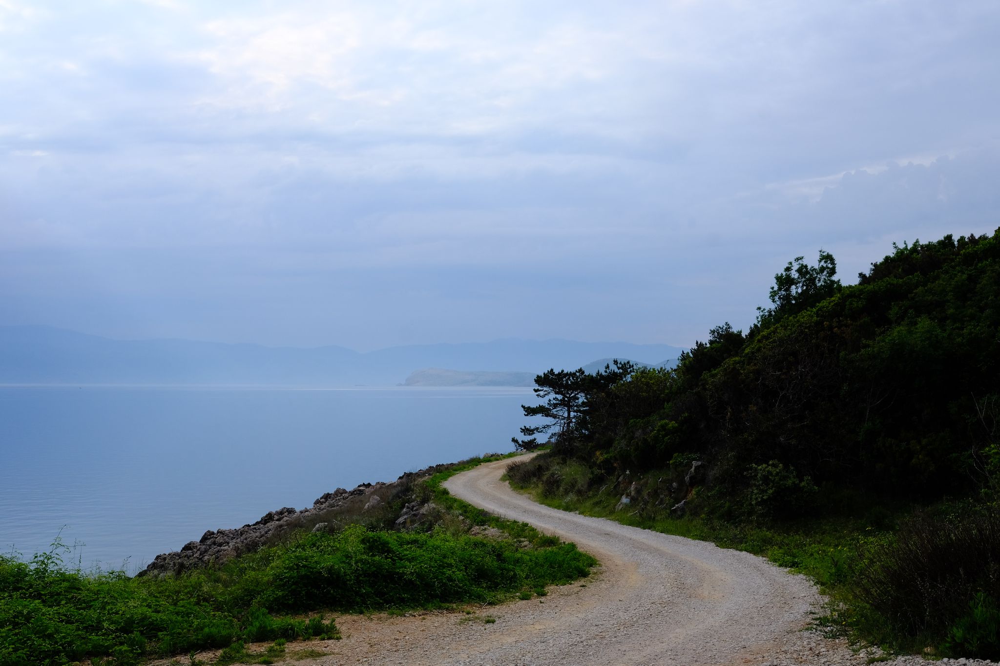
Hiking around Grad Kraljevica offers diverse landscapes where the Adriatic Sea meets mountainous terrain. The region features a mix of coastal paths, lush forested areas, and routes leading to historical landmarks. Hikers can explore trails that provide panoramic views of the sea and surrounding islands, often incorporating significant historical sites like Frankopan castles. The area's varied topography includes both gentle coastal walks and more challenging ascents into the hills.
Best bus station hiking trails around Grad Kraljevica
- The most popular bus station hiking route is Information board Bakaracke tunere – Frankopan Castle Kraljevica loop from Kraljevica, a 2.8 miles (4.6 km) trail that takes 1 hour 17 minutes to complete, offering views of Frankopan Castle.
- Another top favourite among local hikers is Frankopan Castle Kraljevica – Information board Bakaracke tunere loop from Kraljevica, a moderate 6.8 miles (10.9 km) path. This route explores the historical surroundings of Kraljevica, including the Frankopan Castle.
- Local hikers also love the View of the Island of Krk – Hreljin Castle Ruins loop from Hreljin, a 2.3 miles (3.7 km) trail leading through historical ruins and offering views of the Island of Krk, often completed in about 1 hour 6 minutes.
- Hiking around Grad Kraljevica is defined by coastal paths, forested valleys, and historical landmarks. The network offers options for different ability levels, from easy walks to more challenging ascents.
- The routes in Grad Kraljevica are highly rated by the komoot community with an average score of 4.4 stars from over 200 reviews. More than 1000 hikers have used komoot to explore Grad Kraljevica's varied terrain.
Last updated: July 9, 2026
4.7
(3)
16
hikers
10.5km
03:41
300m
300m
Hard hike. Good fitness required. Sure-footedness, sturdy shoes and alpine experience required.
5.0
(4)
12
hikers
6.96km
02:02
190m
190m
Moderate hike. Good fitness required. Easily-accessible paths. Suitable for all skill levels.

Sign up for free
3.8
(5)
22
hikers
Moderate hike. Good fitness required. Easily-accessible paths. Suitable for all skill levels.
5.0
(4)
12
hikers
3.70km
01:07
120m
120m
Easy hike. Great for any fitness level. Easily-accessible paths. Suitable for all skill levels.
3.8
(4)
18
hikers
6.47km
01:47
110m
110m
Easy hike. Great for any fitness level. Easily-accessible paths. Suitable for all skill levels.
Get access to more routes and recommendations from other explorers.
Sign up for free
Already have an account?
Our route recommendations are based on thousands of hikes, rides, and runs completed by other people on komoot.
Start today with a free account
Your next adventure awaits.
Login or Signup
Popular around Grad Kraljevica
Other adventures around Grad Kraljevica

Tips from the Community


Fishing sport. The professionals get carp weighing over 30kg.
1
0

Beautiful castle on the bay of Kraljevica.
2
0

Nice view over the bay and the bridge to Krk
3
0

One of the "summits" here. Magnificent view, but sturdy shoes are essential, as here too you walk over some "crackly" scree.
0
0

Many fishermen, no bathing lake
1
0

The 'Tribaljsko jezero' is an artificial lake in Vinodol, in the hinterland of Crikvenica near the settlement of Triblja, which also invites you to take a short break.
2
0
'Tribaljsko jezero' is an artificial lake in Vinodol, in the hinterland of Crikvenica, near the settlement of Triblja. It was built for the needs of the Vinodol hydroelectric power station and later stocked with carp. The special thing about the lake is that it is only a few kilometers away from the sea. The average depth of the lake is 4 m. In the 41-hectare lake, carp are the most common, but there are also babushka, catfish, zander, perch, eel, yellow eye and whiting. [wikipedia]
3
0
Frequently Asked Questions
How many bus-accessible hiking trails are available around Grad Kraljevica?
There are over 20 hiking trails around Grad Kraljevica that are easily accessible from bus stations. These routes offer a variety of experiences, from coastal walks to forested paths, catering to different preferences and fitness levels.
Are there easy hiking trails accessible from bus stations in Grad Kraljevica?
Yes, Grad Kraljevica offers several easy hiking trails accessible by bus. For instance, the Information board Bakaracke tunere – Frankopan Castle Kraljevica loop from Kraljevica is an easy 4.5 km route. Another great option is the View of the Island of Krk – Hreljin Castle Ruins loop from Hreljin, which is about 3.7 km and also considered easy.
What kind of terrain can I expect on bus-accessible hikes in Grad Kraljevica?
Hikes around Grad Kraljevica offer a diverse range of terrain. You can expect refreshing coastal paths with sea views, tranquil forested areas, and trails that lead to panoramic viewpoints. The region is known for its blend of sea and mountains, providing varied landscapes for hikers.
Are there any circular routes starting near bus stations in Grad Kraljevica?
Yes, many routes in the area are circular, making them convenient for bus travelers. The Frankopan Castle Kraljevica – Information board Bakaracke tunere loop from Kraljevica is a moderate 10.9 km circular trail. The 'Our Landscape' walking trail, mentioned in local guides, is also an 11-kilometer circular route that combines forested areas and sea views.
Can I find family-friendly walks accessible by bus in Grad Kraljevica?
Absolutely. Many trails in Grad Kraljevica are suitable for families. The 'Our Landscape' walking trail is particularly noted as undemanding and suitable for all ages. These trails often feature gentle slopes and scenic points of interest that children can enjoy.
Are there dog-friendly hiking options near Grad Kraljevica bus stops?
Yes, Grad Kraljevica is generally welcoming to hikers with dogs. The 'Our Landscape' walking trail even hosts organized 'Bark & Hike' programs, indicating a dog-friendly environment. Always ensure your dog is on a leash and follow local regulations.
What historical landmarks can I explore on hikes from bus stations?
The region is rich in history, and several bus-accessible hikes lead to significant landmarks. You can visit the impressive Frankopan Castle Kraljevica, which offers panoramic views. Other routes might take you past the Information board Bakaracke tunere or the historical Hreljin Castle Ruins.
Are there any viewpoints or natural features to see along these trails?
Yes, the trails around Grad Kraljevica are known for their stunning natural beauty and viewpoints. You can expect breathtaking panoramic views of the Adriatic Sea, especially from historical sites like Frankopan Castle. Coastal walks offer clear sea views, and forested paths provide a refreshing natural experience. The region is also strategically located near Učka Nature Park, offering diverse flora and fauna.
What is the best time of year to hike around Grad Kraljevica?
The spring and autumn months are generally ideal for hiking in Grad Kraljevica, offering pleasant temperatures and lush scenery. Summer can be warm, but coastal trails provide refreshing sea breezes. Winter hiking is also possible, especially on lower-elevation trails, though some higher routes might require more preparation.
Where can I find places to eat or drink after a hike near Grad Kraljevica bus stations?
Grad Kraljevica and its surrounding towns offer various cafes and restaurants where you can relax and refuel after your hike. Many establishments are conveniently located near bus stops and popular trailheads, especially in the town center and along the coast.
Are there any longer, more challenging hikes accessible by bus?
Yes, for those seeking a greater challenge, there are more demanding routes. The Benić Kuk Summit – Lake Tribalj loop from Tribalj is a difficult 10.4 km hike with significant elevation gain, offering a rewarding experience for experienced hikers.
What do other hikers enjoy the most about hiking in Grad Kraljevica?
The area is highly rated by the komoot community, with an average score of 4.4 stars. Reviewers often praise the diverse landscapes, the combination of sea and mountain views, and the historical landmarks encountered along the trails. The accessibility from bus stations is also a frequently appreciated aspect.
Most popular routes around Grad Kraljevica
Most popular attractions around Grad Kraljevica

Get inspired with the komoot mobile app


Explore more
Browse the best Hikes in other regions.
