The best traffic-free bike rides in Calhoun County
31
riders
7
rides
Gravel biking in Calhoun County, Alabama, offers diverse terrain within the Appalachian foothills, characterized by varied topography and scenic landscapes. The region features a mix of rail-trails, challenging mountain routes, and extensive forest areas. Riders can expect elevation changes and natural features such as creeks and mountain views, providing a compelling environment for no traffic gravel bike trails.
Best no traffic gravel bike trails in Calhoun County
- The most popular no traffic gravel bike trail is Chief Ladiga Trail – Piedmont loop from Piedmont, a 55.2 miles (88.9 km) trail that takes 6 hours 9 minutes to complete. This route utilizes a significant portion of the Chief Ladiga Trail, offering a long-distance gravel experience.
- Another top favourite among local gravel bikers is Flag Mountain – Brymer Mountain loop from Heflin, a difficult 37.0 miles (59.6 km) path. This route navigates through the Appalachian foothills, featuring substantial elevation gains and varied surfaces.
- Local gravel bikers also love the Shoal Creek – Brymer Mountain loop from Coleman Dam, a 21.0 miles (33.8 km) trail leading through mountainous terrain and near natural waterways, often completed in about 2 hours 6 minutes.
- Gravel biking in Calhoun County is defined by Appalachian foothills, diverse trail systems, and extensive forest areas. The network offers options for different ability levels, from challenging mountain routes to more accessible paths.
- The guide includes highly-rated routes that showcase the best of the region's landscape. More than 20 gravel bikers have used komoot to explore Calhoun County's varied terrain.
Last updated: July 7, 2026
6
riders
59.6km
04:00
890m
890m
Hard gravel ride. Very good fitness required. Mostly paved surfaces. Suitable for all skill levels.
8
riders
88.9km
06:09
1,340m
1,340m
Hard gravel ride. Very good fitness required. Mostly paved surfaces. Suitable for all skill levels.

Sign up for free
3
riders
33.8km
02:06
450m
450m
Hard gravel ride. Very good fitness required. Mostly paved surfaces. Suitable for all skill levels.
6
riders
104km
06:53
1,580m
1,580m
Hard gravel ride. Very good fitness required. Mostly paved surfaces. Suitable for all skill levels.
5
riders
48.1km
03:16
710m
710m
Hard gravel ride. Very good fitness required. Mostly paved surfaces. Suitable for all skill levels.
Get access to more routes and recommendations from other explorers.
Sign up for free
Already have an account?
Our route recommendations are based on thousands of hikes, rides, and runs completed by other people on komoot.
Start today with a free account
Your next adventure awaits.
Login or Signup



Other adventures in Calhoun County

Tips from the Community

Shoal Creek was once called Sycamore River, and snakes 68 miles across Tennessee and Alabama. It is a branch of the Tennessee River and was once dotted with mills and distilleries.
0
0

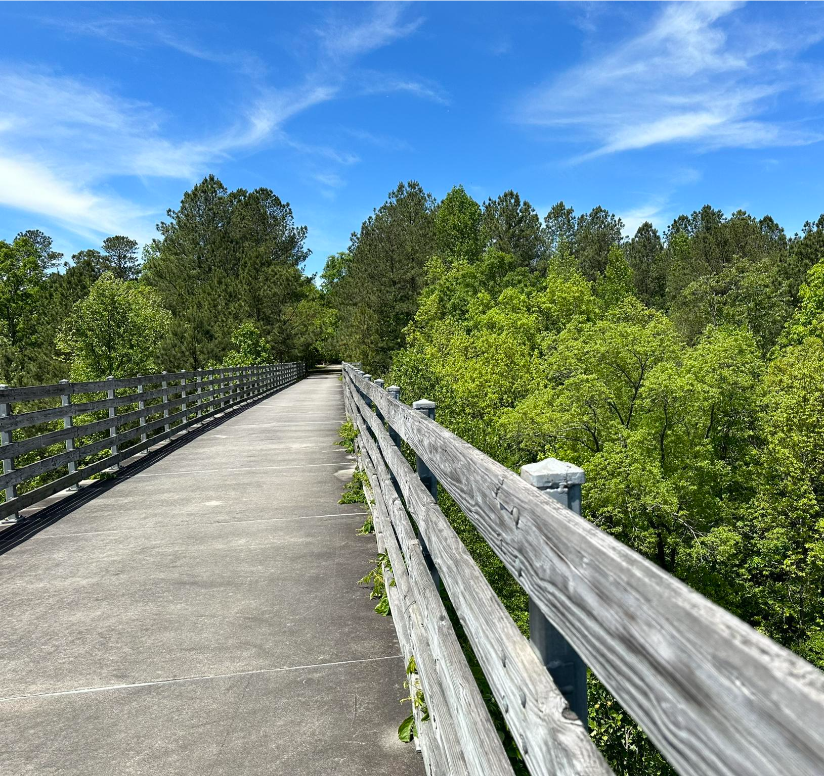
The Chief Ladiga Trail is a 34 mile trail that runs from Anniston, Alabama to the Georgia Border. It has been built over an old railway line and is fully paved and very flat. It runs through several towns with amenities, so there are options to resupply if needed.
0
0
Frequently Asked Questions
How many traffic-free gravel bike trails are available in Calhoun County?
This guide features 5 dedicated traffic-free gravel bike routes in Calhoun County, ranging from moderate to difficult. These routes offer a great way to explore the region's natural beauty without vehicle interference.
What kind of terrain can I expect on Calhoun County's no-traffic gravel trails?
You'll encounter diverse terrain, typical of the Appalachian Foothills. Expect a mix of gravel roads, some potentially challenging climbs, and scenic descents. Routes like the Flag Mountain – Brymer Mountain loop from Heflin showcase the varied topography, offering both forested sections and open views.
Are there any family-friendly or beginner-friendly no-traffic gravel routes in Calhoun County?
While many of the featured routes are rated moderate to difficult due to elevation changes, the region offers other options that can be adapted for families or beginners. The Chief Ladiga Trail, for instance, is a paved rail-trail that provides a very accessible and traffic-free experience, perfect for those looking for an easier ride or to introduce children to cycling. For a moderate gravel option, consider the Brymer Mountain – Shoal Creek loop from Pine Glen Recreation Area.
What natural features or landmarks can I see along these gravel bike trails?
Calhoun County's trails often wind through beautiful natural settings. You might encounter sections of the Talladega National Forest, offering dense woodlands and serene environments. While not directly on every gravel route, the region is home to attractions like Bain's Gap Waterfall and the scenic Cheaha State Park, Alabama's highest point, which are worth exploring before or after your ride. The Chief Ladiga Trail – Piedmont loop from Piedmont offers views of the Talladega Mountains.
Are there any circular no-traffic gravel bike routes in Calhoun County?
Yes, several of the routes in this guide are designed as loops, allowing you to start and end at the same point. Examples include the Flag Mountain – Brymer Mountain loop from Heflin and the Shoal Creek – Flag Mountain loop from Coleman Dam, providing convenient cycling experiences.
What is the best season for gravel biking in Calhoun County?
Spring and Fall generally offer the most pleasant conditions for gravel biking in Calhoun County, with mild temperatures and beautiful foliage. Summers can be hot and humid, while winters are typically mild but can have occasional cold snaps. Always check local weather forecasts before heading out.
Where can I find parking for these gravel bike trails?
Parking availability varies by route. For tours starting from specific locations like Heflin, Piedmont, Coleman Dam, or Pine Glen Recreation Area, you can typically find designated parking areas. For example, the Brymer Mountain – Shoal Creek loop starts from Pine Glen Recreation Area, which usually has parking facilities. It's always advisable to check the tour details on komoot for specific parking information before your trip.
Are dogs allowed on the no-traffic gravel bike trails in Calhoun County?
Dog policies can vary depending on the specific trail or land management. While many public lands in the Talladega National Forest generally allow dogs on leash, it's crucial to verify the rules for each specific route or park you plan to visit. Always ensure your dog is under control and that you clean up after them.
What should I bring for a gravel bike ride in Calhoun County?
Given the varied terrain and potential for longer rides, it's recommended to bring plenty of water, snacks, a repair kit (including spare tubes), a first-aid kit, and appropriate navigation tools. Wearing a helmet is essential, and consider layers of clothing suitable for changing weather conditions in the Appalachian Foothills. Sunscreen and insect repellent are also good to have.
Are there any cafes or places to eat near the gravel bike trails?
While the trails themselves are often in natural, undeveloped areas, towns like Piedmont, Jacksonville, Weaver, and Anniston, which are connected by or near routes like the Chief Ladiga Trail, offer various dining options. It's a good idea to plan your food and drink stops in these towns before or after your ride, as amenities directly on the trails are limited.
How do the difficulty levels of these trails compare?
Most of the traffic-free gravel routes in this guide are rated as 'difficult' due to significant elevation gain and distance, such as the Chief Ladiga Trail – Piedmont loop from Piedmont with over 1300m of ascent. There is one 'moderate' option, the Brymer Mountain – Shoal Creek loop from Pine Glen Recreation Area, which still presents a good challenge but with less overall climbing. Riders should be prepared for sustained efforts and varied surfaces.
Most popular routes in Calhoun County

Get inspired with the komoot mobile app


Didn’t find what you were looking for?
Check out more Gravel rides throughout Calhoun County below and find the perfect route in your destination.
Explore more
Browse the best Gravel rides in other regions.
