The best family-friendly hikes and walks in Pickens County
4.7
(182)
1,978
hikers
34
hikes
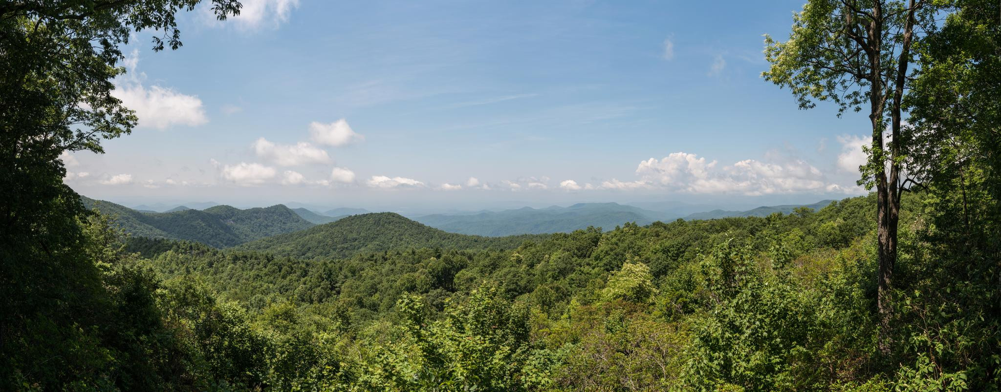
Family friendly hiking trails in Pickens County are found within the foothills of the Blue Ridge Mountains, offering a diverse landscape of forests, rivers, and significant natural features. The region is characterized by varied terrain, from gentle paths along lakeshores to more challenging ascents towards prominent peaks. Hikers can explore areas rich in water features, including scenic waterfalls and flowing rivers, alongside expansive protected lands.
Best family friendly hiking trails in Pickens County
- The most popular family friendly hiking route…
Last updated: October 11, 2026
5.0
(2)
10
hikers
15.5km
04:41
240m
960m
Embark on the Sassafras Mountain to Pinnacle Lake trail, a challenging yet rewarding hike that spans 9.6 miles (15.5 km) with an elevation gain of 803 feet (245 metres). This…
3
hikers
13.2km
04:06
260m
440m
Prepare for a challenging hike on the Foothills Trail, a difficult 8.2 miles (13.2 km) route that will take you through the scenic Jocassee Gorges. You will gain 842 feet…

2
hikers
4.10km
01:26
340m
20m
Embark on a moderate hike from Chimneytop Gap to Sassafras Mountain, a journey that covers 2.5 miles (4.1 km) and climbs 1113 feet (339 metres). This uphill route takes about…
2
hikers
11.0km
03:13
300m
310m
Embark on the Roundtop Passage of the Palmetto Trail, a moderate hike spanning 6.8 miles (11.0 km) through the rugged Jocassee Gorges Wilderness Area. You'll gain 984 feet (300 metres)…
1
hikers
3.37km
00:56
20m
130m
Hickorynut Mountain via Foothills Trail offers an easy hiking experience, leading you through a classic Southern Appalachian 'green tunnel' of lush forests. You will find yourself surrounded by rhododendron, mountain…
Get access to more routes and recommendations from other explorers.
Already have an account?
Our route recommendations are based on thousands of hikes, rides, and runs completed by other people on komoot.
Start today with a free account
Your next adventure awaits.


Other adventures in Pickens County

Tips from the Community

This is a beautiful spot to sit and take it easy after a long hike!
0
0
The Foothills Trail ends at Table Rock State Park and is really beautiful. The terminus is a welcome sight after a long hike
0
0

Toxaway Creek Campsite sits just after the Toxaway Creek crossing, with plenty of tent sites close to the river, making it a great spot to spend the night. It offers a peaceful setting and water source. The site has ample space for tents, but during peak season, it can get busy. Keep in mind that you'll need to hike 6 more miles to the next campsite at Laurel Fork.
0
0

Chimneytop Gap is a pass just east of Chimneytop Mountain on the F. Van Clayton Memorial Highway. This is a challenging, but great, pass to ride up near the border of North and South Carolina in the Smokey Mountains.
0
0

The viewing platform at the top of Sassafras Mountain is the perfect reward for all that climbing. On the border of North and South Carolina, the views are breathtaking.
0
0

Standing on the summit of Sassafras Mountain puts you on the highest point in the state of South Carolina. At 3,554 feet, the peak offers multiple observation areas and platforms that point in different directions off the top of the mountain. Being part of the Blue Ridge Mountain Range, the peak is highly popular, allowing both car and foot access from the bottom to the summit area (there is a steep incline from the parking lot to the observation deck).
0
0

The first part of the hiking trails in Table Rock State Park features a number of beautiful waterfalls - the Green Creek gently uses the various rock formations to bring its water down to Pinnacle Lake.
4
0

This is where the 77 mile Foothills Trail begins. It takes you through dense forest and over beautifull hills with a considerable amount of wooden stairs. It ends at Oconee State Park.
3
0
Frequently Asked Questions
How many family-friendly hiking trails are available in Pickens County?
Pickens County offers a wide selection of family-friendly hiking opportunities. Our guide features 36 routes, with 15 rated as easy and 18 as moderate, ensuring there's something suitable for various family skill levels.
Are there any easy trails suitable for young children or strollers?
Yes, for families with young children or strollers, the 7.5-mile paved Doodle Trail connecting Pickens and Easley is an excellent option. It offers a less strenuous outdoor activity. For a natural setting, the Hickorynut Mountain via Foothills Trail is an easy, shorter hike.
What kind of natural attractions can we see along these family-friendly routes?
Pickens County is rich in natural beauty. Many trails lead to stunning features like waterfalls, such as the Green Creek Waterfalls in Table Rock State Park. You can also explore beautiful lakes like Lake Hartwell and Lake Oolenoy, or enjoy panoramic views from spots like Governor's Rock.
Can we bring our dog on these family-friendly hiking trails?
Many trails in Pickens County are dog-friendly, but it's always best to check specific park or trail regulations before you go. Generally, dogs are welcome on leash in most state parks and forest areas. Always ensure your dog is well-behaved and pick up after them.
What is the best time of year to go hiking with family in Pickens County?
Spring and fall are generally the most pleasant seasons for family hiking in Pickens County. Spring offers mild temperatures and blooming wildflowers, while fall provides comfortable weather and spectacular fall foliage, especially in the Blue Ridge Mountain foothills. Summers can be hot and humid, so early mornings or late afternoons are preferable if hiking during this season.
Are there any loop trails suitable for families?
Yes, loop trails are great for families as they bring you back to your starting point without retracing steps. While specific loop trails are not detailed in the provided routes, many parks like Table Rock State Park and the Clemson Experimental Forest offer various loop options. We recommend checking individual park maps for current loop trail availability.
What do other hikers enjoy most about the family-friendly trails in Pickens County?
The komoot community highly rates the trails in Pickens County, with an average score of 4.7 stars. Hikers often praise the diverse landscapes, from mountain views to serene forest paths and picturesque lakeside walks, making it an exceptional environment for outdoor activities with family.
Are there any trails that offer views of waterfalls?
Absolutely! Pickens County is known for its beautiful waterfalls. The Foothills Trail segment from Virginia Hawkins Falls to Laurel Fork Falls is a more challenging option that features two impressive waterfalls. For a less strenuous option, the 1.5-mile Waldrop Stone Falls Trail in the Clemson Experimental Forest leads to a multi-tiered waterfall.
Where can we find parking for these family-friendly trails?
Most state parks and popular trailheads in Pickens County, such as Table Rock State Park, Keowee-Toxaway State Park, and access points for the Doodle Trail, offer designated parking areas. Some may require a small day-use fee or state park pass. It's always advisable to check the specific trail or park website for parking details before your visit.
Are there any trails that offer panoramic views?
For breathtaking panoramic views, consider a hike towards Sassafras Mountain, the highest point in South Carolina. While some routes to the summit are challenging, the observation areas at the top are accessible and offer expansive vistas of the Blue Ridge Mountains. The View from the Top of Table Rock also provides stunning scenery.
What is the typical duration for these family-friendly hikes?
The duration varies significantly depending on the trail's length and difficulty. Easy trails like the Hickorynut Mountain via Foothills Trail might take around an hour. Moderate trails, such as the Roundtop Passage of the Palmetto Trail, could take 3-4 hours. Always check the estimated duration for your chosen route and factor in extra time for breaks and enjoying the scenery with your family.
Most popular routes in Pickens County
Most popular attractions in Pickens County

Get inspired with the komoot mobile app


Didn’t find what you were looking for?
Check out more Hikes throughout Pickens County below and find the perfect route in your destination.
Explore more
Browse the best Hikes in other regions.
