The best hikes from bus stations in Burlington County
4.4
(31)
596
hikers
3
hikes
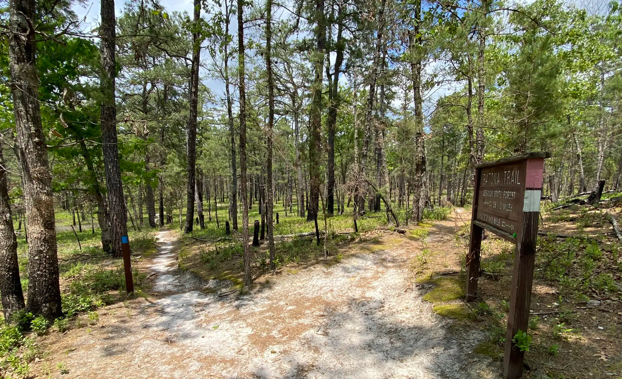
Hiking in Burlington County, New Jersey, offers a diverse landscape characterized by the unique Pine Barrens ecosystem, featuring pine and oak forests, extensive wetlands, and sandy soils. The region includes scenic river paths and wetlands along waterways such as the Rancocas Creek and Mullica River. While generally flat, the terrain also encompasses deciduous forests, open grasslands, and areas with minimal elevation changes, providing varied experiences for hikers.
Best bus station hiking trails in Burlington County
- The most popular bus station hiking route is Veterans Park loop from Hamilton Township, a 4.1 miles (6.6 km) easy trail that takes 1 hour 41 minutes to complete. This route features gentle paths through parkland.
- Another top favourite among local hikers is Calhoun Street Bridge loop from Trenton, an easy 2.9 miles (4.6 km) path. This trail offers views along the river and through urban green spaces.
- Local hikers also love the Race Street Pier loop from Edgar Allan Poe National Historic Site, a 3.5 miles (5.6 km) trail leading through urban waterfront areas, often completed in about 1 hour 26 minutes.
- Hiking in Burlington County is defined by pine and oak forests, extensive wetlands, and river paths, with routes offering options for different ability levels.
- The routes in Burlington County are highly rated by the komoot community with an average score of 4.2 stars from over 28 reviews. More than 500 hikers have used komoot to explore Burlington County's varied terrain.
Last updated: June 24, 2026
2
hikers
4.59km
01:11
20m
20m
Easy hike. Great for any fitness level. Easily-accessible paths. Suitable for all skill levels.
6
hikers
Embark on a fascinating urban exploration with the Race Street Pier – Race Street Pier loop from Edgar Allan Poe National Historic Site, an easy 3.7-mile (6.0 km) hiking route that connects Philadelphia's literary past with its vibrant waterfront present. You'll transition from historic city streets to the modern Race Street Pier, where you can enjoy expansive views of the Delaware River and the Benjamin Franklin Bridge. This route, with its minimal 86 feet (26 metres) of elevation gain, is primarily on paved surfaces and takes about 1 hour and 32 minutes, making it a perfect, accessible urban hike for a leisurely afternoon.
Planning your visit is straightforward, as this route is an urban walk with no specific trailhead parking, though street parking and public transport to Race Street Pier Philadelphia are readily available. The path is entirely paved and flat, making it a wheelchair accessible path Race Street Pier option. There are no permits or fees required, and you can enjoy this family friendly hiking Race Street Pier loop at any time of year, though spring and fall offer ideal weather for strolling through the city and along the river.
This unique route highlights Philadelphia's commitment to urban revitalization, transforming former industrial areas into public recreational spaces. The Race Street Pier itself is a two-level modern design, part of the larger Central Delaware Waterfront project, offering seasonal free yoga classes and picnic spots. Starting from the Edgar Allan Poe National Historic Site, you get a dose of literary history before immersing yourself in the contemporary charm of one of the best urban hikes Philadelphia Race Street Pier area has to offer.

Sign up for free
5
hikers
3.43km
00:53
10m
10m
Explore the tranquil beauty of the Delaware River loop from Roebling, an easy 2.1-mile (3.4 km) hike that winds through the unique Abbott Marshlands. You'll traverse woodlands and marshy areas, offering serene views of Spring Lake and the Delaware River. The trail provides a peaceful escape, perfect for birdwatching and enjoying nature, with minimal elevation gain of just 41 feet (12 metres).
This family-friendly Delaware River loop hike is easily accessible, with parking typically available near the trailhead. While the route is generally well-maintained, be aware that some sections, particularly on the island portions, can be muddy or slippery, so sturdy shoes are recommended. Completing the loop takes approximately 52 minutes, making it an ideal option for a short, refreshing outing.
Beyond its natural appeal, the area is rich in history, encompassing the significant archaeological site of the Abbott Marshlands and passing by the former Roebling Steel Mill site. This blend of natural beauty and historical landmarks makes the Delaware River loop from Roebling a unique experience, offering more than just a walk but a journey through time and a diverse ecosystem.
Our route recommendations are based on thousands of hikes, rides, and runs completed by other people on komoot.
Start today with a free account
Your next adventure awaits.
Login or Signup
Popular around Burlington County
Other adventures in Burlington County

Tips from the Community

This location treats you to expansive views of the Delaware River and the Benjamin Franklin Bridge. There's ample room for a picnic or simply to bask in the scenery.
0
0

The Calhoun Street Bridge is a historic bridge that connects Trenton and Morrisville. The bridge, constructed in 1884, crosses the Delaware River.
2
0

Race Street Pier offers a stunning panorama of Philadelphia's skyline and the majestic Benjamin Franklin Bridge. Framed by the Delaware River, this iconic view encompasses historic landmarks, such as Independence Hall and the Philadelphia Museum of Art, creating a captivating backdrop that epitomizes the city's rich heritage and modern vibrancy. Jump off the bike if you'd like to have a look at the end of the pier.
0
0

The Delaware River, at over 280 miles in length, is the longest free-flowing river in the Eastern United States. It provides drinking water for 17 million people and is well-known for its fishing opportunities.
0
0
This location treats you to expansive views of the Delaware River and the Benjamin Franklin Bridge. There's ample room for a picnic or simply to bask in the scenery.
0
0

Great view of the Ben Franklin Bridge and many place to sit. If you are lucky it won't be rainy as it was during my visit.
1
0

Frequently Asked Questions
How many bus-accessible hiking trails are available in Burlington County?
This guide features 3 easy hiking routes that are conveniently accessible from bus stations in and around Burlington County. These trails offer a great way to explore the region's natural beauty without needing a car.
Are the bus station hiking trails in Burlington County suitable for beginners?
Yes, all the trails listed in this guide are rated as easy. They feature minimal elevation gain and generally well-maintained paths, making them perfect for beginners or those looking for a relaxed outdoor experience. For example, the Veterans Park loop from Hamilton Township is a gentle 6.6 km route.
What kind of landscapes can I expect to see on these bus-accessible hikes?
Burlington County is known for its diverse landscapes, including the unique Pine Barrens ecosystem with its pine and oak forests, extensive wetlands, and sandy soils. You'll also find trails along waterways like the Rancocas Creek and Mullica River, offering opportunities for birdwatching and enjoying varied terrain, even if generally flat. The Race Street Pier loop from Edgar Allan Poe National Historic Site offers scenic views along the waterfront.
Are there any loop trails accessible from bus stations?
Yes, several of the routes are convenient loop trails, allowing you to start and end at the same point, which is ideal when relying on public transport. Examples include the Veterans Park loop from Hamilton Township and the Calhoun Street Bridge loop from Trenton.
What do other hikers say about the trails in Burlington County?
The komoot community rates the hiking experiences in Burlington County highly, with an average score of 4.2 stars. Hikers often praise the peaceful natural settings, the accessibility of trails, and the chance to explore unique ecosystems like the Pine Barrens.
Can I bring my dog on these bus-accessible trails?
Many parks and preserves in Burlington County are dog-friendly, though specific rules may vary. For example, Pennington Park, a popular spot in the region, even features dedicated dog play areas. It's always best to check the specific regulations for each trail or park you plan to visit, and ensure your dog is on a leash.
Are there any family-friendly hiking options near bus stops?
Absolutely. The easy difficulty of the trails in this guide makes them suitable for families. Routes like the Veterans Park loop from Hamilton Township are relatively short and flat, providing an enjoyable outing for all ages. Many parks also offer amenities like picnic areas.
What interesting landmarks or natural features can I see along these routes?
While hiking these trails, you can discover various points of interest. Notable natural features include the unique Pine Barrens ecosystem and serene lakes like Atsion Lake and Pakim Pond. You might also encounter historical sites such as Batsto Village, offering a glimpse into the region's past.
What is the best season for hiking in Burlington County?
Spring and fall are generally considered the best seasons for hiking in Burlington County. The weather is mild, and the natural scenery is vibrant, with blooming wildflowers in spring and colorful foliage in autumn. Summer can be pleasant, but be prepared for warmer temperatures and potential humidity. Winter hiking is also an option, especially on the easy, well-maintained trails, offering a different, quieter perspective of the landscape.
Are there opportunities for wildlife viewing on these trails?
Yes, Burlington County's diverse ecosystems, especially within the Pine Barrens and along its waterways, provide excellent opportunities for wildlife viewing. Areas like Boundary Creek Natural Resource Area are known for birdwatching, and you might spot various bird species, small mammals, and unique plant life characteristic of the region's wetlands and forests.
What is the typical duration for these bus-accessible hikes?
The hikes featured in this guide are relatively short, ranging from approximately 4.5 km to 6.6 km. This means most routes can be completed within 1.5 to 2 hours at a moderate pace, making them ideal for a half-day outing or a quick escape into nature.
Most popular routes in Burlington County
Most popular attractions in Burlington County

Get inspired with the komoot mobile app


Explore more
Browse the best Hikes in other regions.
