The best family-friendly hikes and walks in Taos County
4.8
(30)
475
hikers
22
hikes
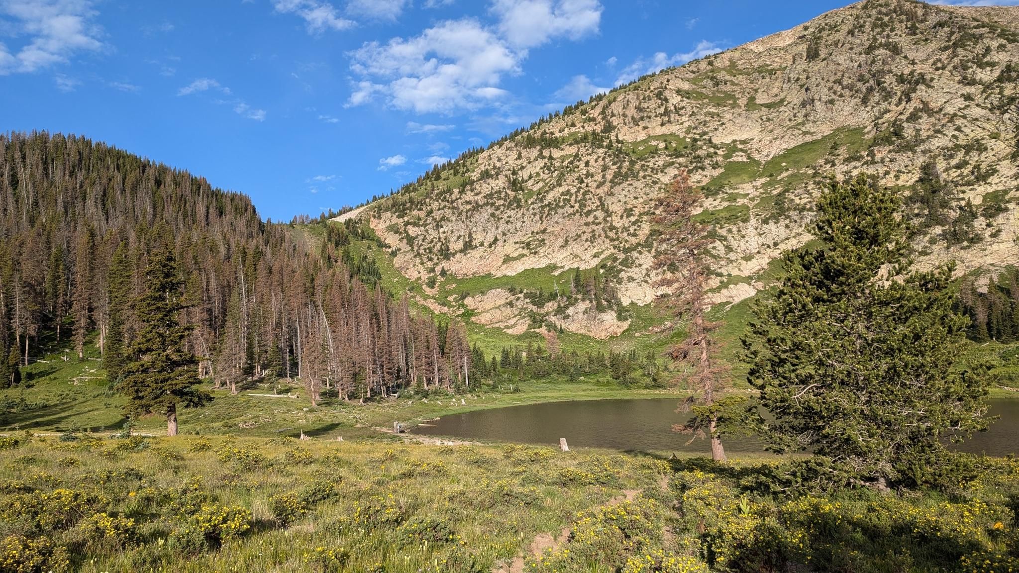
Family friendly hiking trails in Taos County traverse a diverse landscape, ranging from the dramatic Rio Grande Gorge to the high-alpine wilderness of the Sangre de Cristo Mountains. The region features forested canyons, sagebrush-covered mesas, and rugged peaks, offering varied terrain for outdoor exploration. Hikers can experience everything from river-level paths to trails ascending through dense forests. This varied topography provides a wide array of natural features for family-friendly adventures.
Best family friendly hiking trails in Taos County
- The most…
Last updated: July 8, 2026
8
hikers
13.1km
04:12
510m
510m
The La Junta and River Trail Loop takes you deep into the dramatic landscapes of the Rio Grande del Norte National Monument, offering a unique perspective on New Mexico's high…
1
hikers
2.91km
01:02
280m
0m
The South Boundary Trail to First Peak offers a quick, high-reward escape into the Sangre de Cristo Mountains, immersing you in the natural beauty of the Carson National Forest. You'll…

Sign up for free
1.17km
00:19
20m
0m
Embark on an easy hike along the Middle Fork Trail, a peaceful escape winding through the natural beauty of Carson National Forest. You will find yourself immersed in a lush…
152km
41:30
1,970m
2,110m
The Enchanted Circle offers an immersive hiking experience through northern New Mexico's incredibly varied terrain, from sage-covered desert plateaus to high alpine forests. You'll journey past vibrant aspen groves, catch…
5.0
(2)
39
hikers
5.45km
01:29
80m
80m
Hike the easy 3.4-mile West Rim Trail in Rio Grande del Norte National Monument, featuring views of the Rio Grande Gorge and Bridge.
Get access to more routes and recommendations from other explorers.
Sign up for free
Already have an account?
Our route recommendations are based on thousands of hikes, rides, and runs completed by other people on komoot.
Start today with a free account
Your next adventure awaits.
Login or Signup


Other adventures in Taos County

Tips from the Community

At the heart of historic Taos, the Taos Plaza is a lively gathering place surrounded by adobe buildings, galleries, and locally owned shops. Once the center of trade and community life dating back to the 18th century, it remains the cultural core of town today. Visitors can explore art studios, grab a coffee, or simply relax under the shade of old elm trees while taking in the vibrant blend of history, art, and mountain-town charm.
0
0
Set in a forested valley near the Pecos Wilderness, Santa Barbara Campground is a convenient base for exploring nearby trails like Beatty’s Trail and the Santa Barbara Divide. The campground has a resident host, potable water, and vault toilets, making it a comfortable stop before heading into the backcountry. Sites are shaded and spacious, offering a quiet place to rest beside the creek and enjoy the crisp mountain air.
0
0

Truly a beautiful place.
3
0

From this spot along the River Trail provides fantastic views of the Río Grande. There is a short spur trail here if you want to get a little closer to the water.
1
0
La Junta Point is a stunning overlook located in the Wild Rivers Recreation Area, which is part of the Río Grande del Norte National Monument in New Mexico. This spot is celebrated as one of the most picturesque locations in the state; La Junta Point provides a breathtaking vista of the confluence of the Red River and the Río Grande. You also get great views behind you of the Sangre de Cristo Mountains. This dramatic overlook is fully wheelchair accessible, making it a great destination for visitors of all mobility levels.
0
0
Red River, New Mexico, was originally a bustling mining town in the late 19th century that attracted prospectors seeking gold, silver, and copper. However, as mining declined, the town reinvented itself in the 1920s as a tourist destination, preserving its historic charm. Today, Main Street is surrounded by the Carson National Forest, which provides mountain biking and hiking in summer and skiing, snowboarding, and tubing in winter at the Red River Ski Area. The Red River is also known for great trout fishing. The town also hosts annual events like the Red River Folk Festival and the Fourth of July Parade, which are beloved traditions by locals and visitors alike.
0
0

This spot, just a short distance from the main parking area and overlook, is a great place to take in the striking views of the Rio Grande Gorge and bridge away from some of the crowds closer to the parking area. This is an amazing spot to snap a few photos before continuing down the West Rim Trail.
1
0
Frequently Asked Questions
How many family-friendly hiking trails are available in Taos County?
Taos County offers a diverse selection of over 20 family-friendly hiking trails. These range from easy strolls perfect for young children to more moderate paths for active families, ensuring there's an adventure for everyone.
What are some easy hiking trails suitable for families with young children in Taos County?
For families with young children, trails like the South Boundary Trail to First Peak offer an accessible experience with manageable distances and elevation. Another great option is the Middle Fork Trail, which is relatively flat and short, ideal for toddlers.
Are there any family-friendly trails with river access or water features in Taos County?
Yes, the La Junta and River Trail Loop offers scenic views and access to the river, providing a refreshing experience for families. Additionally, the Rio Grande Gorge area features trails that lead down to the river, such as those near the Black Rock Hot Springs, offering unique opportunities for exploration and relaxation by the water.
What kind of views and natural features can we expect on family hikes in Taos County?
Taos County's family-friendly trails offer a stunning variety of landscapes. You can expect dramatic views of the Rio Grande Gorge, such as from the West Rim Trail, or panoramic vistas of the Taos Valley and Sangre de Cristo Mountains from trails like the Devisadero Loop. Many routes also feature forested canyons, sagebrush-covered mesas, and high-alpine environments, with highlights like Williams Lake nestled in the mountains.
What is the best time of year for family hiking in Taos County?
The best time for family hiking in Taos County is generally from late spring through early fall (May to October). During these months, the weather is pleasant, and most trails are free of snow. Summer offers lush greenery and wildflowers, while fall brings spectacular autumn colors, especially in the higher elevations of the Sangre de Cristo Mountains.
Are there any circular routes suitable for families in Taos County?
Yes, the La Junta and River Trail Loop is a great example of a circular route that provides a varied and engaging experience for families without requiring a return trip on the same path. Many other trails in the region also offer loop options or can be combined to create circular walks.
What do other hikers enjoy most about family-friendly trails in Taos County?
The area is highly rated by the komoot community, with an average score of 4.8 stars. Reviewers often praise the stunning natural beauty, the variety of terrain suitable for different ages, and the well-maintained paths that make for an enjoyable family outing. The accessibility of trails offering incredible views, like those along the Rio Grande Gorge, is frequently highlighted.
Are there any specific landmarks or points of interest to look out for on family hikes?
Absolutely! Many trails offer access to notable landmarks. You might encounter the dramatic Rio Grande Gorge and Bridge View, or explore the serene alpine environment around Williams Lake. The region is rich in natural beauty, from high peaks like Wheeler Peak Summit to unique geological formations.
Are dogs allowed on family-friendly hiking trails in Taos County?
Many trails in Taos County, especially within the Carson National Forest and Rio Grande del Norte National Monument, are dog-friendly. However, regulations can vary, so it's always best to check specific trail rules beforehand. Generally, dogs should be kept on a leash to protect wildlife and ensure a pleasant experience for all hikers.
What are the parking options like for family hiking trails in Taos County?
Parking availability varies by trailhead. Popular spots like the West Rim Trail and trails leading to Williams Lake typically have designated parking areas. For less frequented trails, roadside parking might be available. It's advisable to arrive early during peak seasons to secure a spot, especially for popular family destinations.
Are there any permits required for family hiking in Taos County?
For most day hikes on family-friendly trails in Taos County, especially within the Carson National Forest or Rio Grande del Norte National Monument, permits are generally not required. However, specific wilderness areas or certain activities might have different regulations. Always check with the local forest service or park office if you plan to venture into more remote or protected zones.
Most popular attractions in Taos County

Get inspired with the komoot mobile app


Didn’t find what you were looking for?
Check out more Hikes throughout Taos County below and find the perfect route in your destination.
Explore more
Browse the best Hikes in other regions.
