The best family-friendly hikes and walks in Lewis County
4.9
(526)
7,547
hikers
40
hikes
Family friendly hiking trails in Lewis County, Washington, traverse a diverse landscape ranging from gentle river valleys to the rugged Cascade Mountains. The region features extensive old-growth forests, significant portions of Mount Rainier National Park, and the vast Gifford Pinchot National Forest. Hikers can explore varied terrain, including subalpine meadows, volcanic landscapes near Mount St. Helens, and wetlands along the Chehalis River. This geographical variety provides a wide array of experiences for different skill levels.
Best family friendly hiking trails in Lewis County
- The most popular family friendly hiking route is Skyline Trail Loop, a 6.3 miles (10.2 km) trail that takes 3 hours 27 minutes to complete. This moderate route offers panoramic mountain views within Mount Rainier National Park.
- Another top favourite among local hikers is Skyline, Mazama Ridge, Wonderland, and Lower Lakes Loop, a difficult 11.3 miles (18.1 km) path. This challenging trail explores high-elevation meadows and lakes, showcasing diverse alpine scenery.
- Local hikers also love the Pinnacle Peak Trail, a 1.9 miles (3.1 km) trail leading through subalpine terrain, often completed in about 1 hour 41 minutes.
- Hiking in Lewis County is defined by old-growth forests, mountain views, and river valleys, with options ranging from easy strolls to challenging alpine expeditions. The trail network accommodates various ability levels.
- The routes in Lewis County are highly rated by the komoot community with an average score of 4.8 stars from over 400 reviews. More than 6,500 hikers have used komoot to explore Lewis County's varied terrain.
Last updated: August 31, 2026
4.9
(120)
1,573
hikers
10.2km
03:27
510m
510m
Embark on the Skyline Trail Loop for a classic Mount Rainier hiking experience, covering 6.3 miles (10.2 km) with a moderate difficulty. You'll ascend 1684 feet (513 metres) over an estimated 3 hours and 27 minutes, traversing varied terrain from paved sections to rocky paths. As you climb, you'll be treated to expansive views of Mount Rainier and its majestic glaciers. Look out for vibrant subalpine wildflower meadows that add splashes of color to the landscape. Don't miss the stunning vistas from Panorama Point Summit, offering 360-degree views of the surrounding peaks. The trail also passes the picturesque Myrtle Falls Viewpoint, where Mount Rainier provides a dramatic backdrop.
Plan your hike on the Skyline Trail Loop between mid-July and early October, which is the prime season for exploring this area. If you want to see the wildflowers at their peak, aim for late July to mid-August. Be prepared for varied terrain, including potential snow patches at higher elevations, even during summer months. This popular trail can become very crowded, especially on summer weekends, so consider starting early or visiting on a weekday to avoid the busiest times.
The Skyline Trail Loop offers a deep dive into the natural environment of Mount Rainier National Park. You'll encounter diverse ecosystems, from the lush subalpine meadows to the rugged, glaciated slopes of the mountain itself. Keep an eye out for local wildlife, such as marmots, which are often spotted along the route. This trail is notable for providing some of the most iconic and accessible views of Mount Rainier, making it a highlight for many visitors to the park.
5.0
(10)
118
hikers
18.1km
06:33
1,150m
720m
Embark on the Skyline, Mazama Ridge, Wonderland, and Lower Lakes Loop for a difficult hiking adventure that showcases the stunning beauty of Mount Rainier National Park. This challenging route covers 11.3 miles (18.1 km) and involves a significant elevation gain of 3778 feet (1152 metres), typically taking around 6 hours and 33 minutes to complete. As you ascend, you will be treated to expansive vistas of Mount Rainier and the Tatoosh Range from viewpoints like Panorama Point. The trail also meanders through vibrant subalpine meadows, bursting with wildflowers during peak season, and skirts the serene Reflection Lakes, famous for their clear mountain reflections.
To make the most of your hike, plan your visit between late July and September, when the wildflowers are in full bloom and most of the snow has melted. Be prepared for potentially steep and slushy snowfields in higher sections, even into late summer; trekking poles or microspikes can be very helpful. Parking at the Paradise Visitor Center, which is where the trailhead begins, fills up quickly, so arriving early is highly recommended to secure a spot.
This loop offers a comprehensive journey through Mount Rainier's diverse ecosystems, from high alpine views to lush subalpine environments. You will experience the park's varied terrain and natural features, making it a notable route for those seeking a full immersion into the landscape. The trail's design ensures you encounter a wide array of scenic highlights, providing a memorable experience of the region's natural grandeur.

Sign up for free
6
hikers
3.11km
01:41
410m
0m
Embark on the Pinnacle Peak Trail for a difficult hike that promises a rewarding climb through Mount Rainier's subalpine landscape. This route covers 1.9 miles (3.1 km) and demands a significant effort, with an elevation gain of 1361 feet (415 metres). You can expect to complete this strenuous journey in about 1 hour and 41 minutes, pushing yourself towards spectacular views.
Before you head out, remember that this trail is within Mount Rainier National Park, so be prepared for park entrance fees. Parking is available at the trailhead, but it can fill up quickly during busy times, especially in peak season. Always check the park's official website for current conditions and operating hours, as seasonal road closures are common, particularly outside of summer months.
As you ascend, you will pass through diverse terrain, eventually reaching Pinnacle Saddle, a mountain pass that opens up to expansive vistas. The trail is renowned for its stunning Reflection Lake View of Mount Rainier, where the majestic peak is often mirrored in the water. This challenging route is a true test of endurance, but the panoramic rewards make the effort worthwhile.
1
hikers
14.3km
07:10
1,110m
700m
The Castle Traverse is a difficult hiking route that takes you through the rugged Tatoosh Range, offering dramatic vistas of Mount Rainier. You will cover 8.9 miles (14.3 km) and gain 3651 feet (1113 metres) in elevation, making this a challenging day out. Expect sections of alpine scrambling as you navigate the terrain, providing a true mountain adventure. The estimated duration for this demanding hike is 7 hours and 9 minutes. You will pass by scenic spots like Pinnacle Saddle, enjoying the unique atmosphere of this high-alpine environment.
Be prepared for challenging conditions when planning your visit to the Castle Traverse. Early season hikes might encounter snow, so consider bringing an ice axe for safety. The route involves class 3-4 scrambling, and you might need a rope for belay on steeper sections, including a short rappel on Castle Peak. Always check current trail conditions before you head out to ensure a safe and enjoyable experience. This difficult trail requires careful preparation and awareness of the mountain environment.
This route is located within the stunning Mount Rainier National Park, a region renowned for its majestic peaks and diverse ecosystems. The trail offers an iconic Reflection Lake View of Mount Rainier, providing excellent photo opportunities. It stands out as a rewarding experience for experienced hikers seeking a true mountain challenge. The rugged nature of the Tatoosh Range makes this traverse a notable adventure in the park.
2
hikers
549m
00:09
0m
0m
The Box Canyon Trail offers a surprisingly dramatic experience for such a short route, leading you into the impressive Box Canyon of the Muddy Fork Cowlitz River. This easy 0.3-mile (0.5 km) hike, with only 11 feet (3 metres) of elevation gain, is a fantastic way to stretch your legs and take in some truly unique natural features. You'll be treated to striking canyon views and, weather permitting, a clear View of Mount Rainier, making it a perfect, quick stop for all ages.
Planning your visit to the Box Canyon Trail is straightforward; it's a very accessible route that takes roughly 8 minutes to complete. Parking is generally available at the trailhead, making it an easy addition to any itinerary. This trail is particularly family-friendly, offering a big scenic payoff for minimal effort, and is best enjoyed during daylight hours to fully appreciate the surrounding landscape.
This particular Box Canyon is notable for its geological formation along the Muddy Fork Cowlitz River, showcasing the powerful forces of nature that shaped the region. It provides a unique perspective on the local environment and is an excellent example of the diverse natural features found near Mount Rainier. It's a great option if you're looking for Box Canyon Trail unique features without committing to a long hike.
Get access to more routes and recommendations from other explorers.
Sign up for free
Already have an account?
Our route recommendations are based on thousands of hikes, rides, and runs completed by other people on komoot.
Start today with a free account
Your next adventure awaits.
Login or Signup





Tips from the Community

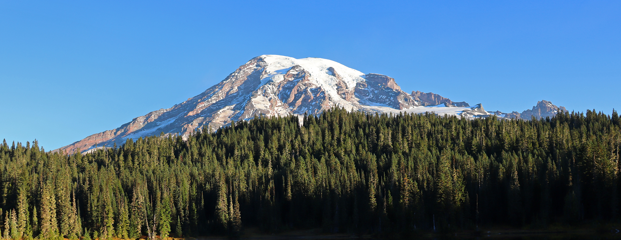
That iconic Mount Rainier reflection never gets old. There's something incredibly peaceful about standing at Bench Lake on a calm morning when the water turns into a perfect mirror. The Tatoosh Range always delivers. https://www.metlifedentalprovider.com
0
0
I was recently looking for traditional Viennese restaurants and came across Restaurant Marienhof https://restaurant-marienhof.de/ . I particularly liked the combination of classic Viennese cuisine, cozy atmosphere, and the quiet courtyard garden. Such places show that traditional gastronomy still retains its special charm today. Those who want to enjoy authentic Austrian dishes and spend a relaxing evening in Vienna will find an interesting address there.
0
0

Beautiful hike. Crowded. Make sure you bring water as there is no where to fill up. Not even visitor center. No restrooms. Just overstuff porta potties. Come early. Parking difficult. We got here at 310 pm and found some. But there’s a lot of people. We waiting in line to get into park 1 hour! They need a better system!
0
0

Great trail with amazing views of the surrounding mountains and Mt. Rainier.
0
0
Great unobstructed view of the glacier.
0
0
Great visitor center. The parking lot has just been renovated. The restrooms are currently being renovated.
0
0
Frequently Asked Questions
How many family-friendly hiking trails are available in Lewis County?
Lewis County offers a wide selection of family-friendly hiking trails, with over 40 routes specifically curated for families. These range from easy strolls to more moderate adventures, ensuring there's something for every family's comfort level.
What is the best time of year for family hikes in Lewis County?
The best time for family hikes in Lewis County is generally from late spring through early autumn. During these months, the weather is milder, trails are typically clear of snow, and wildflowers are in bloom in alpine meadows. Summer offers the warmest temperatures, while autumn brings vibrant fall foliage.
Are there any easy, short hikes suitable for young children or beginners?
Yes, Lewis County has several easy and short trails perfect for young children or those new to hiking. The Box Canyon Trail, for example, is a very short and accessible option. Many state parks like Lewis and Clark State Park also offer gentle loops through old-growth forests.
Can we see waterfalls on family-friendly hikes in Lewis County?
Absolutely! Lewis County is home to several beautiful waterfalls that are accessible on family-friendly routes. You can visit Narada Falls in Mount Rainier National Park, or explore the area around Rainbow Falls State Park. Another notable spot is Covel Creek Falls (Curtain Falls).
Are there any loop trails that are good for families?
Yes, loop trails are excellent for families as they offer varied scenery without retracing steps. While some longer loops like the Skyline Trail Loop are more moderate, many local parks provide shorter, easier loops. For instance, Lewis and Clark State Park features a 1.7-mile loop through an old-growth forest that is very family-friendly.
What kind of wildlife might we encounter on the trails?
Lewis County's diverse landscapes mean you might spot a variety of wildlife. In areas like the Goat Rocks Wilderness, you could see mountain goats, elk, black bears, and marmots. River valleys and wetlands, such as the Chehalis River Surge Plain Natural Area Preserve, are excellent for birdwatching, with osprey and bald eagles often sighted.
Are dogs allowed on family-friendly hiking trails in Lewis County?
Many trails in Lewis County are dog-friendly, but regulations vary by location. National Parks like Mount Rainier generally have stricter rules, often requiring dogs to be on a leash and only on paved roads or in developed areas. State parks and national forests typically allow leashed dogs on trails. Always check specific trail regulations before heading out with your furry friend.
Where can we find scenic viewpoints or landmarks along the trails?
Lewis County offers numerous scenic viewpoints. Within Mount Rainier National Park, Faraway Rock Overlook provides stunning vistas. Outside the park, High Rock Lookout offers breathtaking panoramic views of Mount Rainier, Mount Saint Helens, Mount Adams, and Mount Hood. Ricksecker Point also provides expansive views of the Pacific Northwest landscapes.
What do other hikers enjoy most about family-friendly hiking in Lewis County?
The komoot community highly rates the family-friendly hiking experiences in Lewis County, with an average score of 4.8 stars. Reviewers often praise the diverse scenery, from lush old-growth forests to stunning mountain views, and the accessibility of trails for all ages. The presence of waterfalls and serene lakes is also frequently highlighted as a favorite feature.
Are there any trails suitable for strollers or wheelchairs?
While many trails in Lewis County involve natural terrain, some parks offer more accessible paths. The Willapa Hills Trail, a multi-use trail, has gentle grades suitable for strollers and some wheelchairs, though its surface can vary. Lewis and Clark State Park also has some easily accessible paths. It's always best to check specific trail conditions for accessibility before your visit.
Do I need permits or reservations for family hikes in Lewis County?
For most family-friendly trails in state parks and national forests in Lewis County, you typically do not need specific hiking permits, though a Discover Pass might be required for parking at state parks. If you plan to hike within Mount Rainier National Park, an entrance fee is required, and some popular trails or overnight stays might require permits or reservations, especially during peak season. Always check the official park websites for the latest requirements.
Are there any trails that lead to lakes or offer water access for families?
Yes, several family-friendly trails in Lewis County lead to beautiful lakes or offer water access. Within Mount Rainier National Park, you can find trails near Reflection Lake, known for its mirror-like reflections of the mountain. Ike Kinswa State Park and Cowlitz River Park also provide access to rivers or lakes, often with amenities like picnicking areas.
Most popular attractions in Lewis County

Get inspired with the komoot mobile app


Didn’t find what you were looking for?
Check out more Hikes throughout Lewis County below and find the perfect route in your destination.
Explore more
Browse the best Hikes in other regions.
