The best traffic-free bike rides around De Ronde Venen
4.5
(17)
229
riders
4
rides
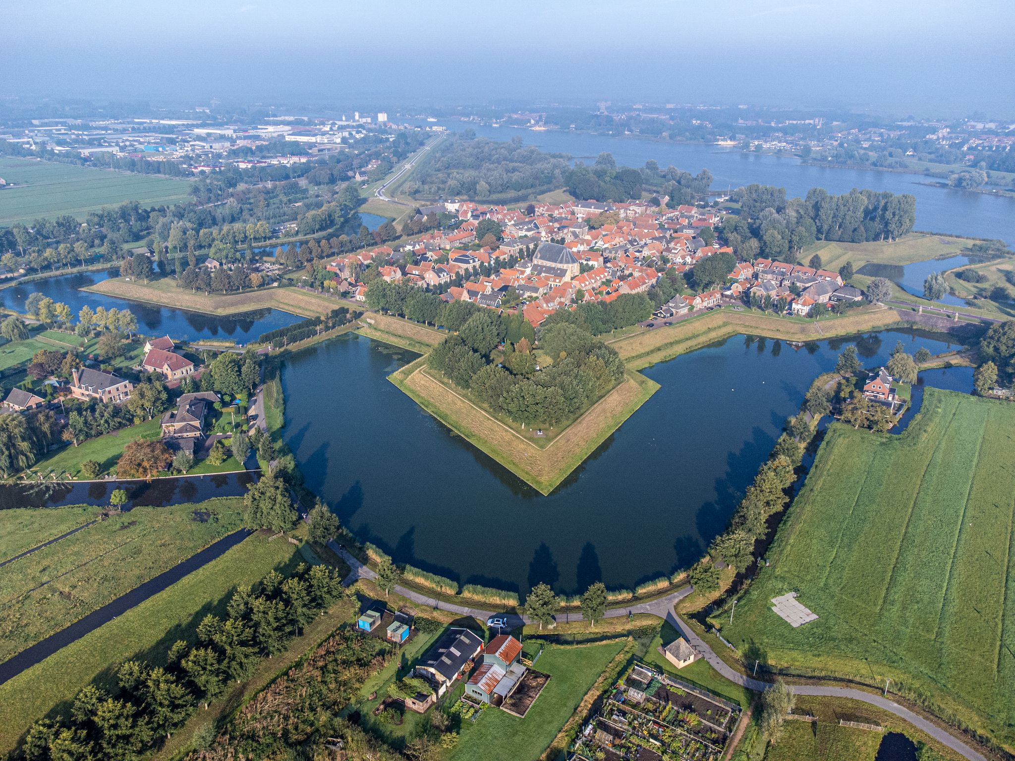
No traffic gravel bike trails around De Ronde Venen traverse a distinctive landscape of Dutch polder systems and expansive peat meadows. This region, situated within the "Groene Hart," is characterized by low-lying, often flat terrain, crisscrossed by numerous waterways and winding peat streams. The area features large lakes like the Vinkeveense Plassen and nature reserves such as Botshol, offering varied surfaces and scenic routes for gravel biking. The terrain generally presents low elevation gains, making routes less strenuous.
Best no…
Last updated: July 7, 2026
5.0
(1)
76
riders
56.8km
02:50
100m
100m
Moderate gravel ride. Good fitness required. Mostly paved surfaces. Suitable for all skill levels.
5.0
(4)
34
riders
35.6km
01:52
50m
50m
Easy gravel ride. Great for any fitness level. Mostly paved surfaces. Suitable for all skill levels.

Sign up for free
4.5
(2)
10
riders
Easy gravel ride. Great for any fitness level. Mostly paved surfaces. Suitable for all skill levels.
16
riders
Moderate gravel ride. Good fitness required. Mostly paved surfaces. Suitable for all skill levels.
Our route recommendations are based on thousands of hikes, rides, and runs completed by other people on komoot.
Start today with a free account
Your next adventure awaits.
Login or Signup

Other adventures around De Ronde Venen

Tips from the Community

Enjoy one of the delicious homemade cakes here.
0
0

The drainage of the Breukelerveen and Tienhoven water board was originally carried out by two barges (built in 1649 and 1684) at the northern end of the Scheendijk-Noord in Breukelen. They discharged their water directly south of the Weersluis lock into the Vecht River. The mills were shut down in 1830 and demolished in 1840. By that time, the area of the Loosdrechtse Plassen had been created by peat extraction. In the eastern corner of Tienhoven, the land remained in agricultural use, and the farmers there suffered from significant flooding. They joined forces, established the Oostelijke Binnenpolder (Eastern Inner Polder), and had their own mill built, which discharged water into the Breukeleveen and Loosdrechtse Plassen. The necessary land was purchased in 1831, and the mill and adjacent lock were put into operation in 1833. It is suspected that an old upper house (from a demolished mill) was used in its construction. (https://www.molens.nl/ontdek-molens/alle-molens/de-trouwe-wachter-te-tienhoven)
2
0
The origin of this boulder is not entirely clear. However, you can easily test for yourself on site whether it actually bleeds when you prick it.
3
0


Beautiful landscape at sunrise...
0
0

That it can be a bit busy here sometimes seems inevitable to me. That's what you get with such a beautiful spot.
0
0

This mill was used to drain the Polder Tienhoven from 1833 to 1947. The mill owes its name to its role in the Second World War. Since the Second World War, the mill has borne its current name. This is because of the signs that the then miller Arie van Garderen gave with the sails to people in hiding in the area. This is often spelled as "De Trouwe Waghter" but nowadays the normal spelling is used: "De Trouwe Wachter". Before that name came into use, this mill was also called the "Dwarsdijkmolen".
1
0
On one side is the coat of arms of the province of North Holland, on the other side the coat of arms of Utrecht. Because already in the Middle Ages there were regular border conflicts between the counts of Holland and the bishops of Utrecht. In the year 1719 the border was finally established.
0
0
Frequently Asked Questions
How many traffic-free gravel bike trails are available in De Ronde Venen?
Komoot currently features 4 dedicated traffic-free gravel bike routes in De Ronde Venen. These routes are carefully curated to offer a serene and enjoyable cycling experience away from vehicle traffic, allowing you to fully immerse yourself in the region's unique polder landscapes and waterways.
What do other gravel bikers enjoy most about the traffic-free trails in De Ronde Venen?
The komoot community highly rates the gravel biking experience in De Ronde Venen, with an average score of 4.3 stars. Riders frequently praise the tranquility of the polder systems and peat meadows, the scenic routes along canals and dikes, and the feeling of being truly immersed in nature within the Groene Hart. The absence of traffic is consistently highlighted as a major plus.
Are there easy gravel bike routes in De Ronde Venen suitable for beginners?
While all the listed traffic-free gravel routes in De Ronde Venen are classified as 'moderate' difficulty, this primarily refers to their length rather than technical challenge. The terrain is generally flat, characteristic of the Dutch polder landscape, making them accessible for beginners with a reasonable level of fitness. Routes like the View of the Loenderveense Plas – Zanderij Crailoo Nature Bridge loop from Stichtse Vecht, at 40.5 km, offer a good starting point.
What kind of landscapes can I expect on these traffic-free gravel trails?
De Ronde Venen's traffic-free gravel trails primarily traverse the distinctive Dutch polder systems and expansive peat meadows. You'll cycle alongside numerous waterways, canals, and dikes, often with views of the large lakes like the Vinkeveense Plassen. The routes offer a unique blend of open fields, tranquil nature reserves, and picturesque rural scenery, all within the peaceful 'Groene Hart' region.
Are there any circular gravel routes available?
Yes, all the traffic-free gravel routes featured in this guide are designed as loops, bringing you back to your starting point. This makes planning your ride and transportation much simpler. For example, the Roedenlaan Gravel Path – Hoorneboeg Heath loop from Maarssen is a great circular option.
What are some interesting sights or attractions along the traffic-free gravel routes?
The routes offer plenty to see. You can enjoy views of historic structures like the Faithful Watchman Windmill, which is part of the The Faithful Watchman Windmill – Stulpselaan Gravel Path loop from Maarssen. You'll also encounter beautiful natural features such as the Loosdrecht Lakes near Muyeveld and the Gravel path along the Ankeveen Lakes. Keep an eye out for the UNESCO World Heritage forts of the Stelling van Amsterdam, which are scattered throughout the region.
Can I bring my dog on these gravel trails?
While many parts of De Ronde Venen are dog-friendly, specific rules may apply in nature reserves like Botshol or Groene Jonker, especially concerning leashing. It's always best to check local signage or the specific nature reserve's regulations before heading out with your dog. Generally, on public paths and dikes, dogs are welcome on a leash.
Are there options for long-distance traffic-free gravel routes?
The traffic-free gravel routes in De Ronde Venen range from approximately 40 km to 55 km, offering substantial distances for a satisfying ride. The longest route, Roedenlaan Gravel Path – Hoorneboeg Heath loop from Maarssen, covers about 55.6 km, providing a good challenge for those looking for a longer day out on the bike.
Is public transport accessible to the starting points of these trails?
De Ronde Venen is well-connected by public transport, particularly buses, which can take you to towns like Maarssen, Weesp, and Stichtse Vecht, where many of these routes begin. Check local public transport schedules for the most convenient connections to your chosen starting point. Some routes, like the Bussummerheide – Zuiderheide loop from Weesp, start from easily accessible towns.
What is the best time of year for gravel biking in De Ronde Venen?
The spring (April-May) and autumn (September-October) months are generally ideal for gravel biking in De Ronde Venen. During these periods, the weather is typically mild, and the landscapes are particularly beautiful, with blooming flowers in spring or vibrant foliage in autumn. Summer can also be pleasant, but be prepared for potentially warmer temperatures and more visitors. Winter rides are possible, but conditions can be wet and muddy on unpaved sections.
Are there any family-friendly traffic-free gravel trails?
While the listed routes are moderate in length (40-55 km), the flat terrain and absence of traffic make them suitable for families with older children who are accustomed to longer rides. For younger children, you might consider shorter sections of these routes or explore the extensive network of paved cycle paths in the region, which also offer traffic-free sections through similar scenic landscapes.
Where can I find parking for these gravel bike trails?
Most towns and villages in De Ronde Venen, such as Maarssen, Weesp, and Stichtse Vecht, offer public parking facilities. You can typically find parking near the suggested starting points of the routes. It's advisable to check local parking regulations and availability beforehand, especially during peak season.
Most popular routes around De Ronde Venen
Most popular attractions around De Ronde Venen

Get inspired with the komoot mobile app


Explore more
Browse the best Gravel rides in other regions.
