The best traffic-free bike rides around Pradelles-Cabardès
4.2
(14)
162
riders
3
rides
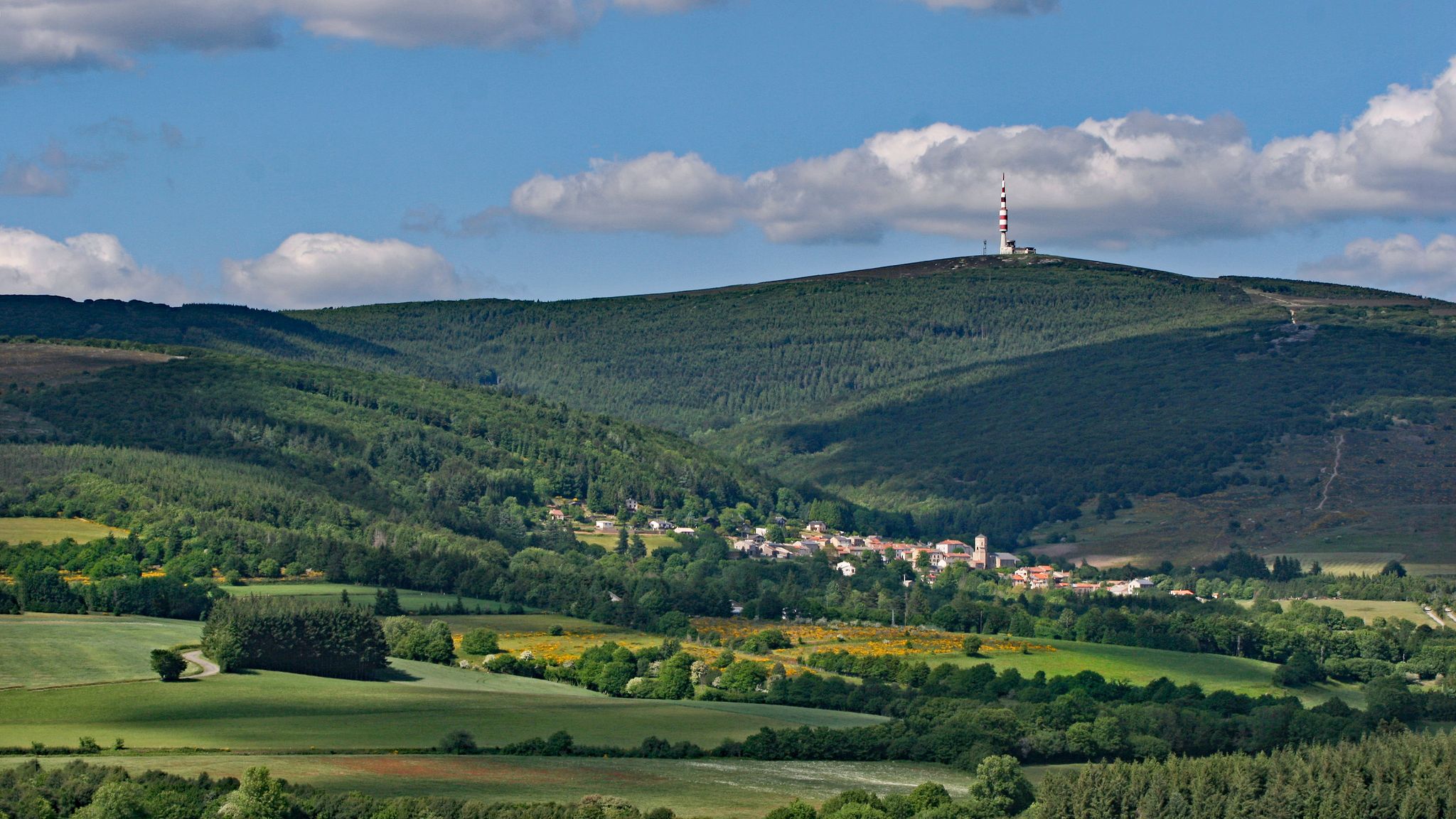
Gravel biking around Pradelles-Cabardès offers diverse terrain within the Montagne Noire, characterized by low mountains, vast forests, and tranquil rural paths. The region features a mix of surfaces suitable for gravel bikes, including older routes and challenging climbs. Elevations range from 217 to 1,211 meters, providing varied experiences for cyclists. This area in the Aude department is well-suited for exploring natural and historical features on two wheels.
Best no traffic gravel bike trails around Pradelles-Cabardès
- The most popular no traffic…
Last updated: October 23, 2026
6
riders
71.4km
05:23
1,810m
1,810m
Hard gravel ride. Very good fitness required. Mostly paved surfaces. Suitable for all skill levels.
2
riders
50.1km
03:06
310m
310m
Moderate gravel ride. Good fitness required. Mostly paved surfaces. Suitable for all skill levels.

3
riders
54.9km
04:04
1,410m
1,410m
Hard gravel ride. Very good fitness required. Mostly paved surfaces. Suitable for all skill levels.
3
riders
29.1km
01:52
490m
490m
Hard gravel ride. Very good fitness required. Mostly paved surfaces. Suitable for all skill levels.
2
riders
41.5km
02:42
710m
710m
Hard gravel ride. Very good fitness required. Mostly paved surfaces. Suitable for all skill levels.
Our route recommendations are based on thousands of hikes, rides, and runs completed by other people on komoot.
Start today with a free account
Your next adventure awaits.




Tips from the Community

The Trèbes locks are a flight of locks composed of three basins. Built around 1674, it is located downstream from the port of Trèbes at the exit of the town in the direction of the village of Marseillette. Taking advantage of the significant drop in the flight of locks, intense milling activity was established on the left bank of the lock. A first upper mill was built at the end of the 17th century. It is crossed by a diversion of the Canal du Midi which ensures its operation; it is described as having four millstones with a stable and a shed. A transformation of this first mill was carried out in 1867 to make it a mill with 6 millstones. This new building, later enlarged in the 1930s, consists of a basement and 4 floors at its highest point. It has today been converted into a restaurant.
0
0
The Trèbes locks are a flight of locks composed of three basins. Built around 1674, it is located downstream from the port of Trèbes at the exit of the town in the direction of the village of Marseillette. Taking advantage of the strong difference in level of the flight, an intense milling activity was established on the left bank of the lock. A first upper mill was built at the end of the 17th century. It is crossed by a diversion of the Canal du Midi which ensures its operation; it is described as having four millstones with a stable and a shed. A transformation of this first mill was carried out in 1867 to make it a flour mill comprising 6 millstones. This new building, later enlarged in the 1930s, consists of a base and 4 floors at its highest point. Today it has been converted into a restaurant.
0
0
The pond covers an area of 2000 ha, and is shared between the municipalities of Marseillette, Aigues-Vives, Saint-Frichoux and Puichéric. In the past, it supplied the region with fish. From the 12th century onwards, people began to talk about draining this stagnant body of water, a source of death and misery for Marseillette and the surrounding villages, which were becoming depopulated. In 1605, Henry IV issued a royal decree to drain the Pond. But it wasn't until 1804 and the purchase of the Pond by an Irishwoman, Madame de Lawless, that it was drained, thanks to a vast construction project. The pond was then cultivated and developed to use the waters of the Aude, with an original irrigation system consisting of perpendicular canals allowing the flooding of the land. Today, vines, apples, and rice are the main products found there. Its quiet and flat paths are very pleasant for hiking or cycling, in a typical landscape.
0
0
Le Canal du Midi, formerly Canal Royal, is a 17th-century technical feat designed by Pierre-Paul Riquet to connect the Atlantic to the Mediterranean. Today, it is above all a place for relaxation and discovery, where heritage, nature, and conviviality blend.
0
0
The Canal du Midi, formerly the Royal Canal, is a 17th-century technical feat designed by Pierre-Paul Riquet to connect the Atlantic to the Mediterranean. Today, it is above all a place for relaxation and discovery, where heritage, nature, and conviviality blend together.
0
0
The Canal du Midi, formerly Canal Royal, is a 17th-century technical feat designed by Pierre-Paul Riquet to connect the Atlantic to the Mediterranean. Today, it is above all a place for relaxation and discovery, where heritage, nature, and conviviality blend together.
0
0
The l'Aiguille lock is a double lock on the Canal du Midi located in the commune of Puichéric.
0
0

Frequently Asked Questions
What kind of terrain can I expect on traffic-free gravel bike trails around Pradelles-Cabardès?
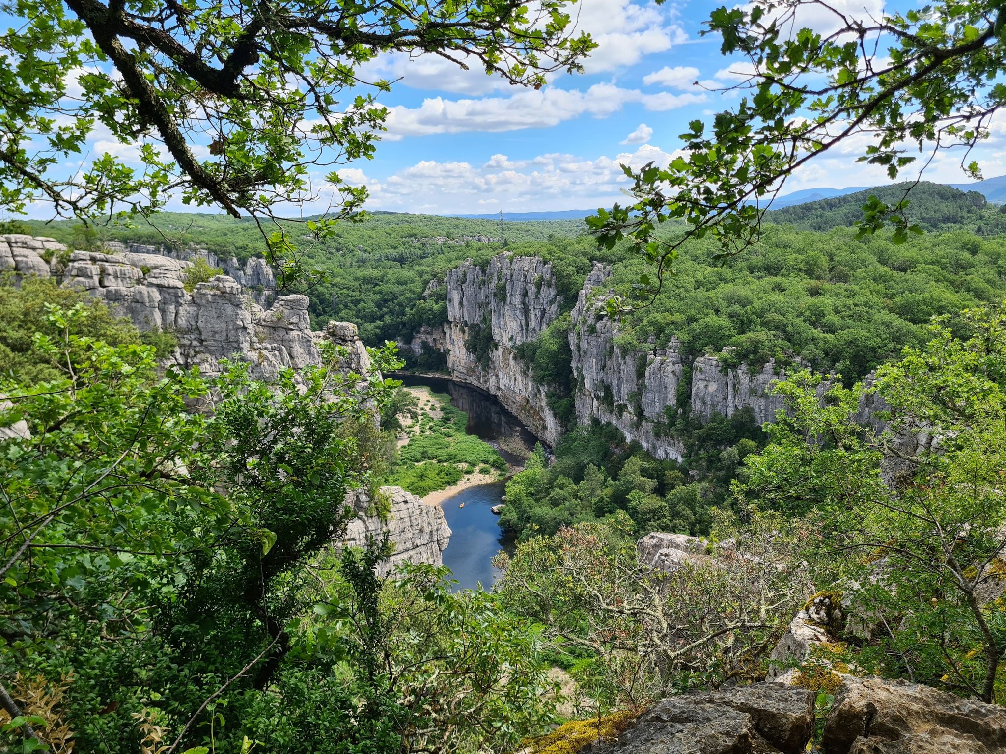
The Montagne Noire region, where Pradelles-Cabardès is located, offers a diverse landscape perfect for gravel biking. You'll encounter a mix of low mountains, vast forests, and tranquil rural paths. Expect varied surfaces, from ancient Roman roads to forest tracks, providing both challenging climbs and scenic, quiet sections.
Are there any challenging no-traffic gravel routes for experienced riders?
Yes, the area is known for its demanding terrain. For instance, the Pic de Nore – Pic de Nore Summit loop from Lastours is a difficult route covering over 71 km with more than 1800 meters of elevation gain. Another challenging option is the Pic de Nore – Pic de Nore Summit loop from Mas-Cabardès, which is nearly 55 km long with over 1400 meters of ascent, offering a rewarding experience for those seeking significant elevation.
What are the best times of year to ride traffic-free gravel trails in Pradelles-Cabardès?
The Montagne Noire region is generally pleasant for gravel biking from spring through autumn. Spring brings lush greenery, while autumn offers beautiful foliage. Summers can be warm, so early morning or late afternoon rides are recommended. Winters are possible, but check local conditions for snow or ice, especially at higher elevations like Pic de Nore.
Are there any circular no-traffic gravel routes available?
Yes, many of the routes in the area are designed as loops, allowing you to start and finish in the same location. Examples include the challenging Pic de Nore – Pic de Nore Summit loop from Lastours and the Gorges du Banquet – Gorges du Banquet loop from Mazamet, which offers a shorter, yet still difficult, circular option.
What kind of natural attractions can I see along the quiet gravel bike trails?
The region is rich in natural beauty. You can ride towards the impressive Cubserviès Waterfall, the highest in the Aude department, offering a spectacular sight. The ascent to Pic de Nore provides breathtaking 360-degree panoramic views. Additionally, you might pass by tranquil spots like Lac de Pradelles-Cabardès (Lac de Birotos).
Are there any historical landmarks or points of interest accessible by gravel bike?
Absolutely. The Montagne Noire is dotted with historical sites. You might encounter remnants of ancient Roman roads, medieval castles like Roquefère Castle, and other cultural landmarks that add an element of historical discovery to your ride. The region's rich past is woven into its landscape.
What do other gravel bikers enjoy most about the traffic-free trails in Pradelles-Cabardès?
The komoot community highly rates the routes around Pradelles-Cabardès, with an average score of 4.5 stars. Riders frequently praise the serene environment, the absence of traffic, and the challenging yet rewarding climbs that lead to spectacular views, especially from Pic de Nore.
Are there any gravel routes that offer views of the Gorges du Banquet?
Yes, the Gorges du Banquet – View of Boisezon loop from Mazamet is a difficult 41 km route that takes you through this scenic area, offering beautiful vistas of the gorges and surrounding landscapes. Another option is the Gorges du Banquet – Gorges du Banquet loop from Mazamet.
Where can I find parking for these quiet gravel bike trails?
Many routes start from villages or towns like Lastours or Mazamet, which typically offer public parking facilities. For example, routes like the Pic de Nore loop start from Lastours, where you can usually find parking. Always check local signage for specific parking regulations.
Are there any routes that pass by the Pas des Bêtes Dam?
Yes, the Pas des Bêtes Dam – View of Boisezon loop from Mazamet is a difficult 41 km route that includes this feature. It offers a scenic ride with over 700 meters of elevation gain, providing views of the dam and the surrounding natural beauty.
Most popular routes around Pradelles-Cabardès
Most popular attractions around Pradelles-Cabardès

Get inspired with the komoot mobile app


Explore more
Browse the best Gravel rides in other regions.
