The best traffic-free bike rides around Hagenbach
4.6
(196)
4,060
riders
109
rides
No traffic road cycling routes around Hagenbach are situated within the Southern Palatinate region of Germany, characterized by the Upper Rhine Plain. This area offers a diverse landscape for road cycling, featuring both flat and gently undulating terrain. The region is defined by its proximity to the Rhine River and the Bienwald Forest, providing varied natural settings for rides. These routes offer opportunities to explore the natural beauty of the Rhine floodplains and the dense forest landscapes.
Best no traffic…
Last updated: October 21, 2026
4.7
(12)
31
riders
54.8km
02:44
310m
310m
Cycle the moderate 34.0-mile La vallée de la Largue loop from Dannemarie, enjoying verdant landscapes and a car-free greenway.
5.0
(2)
40
riders
Easy road ride. Great for any fitness level. Mostly well-paved surfaces and easy to ride.

4.0
(1)
37
riders
80.8km
03:45
930m
930m
Hard road ride. Very good fitness required. Mostly well-paved surfaces and easy to ride.
15
riders
29.9km
01:22
180m
180m
Easy road ride. Great for any fitness level. Mostly well-paved surfaces and easy to ride.
10
riders
93.9km
04:00
570m
570m
Moderate road ride. Good fitness required. Mostly well-paved surfaces and easy to ride.
Get access to more routes and recommendations from other explorers.
Already have an account?
Our route recommendations are based on thousands of hikes, rides, and runs completed by other people on komoot.
Start today with a free account
Your next adventure awaits.
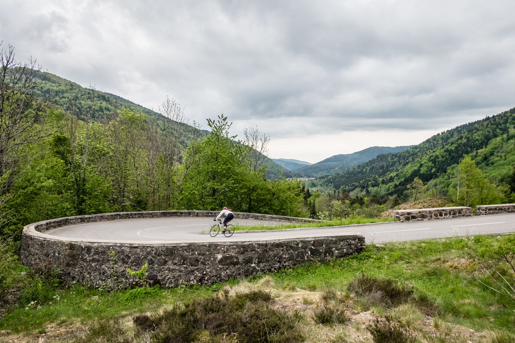
Other adventures around Hagenbach

Tips from the Community

This large lake is a popular stop along the cycling routes around Belfort, with beautiful views over the water and the surrounding nature.
7
0
The Étang du Malsaucy (often also called Lac du Malsaucy) is, with an area of 55 hectares, the largest lake in the French department of Territoire de Belfort. It is nestled in the Parc naturel régional des Ballons des Vosges, spread across the municipalities of Évette-Salbert, Lachapelle-sous-Chaux, and Sermamagny. Originally built at the end of the 15th century for fish farming, it is now one of the most important recreational and natural areas in the region.
7
0

Ammertzwiller – destroyed front village and mine warfare Ammertzwiller was one of the particularly contested locations on the Sundgau front during World War I. From September 1914, the front line ran immediately west of the village. German troops held Ammertzwiller, while French positions were located near Gildwiller-le-Mont, among other places. On January 1, 1915, the entire population was evacuated. Shortly thereafter, the abandoned village itself became a combat zone. The church was destroyed on January 8, 1915. By the end of the war, Ammertzwiller was almost completely devastated. The place became particularly known for mine warfare. From May 1915, French sappers and German pioneers dug tunnels under the enemy positions and detonated them. The underground warfare lasted until early 1916 and left numerous explosion craters. A striking event was the German mine detonation on July 11, 1915. The explosion under the German outpost Sautter created a massive crater. The mine crater, now filled with water, is preserved as the "Entonnoir" and serves as a reminder of this form of warfare. German troops also built an extensive system of bunkers, shelters, and underground facilities. Today, the approximately 10.5 km long "Circuit de la mémoire d’Ammertzwiller" leads through this former front landscape. Around 15 information boards explain the local history. After the war, the residents returned to a largely destroyed village. Reconstruction left a lasting mark on Ammertzwiller. Today's Saint-Étienne church, with its depictions, preserves the memory of evacuation, war, and return. Particularly worth seeing: the water-filled mine crater and the Circuit de la mémoire d’Ammertzwiller.
0
0

This old chapel was erected after the French Revolution on the old path to Thann and fell into disrepair over time. In 1932, the community decided to rebuild it. The current small building has a simple nave, an open porch, and a small bell tower with a bell. In front of the chapel stands a statue of the Virgin Mary, which underscores the character of the place as a pilgrimage and devotional site. The chapel is dedicated to the "Mother of God of Perpetual Help" and belongs to the typical small religious monuments of southern Alsace.
1
0

Virtually no incline, good asphalt – everything invites you to pedal briskly through beautiful nature.
0
0
The former railway line between Dannemarie and Pfetterhouse has been redesigned according to the well-known French principle as a perfect "piste cyclable" or "voie vert." Good asphalt, gentle gradients, and, above all, a lack of motorized traffic entice you to glide along at a brisk pace. Often through beautiful forests or through fields, only occasionally do you have to cross a road where there used to be a tunnel or bridge, which has unfortunately been dismantled.
0
0
A long, flat viaduct carries the railway between two hills across the plain. The structure's many small arches create a steady rhythm in this landscape, which is also characterized by a constant mix of plains and low elevations.
0
0
A well-maintained fish pond outside Ballersdorf – so well maintained that it stands out from similar ponds in the area. Caution and also worth mentioning: directly in front of it, there's a substantial traffic calming barrier: two concrete elements rise almost waist-high to the left and right. Fortunately, there's space in the middle for bicycles.
0
0
Frequently Asked Questions
How many no-traffic road cycling routes are available around Hagenbach?
Komoot offers over 100 no-traffic road cycling routes around Hagenbach. These routes cater to various fitness levels, with a significant number being easy or moderate, ensuring a pleasant ride for most cyclists.
What kind of terrain can I expect on no-traffic road cycling routes around Hagenbach?
The region around Hagenbach, situated on the Upper Rhine Plain, offers a mix of flat and gently undulating terrain. You'll find many routes along the Rhine River and through the Bienwald Forest, providing scenic rides with minimal elevation changes, ideal for road cycling without heavy traffic.
Are there routes suitable for beginners or families with children?
Yes, Hagenbach offers numerous easy, no-traffic road cycling routes perfect for beginners or families. These often follow paved paths along the Rhine or through the Bienwald, providing a safe and enjoyable experience. For example, the Restaurant Au 1000 Pâtes – Écluse Muehlenmatten loop from Balschwiller is an easy option.
Are there any challenging no-traffic road cycling routes for experienced riders?
While many routes are gentle, there are options for more experienced riders seeking a challenge. Some routes incorporate greater elevation changes, especially those venturing towards the edges of the Palatinate Forest. The Chapel of Rammersmatt – Hundsruck loop from Dannemarie is a more difficult route with significant climbing.
What is the best time of year for no-traffic road cycling in Hagenbach?
The spring, summer, and early autumn months (roughly April to October) are generally the best for road cycling in Hagenbach. During these periods, the weather is typically mild and pleasant, and the natural landscapes along the Rhine and in the Bienwald are at their most vibrant. Always check local weather forecasts before heading out.
Can I bring my dog on these no-traffic road cycling routes?
Many of the no-traffic road cycling routes, especially those on dedicated cycle paths or quiet country roads, are suitable for cycling with dogs, particularly if they are accustomed to a bike trailer. However, always ensure your dog is comfortable and safe, and be mindful of local regulations in nature reserves or specific areas.
Are there options for circular no-traffic road cycling routes?
Yes, many of the no-traffic road cycling routes around Hagenbach are designed as circular loops, allowing you to start and end at the same point without retracing your steps. This is ideal for exploring different sections of the Rhine Cycle Path or the Bienwald Forest. The Port of Dannemarie – Bellefontaine Chapel loop from Dannemarie is a moderate circular option.
Where can I park my car when starting a no-traffic road cycling tour?
Parking is generally available in Hagenbach itself or at various points along the Rhine Cycle Path and near the Bienwald Forest. Look for designated parking areas in towns or at trailheads. Specific parking information can often be found on individual route descriptions on komoot.
How can I reach the starting points of these routes using public transport?
Hagenbach has public transport connections, and some routes are accessible via train or bus, especially those near larger towns. While direct bike transport might vary, many regional trains allow bikes. It's advisable to check the local public transport provider's website for current schedules and bike carriage policies before planning your trip.
What natural features or landmarks can I see along no-traffic road cycling routes?
You'll encounter diverse natural beauty and points of interest. The Rhine River and its floodplains are prominent, offering scenic views. The Bienwald Forest provides a unique forest landscape. You can also discover tranquil lakes like Étang La Belle Île or Riedweiher Pond, and historical sites such as the Port of Dannemarie or the Eglingen Lock.
Are there places to stop for refreshments or accommodation near the no-traffic routes?
Yes, the region is well-equipped for cyclists. You'll find cafes, restaurants, and pubs in Hagenbach and the surrounding villages. Many establishments are cyclist-friendly. For longer trips, there are various accommodation options, from guesthouses to hotels, often catering to outdoor enthusiasts.
What do other road cyclists enjoy the most about road cycling in Hagenbach?
The area is highly rated by the komoot community, with an average score of 4.55 stars. Reviewers often praise the quiet, well-maintained paths, the beautiful natural scenery along the Rhine and through the Bienwald, and the overall peaceful experience of cycling away from heavy traffic.
Most popular attractions around Hagenbach

Get inspired with the komoot mobile app


Explore more
Browse the best Road cycling routes in other regions.
