The best traffic-free bike rides around Peyrehorade
4.3
(207)
850
riders
54
rides
No traffic touring cycling routes around Peyrehorade traverse a landscape characterized by river valleys, rolling hills, and agricultural areas. The region is situated at the confluence of several rivers, including the Gave d'Oloron and the Adour, offering generally low-altitude routes. Cyclists encounter distinctive kiwi orchards and the characteristic Landes countryside. While many routes provide gentle rides, the proximity to the Pyrenees offers options for more challenging ascents.
Best no traffic touring cycling routes around Peyrehorade
- The most popular no traffic…
Last updated: July 3, 2026
3.0
(1)
20
riders
95.5km
05:40
610m
610m
Hard bike ride. Very good fitness required. Mostly paved surfaces. Suitable for all skill levels.
4.0
(3)
16
riders
106km
06:10
340m
340m
Hard bike ride. Very good fitness required. Mostly paved surfaces. Suitable for all skill levels.

Sign up for free
4.5
(4)
16
riders
39.9km
02:17
100m
100m
Moderate bike ride. Good fitness required. Mostly paved surfaces. Suitable for all skill levels.
3.0
(1)
4
riders
Moderate bike ride. Good fitness required. Mostly paved surfaces. Suitable for all skill levels.
3.0
(2)
8
riders
126km
07:38
790m
790m
Hard bike ride. Very good fitness required. Mostly paved surfaces. Suitable for all skill levels.
Get access to more routes and recommendations from other explorers.
Sign up for free
Already have an account?
Our route recommendations are based on thousands of hikes, rides, and runs completed by other people on komoot.
Start today with a free account
Your next adventure awaits.
Login or Signup
Popular around Peyrehorade
Tips from the Community

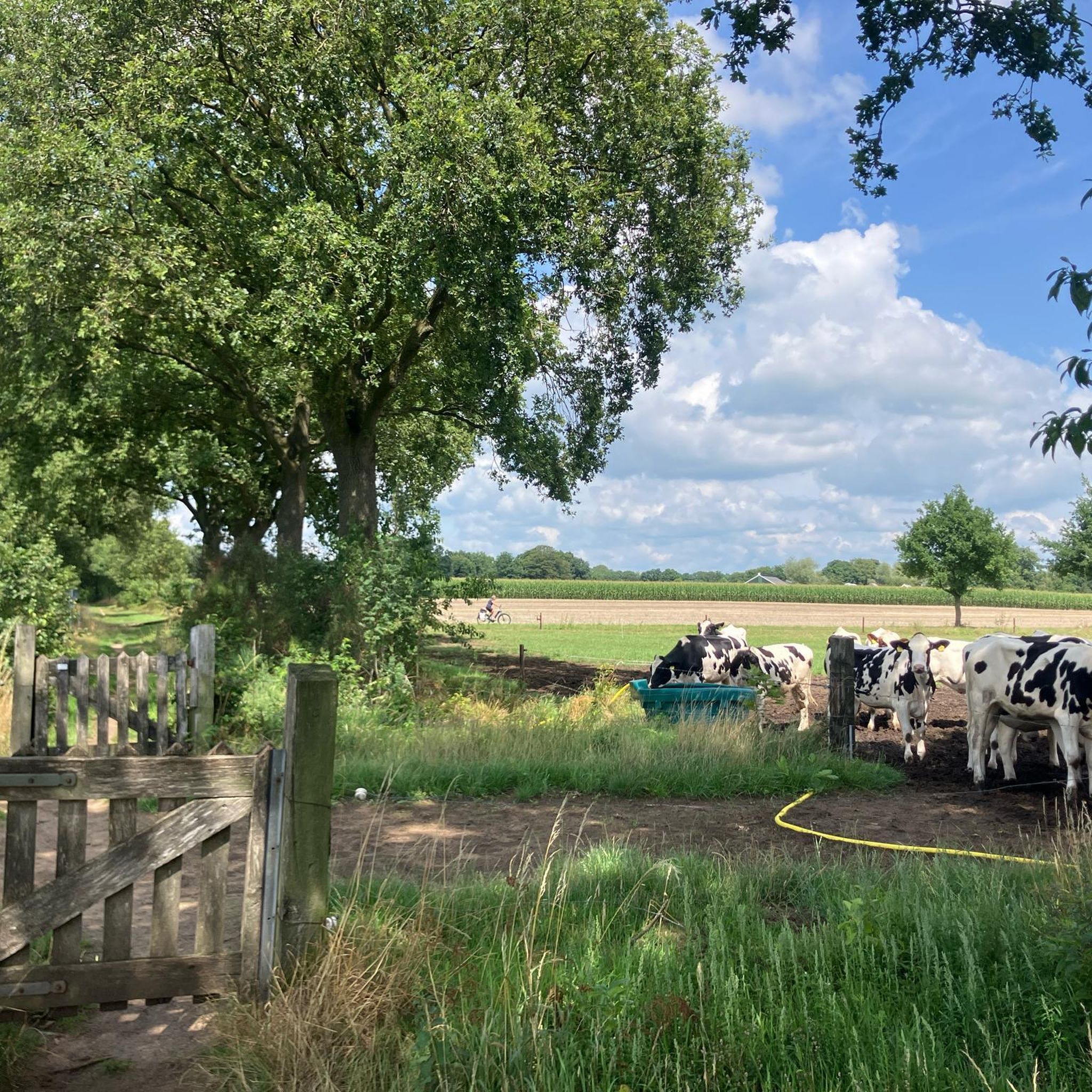
The Kiwi Valley, at the crossroads of the Basque Country, the mountains of Béarn and the beaches of the southern Landes, stretches over 24 municipalities in the Landes. It straddles three cultures and is rich in exceptional built and natural heritage.
1
0

## The tunnel The tunnel, located between the Puyoô and Salies-de-Béarn stations, is one of the significant structures on line n° 662.000 connecting Puyoô to Mauléon. It is a single-track tunnel 848.5 m long and 5.00 m wide between the abutments. The height under the crown is 6.00 m. It is a multi-radius arch. The structure is generally oriented North-South, with a curve of R400 m for the first 250 meters on the North side, then a straight section to the South end. The longitudinal profile has a constant gradient of 0.01 m/m from the North. A central aqueduct equips the structure along its entire route. The maximum cover is 49 m. The tunnel is built in the Campanian flysch (Upper Cretaceous). The construction of the tunnel (1879-1883) was carried out from two headings via shafts approximately 35 m deep, located at PM219 and PM632. The shafts were retained as ventilation shafts. The masonry thicknesses (limestone rubble set in lime mortar) vary from 0.50 m to 1.20 m. The length of the tunnel, initially projected at 400 m, was increased to 787 m following the decision to lower the profile (from 20‰ to 16‰). During construction, ground instabilities encountered during the excavation of access trenches led to a further extension of the structure, which finally reached a length of 848.5 m. Numerous ground instabilities (landslides) caused significant delays in the progress of the work. The tunnel was electrified in 1930 and the overhead line equipment was removed in 1971.
0
0

Beautiful village, don't forget to go through the gate! 🤩
0
0

Beautiful, very quiet road along the Adour
0
0
Boats restored by the AdourA Saubusse association
0
0
Magnificent landscapes of Barthes, the horses are free there.
0
0

THE BOATS OF THE ADOUR BAYOUNE A galupe used for transporting goods (60 tons) • Flat-bottomed barge with a shallow draft (18 cm) • Length: 18 m; Beam: 3.70 m • Weight: 10 tons • Oak wood • Aft decked with a "half-tillac" or "escapuchot" (shelter-berth and hold) • Rudder balanced by a stone (80 kg) • Equipped with a mast and a single-yard sail LOU TARRIT The couralin used for amateur and professional fishing • Flat-bottomed boat • Length: 5.50 m; Beam: 2 m • Bow with a flat shape • Lug rigging • Navigation: sail, sculling, pole, and oar
0
0

On this section there are also some beautiful, old renovated farms and a small chalet
0
0
Frequently Asked Questions
How many no-traffic touring cycling routes are available in Peyrehorade?
There are over 10 dedicated no-traffic touring cycling routes around Peyrehorade, offering a variety of distances and difficulty levels to explore the region's diverse landscapes.
What kind of terrain can I expect on no-traffic cycling routes in Peyrehorade?
You'll find a mix of riverine scenery, gentle rolling hills, and agricultural areas, including distinctive kiwi orchards. Routes often follow river valleys like the Gave d'Oloron and Adour, providing scenic and generally low-altitude cycling. Some routes also venture into the characteristic Landes countryside.
Are there any easy, family-friendly no-traffic cycling routes?
Yes, while many routes are moderate to difficult, there is at least one easy route suitable for families. The river valleys generally offer flatter, more accessible paths. Look for routes with minimal elevation gain for a relaxed family outing.
What historical sites can I visit along the no-traffic cycling routes?
Many routes incorporate historical points of interest. You can cycle through charming bastide towns like Hastingues Village, which was founded in 1289. The View of Château de Gramont – Hastingues Village loop from Peyrehorade is a moderate route that allows you to explore this historical area and offers views of Gramont Castle in Bidache.
Are there any circular no-traffic cycling routes around Peyrehorade?
Yes, many of the no-traffic routes are designed as loops, allowing you to start and end in the same location. For example, the moderate Peyrehorade, Adour, Anglet – Hastingues Village loop from Peyrehorade offers a great circular experience.
What are the best times of year for no-traffic touring cycling in Peyrehorade?
Spring and autumn generally offer the most pleasant cycling conditions with mild temperatures and less crowded paths. Summer can be warm, but routes along the rivers provide refreshing breezes. Winter cycling is possible, but check local weather conditions.
What do other touring cyclists enjoy most about the no-traffic routes in Peyrehorade?
The komoot community rates the touring cycling in Peyrehorade highly, with an average score of 4.3 stars from nearly 150 ratings. Reviewers often praise the peaceful, car-free paths, the beautiful river scenery, and the opportunity to discover charming villages and agricultural landscapes like the kiwi orchards.
Can I find routes that offer views of the Adour River?
Absolutely. Peyrehorade is situated at the confluence of several rivers, and many routes follow the scenic Adour River. The Riverside Path Along the Adour – La Marquèze Bridge loop from Peyrehorade is a challenging route that offers extensive views along the Adour.
Are there any longer, more challenging no-traffic touring routes?
Yes, for those seeking a greater challenge, there are several difficult routes. The Presidents' Footbridge – La Marquèze Bridge loop from Peyrehorade is a demanding option, covering a significant distance and elevation, perfect for experienced touring cyclists.
What natural features or attractions can I expect to see along the routes?
Beyond the rivers and rolling countryside, you'll encounter numerous kiwi orchards, especially in areas known as the 'Kiwi Valley.' You might also pass by the Adour Towpath, offering picturesque views, and even discover small, charming features like the Bourg-Neuf Washhouse Fountain.
Are there any routes that explore the 'Kiwi Valley'?
Yes, the region is known for its kiwi orchards, and many routes will take you through these agricultural landscapes. While not a specific route name in our selection, routes exploring the countryside between Peyrehorade, Bélus, and Cauneille are designed to showcase the 'Kiwi Valley' experience.
Most popular attractions around Peyrehorade

Get inspired with the komoot mobile app


Explore more
Browse the best Cycling routes in other regions.
