The best traffic-free bike rides around Arvillard
4.5
(204)
5,349
riders
46
rides
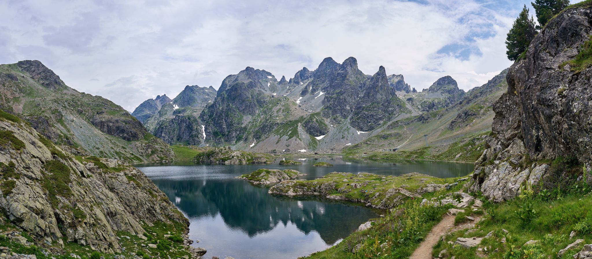
Touring cycling around Arvillard, located in France's Savoie department, offers diverse landscapes within the Belledonne mountain range. The region features significant elevation changes, with altitudes ranging from 400 meters to over 2,800 meters, providing varied terrain for cyclists. Extensive forests, such as Arvillard's communal forest, and scenic valleys like the Vallons du Joudron and du Bens, characterize the area's natural environment. These physical features create a network of no traffic touring cycling routes suitable for different skill levels.
Best no traffic touring cycling routes around Arvillard
- The most popular no traffic touring cycling route is Arvillard – Lake Saint Clair loop from La Croix-de-la-Rochette, a 20.3 miles (32.7 km) trail that takes 2 hours 15 minutes to complete. This difficult route includes significant elevation gain and views of Lake Saint Clair.
- Another top favourite among local touring cyclists is Col de Cochette (587 m) – Lake Saint Clair loop from La Rochette, a difficult 15.9 miles (25.5 km) path. This route features a challenging climb to Col de Cochette and scenic sections around Lake Saint Clair.
- Local touring cyclists also love the Bar des Alpes – Gelon Valley loop from La Rochette, a 15.1 miles (24.4 km) trail leading through the Gelon Valley, often completed in about 1 hour 28 minutes.
- Touring cycling around Arvillard is defined by mountainous terrain, scenic valleys, and extensive forests. The network offers options for different ability levels, from moderate valley rides to difficult mountain ascents.
- The routes in Arvillard are highly rated by the komoot community with an average score of 4.6 stars from over 280 reviews. More than 7600 touring cyclists have used komoot to explore Arvillard's varied terrain.
Last updated: July 3, 2026
4.4
(7)
67
riders
32.5km
02:14
590m
590m
Hard bike ride. Very good fitness required. Mostly paved surfaces. Suitable for all skill levels.
5.0
(4)
30
riders
25.5km
01:49
530m
530m
Hard bike ride. Very good fitness required. Mostly paved surfaces. Suitable for all skill levels.

Sign up for free
4.3
(3)
38
riders
24.4km
01:28
160m
160m
Moderate bike ride. Good fitness required. Mostly paved surfaces. Suitable for all skill levels.
28
riders
32.0km
02:06
470m
470m
Hard bike ride. Very good fitness required. Mostly paved surfaces. Suitable for all skill levels.
5.0
(3)
12
riders
33.7km
02:35
880m
880m
Hard bike ride. Very good fitness required. Mostly paved surfaces. Suitable for all skill levels.
Get access to more routes and recommendations from other explorers.
Sign up for free
Already have an account?
Our route recommendations are based on thousands of hikes, rides, and runs completed by other people on komoot.
Start today with a free account
Your next adventure awaits.
Login or Signup

Other adventures around Arvillard

Tips from the Community

Very beautiful hamlet, which notably opens up the view of the Bauges in the background. The road that allows access from Allevard is very accessible.
0
0

just magnificent, keep it secret or almost....
0
0

magnificent view of the snow-capped mountains at the end of May
1
0

Le Bar des Alpes is a perfect place for a coffee break in La Rochette. At lunchtime, there is a generous menu!
0
0

Nice little pass away from traffic
0
0

Large parts of the tour have very little traffic, so you can enjoy the beautiful nature even more.
1
0

Lac Saint Clair is a small lake just outside La Rochette. There are plenty of places to have a picnic and enjoy the lake during the summer months.
1
0
The Col de Cochette from La Trinité is 2.99 km long with a total drop of 237 m. The average gradient is 7.9% with maximum gradients of 10%. From Villard-d'Héry, it is 1.89 km with an average gradient of 7.8%. There is a total drop of 148m.
2
0
Frequently Asked Questions
How many no-traffic touring cycling routes are available around Arvillard?
There are over 50 dedicated no-traffic touring cycling routes around Arvillard. These routes offer a mix of easy, moderate, and difficult options, ensuring there's something for every skill level.
Are there any easy, traffic-free touring cycling routes suitable for beginners or families?
Yes, Arvillard offers 15 easy touring cycling routes that are ideal for beginners or families looking for a relaxed ride away from traffic. These routes often follow scenic pathways, such as the new section of cycle route 62 along the river between Sainte-Hélène-sur-Isère and Grésy-sur-Isère.
What kind of terrain can I expect on the no-traffic touring cycling routes in Arvillard?
The terrain around Arvillard is quite varied, ranging from gentle valley rides to challenging mountain ascents. You can expect paved surfaces on most touring routes, with some sections offering rewarding climbs into the Belledonne mountain range. The region's altitude varies significantly, providing diverse landscapes from forests to high mountain areas.
Are there any circular no-traffic touring cycling routes around Arvillard?
Yes, many of the no-traffic touring cycling routes in Arvillard are designed as loops. For example, you can explore the Bar des Alpes – Gelon Valley loop from La Rochette, which is a moderate option, or the more challenging Arvillard – Lake Saint Clair loop from La Croix-de-la-Rochette.
What are some notable viewpoints or attractions along the no-traffic touring cycling routes?
The routes offer stunning views of the Belledonne mountain range and the surrounding valleys. You might encounter natural features like the Vallons du Joudron and du Bens. For specific points of interest, consider routes that pass near the Marocaz Pass or offer views towards Crêt du Poulet. Lac Saint Clair is also a popular spot for relaxation.
What is the best season for no-traffic touring cycling in Arvillard?
The best season for touring cycling in Arvillard is typically from spring through autumn. During these months, the weather is generally mild, and the mountain passes are clear of snow. Summer offers the warmest temperatures, while spring and autumn provide beautiful scenery with fewer crowds. Winter cycling is possible at lower altitudes but requires appropriate gear and caution due to snow and ice.
Are there places to eat or rest near the no-traffic cycling trails?
While specific cafes directly on every trail might be limited, the towns and villages near the routes, such as La Rochette, Allevard, and Chambéry, offer various options for refreshments and provisions. Many routes pass through or near these communities, allowing for convenient stops. Lac Saint Clair also provides a pleasant spot for picnics.
What do other touring cyclists enjoy most about the no-traffic routes in Arvillard?
The no-traffic touring cycling routes in Arvillard are highly rated by the komoot community, with an average score of 4.6 stars from 286 ratings. Reviewers often praise the stunning natural beauty, the quiet and peaceful atmosphere away from cars, and the diverse range of routes catering to different fitness levels.
Are there any challenging no-traffic touring cycling routes for experienced riders?
Absolutely. Arvillard is situated within the Belledonne mountain range, offering 22 difficult touring cycling routes for experienced riders. These routes often include significant elevation gains, such as the ascent to Val Pelouse or sections leading towards renowned passes like the Col de la Croix-de-Fer (though further afield). An example is the Gelon Valley – Col de Champlaurent loop from Rotherens.
Is public transport available to access the no-traffic touring cycling routes in Arvillard?
While direct public transport access to every specific trailhead might be limited, major towns in the region, such as Chambéry, are well-connected by public transport. From these hubs, you may find local bus services that can get you closer to Arvillard or other starting points for the routes. It's advisable to check local transport schedules in advance for specific connections.
Where can I find parking for my touring bike near the no-traffic trails?
Parking is generally available in the towns and villages that serve as starting points for many of these routes, such as La Rochette or Arvillard itself. Look for designated parking areas within these communities, which often provide convenient access to the trail networks. Always check local signage for parking regulations.
Most popular routes around Arvillard
Most popular attractions around Arvillard

Get inspired with the komoot mobile app


Explore more
Browse the best Cycling routes in other regions.
