The best traffic-free bike rides around La Giettaz
4.5
(493)
21,441
riders
18
rides
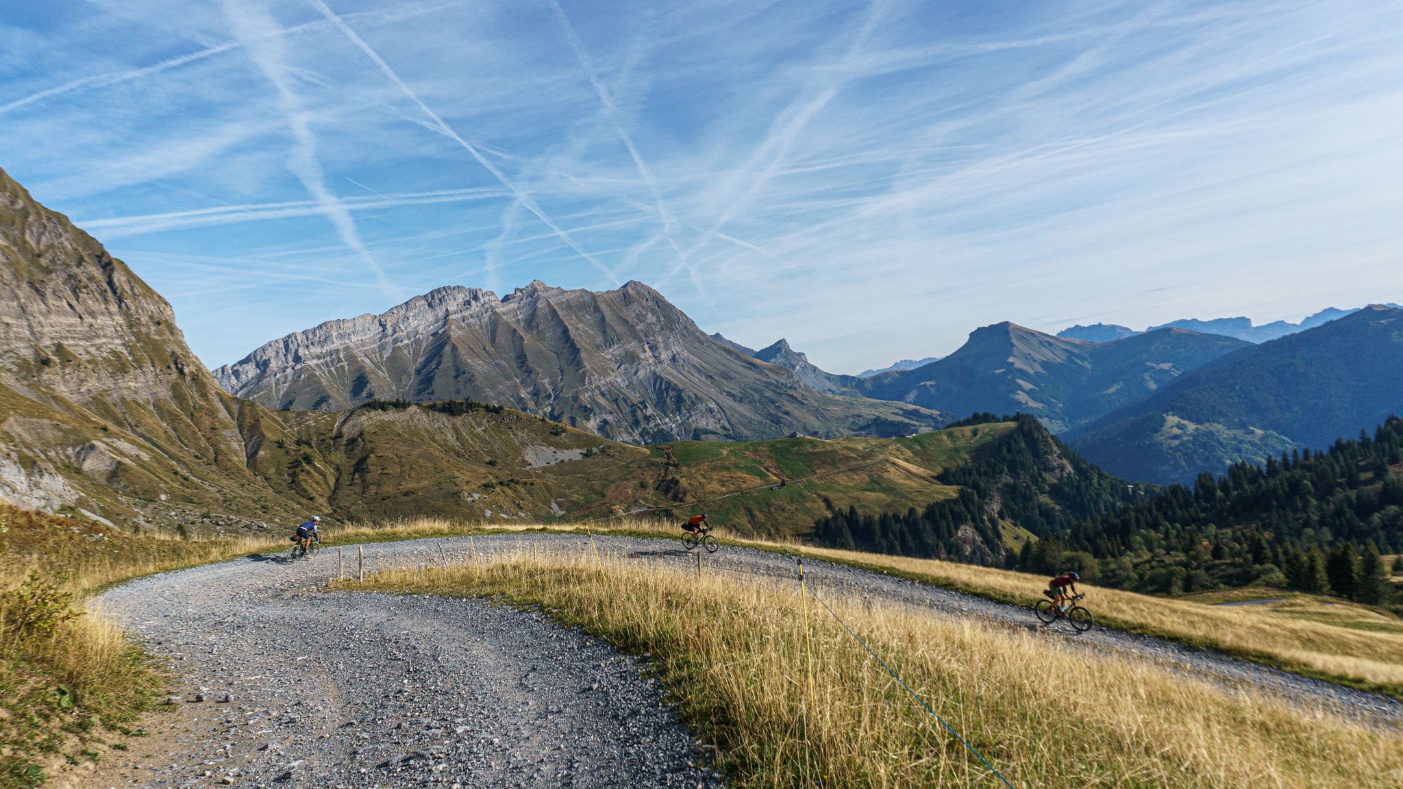
No traffic road cycling routes around La Giettaz are situated within the Aravis massif, an alpine region characterized by significant mountain passes and panoramic views. The terrain features challenging ascents to passes like Col des Aravis and Col des Annes, offering vistas of the Mont Blanc and Beaufortain ranges. Cyclists navigate through spruce forests, alpine meadows, and traditional villages with stone chalets. The area provides a blend of varied elevations and serene pathways.
Best no traffic road cycling routes around La Giettaz
- The most popular no traffic road cycling route is Col des Saisies – Crest-Voland Village Center loop from Crest-Voland, a moderate 11.5 miles (18.5 km) trail that takes about 1 hour 8 minutes to complete. This route features a steady climb towards the Col des Saisies, offering views of the surrounding alpine landscape.
- Another top favourite among local road cyclists is Nant Barlottier Waterfall – Plan Bois Pass loop from Manigod, a moderate 12.7 miles (20.5 km) path. This route includes a substantial ascent to Plan Bois Pass, providing expansive views and passing natural features like the Nant Barlottier Waterfall.
- Local road cyclists also love the Col des Confins – La Clusaz Village loop from La Clusaz, a 7.7 miles (12.4 km) trail leading through alpine valleys and past traditional villages, often completed in about 49 minutes.
- Road cycling around La Giettaz is defined by high mountain passes, lush alpine meadows, and traditional village settings. The network offers options for different ability levels, from easier loops to more challenging climbs.
- The routes in La Giettaz are highly rated by the komoot community with an average score of 4.5 stars from more than 300 reviews. More than 16,000 road cyclists have used komoot to explore La Giettaz's varied terrain.
Last updated: October 19, 2026
5.0
(1)
100
riders
18.5km
01:08
470m
470m
Moderate road ride. Good fitness required. Mostly well-paved surfaces and easy to ride.
5.0
(2)
50
riders
21.3km
01:48
820m
830m
Moderate road ride. Good fitness required. Mostly well-paved surfaces and easy to ride.

5.0
(2)
36
riders
11.2km
00:47
370m
370m
Moderate road ride. Good fitness required. Some segments of this route may be unpaved and difficult to ride.
52
riders
15.3km
01:05
540m
540m
Moderate road ride. Good fitness required. Some segments of this route may be unpaved and difficult to ride.
4.0
(1)
12
riders
15.7km
00:54
300m
300m
Moderate road ride. Good fitness required. Mostly well-paved surfaces and easy to ride.
Get access to more routes and recommendations from other explorers.
Already have an account?
Our route recommendations are based on thousands of hikes, rides, and runs completed by other people on komoot.
Start today with a free account
Your next adventure awaits.


Other adventures around La Giettaz

Tips from the Community

If you are ascending this col, don't worry about the car wrecks on the side of the road. They probably crashed during the descend.
0
0

A superb plateau perched at an altitude of over 1,400 meters. Located above La Clusaz, it is home to magnificent little chalets that populate its mountain pastures.
1
0

Great little road from Combloux to Megeve which avoids the main busy road below.
0
0

Charmless pass between the ski slopes. The end of the road above Hauteluce offers beautiful views towards Arêches.
1
0

Perfect starting point for great mountain bike or running tours. Everything on site. Parking, shops, nature.
2
0
Pretty little waterfall which offers a refreshing moment on the climb towards the Plan Bois pass. The Nant Barlottier has its source upstream before joining the Fier further down in the valley.
0
0

Mecca for cycling, the Col des Saisies is less known for trail running. With its many services, it nevertheless has the advantage of being a good refueling point during long outings. It can also serve as a starting point if you do not want to leave the valley.
1
0
Frequently Asked Questions
How many no-traffic road cycling routes are available around La Giettaz?
There are 17 dedicated no-traffic road cycling routes around La Giettaz listed in this guide, offering a variety of experiences for different skill levels.
Are there easy no-traffic road cycling routes suitable for beginners in La Giettaz?
Yes, this guide features 6 easy no-traffic road cycling routes. One option is the Saint John the Baptist Church – Megève Town Center loop from Combloux, which is 17.2 km long with 279 m of elevation gain, offering a gentle introduction to the region's scenic beauty.
What kind of terrain and elevation can I expect on the no-traffic road cycling routes?
The routes around La Giettaz vary significantly. While some are easier with moderate elevation, many routes feature the challenging ascents characteristic of the Aravis massif. For example, the Nant Barlottier Waterfall – Plan Bois Pass loop from Manigod covers 20.4 km with over 800 m of elevation gain, often including sections of the iconic mountain passes.
Are there any circular no-traffic road cycling routes in the area?
Yes, many of the no-traffic routes around La Giettaz are designed as loops, allowing you to start and finish in the same location. An example is the Col des Saisies – Crest-Voland Village Center loop from Crest-Voland, which is 18.5 km long and includes a significant climb.
What are some notable landmarks or viewpoints I can see along these routes?
The region offers majestic panoramas of the Beaufortain, Aravis, and Mont Blanc mountain ranges. You can cycle past famous mountain passes like the Col des Aravis and the Col des Annes, both offering breathtaking views. Other highlights include the Tête du Danay viewpoint and the View of the Mont Blanc range.
Are there any routes that pass by natural features like waterfalls?
Yes, some routes will bring you close to natural water features. For instance, the Nant Barlottier Waterfall – Plan Bois Pass loop from Manigod is a moderate route that includes the Nant Barlottier Waterfall, offering a refreshing stop amidst your ride.
What is the best time of year for quiet road cycling in La Giettaz?
The spring and autumn months generally offer the most serene cycling experience with fewer crowds and pleasant temperatures. Spring brings vibrant wildflowers to the alpine meadows, while autumn showcases stunning foliage. Summer is also popular, but can be busier, especially on the more famous passes. Always check local weather conditions before heading out.
Are there any cafes or refreshment stops along the no-traffic routes?
While specific cafes on every route aren't listed, the region is dotted with traditional villages and hamlets. The Col des Annes, for example, has a refreshment bar at its summit, offering local specialties. Many routes pass through or near villages like Flumet or La Clusaz, where you can find places to refuel.
What do other road cyclists enjoy most about the no-traffic routes in La Giettaz?
The area is highly rated by the komoot community, with an average score of 4.46 stars. Reviewers often praise the region's authentic mountain environment, the challenge of its iconic passes, and the breathtaking views of the Aravis and Mont Blanc ranges. The tranquil atmosphere and untouched nature are frequently highlighted as key attractions for those seeking quiet cycling experiences.
Are there any advanced or challenging car-free road cycling routes for experienced cyclists?
Yes, La Giettaz is renowned for its challenging ascents. Many of the 11 moderate routes in this guide offer significant climbs and distances, perfect for experienced cyclists. Routes that incorporate passes like the Col des Aravis or Col des Annes will provide a demanding yet rewarding experience with substantial elevation gains.
Where can I find parking for these quiet road cycling routes?
Many routes start from villages or towns like Combloux, Cordon, or Manigod, which typically offer public parking facilities. It's advisable to check specific starting points for each route on komoot for detailed parking information, as options can vary.
Most popular routes around La Giettaz
Most popular attractions around La Giettaz

Get inspired with the komoot mobile app


Explore more
Browse the best Road cycling routes in other regions.
