The best traffic-free bike rides around Burela
4.8
(19)
149
riders
13
rides
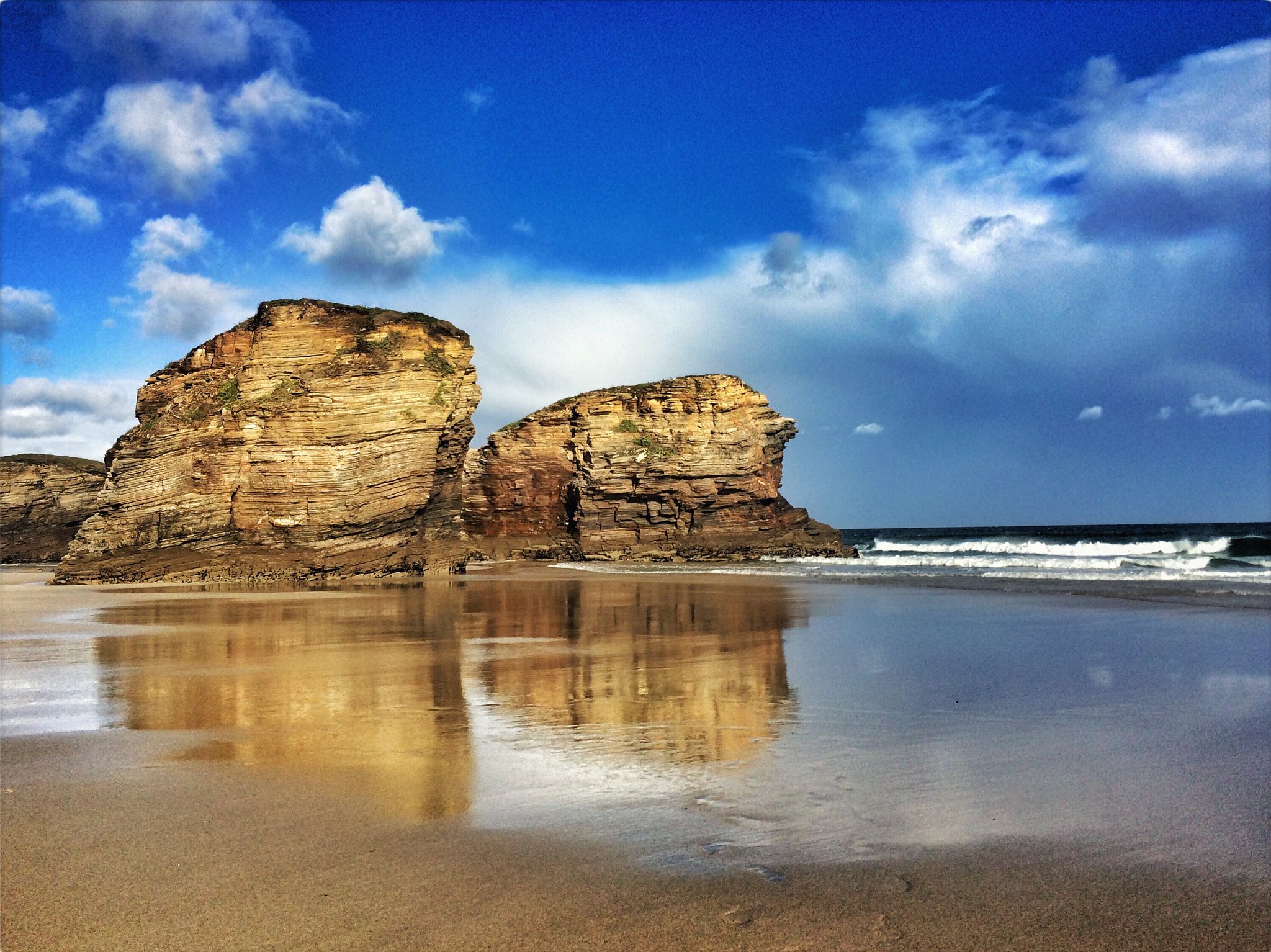
No traffic touring cycling routes around Burela are set along the Cantabrian Sea, offering a diverse landscape for outdoor activities. The region features a green Galician coastline with numerous beaches, capes, and impressive geological formations. Rivers such as the Covo and Xunco flow through the area, contributing to varied terrain that includes coastal paths and gentle inclines.
Best no traffic touring cycling routes around Burela
- The most popular no traffic touring cycling route is Burela - loop via Covo river and Marosa Beach, a 19.1 miles (30.8 km) trail that takes 2 hours 15 minutes to complete. This difficult route explores the Covo river valley before reaching the scenic Marosa Beach.
- Another top favourite among local touring cyclists is San Cibrao - return via Xunco river and Old Sargadelos porcelain factory, a difficult 15.3 miles (24.7 km) path. It follows the Xunco river and passes by the historic Old Sargadelos porcelain factory.
- Local touring cyclists also love the Burela – Marosa Beach loop from San Cibrao, a 13.0 miles (20.9 km) trail leading through coastal areas and past Marosa Beach, often completed in about 1 hour 20 minutes.
- Touring cycling around Burela is defined by its rugged coastline, sandy beaches, and river valleys. The network offers options for different ability levels, from moderate coastal loops to more challenging routes with significant elevation gain.
- The routes in Burela are highly rated by the komoot community with an average score of 4.9 stars from around 20 reviews. More than 170 touring cyclists have used komoot to explore Burela's varied terrain.
Last updated: October 19, 2026
1
riders
30.8km
02:15
550m
550m
Hard bike ride. Very good fitness required. Mostly paved surfaces. Suitable for all skill levels.
1
riders
24.7km
01:53
450m
450m
Hard bike ride. Very good fitness required. Some segments of this route may be unpaved and difficult to ride.

5.0
(6)
23
riders
22.2km
01:25
230m
230m
Moderate bike ride. Good fitness required. Mostly paved surfaces. Suitable for all skill levels.
4.8
(4)
18
riders
51.5km
03:15
520m
520m
Hard bike ride. Very good fitness required. Mostly paved surfaces. Suitable for all skill levels.
5.0
(1)
13
riders
44.1km
02:53
520m
510m
Hard bike ride. Very good fitness required. Mostly paved surfaces. Suitable for all skill levels.
Get access to more routes and recommendations from other explorers.
Already have an account?
Our route recommendations are based on thousands of hikes, rides, and runs completed by other people on komoot.
Start today with a free account
Your next adventure awaits.

Other adventures around Burela

Tips from the Community

Stage 2. Burela/Viveiro 128 kilometers. 2,660 positive meters. The spectacular Cabo de Burela bike path makes it easy to get out of the town by bicycle along the coastal cliffs and the little beaches of Reliño and Marosa, then comes the crossing near the Cervo business park and again the charms of the coastal towns in San Cibrao, a beautiful fishing port formed by two neighborhoods that were created when the coastal sediments joined the coastal point with the islet where the Punta da Atalaia lighthouse is now located. The Nature Trail draws a curious perimeter route through the town that culminates in views of the coast from the spectacular overhanging balcony of the Miradoiro da Atalaia and descends through O Pedregal. The landmarks of the route move away from the coast to surround the industrial complex of an immense aluminum factory and return again to coastal fantasies in the port of Morás, an important whaling port during the Middle Ages. The entrance to the port and the surrounding area are decorated with hundreds of idols, which are the remains of the concrete pieces that were made to build the docks of the current industrial port of San Cibrao. The coastal landscape changes its atmosphere, the first serious slopes arrive. Near the famous Paper Cliffs, a fun stretch along mountain trails begins on the cliffs of Morás and the viewpoints of Monte Castelo, in Punta Roncadoira, accumulating a good positive gradient before descending again to the shore of the Cantabrian Sea and passing through Viveiro. and Covas for the first time. The stage ends in Viveiro although there is still the fabulous final stretch to the Ortigueira estuary and the return. In Covas there is a bicycle shop, it is next to a giant specimen of Monterrey cypress, 32 meters high, planted in 1880. The Natural Trail leaves the urban environment of the Viveiro estuary through Mount O Facho and the surprising viewpoint of the Cruz de San Román, between the beaches of San Román and Area Grande. The route is a constant see-saw through eucalyptus and pine forests between beaches, estuaries and small coves that seem inaccessible from the edge of the cliffs. The crossing of the Barqueiro estuary is another environmental fantasy, on the eastern shore is the port of O Vicedo and on the western shore the fishing streets of O Porto do Barqueiro, staggered on the slope of the mouth of the Sor river, the gateway to the Estaca de Bares, the northernmost point of the Iberian Peninsula.
0
0

Burela is a small, but very active, fishing port. In its surroundings you will find the typical green landscape of the Galician coast facing the Bay of Biscay and its dream beaches.
2
0

The Paseo Marítimo de Foz is a public space for recreation and promenade with incredible views of the Galician north Atlantic coast.
3
0
Foz, a small fishing village and former whaling port at the mouth of the Foz estuary. The area is a unique natural habitat of salt marshes for one of the largest seabird colonies in northwestern Spain.
1
0
Recreational path along the Cervo river. There are ruins of the buildings of an old porcelain factory and a museum dedicated to the Sargadelos factory.
2
0

The castro of Fazouro is an old fortified settlement dating between the 1st and 3rd centuries AD. Rectangular buildings, benches attached to the stone walls and remains of homes are preserved. It is the only fort on the Galician Cantabrian coast that is preserved as a museum.
1
2
The strategic position of Cape Burela is possibly the reason why an important fort was built right next to it. Although few vestiges of this pre-Roman fortified town remain today, valuable objects such as the famous Burela torc were found here.
1
0
An important settlement from the Iron Age and prehistory on the Galician north coast. The tip of Cape Burela is also accessible here from the seafront. Spectacular seascape and views.
1
0
Frequently Asked Questions
How many no-traffic touring cycling routes are available around Burela?
There are over 10 dedicated no-traffic touring cycling routes around Burela, offering a variety of experiences for cyclists. Most of these routes are rated as difficult, providing a good challenge, while a few are moderate.
What is the best time of year to enjoy traffic-free cycling in Burela?
Burela experiences an Atlantic climate with mild, wet winters and pleasant summers, making it suitable for cycling throughout the year. However, the pleasant summer months are ideal for enjoying the coastal routes and beaches without heavy traffic.
Are there any circular no-traffic touring routes in Burela?
Yes, several routes offer circular options. For example, the Burela - loop via Covo river and Marosa Beach is a challenging 30 km loop, and the Burela – Marosa Beach loop from San Cibrao offers a moderate 20 km circular ride.
What kind of terrain can I expect on these traffic-free routes?
The routes around Burela feature diverse terrain. You'll find well-paved surfaces, especially along coastal promenades like the one connecting Burela's urban beach with A Marosa. Some routes may include sections with significant elevation gains as they traverse the green Galician coastline.
What attractions or landmarks can I see along the no-traffic touring cycling routes?
Many routes offer scenic views and pass by notable landmarks. You might encounter the Punta Atalaia Lighthouse, the charming San Cibrao Fishing Village, or the Covo River Bridge. The coastline itself is rich with surprising rock formations and impressive folds.
Are there any family-friendly no-traffic cycling options in Burela?
While many routes are rated difficult, the coastal promenades, such as the one connecting Burela's urban beach with A Marosa, offer flatter, traffic-free sections that are more suitable for families. Look for routes with lower elevation gains and shorter distances for a more relaxed family experience.
Where can I find parking for these cycling routes in Burela?
Burela, being a coastal town, typically offers parking options near its beaches and town center. For routes starting from the town, you can often find parking close to the promenade or main access points. Specific parking details might vary by route start point.
Is public transport accessible near the starting points of these routes?
Burela is a well-connected town in the Galician province of Lugo. Local bus services often connect different parts of the town and nearby villages. It's advisable to check local public transport schedules for specific route starting points.
What do other touring cyclists enjoy most about the no-traffic routes in Burela?
The komoot community highly rates the touring cycling experience in Burela, with an average score of 4.9 out of 5 stars. Reviewers often praise the stunning coastal scenery, the peacefulness of the traffic-free paths, and the challenging yet rewarding climbs that offer breathtaking panoramic views.
Are there any moderate no-traffic touring cycling routes for less experienced riders?
Yes, while many routes are challenging, there are some moderate options. The Burela – Marosa Beach loop from San Cibrao is a moderate 20 km route that provides a great way to experience the area without extreme difficulty.
Can I find cafes or pubs along these traffic-free cycling routes?
Given Burela's coastal location and active fishing port, you'll find various cafes, restaurants, and pubs, especially in the town center and near popular beaches like A Marosa and O Portelo. Routes that hug the coastline or pass through villages will likely offer opportunities for refreshments.
Most popular attractions around Burela

Get inspired with the komoot mobile app


Explore more
Browse the best Cycling routes in other regions.
