The best traffic-free bike rides around Azzone
4.6
(10)
137
riders
14
rides
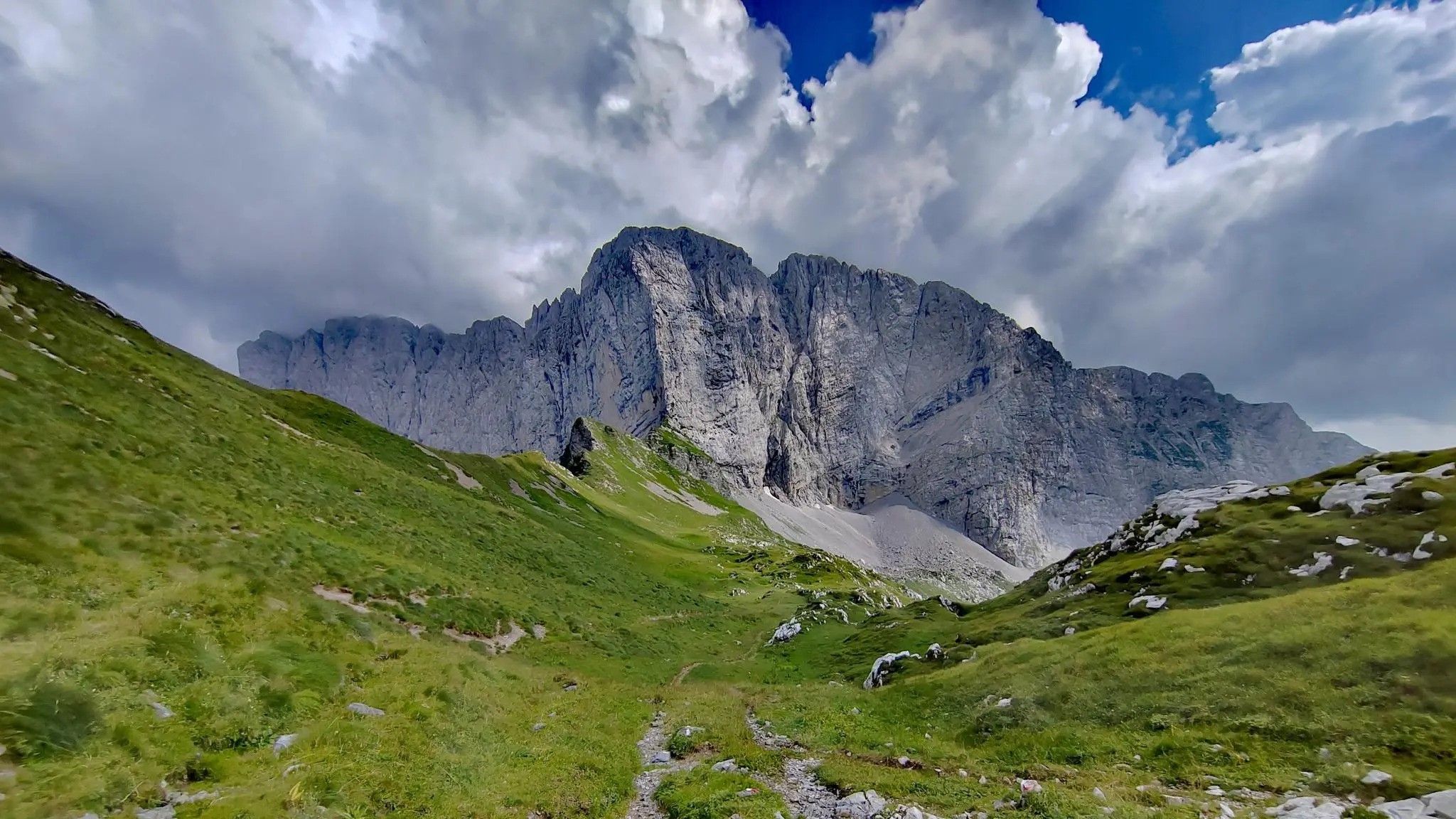
Gravel biking around Azzone is set within the mountainous landscape of the Province of Bergamo, Lombardy, Italy. The region is characterized by its valleys, such as Val Seriana and Val di Scalve, and the presence of significant peaks like Monte Altissimo and Presolana Pass. No traffic gravel bike trails in this area often follow forest tracks, unpaved roads, and dedicated cycle paths, providing routes away from vehicular traffic. This terrain offers varied riding experiences, from valley floors to mountain ascents.
…Last updated: June 30, 2026
5.0
(5)
18
riders
25.7km
02:17
950m
950m
Hard gravel ride. Very good fitness required. You may need to push your bike for some segments of this route.
12
riders
43.7km
03:50
1,380m
1,380m
Hard gravel ride. Very good fitness required. Mostly paved surfaces. Suitable for all skill levels.

Sign up for free
3.8
(4)
15
riders
Moderate gravel ride. Good fitness required. Mostly paved surfaces. Suitable for all skill levels.
11
riders
67.5km
05:00
1,770m
1,770m
Hard gravel ride. Very good fitness required. Mostly paved surfaces. Suitable for all skill levels.
11
riders
38.6km
03:03
1,110m
1,110m
Hard gravel ride. Very good fitness required. Mostly paved surfaces. Suitable for all skill levels.
Get access to more routes and recommendations from other explorers.
Sign up for free
Already have an account?
Our route recommendations are based on thousands of hikes, rides, and runs completed by other people on komoot.
Start today with a free account
Your next adventure awaits.
Login or Signup



Tips from the Community

By train to Edolo and then by bike up to Ponte di legno. The next day, departure in four stages to Mantua. Beautiful cycle path. Recommended
0
0

🏔️ Monte Altissimo — Identity and location Monte Altissimo is the highest peak of the short mountain range that separates Bassa Val Camonica and Valle di Scalve. It is known for two very different slopes: North slope (Borno): gentle, wooded, with ski slopes and mountain huts. South slope (Erbanno–Gorzone): steep, rocky, with significant elevation changes. This dual nature is also confirmed by the hiking itineraries documented online . 🚶♂️ The main documented itineraries Online sources show several routes, including: 1) From Croce di Salven – Path 6 (classic loop) Passes through Pozze di Val Sorda, Rifugio Lorenzini, Malga Guccione. A very popular loop itinerary, with a gentle and scenic ascent. Data confirmed by hikr.org (loop with ascent from Croce di Salven) . 2) From Borno – Via Mine e Segable A longer and scenic itinerary, with passages over woods, mountain huts, and ridges. Documented in detail on Wikiloc, with a complete description of path 112 → 151 → 155 . 3) From Erbanno – Path 155 Steep and challenging ascent, with sections on rocky outcrops. Direct connection to the final ridge of the Altissimo. 🏞️ Environment and notable points Sources confirm the places you have already visited: Pozze di Val Sorda: damp and bright clearings. Rifugio Colonnello Ferruccio Lorenzini: in the Pratolungo basin, at 1478 m. Malga Guccione: a passing point before the final ascent. Borno ski slopes: often used for descent on winter loops.
0
0
The Malga di Val Sorda is not a "classic" alpine pasture hut with grazing activities, but a hiking landmark located in the large meadow of Val Sorda, along the paths that lead from Croce di Salven towards Pratolungo, Malga Guccione, and finally Monte Altissimo. Online information describes it as part of the valley's pasture and pool system, crossed by CAI trails 186 and 187. 📍 Location The hut is located in the central pasture of Val Sorda, reached after about 1h10 of walking from Croce di Salven along trail 186. It is a junction point between: trail 186 (towards Pratolungo and Altissimo) trail 187 (steeper, climbs towards the Val Sorda refuge/structure)
0
0

Here you'll find a group of engraved monoliths (engraved stone blocks) dating back to the Copper Age (about 4,500 years ago, or the 3rd millennium BC). These stelae were part of an important ceremonial and megalithic site, where rituals were held. They are characterized by engravings depicting celestial symbols, animals, weapons (such as Remedello-type daggers), and stylized human faces, sometimes with decorative elements such as pendants and collars. The original stelae have been removed for conservation reasons and are on display at the MUPRE (National Museum of Prehistory of Valle Camonica) in Capo di Ponte. Reproductions are visible here.
0
0

Nice, historic, relaxing...a beautiful ride along the Oglio cycle path.
0
0

I've done it twice in the same lap, first from Desso, then after climbing Monte Pora. They're completely different. From Desso, it's long and always in double digits, with significant peaks, so take it with a pinch of salt; the other is rideable. Seeing is believing. 🚴♀️
0
0

Stone bridge with nice views around. The river was brown due to heavy rain some hours earlier.
1
0

To reach Montecchio di Darfo, starting from Boario, you cross the so-called "Roman bridge." It is a scenic 24-meter, single-span bridge, built from blocks of granite and Simona stone in 1686, over the remains of an older bridge that connected the medieval castle on Monticolo to the opposite bank of the river. It has been recognized as a national monument.
0
0
Frequently Asked Questions
How many no-traffic gravel bike trails are available around Azzone?
There are several dedicated no-traffic gravel bike trails in the Azzone area, with over 8 routes featured in this guide. These routes offer a range of distances and elevations for different skill levels.
What is the best time of year for gravel biking around Azzone?
The best time for gravel biking around Azzone is typically from late spring through early autumn (May to October). During these months, the weather is generally mild, and the trails are clear of snow, offering optimal conditions for exploring the Lombardy region's beautiful landscapes.
Are there any easy gravel bike trails suitable for beginners or families near Azzone?
While many routes in this guide are rated moderate to difficult, the region does offer options for varying skill levels. For a more relaxed experience, consider routes with less elevation gain. Always check the route details for difficulty before heading out. The Montecchio Roman Bridge – Montecchio Roman Bridge loop from Darfo-Corna is a moderate option with less climbing.
What kind of scenery and attractions can I expect on the gravel bike trails near Azzone?
The gravel bike trails around Azzone offer diverse scenery, from mountain passes to serene lakes. You can expect stunning views of the Lombardy Alps. Notable attractions include various mountain passes like Campelli Pass and Presolana Pass, as well as picturesque lakes such as Gleno Dam and Lake and Lake Moro.
Are the no-traffic gravel trails around Azzone suitable for families with children?
Many of the no-traffic gravel trails are designed to keep you away from busy roads, which is great for families. However, some routes can be quite long or have significant elevation changes. It's crucial to check the specific route's distance, elevation, and difficulty rating to ensure it matches your family's capabilities. Look for routes marked as 'easy' or 'moderate' with shorter distances.
Can I bring my dog on the gravel bike trails near Azzone?
Generally, dogs are welcome on many outdoor trails in the region, especially on less crowded gravel paths. However, regulations can vary, particularly in protected areas or private lands. Always keep your dog on a leash, especially when encountering wildlife or other trail users, and ensure you clean up after them. It's advisable to check local signage for any specific restrictions.
What is the typical length and difficulty of gravel bike routes in the Azzone area?
The gravel bike routes around Azzone vary significantly in length and difficulty. You'll find routes ranging from approximately 25 km to over 65 km. Many routes feature substantial elevation gains, with some climbing over 1700 meters, making them challenging. For example, the Croce di Salven Pass – Malga Valsorda loop from Monte Altissimo is nearly 67 km with over 1700m of ascent, rated difficult.
Are there many circular gravel bike routes available around Azzone?
Yes, many of the gravel bike routes in the Azzone area are designed as loops, allowing you to start and finish at the same point without needing a return trip. Examples include the Baita Termen – Presolana Pass loop from Castione della Presolana and the Monti di Cerveno – Prato Torio loop from Borno.
Where can I find parking for gravel bike trails around Azzone?
Parking availability varies by trailhead. Many starting points for popular routes, especially those near villages or attractions, will have designated parking areas. For instance, routes starting from Castione della Presolana or Borno typically offer parking options. It's always a good idea to check the specific route description or local maps for parking information before you go.
What do other gravel bikers enjoy the most about gravel biking in Azzone?
The area is highly rated by the komoot community, with an average score of 4.58 stars. Reviewers often praise the challenging climbs, the stunning panoramic views of the Lombardy Alps, and the sense of solitude on the less-trafficked gravel paths. The diverse landscapes, from dense forests to open mountain passes, are frequently highlighted as a major draw.
Are there bike rental options in or near Azzone?
While Azzone itself is a small municipality, larger towns in the surrounding Val Seriana or Val di Scalve regions, or even closer to Bergamo, are more likely to offer bike rental services, including gravel bikes. It's recommended to search for rental shops in nearby hubs like Clusone, Darfo-Corna, or even Bergamo city, and arrange your rental in advance.
Can I find places to eat or stay near the gravel trails?
Yes, the region around Azzone, including the Val Seriana and Val di Scalve, has various small towns and villages where you can find accommodation, cafes, and restaurants. Many routes pass through or near these settlements, offering opportunities to refuel or stay overnight. Consider towns like Castione della Presolana or Borno for amenities.
Most popular attractions around Azzone

Get inspired with the komoot mobile app


Explore more
Browse the best Gravel rides in other regions.
