The best traffic-free bike rides around Teolo
4.7
(436)
14,883
riders
20
rides
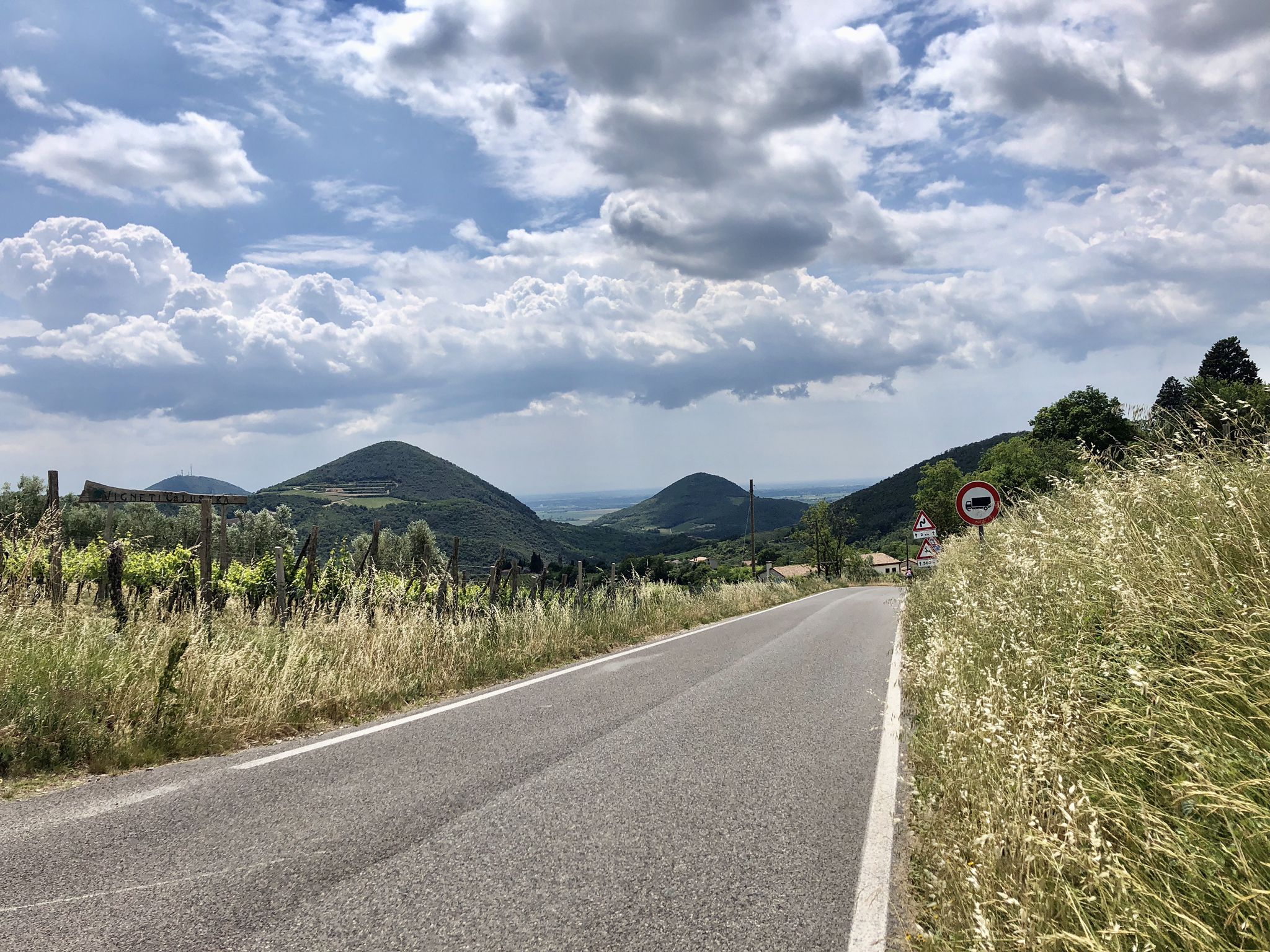
Road cycling around Teolo is centered within the Euganean Hills Regional Park, a region characterized by its unique volcanic origin, where hills rise distinctly from the surrounding plains. The landscape features a mix of rolling hills, vineyards, and historic sites, offering diverse terrain for cyclists. While the area is known for challenging climbs, it also provides numerous no traffic road cycling routes that traverse flatter sections and scenic paths through charming villages. This geological diversity creates varied ecosystems and striking…
Last updated: June 30, 2026
4.3
(3)
48
riders
Easy road ride. Great for any fitness level. Mostly well-paved surfaces and easy to ride.
5.0
(1)
14
riders
33.4km
01:43
550m
550m
Moderate road ride. Good fitness required. Mostly well-paved surfaces and easy to ride.

Sign up for free
5.0
(3)
17
riders
44.1km
02:13
460m
460m
Moderate road ride. Good fitness required. Some segments of this route may be unpaved and difficult to ride.
19
riders
Moderate road ride. Great for any fitness level. Some segments of this route may be unpaved and difficult to ride.
13
riders
38.3km
01:46
300m
300m
Moderate road ride. Good fitness required. Mostly well-paved surfaces and easy to ride.
Get access to more routes and recommendations from other explorers.
Sign up for free
Already have an account?
Our route recommendations are based on thousands of hikes, rides, and runs completed by other people on komoot.
Start today with a free account
Your next adventure awaits.
Login or Signup


Other adventures around Teolo

Tips from the Community


Located on viale Italia in Bovolenta, the Monument to the Fallen is a work of great emotional impact created by sculptor Rocco Mozzato and inaugurated in 1923. The sculptural group in Carrara marble and trachyte depicts the Motherland as a woman holding up a laurel wreath, flanked by a victorious soldier with a flag and a child symbolizing the future and rebirth. Unlike many contemporary works, it does not list individual names but celebrates the collective sacrifice of the soldiers from Bovolenta in the Great War through patriotic inscriptions. Since 2003, the site has also hosted a plaque in memory of Giorgio Perlasca, adding a further layer of civic and historical value to the place.
0
0
Very nice
0
0
Beautiful
0
0
Very nice and well-kept
0
0

A very beautiful and quiet cycling route leading north out of the hills. Densely wooded – perfect for rides on hot days.
1
0

The Bacchiglione is the longest resurgence river in the Veneto and perhaps in Italy (118 km) which originates from the natural area of the homonymous Risorgive, located just north of Vicenza in the municipality of Dueville, a beautiful and idyllic area, worth visiting, where the river originates, continuously drawing water throughout the year from the upper Vicenza plain and the Altopiano dei 7 Comuni and from where a route can start along the banks that reaches the southern lagoon of Venice, where it flows into the Brenta river near Chioggia, without particular differences in height (about 60 m), crossing the cities of Vicenza and Padua. It is an almost entirely navigable river and at the time of the Serenissima it was the main means of transporting goods between Venice, Padua and Vicenza via rafts, which were pulled by oxen along the banks as they went up the current, also thanks to the help of locks that can still be admired along its route. It interfaces with many cycling routes of considerable interest such as the Anello dei Berici, the Treviso/Ostiglia cycle route, the Anello degli Euganei and many others that allow you to discover the vast territories of central Veneto characterised by the presence of the Berici Mountains and the Euganean Hills (both candidates for recognition as a Unesco MAB Biosphere). For much of its route, the Bacchiglione itinerary is in fact one of the most significant sections of the Monaco/Venice cycle route, which after descending from the Brenner Pass and running through the Adige valley, turns east to Verona to reach the Bacchiglione river in Vicenza, which it will then follow to the sea. Following the course of the Bacchiglione it is possible to intercept 3 of the 9 places in the Veneto region included in the UNESCO World Heritage List, namely “Vicenza and the Palladian Villas in the Veneto”, “The 14th Century Fresco Cycles in Padua”, “Venice and its Lagoon”. Given the considerable length of the route, it is possible to reach primary railway stations in several points that allow for an easy return without having to resort to cars or other motorized means. The stations of Vicenza and Padua are a short distance from the route but with modest effort and following well-marked and passable cycle routes you can also reach the station of Grisignano di Zocco following the Treviso/Ostiglia or Grimana cycle paths.
1
0

The best thing about this place is ultra-original name. Even Caffe Commercio across the road can't beat it.
0
0
Frequently Asked Questions
How many no traffic road cycling routes are available around Teolo?
There are over 20 dedicated no traffic road cycling routes around Teolo, offering a variety of experiences for cyclists. These routes are primarily located within the scenic Euganean Hills Regional Park.
What kind of terrain can I expect on traffic-free road cycling routes in Teolo?
The terrain around Teolo is quite diverse, ranging from mostly flat sections ideal for leisurely rides to challenging climbs with significant elevation gains within the Euganean Hills. You'll find well-paved surfaces suitable for road bikes, with some routes offering thrilling descents and panoramic views.
Are there any easy, traffic-free road cycling routes suitable for beginners or families in Teolo?
Yes, Teolo offers 7 easy, traffic-free road cycling routes perfect for beginners or families. These routes typically feature less elevation gain and are designed for a more relaxed pace. An example is the Bovolenta Town Center – Roncaglia-Bovolenta Embankment loop from Albignasego, which is relatively flat.
What are some notable landmarks or attractions I can see along the traffic-free cycling routes?
Many routes pass by or lead to significant cultural and natural attractions. You can cycle past the serene Praglia Abbey, explore historic sites like San Martino della Vaneza Castle or Monselice Castle, and enjoy views from spots like the Mottolone Plateau. The Battaglia Terme Canal also offers picturesque sections.
Are there any circular no traffic road cycling routes around Teolo?
Yes, many of the traffic-free road cycling routes around Teolo are circular, allowing you to start and end in the same location. The broader Euganean Hills Cycle Ring (E2) is a well-known 63-64 km circular route that encircles the park, offering a comprehensive experience of the region's beauty. For a specific example, consider the Prato della Valle – Villa Pisani loop from Padova Campo Marte.
What is the best time of year to enjoy traffic-free road cycling in Teolo?
The Euganean Hills are beautiful year-round, but spring (April-May) and autumn (September-October) generally offer the most pleasant weather for road cycling, with mild temperatures and vibrant landscapes. Summer can be warm, but early mornings or late afternoons are still enjoyable. Winter cycling is possible, but be prepared for cooler temperatures.
What do other road cyclists say about the traffic-free routes in Teolo?
The komoot community highly rates the road cycling experience around Teolo, with an average score of 4.63 stars from 156 ratings. Reviewers often praise the stunning panoramic views, the variety of terrain from flat to challenging climbs, and the opportunity to explore charming villages and historic sites along the way.
Are there any challenging traffic-free road cycling routes with significant elevation gain?
Absolutely. For cyclists seeking a more rigorous experience, Teolo offers routes with substantial elevation gains. Some routes include ascents to peaks like Monte della Madonna, providing demanding loops and requiring good to very good fitness. An example of a moderate route with notable elevation is the Toara Climb – Pozzolo Village loop from Barbarano Mossano.
Can I find routes that combine cycling with stops at cafes or pubs?
Yes, many of the cycling itineraries around Teolo are designed to pass through or near towns and villages, offering ample opportunities for stops. You'll find cafes, restaurants, and local pubs where you can refuel and experience the region's culinary traditions. The Euganean Hills are known for their food and wine, making for delightful breaks.
Is parking available near the starting points of traffic-free cycling routes in Teolo?
Yes, Teolo and the surrounding towns within the Euganean Hills Regional Park typically offer various parking options. Many routes start from or pass through villages where public parking is available, making it convenient to access the traffic-free cycling paths.
Are there any long-distance traffic-free road cycling routes near Teolo?
While many routes are designed for day trips, you can combine several traffic-free sections or utilize the extensive network, including parts of the Euganean Hills Cycle Ring, to create longer rides. For instance, the Legnago Tower – Bussè River Cycle Path loop from Campiglia dei Berici offers a substantial distance of over 60 km.
Most popular attractions around Teolo

Get inspired with the komoot mobile app


Explore more
Browse the best Road cycling routes in other regions.
