The best traffic-free bike rides around Oggebbio
4.5
(709)
18,514
riders
10
rides
Road cycling around Oggebbio offers diverse no traffic road cycling routes on the western shore of Lake Maggiore, extending from the lakefront into the surrounding hills and mountains. The region features varied terrain, providing both moderate and challenging paved routes. Cyclists can expect ascents through valleys and along terraced slopes, offering views of the lake and the alpine foothills.
Best no traffic road cycling routes around Oggebbio
- The most popular no traffic road cycling route is Valle Cannobina - Passo Marco Pantani Climb, a 30.4 miles (48.9 km) trail that takes 2 hours 41 minutes to complete. This difficult route features a challenging climb through the Val Cannobina.
- Another top favourite among local road cyclists is Forcora and Pradecolo, a difficult 42.9 miles (69.1 km) path. This route offers a demanding ride with significant elevation gain through mountain landscapes.
- Local road cyclists also love the View of Lake Maggiore – View of Lake Maggiore loop from Luino, a 17.9 miles (28.8 km) trail leading through varied terrain with lake views, often completed in about 1 hour 56 minutes.
- Road cycling around Oggebbio is defined by Lake Maggiore views, rolling hills, and mountain ascents. The network offers options for different ability levels, from moderate loops to demanding climbs.
- The routes in Oggebbio are highly rated by the komoot community with an average score of 4.5 stars from over 600 reviews. More than 16,000 road cyclists have used komoot to explore Oggebbio's varied terrain.
Last updated: July 14, 2026
4.6
(36)
585
riders
48.9km
02:41
1,030m
1,030m
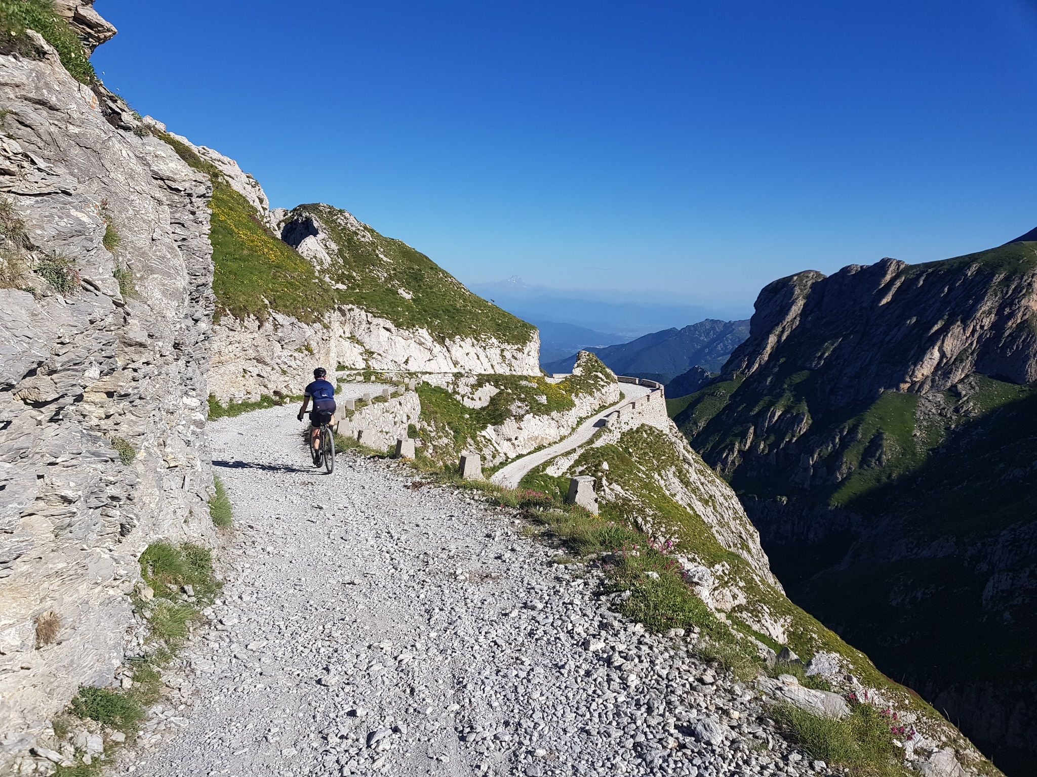
Embark on a challenging road cycling adventure with the Valle Cannobina - Passo Marco Pantani Climb, a difficult route spanning 30.4 miles (48.9 km). You will ascend a significant 3378 feet (1030 metres) over an estimated 2 hours and 41 minutes, pushing your limits through a wild valley. As you pedal, you will pass through charming, picturesque villages, enjoying a peaceful atmosphere away from the lakefront. The route offers diverse landscapes and culminates at the Marco Pantani Pass, where a monument honors the famous cyclist.
When planning your ride, be aware that traffic is generally low, making for a pleasant experience. You should note a tunnel that prohibits bikes; however, a small, well-lit bike path provides a safe bypass. There are numerous water points available along the way, which are especially useful during warmer months, including four fountains near Traffiume. This climb is best suited for cyclists with very good fitness levels, ready for a sustained effort.
This route takes you deep into the Val Grande National Park, offering a unique perspective of the region's natural beauty. The journey through Valle Cannobina provides stunning views and a sense of tranquility. The Marco Pantani Pass itself is a notable landmark, not just for its elevation but also for its tribute to a cycling legend, adding a layer of historical significance to your ride.
5.0
(1)
17
riders
69.1km
04:29
2,130m
2,130m
Hard road ride. Very good fitness required. Mostly well-paved surfaces and easy to ride.

Sign up for free
4.6
(17)
180
riders
28.9km
01:55
860m
860m
Moderate road ride. Good fitness required. Mostly well-paved surfaces and easy to ride.
3.5
(2)
69
riders
33.9km
02:20
1,150m
1,150m
Hard road ride. Very good fitness required. Mostly well-paved surfaces and easy to ride.
4.8
(5)
65
riders
31.8km
02:00
920m
920m
Hard road ride. Very good fitness required. Mostly well-paved surfaces and easy to ride.
Get access to more routes and recommendations from other explorers.
Sign up for free
Already have an account?
Our route recommendations are based on thousands of hikes, rides, and runs completed by other people on komoot.
Start today with a free account
Your next adventure awaits.
Login or Signup
Other adventures around Oggebbio

Tips from the Community

A beautiful tour through the Val Cannobina to the Passo Pantani. There are several "rest sections" ranging from flat to downhill. It gets a bit steeper towards the end of the pass. A must-do is the continuation via Malesco through the Cento Valli with its many sights, Re and the Ponte Romano, and breathtaking views of the valley and the railway line. Via Ponte Brollo and Ascona, the route then leads back to the lakeside road to Cannobio. I've ridden this route many times in spring and fall, and there was always little traffic. I can't recommend the traffic-free route from Malesco to Domodossola.
2
0

Beautiful bathing area
0
0
Beautiful view with seating
0
0

busy road with lots of cars
1
0

For exchanging books this little house is very interesting.
14
0

Rifugio Campiglio, located on the slopes of Monte Lema, offers a spectacular panoramic view of Lake Maggiore. The facility has restaurant services, a bar and rooms for overnight stays. It is open all year round and for information and contacts you can consult the website: https://rifugiocampiglio.wordpress.com/
1
1

Besides being called that, there are actually a lot of Dutch license plates in the area.
0
0

Between Cannobio, on Lake Maggiore, and Piano di Sale, the climb is long and irregular. Although very panoramic, in fact, it consists of over 20 kilometers, some of which are flat and others at an average 7%. The maximum gradient is 11%.
0
0
Frequently Asked Questions
How many no traffic road cycling routes are available around Oggebbio?
There are 10 dedicated no traffic road cycling routes around Oggebbio listed in this guide. These routes are designed to offer quiet and scenic rides away from heavy vehicle traffic.
What is the best time of year for no traffic road cycling in Oggebbio?
Oggebbio benefits from a mild climate year-round, thanks to the surrounding mountains. Spring and autumn generally offer the most pleasant temperatures for cycling, with less heat than summer and fewer crowds. However, the region is suitable for cycling throughout most of the year.
What are the difficulty levels of the no traffic road cycling routes?
The no traffic road cycling routes around Oggebbio cater to cyclists with good to very good fitness levels. This guide features 5 moderate routes and 5 difficult routes, offering varying elevations and distances. For example, the View of Lake Maggiore loop from Luino is a moderate option, while the Forcora and Pradecolo route presents a significant challenge with over 2,100 meters of elevation gain.
Are there any long-distance no traffic road cycling routes for experienced cyclists?
Yes, for experienced cyclists seeking longer distances and significant climbs, routes like Forcora and Pradecolo offer nearly 70 km with over 2,100 meters of elevation. Another challenging option is the Valle Cannobina - Passo Marco Pantani Climb, which covers almost 49 km with over 1,000 meters of ascent, leading to the renowned Passo Pantani.
What kind of views can I expect on these no traffic road cycling routes?
The routes offer breathtaking views of Lake Maggiore, rolling hills, and the surrounding Alps. You'll cycle through picturesque Italian villages, terraced slopes, and wooded areas. Many routes provide panoramic vistas, especially from higher elevations like Piancavallo, which offers marvelous views of the lake.
What historical or natural landmarks can I see along the no traffic road cycling routes?
Many routes pass by or offer access to significant landmarks. You can explore parts of the historic Cadorna Line, such as the Start of the Cadorna Road towards the Monte Morissolo tunnels or the Linea Cadorna fortifications with views over Lake Maggiore. The region also features charming churches like the Church of St. Anthony on the Mountain and the Canonica of San Giorgio. For natural beauty, the Val Cannobina offers stunning scenery, and you might encounter various mountain passes like Pradecolo Pass (1180 m).
Are there any loop routes among the no traffic options?
Yes, several routes are designed as loops, allowing you to start and finish in the same location. An example is the moderate View of Lake Maggiore loop from Luino, which offers scenic views. Another challenging loop is the Val Cannobina – View of Valle Cannobina loop from Falmenta.
What do other cyclists enjoy most about no traffic road cycling in Oggebbio?
The komoot community highly rates the cycling experience in Oggebbio, with an average score of 4.5 stars from over 600 ratings. Cyclists frequently praise the stunning lake and mountain views, the quiet roads that allow for immersive rides, and the diverse terrain that caters to various fitness levels. The combination of challenging climbs and picturesque descents is often highlighted.
Are there cafes or places to stop for refreshments along these routes?
While specific cafes are not listed for every route, the region is dotted with charming Italian villages. Many routes pass through or near these villages, offering opportunities to find local cafes, bars, or restaurants for refreshments. The redesigned lake promenade in Cannobio, a short distance from Oggebbio, is known for its coffee houses and restaurants.
Is public transport available to access the no traffic road cycling routes?
Oggebbio is situated on Lake Maggiore, and the broader region has public transport options, including ferries on the lake and local bus services connecting villages. While direct access to every route start point by public transport might vary, these services can help you reach general areas from which to begin your ride. It's advisable to check local timetables for specific connections.
Where can I find parking near the no traffic road cycling routes?
Parking availability will depend on the specific starting point of your chosen route. Generally, parking can be found in the various villages that make up Oggebbio or in nearby towns like Luino or Colmegna, which are common starting points for some of the listed routes. Look for designated parking areas within these communities.
Most popular attractions around Oggebbio

Get inspired with the komoot mobile app


Explore more
Browse the best Road cycling routes in other regions.
