The 8 Most Amazing Peaks around Parco dei Monti Aurunci
Best mountain peaks around Parco dei Monti Aurunci are found in central Italy's Lazio region, characterized by a rugged landscape. The park's mountains feature limestone karst geology and are notable for their proximity to the Tyrrhenian Sea, offering a blend of marine and mountainous scenery. This area provides a unique setting for trekking and hiking, with views stretching from the mountains to the sea. The Parco dei Monti Aurunci hiking trails offer diverse terrain and significant elevation changes.
Best mountain peaks around Parco dei Monti Aurunci
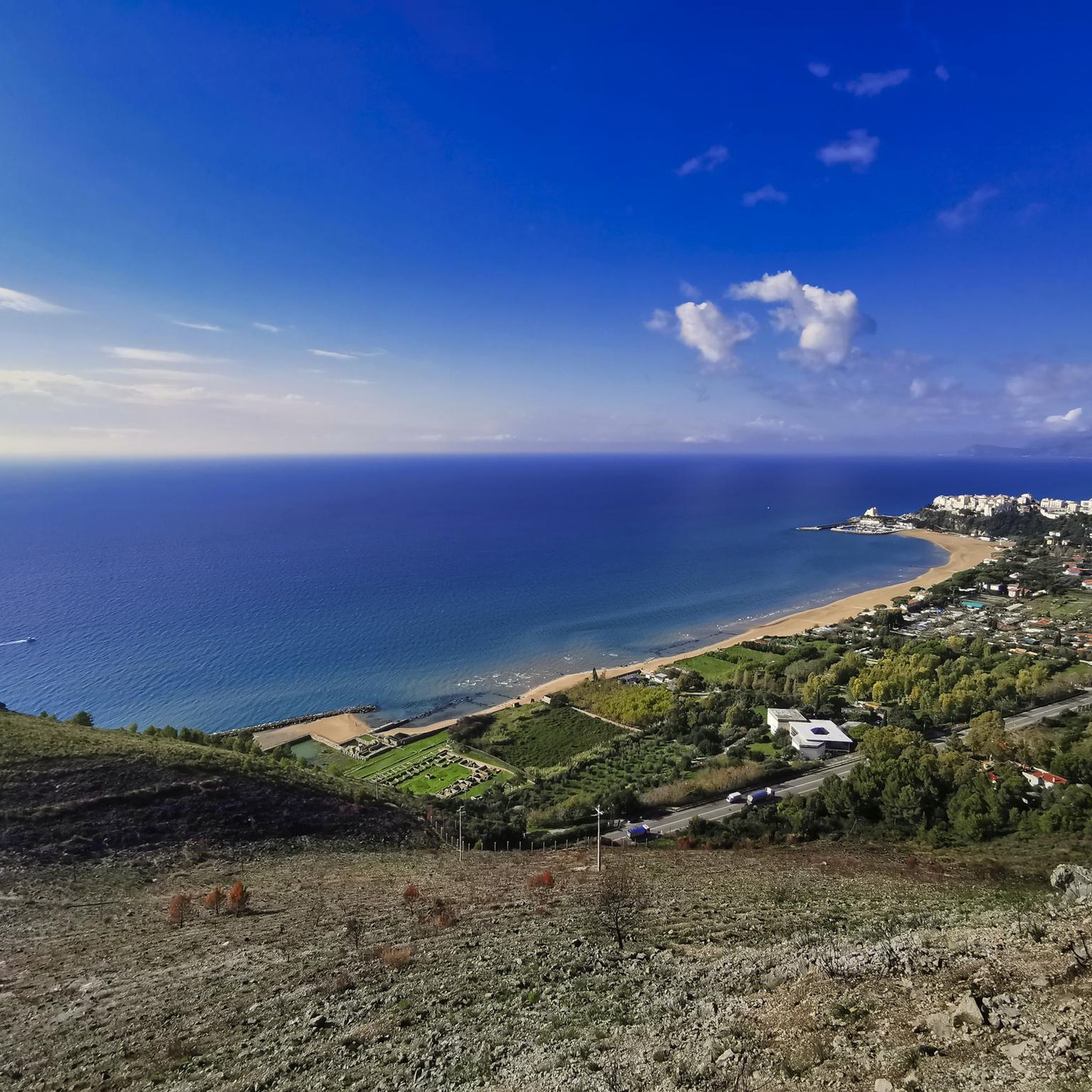
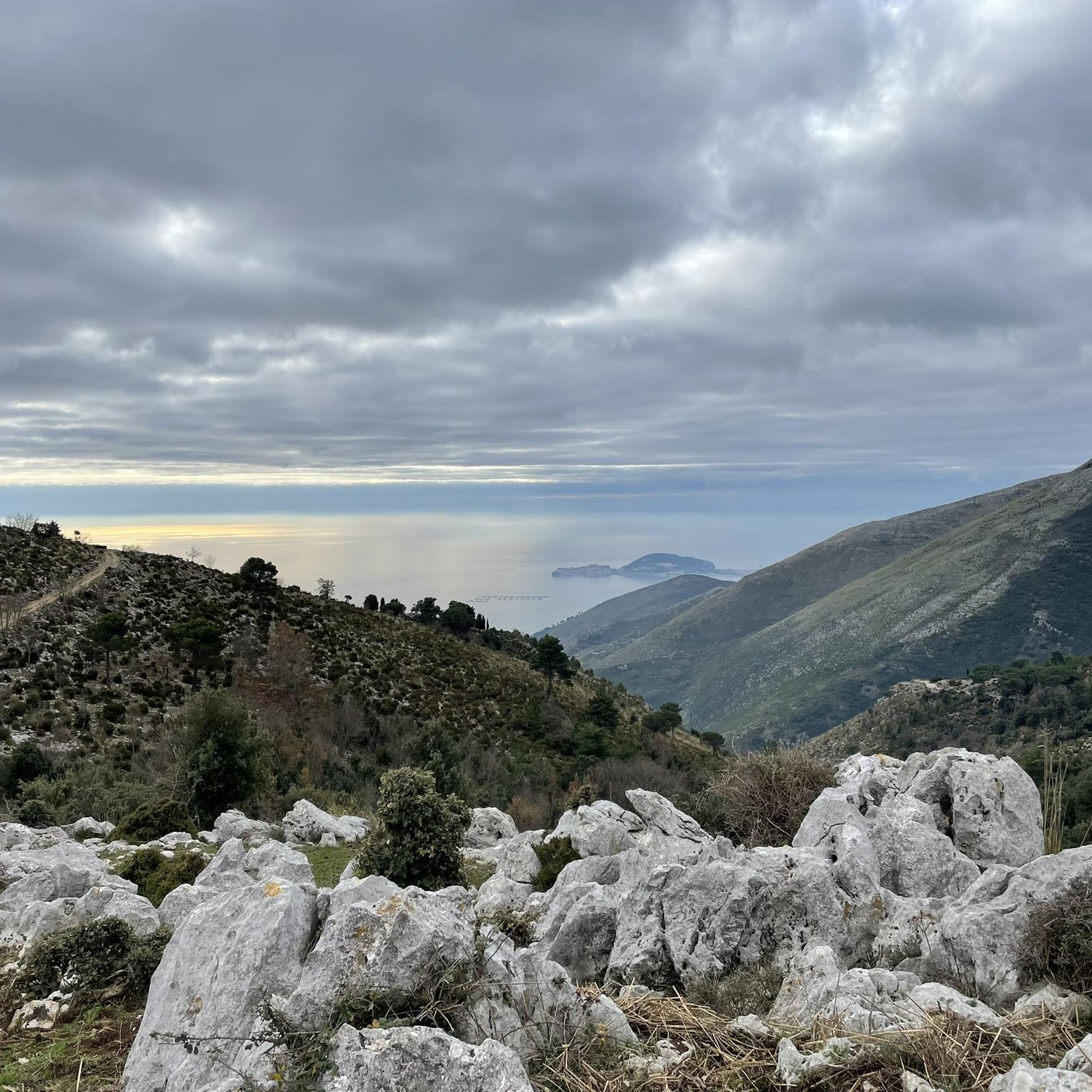
- The most popular mountain peaks is Cima del Redentore (Monte Altino), a summit that offers spectacular panoramic views. From the top, a wide expanse of the Formia coast and the Tyrrhenian Sea is visible, including landmarks like Gaeta and Mount Vesuvius.
- Another must-see spot is Hermitage of St. Michael the Archangel, a religious building and historical site built into the rock. This suggestive place is worth visiting, especially in the afternoon when illuminated by the sun.
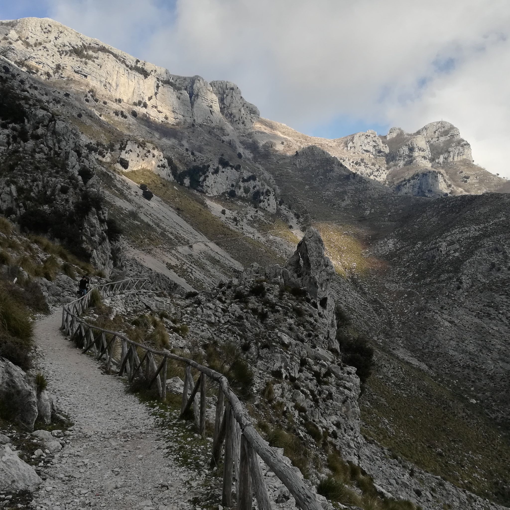
- Visitors also love Monte Petrella, the highest peak of the Monti Aurunci mountain range at 1530.9 meters. Its summit offers panoramic views of the Tyrrhenian Sea coast and the entire Aurunci Mountains.
- Parco dei Monti Aurunci is known for summits, viewpoints, and natural monuments. The region offers a variety of mountain peaks to see and explore, ranging from challenging climbs to intermediate routes.
- The mountain peaks around Parco dei Monti Aurunci are appreciated by the komoot community, with 110 upvotes and 63 photos shared across the highlights.
Last updated: July 8, 2026
Hermitage of St. Michael the Archangel
Highlight • Religious Site
Translated by Google •
Tip by

Cima del Redentore (Monte Altino)
Highlight • Summit
Translated by Google •
Tip by

Sign up now to discover places like this
Get recommendations on the best single tracks, peaks, & plenty of other exciting outdoor places.
Sign up for free
Monte Petrella
Highlight • Summit
Translated by Google •
Tip by
Marco Pantani Summit
Highlight • Summit
At the top of the climb there is a statue dedicated to the cyclist.
Translated by Google •
Tip by

Mount Ruazzo
Highlight • Summit
Translated by Google •
Tip by
Sign up for free to discover even more peaks around Parco dei Monti Aurunci.
Sign up for free
Already have an account?
Start today with a free account
Your next adventure awaits.
Login or Signup
Tips from the Community

Mystical place for contemplation where everything flows slowly amidst the beauty of a church nestled in the rock.
0
0
The climb to the Redentore rewards with a breathtaking panorama of the Gulf of Gaeta
0
0

It's the real reward for all the climbing. The ramps that lead up to the monument are technically challenging. Lower the saddle, put a hard gear and push all the way to the top.
2
0

Very suggestive place, it is absolutely worth taking a short break to stop and admire the hermitage and the view below. A visit is recommended in the afternoon hours when it is illuminated by the sun.
1
0

Breathtaking view on a beautiful day
0
0

The Redentore peak in the Aurunci mountains is a true natural spectacle, offering one of the most majestic panoramic views in the region. At 1,252 meters above sea level, this culminating point offers a wide panorama over the entire coast of Formia.
1
0

A very beautiful but also strenuous hike that requires sturdy shoes and dry weather. Beautiful views and, when the weather is good, a great view. In November it was almost deserted up here.
0
0

Trail reopened at the end of June '23. https://www.comune.formia.lt.it/articolo/ripristinata-celermente-percorribilita-sicurezza-del-tratto-sentiero-rifugio-pornito-cima
2
0
Frequently Asked Questions
Which mountain peaks offer the most spectacular views in Parco dei Monti Aurunci?
For truly spectacular panoramic views, head to Cima del Redentore (Monte Altino). From its summit, you can see a wide expanse of the Formia coast and the Tyrrhenian Sea, including landmarks like Gaeta, Scauri, and even Mount Vesuvius on a clear day. Another excellent choice is Monte Petrella, the highest peak in the range, which provides magnificent views of the Tyrrhenian Sea coast and the entire Aurunci Mountains.
Are there any historical or cultural sites to visit among the mountain peaks?
Yes, the Hermitage of St. Michael the Archangel is a significant historical and religious site. This suggestive place is carved into the rock and is especially beautiful in the afternoon when illuminated by the sun. It's a church dating back to 830 AD, dedicated to St. Michael the Archangel.
What kind of hiking trails can I find around Parco dei Monti Aurunci?
The Parco dei Monti Aurunci offers a variety of hiking trails, ranging from intermediate to challenging. Many routes lead to summits like Monte Petrella and Cima del Redentore, providing significant elevation changes and rewarding views. For specific running trails, you can explore options like the 'From Fonte Canale to Monte Petrella' route, or the 'Monte Sant'Angelo Summit – Fontana di Canale loop' which is a more difficult option. Find more details on Running Trails around Parco dei Monti Aurunci.
What is the best time of year to visit the mountain peaks in Parco dei Monti Aurunci?
The region is generally suitable for hiking and exploring year-round, though the hottest summer months might be less comfortable for strenuous climbs. Spring and autumn offer pleasant temperatures and vibrant scenery. Winter hiking is possible, but be aware that some peaks, like Cima del Redentore, might experience significant snow, making conditions more challenging.
Are there any family-friendly hiking options in the Parco dei Monti Aurunci?
While many peaks involve challenging ascents, the park offers diverse terrain. For specific family-friendly trails, it's best to research routes with lower elevation gain and shorter distances. The park's natural beauty and varied landscape mean there are likely gentler paths suitable for families, though specific 'family-friendly' highlights are not explicitly listed for the peaks themselves.
Can I bring my dog on the trails in Parco dei Monti Aurunci?
The Parco dei Monti Aurunci generally welcomes visitors with dogs. However, it's always recommended to check specific park regulations and trail rules regarding leashes and waste disposal to ensure a pleasant experience for everyone and to protect the local wildlife. No specific dog regulations are provided, so general good practice applies.
What other outdoor activities are available near the mountain peaks?
Beyond hiking and running, the area around Parco dei Monti Aurunci is excellent for cycling. You can find various routes for both gravel biking and road cycling. For gravel enthusiasts, consider routes like 'View of Maranola – The Stone Forest loop'. Road cyclists might enjoy the 'Riviera di Ulisse Loop Trail'. Explore more options on Gravel biking around Parco dei Monti Aurunci and Road Cycling Routes around Parco dei Monti Aurunci.
What makes the geology of the Monti Aurunci unique?
The Monti Aurunci are characterized by their limestone karst geology. This means that rainfall rapidly infiltrates the ground, creating a distinctive landscape with caves, sinkholes, and springs at lower elevations. This geological feature, combined with the mountains' proximity to the Tyrrhenian Sea, creates a unique blend of marine and mountainous scenery.
Is there a peak dedicated to a famous personality?
Yes, the Marco Pantani Summit, originally known as 'Le Crocette', is a steep climb now dedicated to the legendary cyclist Marco Pantani. At the top, you'll find a statue honoring him, commemorating his impressive feats on this very stretch.
What is the significance of Monte Ruazzo?
Monte Ruazzo, at 1,314.4 meters, is another important peak within the Aurunci Mountains. Its name comes from the Itrano dialect word 'ruazzë', meaning robin. It offers significant hiking opportunities and views within the park, contributing to the diverse terrain of the region.
How accessible are the trailheads, and is parking available?
While specific parking information for every trailhead isn't detailed, the Parco dei Monti Aurunci has various entry points and trailheads. It's generally advisable to research specific trail starting points for parking availability. Public transport options to the park are limited, so driving is often the most convenient way to access the hiking routes.
Are there any cafes, pubs, or accommodation options near the park?
The Parco dei Monti Aurunci is surrounded by charming towns like Fondi, Itri, and Formia. These towns offer various cafes, pubs, restaurants, and accommodation options. While not directly at every trailhead, you'll find amenities within a reasonable driving distance from the park's entry points.
Most popular routes around Parco dei Monti Aurunci
Most popular attractions around Parco dei Monti Aurunci

Get inspired with the komoot mobile app


Explore more
See even more amazing summits around Parco dei Monti Aurunci with these guides:
