The best hikes from bus stations around Regional Park Sassi di Roccamalatina
4.4
(3434)
10,947
hikers
10
hikes
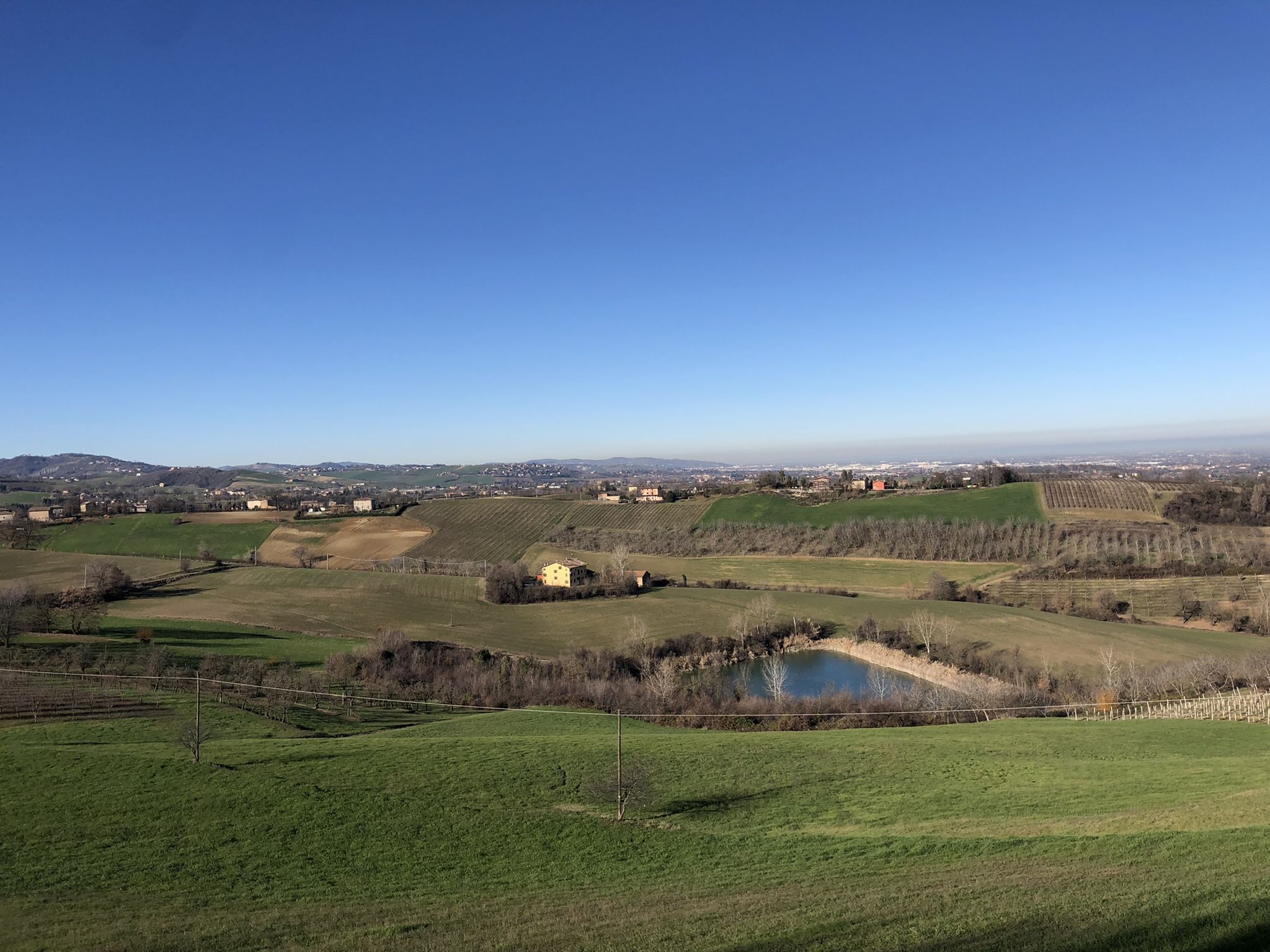
Bus station hiking trails around Regional Park Sassi di Roccamalatina navigate a landscape characterized by unique sandstone spires, rolling hills, and the Panaro River valley. The park features diverse ecosystems, including woodlands, rocky outcrops, and streams. Elevations range from the valley floor to panoramic viewpoints like Sasso della Croce at 567 meters above sea level. This varied terrain offers a range of hiking experiences.
Best bus station hiking trails around Regional Park Sassi di Roccamalatina
- The most popular bus station hiking route is Poggio Castro Loop, a 5.4 miles (8.7 km) trail that takes 2 hours 40 minutes to complete. This moderate route offers varied terrain through the park's natural features.
- Another top favourite among local hikers is Historic trail to Monte Pigna War Memorial (via Route 201A), a moderate 6.4 miles (10.2 km) path. This trail ascends through woodlands to a historic memorial.
- Local hikers also love the Palazzo di Rodiano loop from Tolè, a 7.3 miles (11.8 km) trail leading through varied landscapes, often completed in about 3 hours 30 minutes.
- Hiking around Regional Park Sassi di Roccamalatina is defined by sandstone spires, dense woodlands, and river valleys. The network offers options for different ability levels, from easy walks to more challenging ascents.
- The routes in Regional Park Sassi di Roccamalatina are highly rated by the komoot community with an average score of 4.5 stars from more than 1,500 reviews. More than 4,800 hikers have used komoot to explore Regional Park Sassi di Roccamalatina's varied terrain.
Last updated: October 16, 2026
4.3
(6)
4
hikers
8.71km
02:42
320m
320m
Hike the moderate 5.4-mile (8.7 km) From Crocette to Iddiano (via Route 508) trail, gaining 1039 feet (317 metres) in 2 hours and 41 minutes
4
hikers
24.7km
07:14
680m
680m
Hard hike. Very good fitness required. Easily-accessible paths. Suitable for all skill levels.

2
hikers
10.2km
03:09
370m
370m
Historic trail through Bologna hills connecting wartime memorials with the origins of Samoggia Stream.
4.0
(2)
6
hikers
11.8km
03:31
350m
350m
Moderate hike. Good fitness required. Easily-accessible paths. Suitable for all skill levels.
4.0
(1)
5
hikers
15.8km
04:48
530m
530m
Moderate hike. Good fitness required. Easily-accessible paths. Suitable for all skill levels.
Get access to more routes and recommendations from other explorers.
Already have an account?
Our route recommendations are based on thousands of hikes, rides, and runs completed by other people on komoot.
Start today with a free account
Your next adventure awaits.
Popular around Regional Park Sassi di Roccamalatina
Other adventures around Regional Park Sassi di Roccamalatina

Tips from the Community

The actual name should be Madonna della Neve Alpine Chapel. The trail is easily accessible by mountain bike, and you can see reconstructions of trenches and outposts on the Gothic Line. The fountain is drinkable, but the water tastes a bit like rubber due to a pipe near the tap.
0
0

suitable for travelling in dry months with mild temperatures
1
0
Challenging MTB trails and single treks, where skill and training are required
1
0
AFTER crossing the paths and singletracks of M.Pigna, you arrive at S.LUCIA
1
0

small church with bell tower, unfortunately closed
0
0

The origins of the Samoggia torrent
0
1
Little Cassia Sign
0
0
Depository of history... of wars... of resistance
0
0
Frequently Asked Questions
What are the typical terrain and difficulty levels for bus-accessible hikes in Regional Park Sassi di Roccamalatina?
The trails accessible from bus stations in Regional Park Sassi di Roccamalatina offer a range of difficulties. You'll find everything from easy walks to more challenging routes, some even including short via ferratas. The park features diverse terrain, from rolling hills and dense woodlands to the impressive sandstone spires of the Sassi. Out of the 7 routes featured, 1 is easy, 5 are moderate, and 1 is difficult, ensuring options for various fitness levels.
What natural landmarks and viewpoints can I expect to see on these bus-accessible trails?
Many bus-accessible trails lead to the park's iconic natural features. You can expect to see the impressive Sassi di Roccamalatina and Sasso di Sant'Andrea, which are striking sandstone spires. The park also offers panoramic views, such as those from the "balcony of Emilia" in Guiglia, overlooking the Panaro River valley. Some trails, like the "Sentiero dei Ponticelli" (Path of the Little Bridges), follow streams and cross numerous small bridges.
Are there historical sites or cultural attractions accessible from bus stops?
Yes, the park is rich in history. You can discover ancient sites like the Trebbio Parish Church, a Romanesque church dating back to 1163. Many routes also pass through picturesque medieval villages such as Castellino delle Formiche and Castellaro, which were once fortified settlements. Some trails even follow ancient roads, including sections of the Romea-Nonantolana, an important medieval pilgrimage route.
What kind of wildlife might I encounter while hiking in the park?
Regional Park Sassi di Roccamalatina is a Site of Community Importance and a Special Protection Area, home to diverse wildlife. Hikers often spot animals typical of the middle Apennine zone, including badgers, porcupines, squirrels, dormice, foxes, and roe deer. The Sassi are also a historic nesting site for birds of prey like the peregrine falcon, and a wintering spot for the rare wallcreeper. In secluded aquatic areas, river crayfish can still be found.
What is the best time of year to hike in Regional Park Sassi di Roccamalatina using public transport?
Autumn and spring are particularly stunning seasons to visit Regional Park Sassi di Roccamalatina. During these times, the weather is generally pleasant for hiking, and the natural landscapes are at their most vibrant, with lush greenery in spring and spectacular foliage in autumn. The park's diverse flora, including orchids, anemones, and cyclamen, also adds to the beauty during these seasons.
Are there any family-friendly hiking options accessible by bus?
Yes, the park offers trails suitable for families. While specific 'family-friendly' routes are not explicitly listed, the range of difficulties, including easy and moderate options, means there are paths that can be enjoyed by different age groups. Look for routes with shorter distances and less elevation gain for a more relaxed family outing. The diverse natural features and historical sites also provide engaging points of interest for children.
Are there any circular hiking routes that start and end at a bus station?
Yes, several routes in this guide are circular, allowing you to start and finish your hike at the same bus-accessible point. For example, the Poggio Castro Loop is a moderate 8.7 km circular hike. Another option is the Palazzo di Rodiano loop from Tolè, which is a moderate 11.8 km circular route.
Can I bring my dog on these bus-accessible hiking trails?
Regional Park Sassi di Roccamalatina is generally dog-friendly, but it's always advisable to keep your dog on a leash, especially in areas with wildlife or near agricultural land. Check local regulations for specific trails or protected areas within the park. Ensure your dog is well-behaved around other hikers and wildlife, and always carry waste bags.
What is the longest bus-accessible hike available in this guide?
The longest bus-accessible hike featured in this guide is the Montecuccolo Castle – Wooden Cross Summit loop from Vaglio. This challenging route covers approximately 24.7 kilometers with significant elevation gain, offering a full day's adventure for experienced hikers.
What are some lesser-known or 'hidden gem' spots accessible from bus stops?
Beyond the main Sassi, the park holds many quieter spots. Consider exploring areas around the Zio Teofilo Fallen Tree or seeking out the Sulitura Water Spring for a tranquil experience. The numerous small medieval villages and ancient roads offer a sense of discovery away from the more frequented paths.
How long do these bus-accessible hikes typically take?
The duration of these hikes varies significantly depending on the route's length and difficulty. For example, a moderate hike like the Poggio Castro Loop (8.7 km) can take around 2 hours and 40 minutes. Longer, more difficult routes, such as the Montecuccolo Castle – Wooden Cross Summit loop from Vaglio (24.7 km), can take over 7 hours. Always check the estimated duration for your chosen route.
What do other hikers enjoy most about hiking in Regional Park Sassi di Roccamalatina?
The area is highly rated by the komoot community, with an average score of 4.46 stars from over 1,500 ratings. Reviewers often praise the unique geological formations of the Sassi, the diverse ecosystems, and the well-maintained network of trails. The blend of natural beauty, historical sites, and panoramic views makes it a favorite among hikers seeking both adventure and cultural enrichment.
Most popular routes around Regional Park Sassi di Roccamalatina
Most popular attractions around Regional Park Sassi di Roccamalatina

Get inspired with the komoot mobile app


Explore more
Browse the best Hikes in other regions.
