The best traffic-free bike rides around Koblenzer Stadtwald
4.3
(130)
793
riders
36
rides
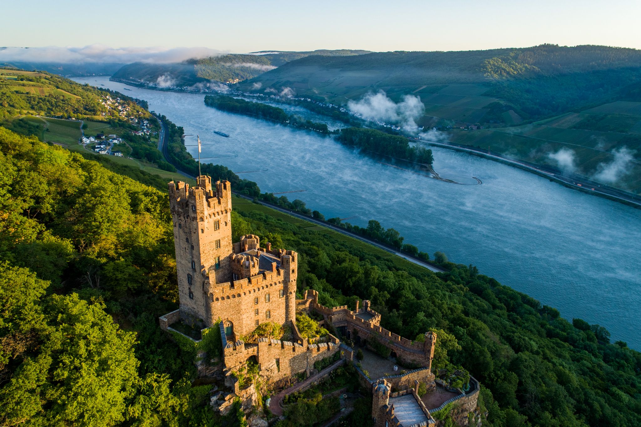
Gravel biking around Koblenzer Stadtwald offers a diverse landscape shaped by its position at the confluence of the Rhine and Moselle rivers, acting as a gateway to the low mountain ranges of Hunsrück, Westerwald, Taunus, and Eifel. The region features extensive green forests, rolling hills, and vineyards, providing varied topography for cyclists. Trails include a mix of asphalted and unpaved sections, often with significant elevation changes, catering to different skill levels. This area provides a rich network of routes for…
Last updated: July 13, 2026
4.5
(11)
39
riders
40.8km
03:28
630m
630m
Hard gravel ride. Very good fitness required. Mostly paved surfaces. Suitable for all skill levels.
4.8
(4)
26
riders
18.0km
01:12
370m
370m
Moderate gravel ride. Good fitness required. Mostly paved surfaces. Suitable for all skill levels.

Sign up for free
4.5
(2)
13
riders
Moderate gravel ride. Good fitness required. Mostly paved surfaces. Suitable for all skill levels.
7
riders
60.4km
04:17
980m
980m
Hard gravel ride. Very good fitness required. Mostly paved surfaces. Suitable for all skill levels.
7
riders
45.3km
02:56
760m
760m
Hard gravel ride. Very good fitness required. Mostly paved surfaces. Suitable for all skill levels.
Get access to more routes and recommendations from other explorers.
Sign up for free
Already have an account?
Our route recommendations are based on thousands of hikes, rides, and runs completed by other people on komoot.
Start today with a free account
Your next adventure awaits.
Login or Signup

Other adventures around Koblenzer Stadtwald

Tips from the Community

One of the last distant views on the Lahnwanderweg, before it comes to an end in Lahnstein.
1
0

Very impressive old railway bridge in the middle of the forest.
3
0


Great viewpoint above Metternich and the Moselle River; Several trails lead downhill. Metternich Owl War Memorial on the Kimmelberg Keywords: War Memorial Subject area(s): Cultural Landscape Management, Regional Studies Municipality(ies): Koblenz District(s): Koblenz State: Rhineland-Palatinate WGS84 Coordinates: 50° 21′ 35.85″ N, 7° 32′ 59.33″ E, 50.35996°N, 7.54981°E UTM Coordinates: 32,396,849.55 m, 5,579,659.06 m Gauss-Krüger Coordinates: 3,396,883.41 m, 5,581,451.20 m The so-called Metternich Owl is located on the Kimmelberg hill in the west of the Koblenz district of Metternich, which lies on the middle river terrace on the left bank of the Rhine. The Metternich Owl is located on the Moselle side of the river. It is the town's landmark and can be seen from afar. The Metternich Owl is a war memorial erected in honor of the Prussian soldiers from Metternich who fell in the Franco-Prussian War. The planning and construction of the memorial were initiated by the Metternich Veterans' and Reservists' Association under the leadership of Max Weidtman, owner of the Weidtman Manor (Trierstraße 388). The foundation stone was laid on June 15, 1913, and subsequently, the design by architect Otto Bäppler was executed by the Frankfurt architect Wilhelm Müller, who then erected the memorial. It is thanks in particular to the newly arrived resident Max Weidtman, owner of the Weidtman Manor, that the memorial could be ceremonially inaugurated on October 18 and 19, 1913, as he largely financed its construction. The monument, standing nine meters tall, was erected as a patriotic memorial, a theme reinforced by the figure of the eagle, which sits with folded wings atop a relatively high, conical pedestal. The eagle was crafted from a single block of trachyte by the Metternich master stonemason Wilhelm Geisen, according to the plans of the Frankfurt sculptor Carl Storck. A 16-meter-wide flight of steps leads to the monument. The monument itself tapers conically upwards. The pedestal has a square base with sides measuring 5.5 meters and consists of rusticated blocks whose edges are reinforced like pillars. An eagle figure with folded wings sits atop the pedestal. At the level of the eagle's feet, an Iron Cross bearing the letter W in honor of Wilhelm I and the year 1870 is affixed. The dates of the laying of the foundation stone and the monument's dedication are inscribed between the blocks. These dates are historically and politically significant, as they coincide with the 100th anniversary of the Battle of Leipzig and the 25th anniversary of Kaiser Wilhelm II's accession to the throne. A wide, two-tiered staircase leads from the surrounding lawn to the monument. The meaning of the monument has changed over time. Initially, the eagle was interpreted as the Prussian eagle, dedicated to the fallen Metternich soldiers of 1870 and 1871. Later, the eagle was reinterpreted as the imperial eagle, a symbol of the new German Empire and a tribute from the local population to the Kaiser and the nation. As part of these reinterpretations, the names of those who participated in the First World War were added. During renovations in 1964, the monument's inscriptions were altered. They now commemorate the soldiers who fell in the wars of 1864-1870/71, 1914-1918, and 1939-1945. For the 80th anniversary of the war memorial in 1993, it was restored once again and rededicated as a "Memorial of Peace." New plaques were attached to the base, bearing, among other things, the inscription "In honor of the dead, as a reminder to the living," and on the reverse, "In memory of the dead of the four wars of the last two centuries." The Metternich Owl is a protected cultural monument. It is surprising that it is referred to as an owl and not an eagle. The residents of Metternich are proud of their owl. It gives its name to the residential area in Metternich at the foot of the monument: Eulenhorst (Owl's Nest). Many houses feature pictures of owls or sculptures of them, and even the fair in Metternich is named after the owl, "Eule-Kärmes" (Owl Fair). Today, the Metternich owl is a significant landmark and one of, if not the, symbols of Metternich. (Friederike Meiers and Anna Serwas, University of Koblenz-Landau, 2014) (Friederike Meiers and Anna Serwas, University of Koblenz-Landau, 2014)
0
0

On the Schmittenhöhe in Koblenz, you can see Konik horses and water buffalo alongside the Taurus cattle. A very beautiful pasture landscape.
0
0

Thanks to the bridge, crossing is no problem at all - no matter what time of year
1
0

Stolzenfels Castle, on the other side of the Rhine.
6
0
Now that the leaves are thinning again, there is a beautiful view here again!
1
0
Frequently Asked Questions
How many traffic-free gravel bike trails can I find in Koblenzer Stadtwald?
The Koblenzer Stadtwald area offers a good selection of traffic-free gravel bike trails, with over 35 routes available. These range from easy to difficult, ensuring options for various skill levels.
What kind of terrain can I expect on the gravel bike trails in Koblenzer Stadtwald?
You'll encounter a diverse mix of terrain, from well-maintained gravel paths to unpaved sections with significant elevation changes. The region's position at the confluence of the Rhine and Moselle rivers, and its proximity to the Hunsrück, Westerwald, Taunus, and Eifel low mountain ranges, means you'll experience extensive forests, rolling hills, and even vineyards. Routes like the Laubbachtal, Kaleschen Anstieg, and the steep Maigesetzweg offer varied challenges.
Are there any easy or beginner-friendly traffic-free gravel bike routes in Koblenzer Stadtwald?
Yes, there are routes suitable for beginners. While many trails feature elevation changes, you can find easier options that require basic technical knowledge. For example, the guide lists 2 easy routes and 15 moderate routes, which can be a good starting point for those new to gravel biking in the area.
Are there any loop routes for gravel biking in Koblenzer Stadtwald?
Absolutely. Many of the gravel bike trails in the region are designed as loops, allowing you to start and end at the same point. A notable example is the Rhine and Lahn Valleys Loop from Koblenz, which offers a scenic and challenging ride.
What are some interesting viewpoints or attractions along the gravel bike trails?
The routes often provide stunning vistas of the Rhine and Moselle rivers, including their confluence at the Deutsches Eck. You might also catch glimpses of historical landmarks like Stolzenfels Castle. For a specific route with great views, consider the View of the Moselle Valley – Kühkopf Viewpoint loop from Koblenz Hbf. Additionally, the Königsbachtal Nature Experience Trail offers a picturesque V-shaped valley with a stream and historical significance.
Are there any family-friendly traffic-free gravel bike routes in Koblenzer Stadtwald?
While many routes involve significant elevation, there are options that can be enjoyed by families, especially those with some biking experience. Look for routes categorized as 'easy' or 'moderate' in the guide, which tend to have less demanding technical sections. The Remstecken local recreation area, with its wildlife park and forest eco-station, could be a pleasant destination for a family outing.
What is the best season for gravel biking in Koblenzer Stadtwald?
The region is beautiful year-round, but spring and autumn generally offer the most pleasant conditions for gravel biking. The mild temperatures and vibrant foliage make for an enjoyable experience. Summer can be great too, but be prepared for warmer weather, especially on exposed sections. Winter riding is possible, but trails might be wet or icy, requiring appropriate gear and caution.
Are there places to stop for refreshments or cafes along the routes?
Yes, you can find opportunities for refreshments. The Kühkopf Forest Inn is a notable spot. Additionally, the Rhenser Mineral Water Fountain is a convenient and refreshing stop for cyclists, providing natural mineral water.
How can I access the gravel bike trails in Koblenzer Stadtwald using public transport?
Many routes, such as the Köppel Observation Tower – Mühlental Path loop and the View of the Moselle Valley – Kühkopf Viewpoint loop, start from Koblenz Hbf (main train station), making them easily accessible by public transport. Check local bus and train schedules for specific connections to trailheads.
What do other gravel bikers enjoy most about gravel biking in Koblenzer Stadtwald?
The area is highly rated by the komoot community, with an average score of 4.36 stars. Reviewers often praise the diverse terrain, the extensive network of traffic-free paths, and the beautiful natural scenery, including the forests, rolling hills, and river views. The challenging climbs and rewarding descents are also frequently highlighted.
Are there any advanced or challenging gravel bike trails in the area?
Yes, Koblenzer Stadtwald offers plenty of challenging routes for experienced gravel bikers. Many trails feature significant elevation gains and technical sections, catering to those seeking a demanding ride. For instance, the Moosbach Crossing – Köppel Observation Tower loop is a difficult route covering over 60 km with nearly 1000 meters of elevation gain.
Most popular routes around Koblenzer Stadtwald
Most popular attractions around Koblenzer Stadtwald

Get inspired with the komoot mobile app


