The best hikes from bus stations around Derwent Water
4.6
(12486)
123,032
hikers
12
hikes
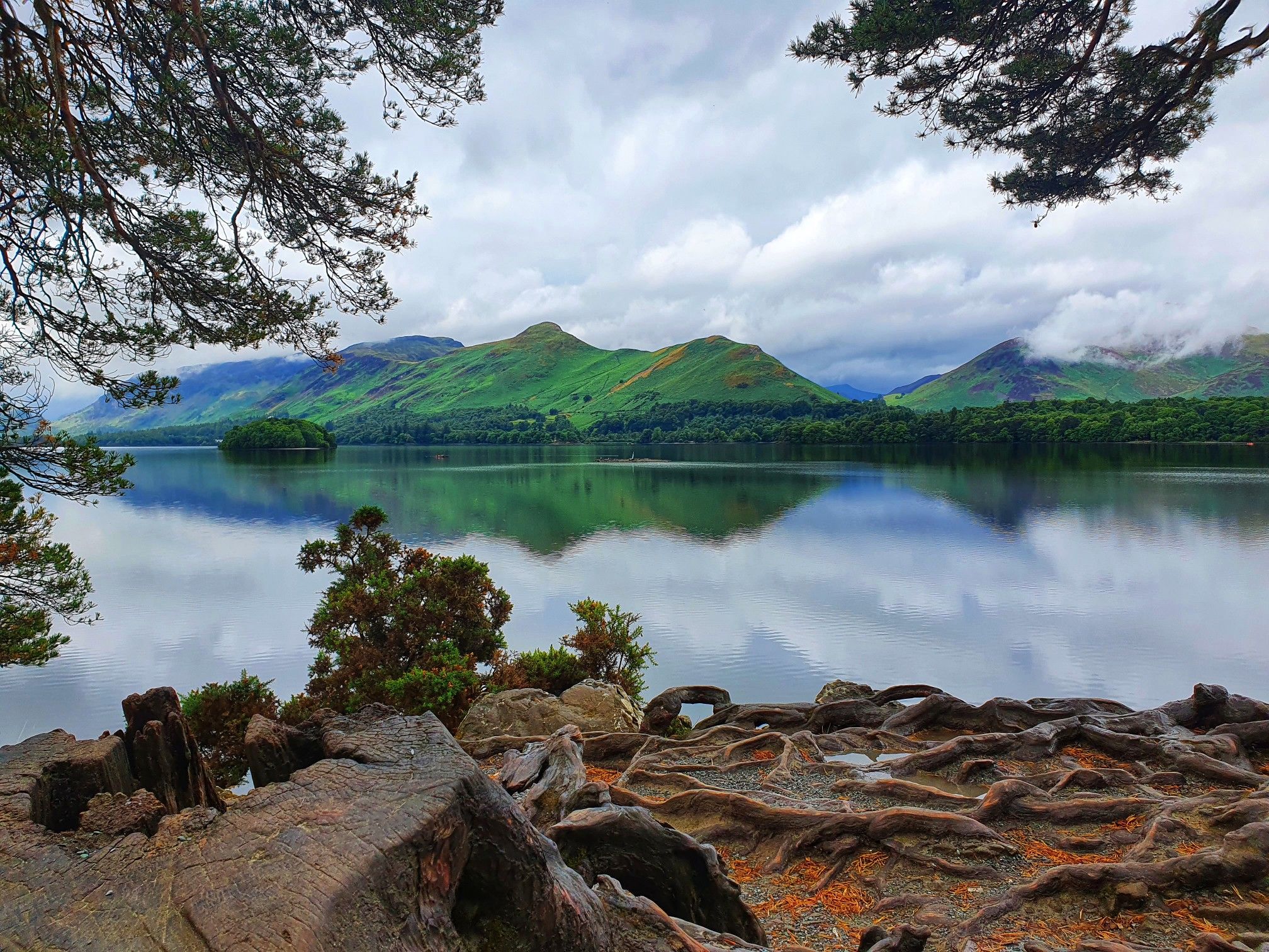
Bus station hiking trails around Derwent Water navigate a landscape characterized by tranquil waters, ancient woodlands, and gentle fells. The region features well-maintained paths along the lake shores and through valleys, offering diverse terrain from lakeside strolls to elevated viewpoints. Hikers can explore areas with varied gradients, including iconic fells and serene forest paths. This area provides a network of trails suitable for different fitness levels, connecting natural features like waterfalls and unique geological formations.
Best bus station hiking trails…
Last updated: October 16, 2026
4.5
(39)
367
hikers
6.11km
02:04
290m
290m
Moderate hike. Good fitness required. Easily-accessible paths. Suitable for all skill levels.
4.8
(9)
225
hikers
Moderate hike. Good fitness required. Easily-accessible paths. Suitable for all skill levels.

4.8
(9)
57
hikers
Moderate hike. Good fitness required. Mostly accessible paths. Sure-footedness required.
4.8
(85)
961
hikers
15.6km
04:39
400m
400m
Moderate hike. Good fitness required. Mostly accessible paths. Sure-footedness required.
4.7
(65)
761
hikers
7.96km
02:02
30m
30m
Moderate hike. Good fitness required. Easily-accessible paths. Suitable for all skill levels.
Get access to more routes and recommendations from other explorers.
Already have an account?
Our route recommendations are based on thousands of hikes, rides, and runs completed by other people on komoot.
Start today with a free account
Your next adventure awaits.
Other adventures around Derwent Water


Tips from the Community

Plenty of benches with a lake view
0
0

Absolutely spectacular views. truly inspiring
0
0

what a wondefull place this is, great base for walking or exploring or getting the steamer
2
0

great walk, we did the lake shore walk first than the steep climb up to the summit. Great choice as coming down this way would have been a challenge with a dog pulling on the lead. the styles with the dog friendly access are awesome 👌🏽
0
0
see this on the way to and from catbells. this can be done by all ages and fitness levels
2
0
One of my favourite places to visit in all weather can get here by walking, driving if parking is available and by steamer
2
0

Great to watch the sunset drop down over Catbells. Big wide area so even when it’s busy you can always find a spot on your own.
0
0

Frequently Asked Questions
How many bus station hiking trails are available around Derwent Water?
There are over 600 hiking routes around Derwent Water that are accessible from bus stations. These routes cater to various fitness levels, with 167 easy, 274 moderate, and 165 difficult options available.
What do other hikers enjoy most about the bus accessible trails in Derwent Water?
The komoot community highly rates the hiking experience around Derwent Water, with an average score of 4.6 out of 5 stars from over 10,000 ratings. Hikers frequently praise the stunning lake views, the accessibility of trails from public transport, and the diverse landscapes ranging from gentle lakeside paths to more challenging fell ascents.
Are there any family-friendly bus accessible walks around Derwent Water?
Yes, Derwent Water offers several family-friendly options accessible by bus. Many sections of the Derwentwater Walk, a 10-mile circular path, are flat and easy, perfect for leisurely strolls. For a slightly more adventurous but still manageable option, the iconic Catbells Summit – View of Derwent Water loop from Stair is a popular choice for families, offering rewarding views without being overly strenuous.
Can I find circular routes that start and end at a bus station?
Absolutely. Many trails around Derwent Water are designed as circular routes, making them ideal for bus travel. For instance, the Trail to Walla Crag – View of Bleaberry Fell loop from Keswick offers a moderate circular hike with excellent views, starting and ending conveniently near Keswick's bus services.
What kind of natural features and landmarks can I expect to see on these trails?
The bus accessible trails around Derwent Water are rich in natural beauty and notable landmarks. You can explore serene waters, ancient woodlands, and gentle fells. Highlights include the picturesque Low Brandlehow Jetty, the tranquil Withesike Bay, and the famous View of Derwent Water from Friars Crag, offering one of the most celebrated vistas in the Lake District. You might also encounter unique geological formations like the Bowder Stone in Borrowdale Valley.
Are there any challenging hikes accessible by bus for experienced fell-walkers?
Yes, for those seeking a more demanding experience, there are several challenging routes. The Derwent Water – Viewpoint overlooking Derwent Water loop from Keswick is a difficult 18.8 km hike with significant elevation gain, offering extensive views. Other challenging options include ascents of Skiddaw, which dominates the northern skyline and provides a magnificent mountain experience.
Are the bus accessible trails around Derwent Water dog-friendly?
Many trails around Derwent Water are dog-friendly, allowing you to enjoy the stunning scenery with your canine companion. It's always recommended to keep dogs on a lead, especially near livestock, and to check specific route details for any restrictions. The lakeside paths and woodland trails generally offer good opportunities for walks with dogs.
What is the best time of year to hike around Derwent Water using public transport?
Spring and autumn are often considered the best times for hiking around Derwent Water. In spring, the fells are vibrant with new growth, and in autumn, the woodlands display spectacular colors. Summer offers longer daylight hours, though trails can be busier. Winter hiking is possible but requires appropriate gear for potentially colder, wetter, or icy conditions, especially on higher fells.
Are there any specific viewpoints or scenic spots along the bus routes?
Derwent Water is renowned for its breathtaking viewpoints. From bus-accessible trails, you can reach spots like Friar's Crag, offering iconic views across the lake. The summit of Cat Bells, accessible via routes like the Skelgill Bank – Catbells Summit loop from Keswick, provides panoramic vistas of Derwent Water and the surrounding fells. Walla Crag also offers stupendous views after a relatively short hike.
Are there any waterfalls I can visit on a bus accessible hike?
Yes, the region boasts beautiful waterfalls that can be incorporated into scenic loop trails. Watendlath Beck Waterfall is a lovely example, and the spectacular Lodore Falls, especially impressive after rainfall, can be reached via routes that pass through the Borrowdale Valley, which is well-served by local bus services.
What kind of terrain should I expect on these bus accessible walks?
The terrain around Derwent Water is varied. You can expect well-maintained paths along the lake shores and through valleys, often with manageable gradients. Some sections feature boardwalks through wetland areas. Higher fells like Cat Bells or Walla Crag involve rocky, uneven paths and steeper ascents, while ancient woodlands offer softer, earthy trails. Always check the specific route details for terrain information.
Are there any less crowded bus accessible walks around Derwent Water?
While popular spots like Cat Bells can get busy, especially during peak season, many trails offer a quieter experience. Exploring the less-frequented paths through ancient woodlands or venturing into the Borrowdale Valley (beyond the immediate lake shore) can provide a more tranquil hike. Early mornings or late afternoons can also offer a more peaceful experience on popular routes.
Most popular routes around Derwent Water
Most popular attractions around Derwent Water

Get inspired with the komoot mobile app


Explore more
Browse the best Hikes in other regions.
