The best hikes from bus stations around Obersee
4.6
(11637)
60,764
hikers
20
hikes
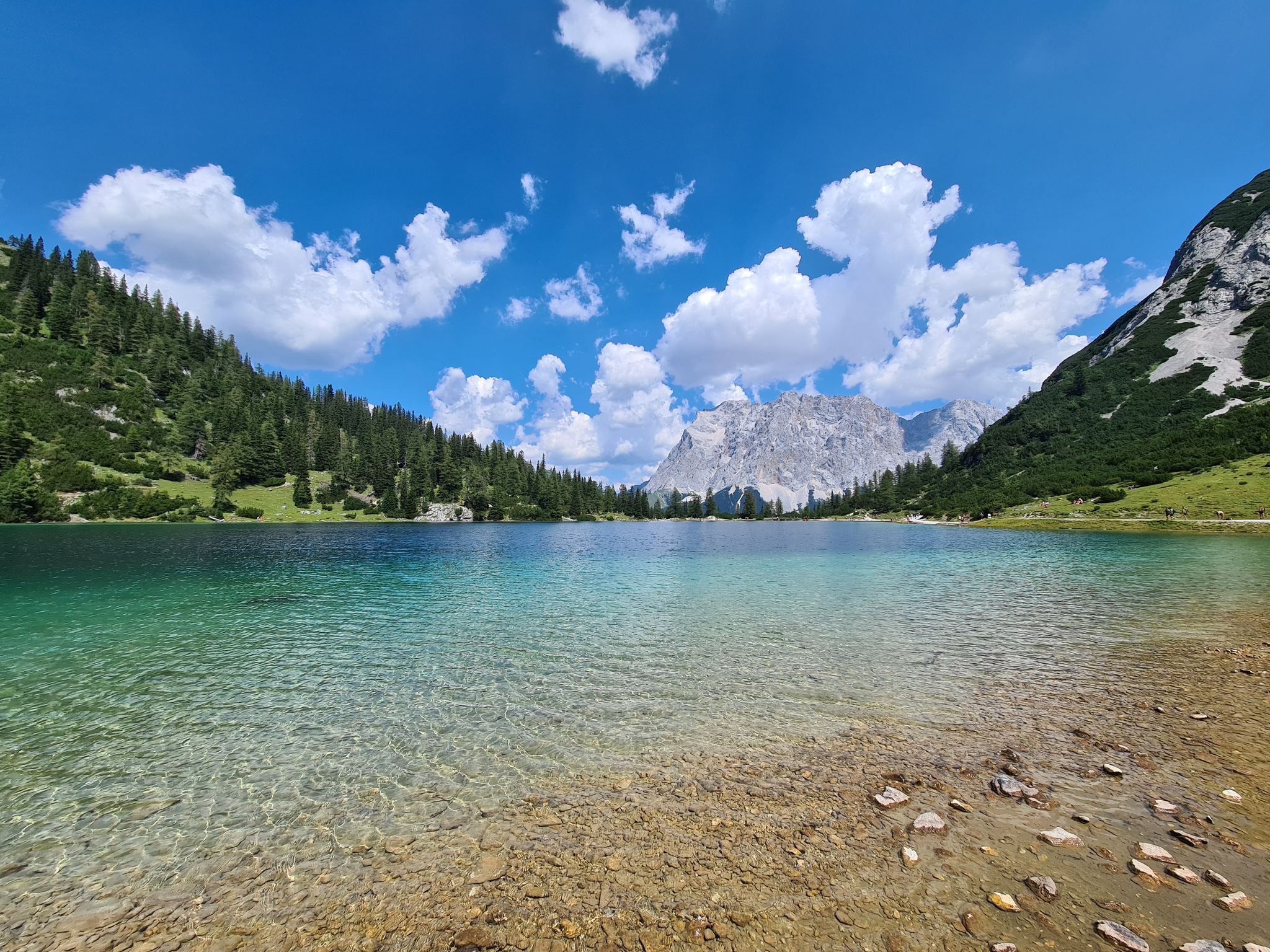
Hiking around Obersee offers access to an alpine landscape characterized by emerald-green waters and dramatic reflections of surrounding mountains. The region features the crystal-clear Obersee, which mirrors the majestic Watzmann peak, and is home to Germany's highest waterfall, the Röthbach Waterfall. Trails often begin after an electric boat tour across the Königssee, leading into a serene and secluded natural environment. The area provides diverse terrain, from gentle lakeside paths to more challenging routes through alpine valleys.
Best bus station hiking…
Last updated: June 29, 2026
4.7
(321)
1,165
hikers
11.5km
05:05
880m
880m
Hard hike. Very good fitness required. Sure-footedness, sturdy shoes and alpine experience required.
4.9
(81)
314
hikers
16.8km
06:36
830m
830m
Hard hike. Very good fitness required. Sure-footedness, sturdy shoes and alpine experience required.

Sign up for free
4.6
(37)
197
hikers
Moderate hike. Good fitness required. Mostly accessible paths. Sure-footedness required.
4.7
(18)
50
hikers
10.2km
03:19
460m
460m
Moderate hike. Good fitness required. Easily-accessible paths. Suitable for all skill levels.
4.5
(22)
80
hikers
24.2km
09:33
1,320m
1,330m
Hard hike. Very good fitness required. Sure-footedness, sturdy shoes and alpine experience required.
Get access to more routes and recommendations from other explorers.
Sign up for free
Already have an account?
Our route recommendations are based on thousands of hikes, rides, and runs completed by other people on komoot.
Start today with a free account
Your next adventure awaits.
Login or Signup
Popular around Obersee
Other adventures around Obersee

Tips from the Community


Mega climb highly recommended. But be free from vertigo and sure-footed, it is a black climb
0
0

definitely use the rooty ascent
0
0


Wonderfully beautiful view with a bench for a short break.
1
0


…a truly worthwhile destination any time of year! During peak season, it's recommended to book your boat ticket 🎫 online to avoid long waiting times! You can also enjoy beautiful hikes from St. Bartholomew's! 🥾
0
0
…A beautiful hiking trail along a crystal-clear stream! You might even spot some anglers here! 🎣
1
0
Frequently Asked Questions
How many bus-accessible hiking trails are there around Obersee?
There are over 20 bus-accessible hiking trails around Obersee, offering a variety of options for different skill levels. You'll find 7 easy routes, 9 moderate, and 5 difficult trails to explore.
Are there easy or family-friendly hikes accessible by bus near Obersee?
Yes, several easy and family-friendly options are accessible by bus. For a gentle stroll, consider the Königssee Boat Pier – Boathouses on Lake Königssee loop from Schönau am Königssee, which is an easy 3.6 km route. The region research also highlights the 'Tour to the Obersee – Barrierefrei hiking trail' as an easy option.
Can I bring my dog on these bus-accessible trails around Obersee?
Generally, dogs are welcome on many hiking trails in the Obersee area, especially on leash. However, specific rules may apply within Berchtesgaden National Park or on certain public transport options like the Königssee electric boats. Always check local regulations and ensure your dog is well-behaved and on a leash to protect wildlife and other hikers.
Are there any circular routes starting from bus stations around Obersee?
Yes, there are several excellent circular routes. The Rabenwand Lookout Trail – Boathouses on Lake Königssee loop from Schönau am Königssee is a moderate 6.2 km loop. Another option is the View of Königssee – View of Watzmann loop from Schönau am Königssee, a more challenging 11.4 km circular hike.
What natural landmarks or viewpoints can I see on bus-accessible hikes?
The region is rich in natural beauty. You can expect stunning views of the emerald-green waters of Obersee and Königssee, and dramatic reflections of surrounding mountains, including the majestic Watzmann peak. A prominent natural landmark is the Röthbach Waterfall, Germany's highest waterfall. You can also visit the Boathouse on the south shore of the Obersee and find Shady Spots by Lake Obersee for relaxation.
What is the best time of year to hike these trails from bus stations?
The best time to hike around Obersee is typically from late spring to early autumn (May to October). During these months, the weather is generally mild, trails are clear of snow, and public transport operates more frequently. Autumn offers spectacular fall foliage, while spring brings vibrant greenery. Winter hiking is possible but requires appropriate gear and awareness of snow conditions.
Are there any less crowded bus-accessible hiking options around Obersee?
While popular spots like the immediate Königssee area can get busy, exploring trails slightly further afield or visiting during off-peak hours (early mornings, weekdays) can offer a more tranquil experience. The 'Tour to the Obersee – Barrierefrei hiking trail' is often mentioned as a serene option. The region offers 21 different routes, so you can often find quieter paths by choosing a less-trafficked trail.
What do other hikers say about the bus-accessible trails around Obersee?
The bus-accessible trails around Obersee are highly rated by the komoot community, with an average score of 4.6 stars from over 12,000 ratings. Reviewers often praise the pristine alpine landscapes, the stunning views of the lakes and mountains, and the well-maintained paths that make these natural wonders accessible.
Are there places to eat or rest near the bus-accessible trails?
Yes, you'll find options for refreshments. The Fischunkelalm, an alpine hut-like restaurant, is a common endpoint for many hikes around Obersee, offering a place to rest and enjoy the views. There are also various cafes and restaurants in Schönau am Königssee, which is a common starting point for bus-accessible routes.
Do I need a permit to hike these trails from bus stations?
Generally, no specific hiking permit is required for most trails in Berchtesgaden National Park. However, certain areas might have restrictions or require fees for specific activities or access, such as the electric boat tour across Königssee to reach Obersee. Always respect national park rules and regulations.
What are some moderate or challenging bus-accessible hikes?
For those seeking a challenge, the Lake Königssee – Kührointhütte loop from Schönau am Königssee is a difficult 16.8 km route. A moderate option is the Boathouses on Lake Königssee – View of Königssee loop from Schönau am Königssee, covering 13.7 km with significant elevation changes.
How long do these bus-accessible hikes typically take?
The duration of bus-accessible hikes varies greatly depending on the route's distance and difficulty. Easy trails like the 'Tour to the Obersee – Barrierefrei hiking trail' can be completed in under an hour. Moderate routes, such as the Rabenwand Lookout Trail – Boathouses on Lake Königssee loop, take around 2 hours. More difficult and longer trails, like the View of Königssee – View of Watzmann loop, can take 5 hours or more.
Most popular routes around Obersee
Most popular attractions around Obersee

Get inspired with the komoot mobile app


Explore more
Browse the best Hikes in other regions.
