The best traffic-free bike rides around Barrage du Ri de Rome
4.4
(51)
2,362
riders
25
rides
No traffic road cycling routes around Barrage du Ri de Rome are situated within the Ardennes massif, characterized by its artificial lake, dense Nismes forest, and varied topography. The region offers a mix of dedicated RAVeL paths and quiet roads, providing diverse terrain for road cyclists. Elevation gains are notable, with some routes featuring significant ascents, contributing to a challenging yet rewarding cycling experience. The landscape includes a 25-hectare lake fed by three rivers, surrounded by woodlands and offering panoramic…
Last updated: July 12, 2026
4.0
(1)
37
riders
50.2km
02:27
580m
580m
Moderate road ride. Good fitness required. Some segments of this route may be unpaved and difficult to ride.
1
riders
68.5km
03:10
680m
680m
Moderate road ride. Good fitness required. Mostly well-paved surfaces and easy to ride.

Sign up for free
2
riders
89.2km
04:14
910m
910m
Hard road ride. Very good fitness required. Mostly well-paved surfaces and easy to ride.
4.0
(3)
27
riders
49km
02:18
530m
530m
Moderate road ride. Good fitness required. Mostly well-paved surfaces and easy to ride.
16
riders
70.2km
03:06
580m
580m
Moderate road ride. Good fitness required. Some segments of this route may be unpaved and difficult to ride.
Get access to more routes and recommendations from other explorers.
Sign up for free
Already have an account?
Our route recommendations are based on thousands of hikes, rides, and runs completed by other people on komoot.
Start today with a free account
Your next adventure awaits.
Login or Signup
Popular around Barrage du Ri de Rome
Tips from the Community

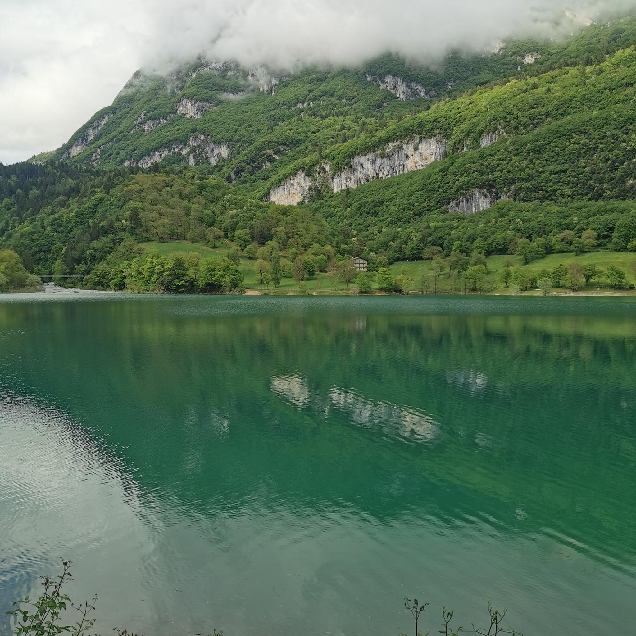
The Plate-Taille Dam is located in southern Belgium in Wallonia, on the border of the provinces of Namur and Hainaut. The dam is situated near the villages of Froidchapelle and Cerfontaine and forms the central element of the Lacs de l’Eau d’Heure lake district, the largest artificial lake complex in the country. This area covers approximately 1800 hectares and consists of several interconnected lakes that together form a unique landscape of open water, wooded hills, and extensive recreational zones. Due to its location between the Ardennes and the Fagne, the area has a varied and gently rolling terrain. The origin of the dam dates back to the 1970s when Belgium faced water management problems. The Sambre River, an important waterway for industry and shipping, experienced highly fluctuating water levels. During dry periods, the water level dropped too low, which had economic consequences. To solve this problem, an ambitious project was launched, including the construction of a series of dams on the Eau d’Heure River and its tributaries. The construction of the Plate-Taille dam began around 1974 and was completed in 1981. As a result of its construction, five lakes were created: * Plate Taille (the largest and deepest) * Eau d’Heure * Falemprise * Ry Jaune * Féronval The construction brought about a major change for the region. Certain areas were submerged, and residents had to relocate. At the same time, this project laid the foundation for a new economic model based on tourism and recreation. The Plate-Taille dam is the largest dam in Belgium and an impressive example of modern hydraulic engineering. The Plate Taille lake itself has a surface area of approximately 350 hectares and is the largest and deepest lake in Belgium. The dam holds back an enormous mass of water and literally forms the heart of the entire lake district. One of the dam's main functions is energy generation through a pumped-storage power plant. * Capacity: ± 140 megawatts * Number of turbines: 4 (reversible) * Type: pumped-storage power plant System Operation The system operates on a clever principle: * During low energy demand, water is pumped to a higher reservoir. * During high energy demand, the water flows back down through turbines, generating electricity. This makes the plant particularly valuable for stabilizing the electricity grid, especially in combination with renewable energy sources such as wind and solar power. Around the dam lies a surprisingly rich nature reserve. The combination of water, forests, and open plains ensures great biodiversity. The landscape is characterized by: * Dense deciduous and coniferous forests * Open grasslands * Reed beds along the banks * Quiet bays and small islands Animals found here include: * Roe deer * Foxes * Waterfowl such as grebes and cormorants * Birds of prey The creation of the lakes has led to new ecosystems where flora and fauna have adapted to the water-rich environment. For someone who enjoys long and challenging hikes, like myself, this area is ideal, and you can easily create routes of several hours here without much crowds. 🚴♂️ Cycling and Recreation Besides hiking, the area is also popular with: * Road cyclists (hilly terrain) * Mountain bikers * Families (flat cycling paths around the lakes) There are well-maintained cycling routes that connect the entire lake district. 🚤 Water Sports and Activities The Lacs de l’Eau d’Heure are the center for water sports in Belgium. Possibilities: * Sailing * Kayaking * Windsurfing * Diving (in certain zones) * Swimming Motorized water sports are permitted to a limited extent, which contributes to a relatively calm and natural atmosphere. 🧭 Tourist Facilities The area is highly developed for visitors without losing its natural charm. Key attractions: * Skywalk Plate-Taille – a panoramic tower with views over the entire area * Natura Parc L’Eau d’Heure – adventure park with climbing routes and zipline * Marinas and beach areas * Holiday parks and campsites This makes the area suitable for both day trips and longer stays.
0
0

An exceptional heritage! Hoping it will soon be accessible to the public.
0
0

A former fortress town, like neighboring Mariembourg, dating back to the 16th century, it has an interesting layout. There are several options for refreshments at the central Place d'Armes.
0
0
Quite a challenging climb with great views and little traffic
0
0

Magnificent church and cobbled sections all around.
0
0

A nice little loop to get back into the swing of things
0
0

The Eglise de Treignes is a historic church in the Belgian village of Treignes. The church has a rich history dating back to the 12th century. The church was originally built in the Romanesque style, but has undergone several alterations and restorations over the centuries. The church was damaged by fire in the 15th century, but was later restored and expanded. The church is located in the heart of Treignes, a picturesque village known for its natural beauty and historic buildings.
8
0
Frequently Asked Questions
How many no-traffic road cycling routes are available around Barrage du Ri de Rome?
There are over 25 dedicated no-traffic road cycling routes in the Barrage du Ri de Rome area, offering a variety of distances and difficulty levels for you to explore.
What kind of terrain can I expect on these no-traffic road cycling routes?
The routes primarily utilize the RAVeL network, featuring smooth asphalt surfaces ideal for road bikes. While generally traffic-free, some sections, like crossing the dam itself, may briefly join quiet roads. Expect hilly terrain, with the RAVeL loop around the dam including a noticeable ascent of 94 meters. More challenging climbs are also present in the wider region.
Are there any family-friendly no-traffic cycling options?
Yes, the RAVeL network around Barrage du Ri de Rome is well-suited for families. Its smooth asphalt and dedicated paths provide a safe and enjoyable environment for cyclists of all ages, away from vehicle traffic. The loop around the dam offers picturesque views and a moderate challenge.
What natural features and landmarks can I see while cycling around Barrage du Ri de Rome?
You'll encounter diverse natural beauty and points of interest. The routes often circle the artificial Lake Ry de Rome and Its Many Ponds, which resembles a mid-mountain lake. You can also enjoy views from the View of Ry de Rome Reservoir and see the impressive Ry de Rome Dam itself. The surrounding Nismes forest within the Ardennes massif offers rich biodiversity and serene landscapes.
What do other road cyclists enjoy most about cycling in Barrage du Ri de Rome?
The area is highly rated by the komoot community, with an average score of 4.5 stars from 50 ratings. Reviewers often praise the tranquil, traffic-free nature of the routes, the beautiful scenery of the Ardennes, and the well-maintained RAVeL paths that make for an excellent road cycling experience.
Are there any challenging no-traffic road cycling routes for experienced riders?
While many routes are moderate, the region offers more demanding options. For instance, the climb known as "Barrage du Ry de Rome depuis Petigny" spans 5.3 kilometers with a positive elevation gain of 234 meters and an average gradient of 4.4%, featuring sections exceeding 10%. For a longer, difficult ride, consider "The Grand Bridge of Couvin – Rocroi Fortifications loop from Couvin" which covers over 88 km with 907m of ascent.
Can I find circular no-traffic road cycling routes in this area?
Yes, many of the no-traffic routes around Barrage du Ri de Rome are circular, allowing you to start and end at the same point. The "Boucle du Barrage du Ry de Rome" is a prime example, offering a scenic loop around the dam on dedicated paths.
What is the best time of year to visit Barrage du Ri de Rome for no-traffic road cycling?
The region is beautiful year-round, but spring and autumn offer particularly pleasant conditions for road cycling with milder temperatures and vibrant foliage. Summer is also popular, though it can be warmer. Winter cycling is possible, but check weather conditions as some paths might be affected by ice or snow.
Are there any longer no-traffic road cycling routes available?
Yes, for those seeking longer rides, routes like "Château de Boussu-en-Fagne – Plate-Taille Dam loop from Couvin" offer substantial distances, covering over 68 km with significant elevation gain, while still prioritizing traffic-free sections where possible.
Where can I park my car to access these no-traffic cycling routes?
Parking is generally available near the Barrage du Ri de Rome, providing convenient access to the RAVeL network and the start of many routes. Specific parking areas are often indicated at popular access points around the lake and in nearby towns like Couvin or Nismes.
Are there any routes that pass through or near historical sites?
While the primary focus is natural beauty, the wider region around Barrage du Ri de Rome has historical elements. For example, the historic Moulin Guillaume (water mill) is nearby. Routes like "Church of Mariembourg – Roly Castle-Farm loop from Couvin" may take you past charming local architecture and historical points of interest in the surrounding villages.
Most popular routes around Barrage du Ri de Rome
Most popular attractions around Barrage du Ri de Rome

Get inspired with the komoot mobile app


Explore more
Browse the best Road cycling routes in other regions.
