The best hikes from bus stations around Oeschinensee
4.7
(2019)
16,294
hikers
86
hikes
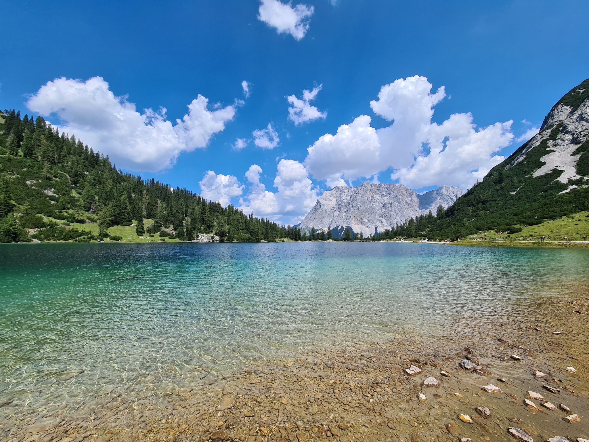
Hiking around Oeschinensee is defined by its glacial lake, encircled by towering peaks such as Blüemlisalp and Doldenhorn. The landscape features steep cliffs, snow-capped mountains, and lush alpine fields, with glacier-fed streams and waterfalls contributing to the natural environment. This region is recognized as part of the Swiss Alps Jungfrau-Aletsch UNESCO World Heritage Site.
Best bus station hiking trails around Oeschinensee
- The most popular bus station hiking route is Lake Oeschinen – Oeschinensee loop from Kandersteg, a 6.4 miles (10.3 km) trail that takes 3 hours 49 minutes to complete. This moderate route offers elevated views of the lake and surrounding mountains.
- Another top favourite among local hikers is Lake Oeschinen – Lakeside Trail at Lake Oeschinensee loop from Kandersteg, a moderate 5.3 miles (8.5 km) path. This trail follows the lake's edge, providing views of the glacial waters and surrounding peaks.
- Local hikers also love the Oeschibach River Trail – Panorama loop from Kandersteg, a 4.6 miles (7.4 km) trail leading through the Oeschibach River area with panoramic views, often completed in about 2 hours 30 minutes.
- Hiking around Oeschinensee is defined by its glacial lake, towering peaks, and alpine meadows, with trails that often feature waterfalls and dramatic rock formations. The network offers options for different ability levels, from easy walks to more challenging ascents.
- The routes in Oeschinensee are highly rated by the komoot community with an average score of 4.7 stars from over 1,800 reviews. More than 16,000 hikers have used komoot to explore Oeschinensee's varied terrain.
Last updated: June 29, 2026
4.7
(112)
460
hikers
10.3km
03:49
530m
530m
Moderate hike. Good fitness required. Mostly accessible paths. Sure-footedness required.
4.8
(28)
597
hikers
5.65km
01:55
300m
300m
Easy hike. Great for any fitness level. Easily-accessible paths. Suitable for all skill levels.

Sign up for free
5.0
(1)
8
hikers
3.85km
01:07
90m
90m
Easy hike. Great for any fitness level. Easily-accessible paths. Suitable for all skill levels.
4.9
(32)
277
hikers
12.9km
05:45
790m
790m
Hard hike. Very good fitness required. Sure-footedness, sturdy shoes and alpine experience required.
4.3
(7)
37
hikers
5.62km
01:45
190m
200m
Easy hike. Great for any fitness level. Easily-accessible paths. Suitable for all skill levels.
Get access to more routes and recommendations from other explorers.
Sign up for free
Already have an account?
Our route recommendations are based on thousands of hikes, rides, and runs completed by other people on komoot.
Start today with a free account
Your next adventure awaits.
Login or Signup
Popular around Oeschinensee
Other adventures around Oeschinensee

Tips from the Community

July 2026. The path from Waldhotel Doldenhorn is open, the other path from Oeschibach River Trail is damaged and NOT open. Steep paths, sheltered hike for most part by trees - shade from sun. 2 steep stream/waterfall crossings with cable hand rail to hold onto. Hutte is amazing at the border between sheltered woods and the raw open mountainside.
0
0


Deep in the secluded Gastern Valley, two distinctive mountain streams meet: the clear, tranquil Schwarzenbach and the more powerful Kander. The visible difference in color and current is particularly impressive and can be beautifully observed at their confluence. Surrounded by steep rock faces, ancient mountain forests, and the typical Gastern Valley stillness, this is a moment of nature that is both invigorating and calming – a little-known gem for anyone who loves wild river landscapes. 💧🌿📸✨
0
0

From Grüenewald, the Gastertal valley lies practically at your feet. Framed by striking peaks, you can see the Kander river winding its way through the valley. To the south, the steep north face of the Doldenhorn drops away, while to the west rises the Gross Lohner massif. Lined with light mountain forest, you'll be treated to breathtaking views at every turn.
1
0


Such a beautiful lake no matter the weather! More touristic than it was 10 years ago but understandably
0
0

There's no shortage of incredible views in the area, and this is certainly one of them!
0
0
Frequently Asked Questions
How many bus station hiking trails are available around Oeschinensee?
There are over 80 bus station hiking trails around Oeschinensee, offering a wide variety of options for all skill levels, from easy strolls to challenging alpine treks.
Are there family-friendly hiking trails accessible from bus stations near Oeschinensee?
Yes, many trails are suitable for families. For an easy option, consider the Simmenfälle – Oeschibach River Trail loop from Kandersteg, which is relatively short and has minimal elevation gain. The area around Lake Oeschinen itself offers gentle paths perfect for a family outing, and you can even rent a rowboat at Rowboat rental at Oeschinen Lake for added fun.
Can I bring my dog on these bus station hiking trails?
Oeschinensee is generally very dog-friendly, and most hiking trails accessible from bus stations welcome dogs. Always keep your dog on a leash, especially around livestock and wildlife, and be sure to carry enough water for both of you. The Lake Oeschinen – Lakeside Trail at Lake Oeschinen loop from Kandersteg is a popular choice for hikers with dogs.
What kind of natural features can I expect to see along these trails?
The trails around Oeschinensee are renowned for their stunning natural beauty. You'll encounter the vibrant turquoise Lake Oeschinen, towering peaks like Blüemlisalp, and numerous waterfalls cascading down the mountain slopes, such as the Waterfall at Lake Oeschinen. The region is also rich in mountain flora and offers chances to spot wildlife.
Are there any circular routes starting from bus stations?
Yes, circular routes are a great way to experience the diverse landscapes without retracing your steps. The Lake Oeschinen – Oeschinensee loop from Kandersteg is a fantastic moderate option that provides extensive views of the lake and surrounding mountains.
What is the best time of year to hike around Oeschinensee by bus?
The best time for hiking is typically from late spring (May/June) through early autumn (September/October). During these months, the trails are usually clear of snow, the weather is pleasant, and the alpine flora is in full bloom. The lake is also accessible for swimming at Swimming Spot at Oeschinen Lake and boating during the warmer months.
Are there challenging hikes accessible from bus stops for experienced hikers?
Absolutely. For those seeking a more strenuous adventure, the Oeschibach River Trail – Doldenhorn Hut loop from Kandersteg offers a significant elevation gain and a longer duration, leading to impressive alpine views. The Fründenschnur trail, while very challenging, is also in the area for highly experienced hikers.
What do other hikers enjoy most about hiking in Oeschinensee?
The area is highly rated by the komoot community, with an average score of 4.7 stars. Reviewers often praise the breathtaking turquoise lake, the dramatic mountain backdrop, and the well-maintained trails that offer stunning panoramic views. The accessibility via public transport is also frequently highlighted.
Can I find places to eat or rest along the bus station hiking trails?
Yes, there are several mountain huts and restaurants around Oeschinensee where you can rest and enjoy local cuisine. These establishments are often strategically located along popular hiking routes, providing convenient stops for refreshments and meals amidst the scenic landscape.
Are there any trails that offer panoramic views of the lake?
Many trails provide spectacular views of Lake Oeschinen. The Oeschibach River Trail – Panorama loop from Kandersteg is specifically designed to offer elevated perspectives and sweeping vistas of the lake and the surrounding peaks, making it a popular choice for photographers and view-seekers.
Most popular routes around Oeschinensee
Most popular attractions around Oeschinensee

Get inspired with the komoot mobile app


Explore more
Browse the best Hikes in other regions.
