The best hikes from bus stations around South Arran Marine Protected Area
4.6
(662)
5,202
hikers
18
hikes
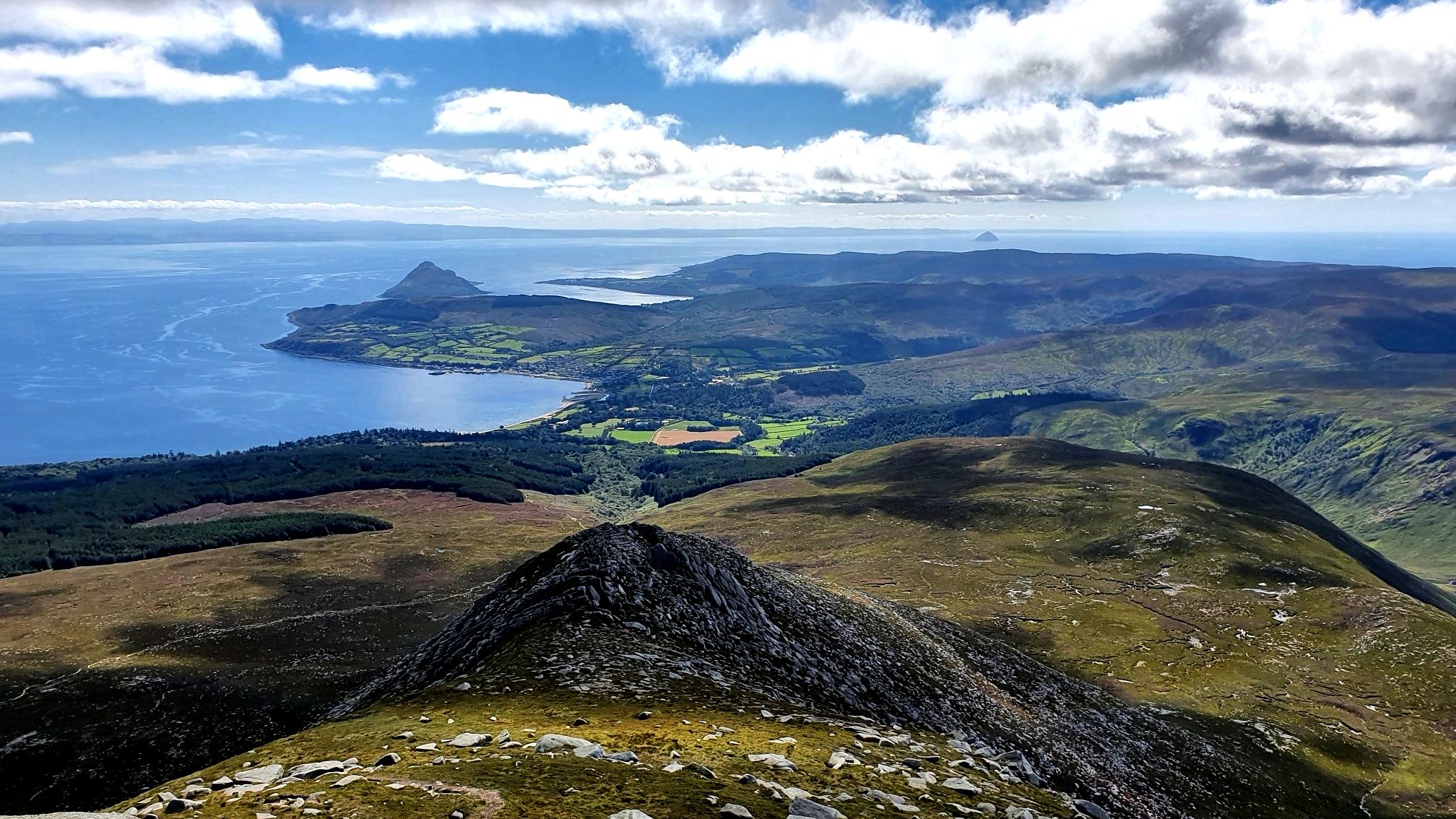
Bus station hiking trails around South Arran Marine Protected Area offer access to a diverse coastal landscape, characterized by rugged cliffs, serene beaches, and varied terrains including stony shores and forests. The region features panoramic viewpoints overlooking islands like Pladda and Holy Isle, alongside inland areas shaped by glacial activity with deep glens and mountains. This area provides a mix of coastal paths and routes leading to significant natural features.
Best bus station hiking trails around South Arran Marine Protected…
Last updated: July 12, 2026
4.9
(20)
120
hikers
Easy hike. Great for any fitness level. Easily-accessible paths. Suitable for all skill levels.
4.5
(11)
61
hikers
17.1km
04:35
200m
200m
Moderate hike. Good fitness required. Easily-accessible paths. Suitable for all skill levels.

Sign up for free
4.4
(10)
72
hikers
7.36km
01:56
60m
60m
Easy hike. Great for any fitness level. Easily-accessible paths. Suitable for all skill levels.
5.0
(3)
31
hikers
5.83km
01:37
100m
100m
Easy hike. Great for any fitness level. Easily-accessible paths. Suitable for all skill levels.
4.4
(5)
23
hikers
10.5km
03:03
280m
270m
Moderate hike. Good fitness required. Easily-accessible paths. Suitable for all skill levels.
Get access to more routes and recommendations from other explorers.
Sign up for free
Already have an account?
Our route recommendations are based on thousands of hikes, rides, and runs completed by other people on komoot.
Start today with a free account
Your next adventure awaits.
Login or Signup
Popular around South Arran Marine Protected Area
Other adventures around South Arran Marine Protected Area

Tips from the Community

There are a number of quite big caves, the biggest being Kings Cave with it's ornate ironwork at the entrance. There is evidence of human occupation and activity going back thousands of years.
0
0
Fine view across the bay to Drumadoon Sill with it's hill fort.
0
0
A fine view from the hill overlooking Machrie Bay, towards Mullach Buidhe.
0
0
A fine viewpoint towards the Kings Cave. The hillfort is quite rough ground but easily reached.
0
0
Just one of a number of stone circles in this ancient landscape.
0
0
The first stone circle, and beautifully presented.
0
0
This is a wonderfully atmospheric place especially when the skies are glowering!
0
0
Frequently Asked Questions
How many bus-accessible hiking trails are available around South Arran Marine Protected Area?
There are 18 bus-accessible hiking trails around the South Arran Marine Protected Area featured in this guide. These routes offer a variety of experiences, with 9 easy, 7 moderate, and 2 difficult options.
What do other hikers say about the trails around South Arran Marine Protected Area?
The trails in this area are highly regarded by the komoot community, boasting an average rating of 4.6 stars from 573 reviews. Hikers frequently praise the diverse coastal landscapes, panoramic views, and the convenience of accessing these routes via public transport.
Are there easy walks suitable for beginners from bus stops?
Yes, there are several easy walks perfect for beginners. For example, the King's Cave – The Doon Iron Age Fort loop from Blackwaterfoot is an easy 7.4 km route that starts conveniently from a bus stop and offers historical interest.
Are there any circular hiking routes accessible by bus?
Absolutely. Many of the bus-accessible routes are circular, allowing you to start and end at the same bus stop. A great option is the View of Glenashdale Falls – View of Holy Isle loop from Whiting Bay, which is an easy 6.2 km circular hike.
Are there any waterfalls accessible on bus-friendly hikes?
Yes, you can discover beautiful waterfalls on routes accessible by bus. The View of Glenashdale Falls – View of Holy Isle loop from Whiting Bay specifically takes you to a viewpoint of Glenashdale Falls, a notable natural feature on Arran.
What natural landmarks or attractions can I see on these bus-accessible trails?
The bus-accessible trails offer access to several fascinating landmarks. You can explore ancient sites like King's Cave, believed to have sheltered Robert the Bruce, or the nearby The Doon Hillfort. Many routes also provide stunning coastal views, such as the View of Holy Isle.
Are there family-friendly hiking options from bus stations?
Yes, the South Arran Marine Protected Area offers several family-friendly hikes that are easily reachable by bus. The easier routes, such as the View of Holy Isle – Viking Fort Viewpoint loop from Whiting Bay, are generally suitable for families, offering manageable distances and interesting sights.
Can I bring my dog on these bus-accessible hikes?
Many trails in the South Arran Marine Protected Area are dog-friendly. However, always keep dogs on a lead, especially near livestock or wildlife, and be mindful of local signage. The coastal paths and forest trails are generally suitable for well-behaved dogs.
What are some challenging hikes I can do from a bus stop?
While many bus-accessible routes are easy to moderate, there are options for those seeking a challenge. For a longer, more demanding hike, consider the King's Cave – Machrie Moor Standing Stones loop from Blackwaterfoot, a moderate 17 km route that combines coastal walking with historical sites.
When is the best time of year to hike the bus-accessible trails in South Arran?
The spring (April-May) and autumn (September-October) months are often ideal for hiking in South Arran, offering milder weather and fewer midges. Summer can also be pleasant, but trails may be busier. Winter hiking is possible but requires appropriate gear for potentially wet and windy conditions.
Are there places to eat or drink near the bus station trailheads?
Yes, many of the bus-accessible trailheads are located in or near villages like Whiting Bay and Blackwaterfoot, which offer local cafes, pubs, and shops where you can refuel before or after your hike. It's always a good idea to check opening times in advance, especially during off-peak seasons.
Most popular routes around South Arran Marine Protected Area
Most popular attractions around South Arran Marine Protected Area

Get inspired with the komoot mobile app


Explore more
Browse the best Hikes in other regions.
