The best family-friendly hikes and walks in Alessandria
4.5
(3253)
12,020
hikers
819
hikes
Family friendly hiking trails in Alessandria offer diverse landscapes, from rolling hills to forested paths. The region, situated in Piedmont, features varied terrain suitable for outdoor exploration. Hikers can find routes winding through vineyard landscapes and dense woodlands. Alessandria's proximity to the Monferrato Hills and the Ligurian Apennines provides a range of elevation and scenery.
Best family friendly hiking trails in Alessandria
- The most popular family friendly hiking route is Ponti and Castelletto d'Erro Loop, a 5.4 miles (8.6 km) moderate trail that takes 2 hours 43 minutes to complete. This route offers a balanced experience through the local landscape.
- Another top favourite among local hikers is Walking through the forests of Merana — Loop tour, a moderate 6.7 miles (10.8 km) path. This trail leads through varied forest terrain, providing a natural setting for a family outing.
- Local hikers also love the Walking through the vineyards from Rossiglione Monferrato — Ring tour, a 9.2 miles (14.8 km) trail leading through vineyard landscapes, often completed in about 4 hours 16 minutes.
- Hiking in Alessandria is defined by rolling hills, vineyard landscapes, and dense woodlands. The network offers options for different ability levels, including many family friendly routes.
- The routes in Alessandria are highly rated by the komoot community with an average score of 4.4 stars from more than 2,600 reviews. More than 9,800 hikers have used komoot to explore Alessandria's varied terrain.
Last updated: June 28, 2026
4.8
(21)
62
hikers
14.8km
04:16
380m
390m
Embark on a moderate ring tour through the UNESCO World Heritage vineyard landscapes around Rosignano Monferrato. This 9.2-mile (14.8 km) hike, with an elevation gain of 1248 feet (380 metres), typically takes around 4 hours and 16 minutes to complete. You will traverse gently rolling hills, expansive vineyards, and ancient woods, enjoying panoramic views of the Monferrato hills and, on clear days, the distant Alps. The route features varied terrain, including both paved and dirt roads, winding through green meadows and hazelnut groves, with some steeper climbs. You will experience the vibrant colors of the vineyards, from bright green in spring to fiery reds and oranges in autumn.
This popular hiking route around Rosignano Monferrato requires a good level of fitness and sure-footedness due to its varied terrain. The trail passes through charming, historic villages like Rosignano Monferrato, which are characterized by medieval architecture and Romanesque churches built with local "Pietra da Cantoni" stone. Many villages offer "balconies" or panoramic viewpoints, providing excellent spots to pause and take in the sweeping vistas. Consider visiting in spring or autumn to fully appreciate the seasonal beauty of the vineyards.
Beyond the natural beauty, this trail offers a deep dive into local culture and history. The region is renowned for its winemaking tradition, and you will find opportunities to experience local food and wine, including tastings at wineries. Explore historical sights such as medieval castles, churches, and unique "infernot"—underground cellars hand-carved into stone. The geological composition of the Monferrato area means you will encounter diverse landscapes, from softer slopes with silt and clay to steeper inclines where sands predominate.
4.7
(14)
42
hikers
16.9km
05:18
640m
640m
Embark on the difficult Laghi Lavagnina, Valico Eremiti — Ring Tour, a challenging 10.5-mile (16.9 km) hike with 2101 feet (640 metres) of elevation gain, typically taking around 5 hours and 18 minutes. This loop trail in Capanne di Marcarolo Natural Park offers a rich variety of landscapes, from picturesque waterside views around the Lavagnina Lakes to wild, rugged gorges carved by the Gorzente stream, complete with waterfalls and emerald-green pools. You will traverse unpaved, natural, and alpine paths, winding through fresh alder and willow groves, as well as pine and broadleaf forests, with some sections featuring rocky outcrops and uneven terrain.
To tackle this route, you need very good fitness, sure-footedness, sturdy shoes, and some alpine experience. While the initial part along the lower Lavagnina Lake can be less demanding, the trail quickly becomes more challenging with significant elevation changes and sometimes narrow, uneven paths. Expect to encounter large stones hidden by grass, loose scree, and exposed rock faces as you progress, requiring careful attention to your footing.
This trail is notable for its dramatic landscape contrasts, transitioning from tranquil lakeside environments to the wild gorges of the Gorzente stream. The area boasts rich biodiversity, with Mediterranean flora like tree heather and helichrysum, and diverse fauna including imperial ravens and peregrine falcons. Near Monte Tugello, you will find Cascina Brignoleto, a site of historical significance as a distribution center for the Resistance during World War II. The Valico Eremiti also serves as a strategic starting point for ascents to other peaks, such as Monte Tobbio.

Sign up for free
4.8
(15)
46
hikers
10.8km
03:39
520m
520m
Embark on the "Walking through the forests of Merana — Loop tour," a moderate hike that takes you through the diverse landscapes of the Sonoran Desert. This route covers 6.7 miles (10.8 km) with an elevation gain of 1711 feet (522 metres), typically taking around 3 hours and 38 minutes to complete. As you hike, you will encounter a mix of flat, sandy plains and rocky, steep climbs, all set against the backdrop of rugged mountain ranges and iconic saguaro cacti, including the unique Crested Saguaro. Keep an eye out for desert wildlife like Roadrunners and enjoy the expansive desert views.
To make the most of your visit, plan your hike during the spring or fall when temperatures are milder and more comfortable for exploring the desert. While this specific trail is rated moderate, the Marana area offers options for all skill levels. Many trails in this region are also dog-friendly, so your canine companion can join you on this adventure.
This loop offers an immersive Sonoran Desert experience, providing stunning scenery without the large crowds often found in bigger metropolitan areas. The region is known for its diverse flora and fauna, making it a prime location for nature observation. You'll appreciate the unique character of the Tortolita Mountains and the surrounding desert, which offers a true taste of Arizona's natural beauty.
4.7
(18)
31
hikers
6.65km
01:55
170m
170m
Embark on the Trisogli Chapel Loop from Lu, an easy hiking route that winds through the picturesque Monferrato region. This trail covers 4.1 miles (6.6 km) with a gentle elevation gain of 555 feet (169 metres), making it a comfortable journey for most. You can expect to complete the loop in about 1 hour and 54 minutes, enjoying views of rolling hills, lush vineyards, and the historic Chiesetta di Trisogli along the way.
This accessible route features a mix of asphalt, unpaved paths, and paved sections, suitable for nearly any fitness level. You will find it generally open and ready for exploration, with no specific warnings about road closures or permits mentioned. It is a great option if you are looking for a family-friendly outing or a dog-friendly walk in the area, offering a relaxed pace to enjoy the scenery.
The Trisogli Chapel Loop offers a glimpse into the natural beauty and cultural heritage of Monferrato, a designated UNESCO World Heritage Site. As you hike, you will appreciate the area's characteristic landscape, dotted with charming towns and showcasing its rich architectural history. The trail provides a rewarding view of Lu Monferrato, highlighting the region's unique blend of nature and tradition.
4.7
(13)
46
hikers
19.1km
05:34
490m
490m
Embark on the Valle Croce, Cavatore — Ring tour, a difficult 11.9 miles (19.1 km) hike that takes approximately 5 hours and 33 minutes to complete, featuring a substantial 1608 feet (490 metres) of elevation gain. This route guides you through an oak wood along a comfortable cart track, past former lavender fields, and up to Monte Capriolo. You will descend towards Cavatore on an asphalt road, eventually reaching the historic streets of the village, all while enjoying diverse scenery including vineyards and, on clear days, distant views of the Alpine arc.
To best experience the trail, consider visiting during the gorse blooming season when the yellow flowers are most vibrant. The route begins in Valle Croce near a farmhouse, and you will pass by the Animal Walk farm and the small San Sebastiano church before reaching Cavatore's municipal building. Clear days are ideal for enjoying the extensive panoramic views from various points along the trail, including the medieval village of Cavatore itself.
This trail is a significant segment of the larger "Anello delle Ginestre," or "Ring of the Gorse," named for the abundant gorse bushes that line its paths. It connects the thermal town of Acqui Terme with the medieval village of Cavatore, allowing you to explore both natural beauty and historical settlements. Don't miss the ancient tower in Cavatore, dating back to 1100, which offers an exceptional panoramic viewpoint, or the unique Animal Walk farm where you can see llamas and alpacas.
Get access to more routes and recommendations from other explorers.
Sign up for free
Already have an account?
Our route recommendations are based on thousands of hikes, rides, and runs completed by other people on komoot.
Start today with a free account
Your next adventure awaits.
Login or Signup
Popular around Alessandria

Family-friendly hikes around Parco naturale delle Capanne di Marcarolo

Family-friendly hikes around Lake della Lavagnina

Family-friendly hikes around Parco naturale del Sacro Monte di Crea

Family-friendly hikes in Riserva Naturale Del Boscone

Family-friendly hikes in Ghiaia Grande (Fiume Po)
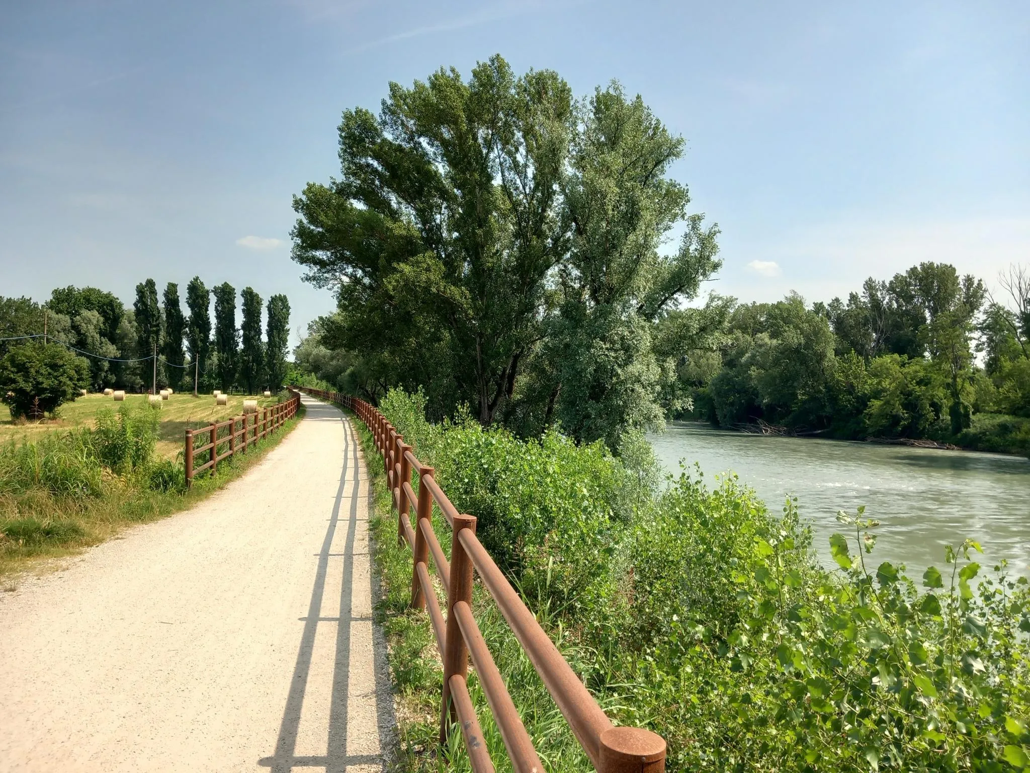
Via Postumia – Hike between the Tyrrhenian and Adriatic seas
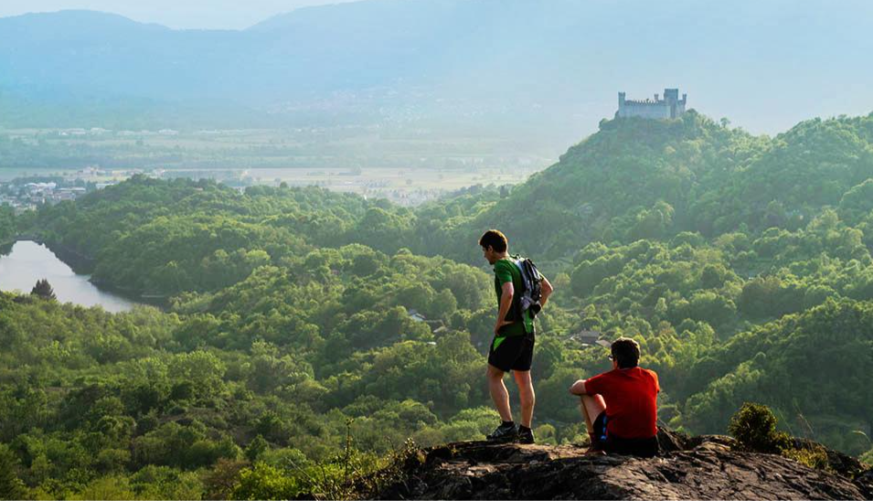
Car Free Piedmont – hiking face to face with nature

Devoto Cammino dei Sacri Monti – on the trail of the ancient pilgrims
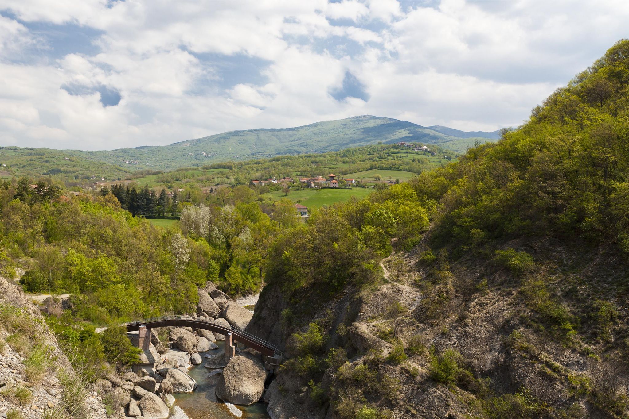
Revolutionary steps in Italy’s Borbera Valley – Cammino dei Ribelli
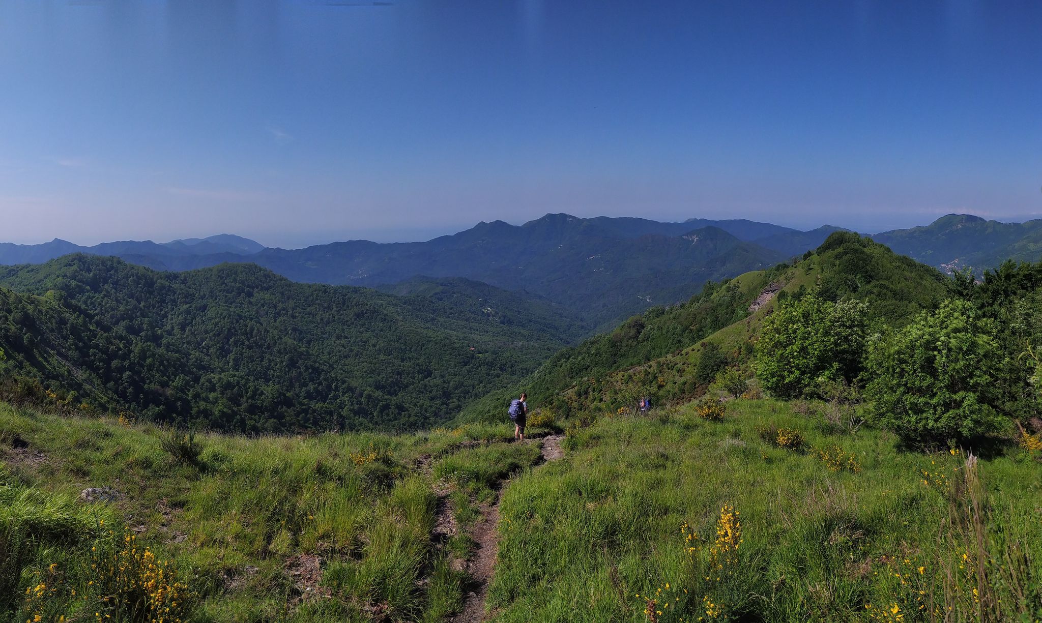
On the way to the sea – Italy’s Salt Road
Other adventures in Alessandria


Tips from the Community

it's called "Rosignano" Monferrato... Rossiglione is in the Ovada area
0
0

Very similar to the Ciciu di Villar, they look like large mushrooms with a stem made of earth and a stone cap
0
0
In May 2023 the giant bench was replaced by an old repainted boat, which also serves as a large bench where you can sit and admire the gullies and the panorama around Merana. It is located at a bend in an asphalted road
0
0

Municipality in the heart of Casalese Monferrato, famous for the production of Grignolino red wine
0
0

It is located on top of a hill south of Acqui Terme. It can be reached both by footpath and by asphalted road.
0
0
It is located south of Acqui Terme, and after Mount Stregone. There is a summit cross, which represents its highest point.
1
0
Excellent viewpoint a few steps from Rossiglione Monferrato.
1
0
Splendid panorama over the Piedmont hills and the vineyards.
1
0
Frequently Asked Questions
How many family-friendly hiking trails are available in Alessandria?
Alessandria offers a wide selection of outdoor adventures, with over 190 easy hiking routes that are generally suitable for families. In total, there are more than 680 hiking trails across various difficulty levels in the region.
What makes hiking in Alessandria suitable for families?
The Alessandria region provides diverse landscapes, from the gentle rolling hills of Monferrato with its vineyards to the more accessible parts of the Ligurian Apennines. Many trails feature clear paths, scenic views, and opportunities to explore nature, making them ideal for families with children of all ages. You'll find routes that are not overly strenuous, allowing for an enjoyable experience for everyone.
What is the best time of year for family hikes in Alessandria?
Spring and autumn are generally the most pleasant seasons for family hiking in Alessandria, offering mild temperatures and beautiful scenery, especially in the vineyard-covered Monferrato Hills. Summer can also be enjoyable, particularly in the higher elevations of the Apennines, but it's advisable to start early to avoid the midday heat. Winter hikes are possible on lower-altitude trails, but always check weather conditions.
Are there easy, short walks suitable for toddlers or very young children?
Yes, while specific toddler-focused routes aren't detailed, many of the easy trails in Alessandria can be adapted for shorter walks. Look for routes with minimal elevation gain and well-maintained paths. The region's gentle hills often provide accessible sections perfect for little legs.
Can I find circular routes for family hikes in Alessandria?
Absolutely. Circular routes are excellent for families as they bring you back to your starting point without needing to retrace your steps. An example is the Walking through the vineyards from Rossiglione Monferrato — Ring tour, which offers a scenic loop through the picturesque Monferrato hills.
What kind of terrain can we expect on family-friendly trails?
Family-friendly trails in Alessandria typically feature a mix of terrain. You'll often find well-trodden paths through vineyards and forests in the Monferrato Hills, as seen on the Walking through the forests of Merana — Loop tour. Some routes might include gentle ascents and descents, offering varied landscapes without being overly challenging. Expect natural surfaces, so sturdy shoes are recommended.
Are there family-friendly hikes with parking available?
Many trailheads in the Alessandria region, especially those outside urban centers, offer convenient parking options. When planning your family hike, it's always a good idea to check the starting point of your chosen route for specific parking information to ensure a smooth start to your adventure.
What interesting landmarks or natural features can we see along family-friendly routes?
The Alessandria region is rich in natural beauty and historical sites. Depending on your chosen route, you might encounter stunning views from peaks like Mount Antola, explore the unique vineyard landscapes of Monferrato, or discover charming villages. The La Bollente Hot Spring Fountain in Acqui Terme is another notable natural monument nearby.
Are there any routes that offer views of lakes or water features?
Yes, for families who enjoy water views, the region offers options. While some routes like the Laghi Lavagnina, valico Eremiti — Ring tour are more challenging, there are often easier sections or viewpoints around the Laghi Lavagnina that can be explored. Always check the difficulty to ensure it's suitable for your family.
What do other hikers enjoy the most about hiking in Alessandria?
The komoot community highly rates the hiking experiences in Alessandria, with an average score of 4.4 stars. Reviewers often praise the region's diverse landscapes, from the tranquil vineyards to the scenic forest paths, and the well-maintained trails that make for enjoyable outings. The sense of peace and natural beauty are frequently highlighted.
Are there any hidden gem family hikes in Alessandria?
While many trails are well-known, exploring the smaller villages and less-trafficked paths in areas like Merana or Ponti can reveal delightful 'hidden gems'. For instance, the Ponti and Castelletto d'Erro Loop offers a charming exploration of the local countryside away from the busiest spots, perfect for a family adventure.
Are there cafes or picnic spots along family-friendly routes?
Many family-friendly routes in Alessandria pass through or near charming villages where you can find local cafes or shops to grab a snack. Additionally, the natural parks and scenic viewpoints often feature designated picnic areas, such as near the summit of Monte Antola, allowing families to enjoy a packed lunch amidst beautiful surroundings.
Most popular routes in Alessandria
Most popular attractions in Alessandria

Get inspired with the komoot mobile app


Didn’t find what you were looking for?
Check out more Hikes throughout Alessandria below and find the perfect route in your destination.
Explore more
Browse the best Hikes in other regions.
