The best hikes from bus stations in Arizona
4.7
(6102)
77,692
hikers
142
hikes
If you've ever tried to plan hiking in Arizona, especially when you're looking to rely on public transport, you know how overwhelming the options can be. Sifting through countless trails to find the ones genuinely worth your time and accessible without a car can feel like a hike in itself. It's tough to tell the true highlights from the filler, and you want to make every step count.
That's where we come in. Our komoot community has mapped, walked, and…
Last updated: May 11, 2026
4.9
(163)
1,456
hikers
10.1km
04:33
630m
630m
The Bright Angel Trail offers a dramatic descent into the Grand Canyon, starting from the South Rim and winding through ancient geological layers. You'll experience a remarkable shift in scenery,…
42
hikers
3.57km
00:56
40m
20m
The Grand Canyon Greenway Trail offers a serene and accessible way to experience the iconic South Rim, winding through fragrant ponderosa and juniper forests before revealing breathtaking rim-side views of…

Sign up for free
4.5
(2)
13
hikers
32.0km
11:19
910m
980m
This challenging loop through Sabino Canyon offers a deep dive into the Sonoran Desert, combining the lush riparian corridor of Seven Falls with the exposed, panoramic views of the historic…
12
hikers
3.58km
01:35
0m
510m
The Hermit Trail to Santa Maria Spring offers a rugged and rewarding journey into the Grand Canyon's less-traveled depths. You'll descend through diverse geological layers, navigating loose rocks and eroded…
5.66km
01:25
0m
10m
The Grand Canal Trail offers a unique urban hiking experience, following an historic irrigation canal system through the Phoenix metropolitan area. You'll traverse a mix of paved and gravel surfaces,…
Get access to more routes and recommendations from other explorers.
Sign up for free
Already have an account?
Our route recommendations are based on thousands of hikes, rides, and runs completed by other people on komoot.
Start today with a free account
Your next adventure awaits.
Login or Signup
Popular around Arizona
Hikes from bus stations in Coconino County
Hikes from bus stations in Maricopa County
Hikes from bus stations in Pima County

Hikes from bus stations in Yavapai County

Hikes from bus stations in the Mollogon Rim

Hikes from bus stations in Mohave County

Grand Enchantment Trail — Slot canyons, spruce peaks & desert solitude

The Arizona Trail — From Mexico to Utah in 43 days
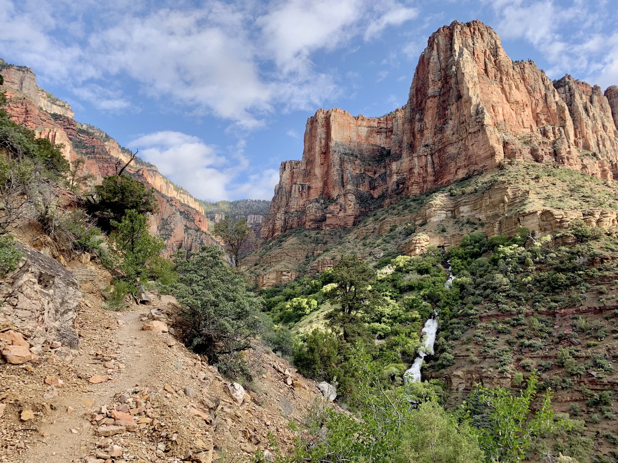
Rim-to-Rim-to-Rim – top to bottom through the Grand Canyon

Highline National Recreation Trail – The High Road around the Mogollon Rim
Other adventures in Arizona


Tips from the Community

Once you've descended past the tunnel, look up to your left to see some amazing petroglyphs, including very-detailed deer done in red, with beautiful antlers!
0
0
Unlike at the 3-mile resthouse, this resthouse does not have benches inside the shelter
0
0

Shuttles leave from here. For more info check out: https://www.fs.usda.gov/r03/coronado/recreation
1
0

This is a great rest stop or turnaround point on your run. Expect vault toilets and shade, and during the summer there's usually potable water here, too. Always check current conditions before you set out, though, because sometimes the water is turned off for maintenance projects. It's usually turned off during the winter, too.
0
0
Another great resting or turnaround point on the trail. This rest house offers vault toilets and shade. There's usually water available during the summer only (not during winter), but always double-check about current conditions before you go, because the water is sometimes turned off for maintenance projects.
0
0

Interesting tunnel that has been cut out of the rock. To add to the fun of passing through the tunnel, there are great canyon views on either side.
0
0

The tunnel is right after the entrance to the Bright Angel Trail, and there is a second one further down.
1
0

Please note that although there is water here it is not potable as is. If you plan on drinking water from this spring you will need to treat it before consuming. And as always when hiking in the Grand Canyon, take much more water than you think you'll need. Hiking back up when you're tired and thirsty is the hardest part.
0
0
Frequently Asked Questions
How many bus-accessible hiking trails are available in Arizona?
Arizona offers a wide variety of hiking trails accessible by bus, with over 130 routes available. These range from easy strolls to more challenging treks, ensuring options for all skill levels.
What is the best time of year to hike trails accessible by bus in Arizona?
Arizona's diverse climate means hiking is possible year-round, depending on the region. The cooler months from October to April are ideal for desert hikes around Phoenix and Tucson. For higher elevation trails, such as those near Flagstaff or the Grand Canyon, late spring through early fall (May to September) offers more pleasant conditions. Always check local weather forecasts before heading out.
Are there easy hiking options for beginners or families accessible by bus?
Yes, there are many easy bus-accessible trails perfect for beginners and families. For example, the Grand Canyon Greenway Trail offers a gentle path with stunning views. Another accessible option is the Grand Canal Trail, providing a flat, urban-friendly experience. Overall, over 69 easy routes are available.
What do other hikers say about bus-accessible trails in Arizona?
The bus-accessible trails in Arizona are highly rated by the komoot community, with an average score of 4.7 out of 5 stars from over 6,500 ratings. Hikers frequently praise the stunning natural beauty, the accessibility to iconic landscapes like the Grand Canyon and Sonoran Desert, and the variety of experiences available, from challenging climbs to serene desert walks.
Are there any loop trails accessible from bus stations in Arizona?
Yes, many bus-accessible routes in Arizona are designed as loop trails, offering a convenient way to experience the scenery without retracing your steps. These are great for exploring areas like Sedona's red rock country or parts of the Sonoran Desert. You can filter for loop trails on komoot to find options near bus stops.
Can I bring my dog on bus-accessible hiking trails in Arizona?
Dog policies vary by trail and park. While many trails in national forests and some state parks are dog-friendly (usually requiring leashes), national parks like the Grand Canyon have stricter rules, often limiting dogs to paved paths or specific trails. Always check the specific trail regulations before bringing your dog. Public transportation rules for pets also vary, so confirm with the bus service provider.
Are there any trails with waterfalls or unique water features accessible by bus?
While Arizona is largely a desert state, it does offer surprising water features. The Seven Falls Trail to Phoneline Trail, for instance, leads to a series of waterfalls, especially impressive after rainfall. Other areas like the Verde River or Saguaro Lake also offer opportunities for hikes near water, though direct bus access to specific waterfall trailheads might require some planning.
What kind of scenic viewpoints can I expect on bus-accessible hikes?
Arizona's bus-accessible trails offer breathtaking scenic viewpoints. You can experience the dramatic vistas of the Grand Canyon on trails like the Bright Angel Trail, or witness the iconic red rock formations of Sedona. The Sonoran Desert trails provide unique views of saguaro cacti forests and desert landscapes. Many routes are specifically chosen for their panoramic outlooks.
Are there any permits required for hiking bus-accessible trails in Arizona?
Most day hikes in Arizona do not require permits, especially on trails accessible by public transport. However, some specific areas, particularly within national parks or wilderness areas, might require entrance fees or permits for overnight stays. Always check the official website of the specific park or land management agency for the most up-to-date information before your trip.
What are some interesting natural attractions near bus-accessible hiking trails?
Near bus-accessible trails, you can find several natural attractions. For instance, the Papago Park Red Rock Formations offer unique geological sights. You might also encounter various mountain passes like Pass Mountain Trail or Sitgreaves Pass, which provide stunning views and challenging terrain. Many trails also lead to or pass by beautiful lakes such as Tempe Town Lake.
Are there any challenging or difficult bus-accessible hikes for experienced hikers?
Yes, Arizona offers challenging bus-accessible hikes for experienced adventurers. The Seven Falls Trail to Phoneline Trail is a difficult route with significant elevation changes. Another demanding option is the Hermit Trail to Santa Maria Spring, known for its steep descent into the Grand Canyon. In total, there are 13 difficult routes available.
Can I find cafes or facilities near bus-accessible trailheads?
In more urban areas or popular tourist destinations like the Grand Canyon Village, you'll often find cafes, restrooms, and other facilities conveniently located near bus stops and trailheads. For trails in more remote wilderness areas, facilities will be scarce, so it's essential to plan ahead and carry all necessary supplies. Always check the specific trailhead information for available amenities.
Most popular routes in Arizona
Most popular attractions in Arizona

Get inspired with the komoot mobile app


Didn’t find what you were looking for?
Check out more Hikes throughout Arizona below and find the perfect route in your destination.
Explore more
Browse the best Hikes in other regions.
