The best hikes from bus stations around Stetten am kalten Markt
4.6
(20854)
71,850
hikers
24
hikes
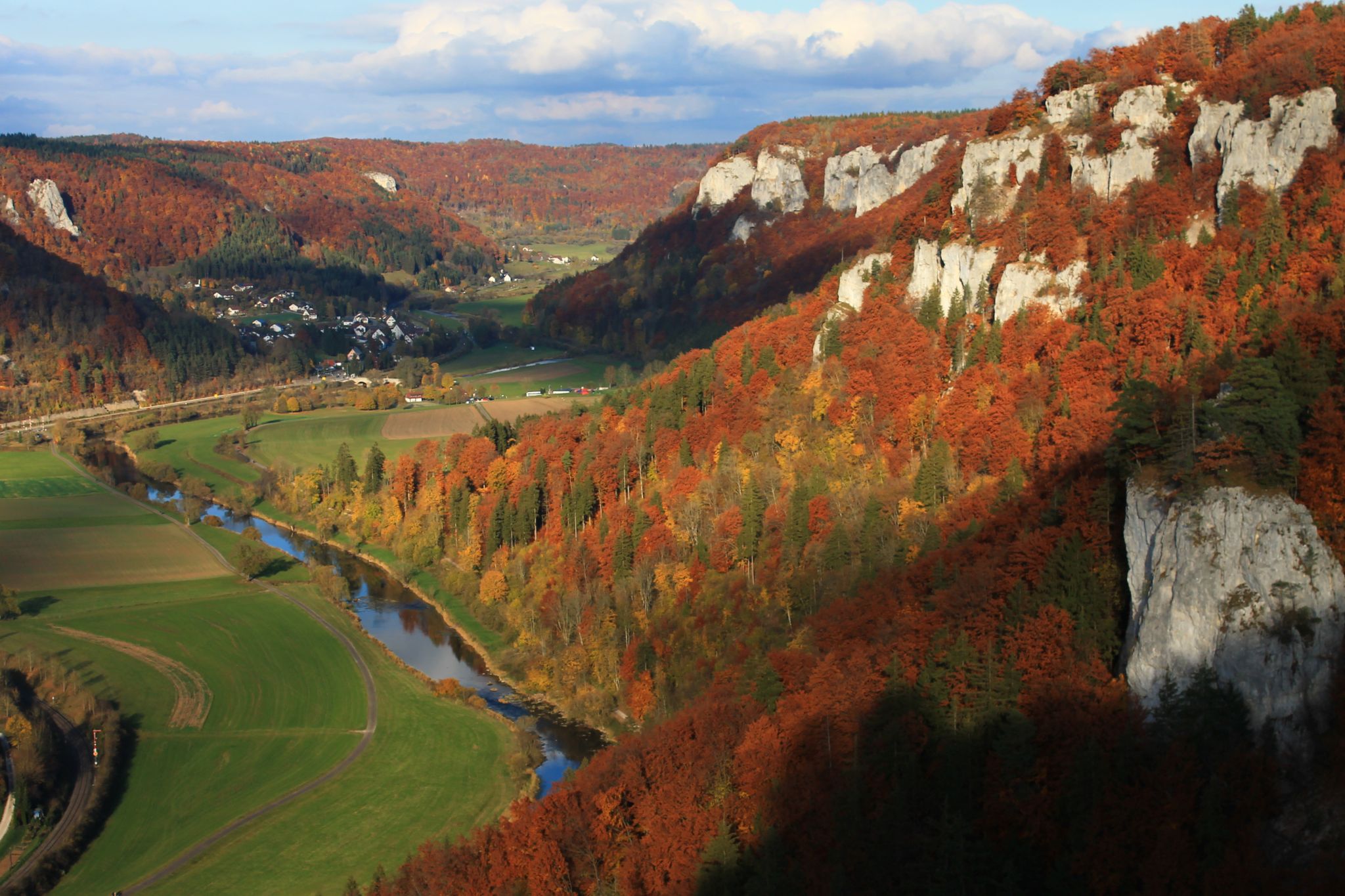
Bus station hiking trails around Stetten am kalten Markt are situated within the Upper Danube Nature Park, characterized by its elevated location and diverse landscapes. The region features gentle hills, dense forests, and river courses, including the Danube and Schmeie valleys. Notable geological formations like the Schaufelsen and Reiftal contribute to the varied terrain, offering views of the Swabian Alb.
Best bus station hiking trails around Stetten am kalten Markt
- The most popular bus station hiking route is Schmeie Valley…
Last updated: October 14, 2026
4.6
(41)
105
hikers
11.2km
03:08
210m
210m
Moderate hike. Good fitness required. Easily-accessible paths. Suitable for all skill levels.
4.1
(14)
54
hikers
Moderate hike. Good fitness required. Easily-accessible paths. Suitable for all skill levels.

4.3
(7)
24
hikers
4.77km
01:28
150m
150m
Easy hike. Great for any fitness level. Easily-accessible paths. Suitable for all skill levels.
4.6
(5)
15
hikers
10.9km
03:08
220m
220m
Moderate hike. Good fitness required. Mostly accessible paths. Sure-footedness required.
3.5
(4)
9
hikers
12.7km
03:41
300m
300m
Moderate hike. Good fitness required. Mostly accessible paths. Sure-footedness required.
Get access to more routes and recommendations from other explorers.
Already have an account?
Our route recommendations are based on thousands of hikes, rides, and runs completed by other people on komoot.
Start today with a free account
Your next adventure awaits.
Popular around Stetten am kalten Markt
Other adventures around Stetten am kalten Markt


Tips from the Community

Super viewpoint, one of the most beautiful highlights in the Danube Valley
0
0

Mega view from up there
0
0

The descent to the Stuhlfels is very alpine and I would only recommend it to experienced climbers, especially since the view is much more beautiful at other points.
1
1

See also http://germancavediving.de/mediapool/60/601543/data/2003_Frohnstetter_Wasserhoehle_VdHK_3_2003.pdf
0
0
Locals call this water cave "Brechfelsen" (Break Rock). They probably call it this because in the spring (when there was a lot of meltwater due to the weather), water would "break" out of a crevice in an arc.
0
0

The Jesus figure is not visible from the direction of the Albverein hut. You either have to climb onto the rock to see it from behind or walk around the bottom of the rock.
0
0
The path passes under the Albstadt Ebingen - Sigmaringen railway line. The Schmeie (Schmicha) river also flows along here. It's rarely used, as a narrow path follows the path further toward Storzingen.
0
0
A very well-maintained hut with outdoor facilities and a barbecue area. There are two benches nearby with beautiful views of the Schmeiental Valley.
0
0
Frequently Asked Questions
How many bus-accessible hiking trails are available around Stetten am kalten Markt?
There are over 20 hiking routes around Stetten am kalten Markt that are easily accessible by bus. These trails offer a range of experiences, from leisurely strolls to more challenging excursions through the diverse landscapes of the Upper Danube Nature Park.
Are there any easy or beginner-friendly hiking routes accessible by bus?
Yes, Stetten am kalten Markt offers several easy routes perfect for beginners or those seeking a relaxed walk. One such option is the Schmeie River – Jesus Statue on the Rock loop from Frohnstetten, which is an easy 4.7 km trail with moderate elevation changes, offering a pleasant experience.
What kind of landscapes can I expect on these bus station hiking trails?
The trails around Stetten am kalten Markt traverse a variety of picturesque landscapes. You'll encounter gentle hills, dense forests, and clear river courses, particularly along the Danube valley and the Swabian Alb. The region is known for impressive rock formations like the Schaufelsen and the dramatic Danube breakthrough, offering diverse natural beauty.
Are there any circular hiking routes that start and end near a bus stop?
Many of the routes accessible by bus are circular, allowing you to return to your starting point without retracing your steps. For example, the Schmeie Valley – Schmeie River loop from Frohnstetten is a moderate 11.2 km circular hike that explores the beautiful Schmeie Valley.
What are some scenic viewpoints or natural attractions I can discover on these hikes?
The region is rich in scenic viewpoints and natural attractions. You can explore the dramatic Danube Valley in the Upper Danube Nature Park, witness the unique rock formations at Amalien Rock, or discover the Inzigkofer caves and rock gate. Many routes offer impressive views of the Danube valley and the Swabian Alb.
Are there any family-friendly hiking options accessible by public transport?
While specific family-themed routes are not listed in the provided data, the region offers trails suitable for families. The "Wilde Welt" nature trail mentioned in the region research is a great option for children to learn about local flora and fauna. Look for the easier-rated trails, such as the Schmeie River – Jesus Statue on the Rock loop from Frohnstetten, which are generally more suitable for families.
What is the best time of year to go hiking from bus stations in Stetten am kalten Markt?
Stetten am kalten Markt benefits from a climatically favorable elevated location, offering pleasant temperatures in summer and autumn, and numerous fog-free sunny days. These seasons are ideal for hiking. The region also experiences dry, snowy winters, which can provide opportunities for winter hiking, though conditions should always be checked beforehand.
Are there any historical sites or landmarks along the bus-accessible hiking trails?
Yes, several routes lead to historical sites. The Danube-Zollernalb Trail, which passes through the Danube valley, leads past the impressive Falkenstein ruin. Wildenstein Castle is another significant attraction accessible via hiking trails, offering breathtaking views and insights into the region's history. The Devil's Bridge in Inzigkofen is also a unique historical landmark.
Can I find places for refreshments or rest stops along these routes?
Yes, the area around Stetten am kalten Markt offers options for refreshments. The Falkenstein ruin, for instance, features a fireplace for resting. Additionally, you can find huts and shelters like the Hossinger Leiter Shelter or the Teufelslochhütte Shelter and Grill Area, which provide good spots for a break.
What do other hikers enjoy most about the trails around Stetten am kalten Markt?
The hiking trails around Stetten am kalten Markt are highly rated by the komoot community, with an average score of 4.6 stars. Reviewers often praise the diverse natural beauty, the well-maintained paths, and the impressive viewpoints, especially those overlooking the Danube valley and the Swabian Alb.
Are there any longer, more challenging routes accessible by bus?
For those seeking a more challenging experience, there are several moderate routes available. The View of Hausen im Tal – Reiftal Trail loop from Glashütte is a moderate 12.7 km hike with significant elevation gain, offering a rewarding adventure through the region's varied terrain.
Most popular routes around Stetten am kalten Markt
Most popular attractions around Stetten am kalten Markt

Get inspired with the komoot mobile app


Explore more
Browse the best Hikes in other regions.
