The best hikes from bus stations around Aichtal
4.5
(628)
3,246
hikers
62
hikes
Bus station hiking trails around Aichtal offer access to a diverse landscape situated between Stuttgart and Tübingen. The region is characterized by the Aich river valley, which features tuberous marl slopes, meadows, and fruit orchards. Adjacent to the Schönbuch Nature Park, the area includes extensive forests, hills, and the nature-protected Schaich Valley with its riparian vegetation and lakes. Elevations range from approximately 295 meters to 498 meters, providing varied terrain for hikers.
Best bus station hiking trails around Aichtal
- The…
Last updated: June 28, 2026
4.4
(35)
145
hikers
21.0km
05:39
250m
250m
Hard hike. Very good fitness required. Easily-accessible paths. Suitable for all skill levels.
4.8
(33)
102
hikers
3.64km
00:58
30m
30m
Easy hike. Great for any fitness level. Easily-accessible paths. Suitable for all skill levels.

Sign up for free
4.4
(19)
67
hikers
4.95km
01:27
140m
140m
Easy hike. Great for any fitness level. Easily-accessible paths. Suitable for all skill levels.
4.6
(8)
55
hikers
Moderate hike. Good fitness required. Easily-accessible paths. Suitable for all skill levels.
4.9
(16)
71
hikers
7.93km
02:21
230m
230m
Moderate hike. Good fitness required. Easily-accessible paths. Suitable for all skill levels.
Get access to more routes and recommendations from other explorers.
Sign up for free
Already have an account?
Our route recommendations are based on thousands of hikes, rides, and runs completed by other people on komoot.
Start today with a free account
Your next adventure awaits.
Login or Signup
Popular around Aichtal
Other adventures around Aichtal

Tips from the Community

Small shelter near the bridge at the Schaich.
4
0

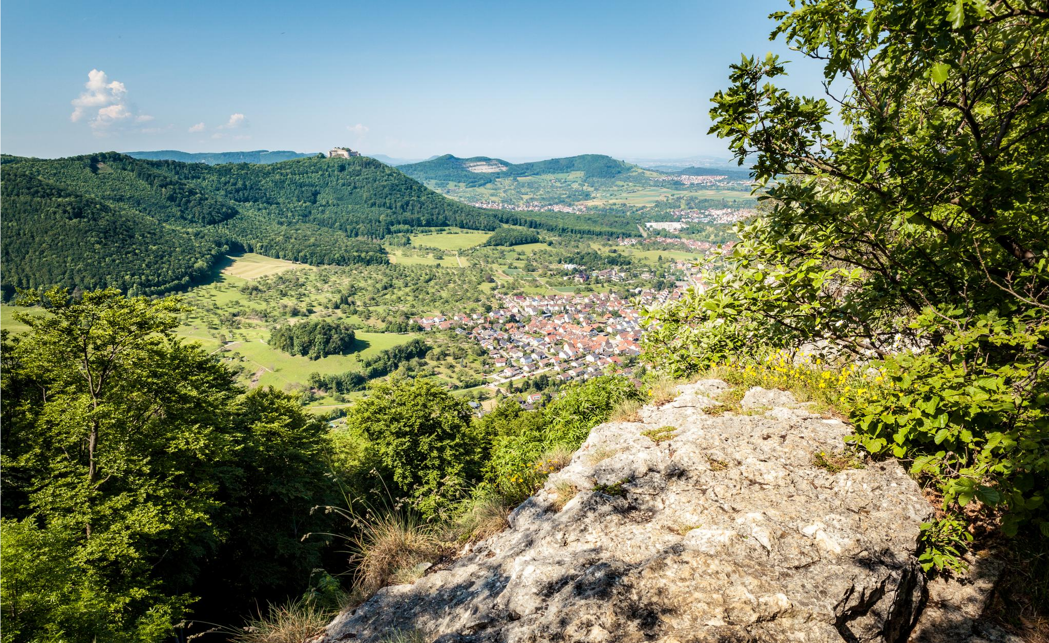
From this viewpoint, with good visibility, you can make out the Swabian Jura with the distinctive points from Hohenneuffen over Jusi, Floriansberg and Wackerstein to Reutlinger Georgenberg.
8
0

The museum is open again from today. Every 2nd Sunday of the month. Next opening in May - as April falls on Easter.
0
0

One of two vineyard cottages in the immediate vicinity
0
0
A striking tree right next to the parking lot
0
0
In commemoration of the prevention of a dam
0
0
When you start turning every gravel road into a highlight...
0
0
One of several spawning waters in the Schaich valley
0
0
Frequently Asked Questions
How many bus station hiking trails are available around Aichtal?
There are over 60 bus-accessible hiking trails around Aichtal, offering a wide range of options for all skill levels. You'll find everything from easy strolls to more challenging treks, all reachable by public transport.
What kind of landscapes can I expect on bus-accessible hikes in Aichtal?
Hikes around Aichtal, particularly those accessible by bus, often lead through the picturesque Aich and Schaich river valleys, featuring lush riparian vegetation, meadows, and fruit orchards. Many routes also border or enter the expansive Schönbuch Nature Park, known for its diverse forests and rolling hills.
Are there easy, family-friendly bus station hikes in Aichtal?
Yes, Aichtal offers many easy bus-accessible routes suitable for families. For example, the Schaichtal Shelter – Schaichtal Rescue Stone loop from Neuenhaus is an easy option, covering about 3.6 km. Another gentle route is the Uhlberg Tower – Fratzenweg loop from Aichtal, which is around 4.9 km and offers pleasant forest paths.
Can I find circular bus-accessible hiking routes in Aichtal?
Absolutely. Many of the bus-accessible trails in Aichtal are circular, allowing you to start and end your hike at the same bus stop. This guide specifically focuses on such routes, ensuring convenient public transport access for your entire journey.
Are there any challenging bus station hikes for experienced hikers?
For those seeking a more demanding experience, the Schlüssel Lake – Schaich Stream in the Schaich Valley loop from Neuenhaus is a difficult, 21 km route. It takes you through varied terrain in the beautiful Schaich Valley, offering a rewarding challenge for experienced hikers.
What natural attractions can I see along bus-accessible trails?
Many bus-accessible trails lead to or pass by notable natural features. You can explore the tranquil Schlüsselsee in the Schaich Valley, or discover other serene bodies of water like the Bürgerseen, Sulzbach Reservoir, and Steigweiher Pond. The region is also known for its diverse forest landscapes within the Schönbuch Nature Park.
Are there any viewpoints or landmarks accessible by bus-friendly hikes?
Yes, several routes offer scenic viewpoints and interesting landmarks. The Uhlberg Tower – Fratzenweg loop from Aichtal, for instance, takes you towards the Uhlberg Tower, which provides excellent panoramic views. Another route, the Carved Faces on Häfnerweg – Uhlberg Tower loop from Neuenhaus, also incorporates the Uhlberg Tower and passes by unique carved faces.
What do other hikers enjoy most about bus station hiking in Aichtal?
The bus-accessible hiking trails in Aichtal are highly regarded by the komoot community, with an average rating of 4.5 stars from over 570 reviews. Hikers frequently praise the region's diverse natural beauty, the well-maintained paths, and the convenience of reaching trailheads directly by public transport.
Are there any unique or themed bus-accessible hikes in the area?
Beyond general nature walks, Aichtal offers routes with unique themes. For example, the Alpaca Farm Schaber – Wengerthäusle Rest Spot loop from Neckartailfingen provides a distinctive experience, combining natural scenery with a visit near an alpaca farm. The region also features historical and nature trails, such as the 'Waldlehrpfad Betzenberg' (Forest Nature Trail Betzenberg), which offer educational insights into the local environment and history.
What is the best time of year for bus-accessible hiking in Aichtal?
Aichtal offers pleasant hiking experiences throughout much of the year. Spring brings blooming orchards and fresh greenery, while autumn showcases vibrant fall foliage in the forests. Summer is ideal for longer treks, and even mild winter days can be suitable for a crisp walk, especially on well-maintained paths.
Most popular routes around Aichtal
Most popular attractions around Aichtal

Get inspired with the komoot mobile app


Explore more
Browse the best Hikes in other regions.
