The best hikes from bus stations around Weilheim an der Teck
4.5
(2128)
9,023
hikers
64
hikes
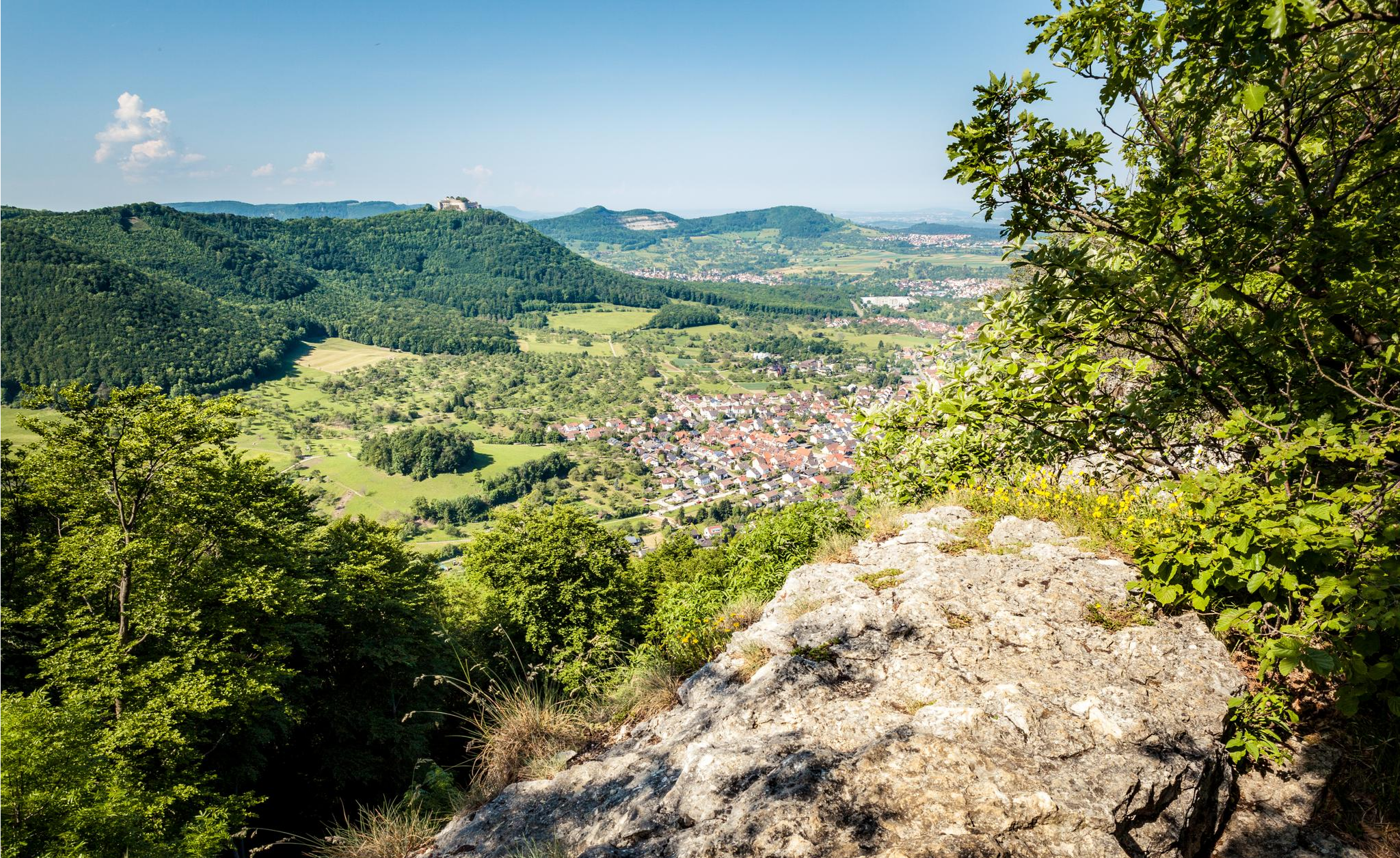
Hiking around Weilheim an der Teck offers access to the dramatic Swabian Alb Escarpment, characterized by steep inclines, forests, and expansive views. The region features diverse terrain, including the conical Limburg Mountain of volcanic origin, deep gorges, and dense woodlands. This landscape provides a variety of bus station hiking trails suitable for different skill levels.
Best bus station hiking trails around Weilheim an der Teck
- The most popular bus station hiking route is Mondhäge – Limburg Viewpoint loop from Weilheim…
Last updated: July 11, 2026
4.8
(72)
380
hikers
5.17km
01:35
190m
190m
Easy hike. Great for any fitness level. Easily-accessible paths. Suitable for all skill levels.
4.9
(28)
179
hikers
29.0km
08:30
710m
710m
Hard hike. Very good fitness required. Mostly accessible paths. Sure-footedness required.

Sign up for free
4.7
(22)
85
hikers
Moderate hike. Good fitness required. Easily-accessible paths. Suitable for all skill levels.
4.6
(43)
86
hikers
5.78km
01:31
50m
50m
Easy hike. Great for any fitness level. Easily-accessible paths. Suitable for all skill levels.
4.7
(16)
61
hikers
Easy hike. Great for any fitness level. Easily-accessible paths. Suitable for all skill levels.
Get access to more routes and recommendations from other explorers.
Sign up for free
Already have an account?
Our route recommendations are based on thousands of hikes, rides, and runs completed by other people on komoot.
Start today with a free account
Your next adventure awaits.
Login or Signup
Popular around Weilheim an der Teck
Other adventures around Weilheim an der Teck

Tips from the Community

Quiet pond with a bench in the shade, ideal for a short break during your hike, with beautiful nature and little hustle and bustle.
5
0
Perfect stopover on a hike with a playground, barbecue area and shady beer garden in the forest, ideal for a relaxing break.
5
0
In autumn particularly impressive with the vineyards 🍇🍂
3
0

Beautiful circular route around the Egelsberg.
0
0

The Boßler is a prominent mountain in the Swabian Alps near Gruibingen, rising to 794.7 meters above sea level. From its vantage point on the edge of the Alb plateau, a sweeping view opens up across the Alb foothills – on a clear day, this extends far to the west. A large memorial cross also stands here, commemorating several tragic aircraft crashes that have occurred in the region since the 1940s.
4
0
The Boßlerhaus, a nature lovers' lodge, is picturesquely situated on the northern edge of the Swabian Alb, at an altitude of 785 meters above sea level, between the idyllic villages of Gruibingen and Weilheim. From here, one has a magnificent panoramic view of the Three Emperor Mountains and the landscape in front of the Swabian Alb.
4
0
Great trail with amazing views. Watch out for hikers.
1
0

Wonderful view of the Reußenstein.
2
0
Frequently Asked Questions
How many bus station hiking trails are available around Weilheim an der Teck?
There are over 60 hiking trails accessible from bus stations around Weilheim an der Teck, offering a wide range of options for exploring the region.
What kind of difficulty levels can I expect on these bus-accessible trails?
The trails cater to various fitness levels. You'll find a wide selection of easy routes, with 48 trails suitable for beginners or leisurely walks. For those seeking more challenge, there are 15 moderate trails and 3 difficult routes that offer more strenuous climbs and longer distances.
Are there any circular hiking routes accessible from bus stops?
Yes, many of the trails accessible by bus are circular, allowing you to start and end your hike at the same bus stop without needing to retrace your steps. These circular routes vary in length and elevation, with options ranging from 2.2 to 11.9 km and elevation changes from 65 to 315 meters.
What natural landmarks or viewpoints can I discover on these hikes?
The region around Weilheim an der Teck is rich in natural beauty and offers several notable landmarks. You can hike to the prominent Limburg Mountain, a distinctive conical peak of volcanic origin, or visit the Breitenstein Viewpoint for impressive panoramic views of the Swabian Alb escarpment. The area also features diverse forests, deep gorges, and even moorland areas like the Schopflocher Moor Boardwalk.
Are there any family-friendly hiking options from bus stations?
Yes, the region offers several child-friendly routes. Many of the easy trails are suitable for families, providing playful exploration opportunities. Look for routes with shorter distances and minimal elevation gain, such as the Lower Egelsberg Trail – Naberner Lake loop from Weilheim an der Teck, which is under 5 km with very little ascent.
What is the best time of year to go hiking from bus stations in Weilheim an der Teck?
Spring and autumn are particularly recommended for hiking, as the forests display vibrant colors or awaken from winter, offering stunning scenery. Even in summer, numerous shady paths provide a pleasant respite from the heat, making it possible to enjoy hikes year-round. Winter can also be beautiful, especially after snowfall, though some paths might be more challenging.
Can I find any waterfalls or caves along the bus-accessible trails?
Yes, the region features interesting geological formations. You can find the Neidlingen Waterfall, which is a beautiful natural sight. Additionally, there are several caves to explore, such as the Sibyllenloch Cave beneath Teck Castle and the Falkensteiner Cave, offering unique natural experiences.
Are there any historical sites or castles to see on these hikes?
Absolutely. The area is dotted with historical sites. You can visit Teck Castle, a prominent landmark, or explore the ruins of Reußenstein Castle. Another interesting ruin is the Rauber Ruins. Many trails offer views of these historic structures, such as the View of Hohenneuffen Castle – Naberner Lake loop from Weilheim an der Teck.
What do other hikers enjoy the most about hiking in Weilheim an der Teck?
The area is highly rated by the komoot community, with an average score of 4.6 stars from nearly 2,000 reviews. Hikers often praise the diverse landscapes, the well-maintained and clearly signposted trails, and the stunning panoramic views from the Swabian Alb escarpment. The accessibility via public transport is also a frequently appreciated aspect.
Are there any longer, more challenging bus-accessible routes for experienced hikers?
Yes, for experienced hikers seeking a challenge, there are longer and more demanding routes. An example is the View of Neidlingen Valley – View of Reußenstein Castle loop from Neidlingen, which covers nearly 30 km with significant elevation changes, leading through varied terrain and offering expansive views.
How well are the hiking trails signposted in the Weilheim an der Teck region?
The region boasts an extensive and well-signposted trail network. There are 13 hiking information boards installed at hiking parking lots within the Weilheim and Hepsisau areas, and circular hiking trails are marked with blue and white numbered signs for clear orientation, ensuring you can easily navigate and enjoy the natural beauty.
Most popular routes around Weilheim an der Teck
Most popular attractions around Weilheim an der Teck

Get inspired with the komoot mobile app


Explore more
Browse the best Hikes in other regions.
