The best traffic-free bike rides around Unterspreewald
4.5
(1039)
3,204
riders
13
rides
No traffic touring cycling routes around Unterspreewald traverse a landscape defined by its intricate network of rivers, canals, and lush forests, part of the UNESCO Spreewald Biosphere Reserve. The region features generally flat topography, making it well-suited for touring cyclists of all fitness levels. Extensive, well-maintained cycle paths often follow waterways and wind through meadows and woodlands, offering a tranquil experience.
Best no traffic touring cycling routes around Unterspreewald
- The most popular no traffic touring cycling route is Gulaschkanone Snack Bar – Swan Mural in Alt Schadow loop from Neuendorfer Seewiesen, a 7.0 miles (11.3 km) trail that takes about 42 minutes to complete, offering an easy ride through the natural surroundings.
- Another top favourite among local touring cyclists is View of the Spree Landscape – View of the Dahme River loop from Sölla, a difficult 31.1 miles (50.1 km) path that explores the Spree and Dahme river landscapes over approximately 3 hours.
- Local touring cyclists also love the Bridge over the Spree – View of the Spree Landscape loop from Neu Lübbenau, a 32.7 miles (52.6 km) trail leading through the Spree landscape, often completed in about 3 hours 22 minutes.
- Touring cycling around Unterspreewald is defined by its labyrinthine waterways, lush forests, and flat terrain. The network offers options for different ability levels, from easy loops to more challenging long-distance routes.
- The routes in Unterspreewald are highly rated by the komoot community with an average score of 4.5 stars from over 600 reviews. More than 2000 touring cyclists have used komoot to explore Unterspreewald's varied terrain.
Last updated: October 14, 2026
4.9
(7)
23
riders
52.8km
03:11
210m
210m
Hard bike ride. Good fitness required. You may need to push your bike for some segments of this route.
4.6
(5)
16
riders
18.8km
01:11
80m
80m
Easy bike ride. Great for any fitness level. Mostly paved surfaces. Suitable for all skill levels.

5.0
(1)
15
riders
50.4km
02:58
100m
100m
Hard bike ride. Good fitness required. You may need to push your bike for some segments of this route.
4.4
(12)
11
riders
53.3km
03:25
200m
200m
Moderate bike ride. Good fitness required. Mostly paved surfaces. Suitable for all skill levels.
4.0
(3)
7
riders
52.7km
03:10
170m
170m
Moderate bike ride. Good fitness required. Mostly paved surfaces. Suitable for all skill levels.
Get access to more routes and recommendations from other explorers.
Already have an account?
Our route recommendations are based on thousands of hikes, rides, and runs completed by other people on komoot.
Start today with a free account
Your next adventure awaits.
Popular around Unterspreewald
Other adventures around Unterspreewald

Tips from the Community

Simply perfect, enjoy the moment.
0
0

Wonderful cycle path through the pine forest and even if you go off the path sometimes, simply wonderful 👍👍👍
1
0

The Storkow region is home to rare salt marshes, among the largest of their kind in Europe. You can discover this unique natural phenomenon on the Salt Trail. From the eight-meter-high observation tower in the Marschallwiesen, you'll have a sweeping view of the landscape – ideal for observing cranes and many other bird species in their natural habitat.
1
0

A great lake for swimming. Very clear water. The bike path along the western shore is mostly well-paved.
0
0

Anyone walking or driving across the bridge here should stop. Not because of the traffic – but for the view. The Spree opens up like a tranquil mirror between forests, reeds, and hidden boat docks. Sometimes covered in water lilies, sometimes clear as glass. And the most beautiful thing: it changes with every weather. Alt Schadow doesn't have a riverside promenade, but it does have that one moment that feels like a vacation – without a selfie stick. If you're in a hurry, you'll miss something. If you stop, you'll understand what a river landscape means.
0
0
This simple yet charming pedestrian bridge marks one of the most beautiful crossings of the Spree south of Neuendorf am See – a place that doesn't impose itself loudly, but quietly seduces. Ideal for hikers seeking the water and for paddlers who trust the river's flow. For hikers: The bridge is a hub on regional walking and hiking trails – those coming from the center of Neuendorf will encounter an almost meditative scenery: reflective water, wide meadows, gently rustling willows. Particularly rewarding at sunrise or in the evening hours, when the sky and landscape merge into one. For canoeists: From a kayak, the bridge appears almost sculptural. It spans the Spree with a gentle sweep, signaling: Here the river flows gently, but not without depth. A good opportunity for a rest, as there are shallow spots along the bank for landing. If you like, you can dock briefly and climb the few steps up to the bridge – the view is worth it.
0
0

Beautiful view over the water
0
0

Great bike path through the forest!
0
0
Frequently Asked Questions
How many no traffic touring cycling routes are available in Unterspreewald?
There are 18 dedicated no traffic touring cycling routes in Unterspreewald, offering a variety of experiences for cyclists. These routes are designed to keep you away from busy roads, allowing you to immerse yourself in the region's natural beauty.
What are the difficulty levels of the no traffic touring routes in Unterspreewald?
The routes cater to various fitness levels. You'll find 11 easy routes, 3 moderate routes, and 4 more challenging routes. The generally flat topography of Unterspreewald makes it accessible for most cyclists, with elevation gains typically being very gentle.
What kind of terrain can I expect on these no traffic cycling routes?
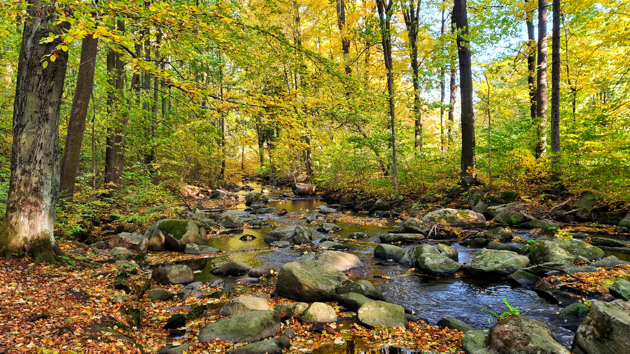
Unterspreewald is characterized by its generally flat topography, making it ideal for touring cycling. The routes often follow well-maintained, paved cycle paths that wind through lush green meadows, rustic forests, and alongside the region's intricate network of rivers and canals. You'll experience a unique 'water world' landscape.
Are there any circular no traffic cycling routes in Unterspreewald?
Yes, many of the no traffic touring routes in Unterspreewald are designed as loops, allowing you to start and end at the same point. For example, the route Gulaschkanone Snack Bar – Swan Mural in Alt Schadow loop from Neuendorfer Seewiesen offers a pleasant circular ride.
What natural features can I expect to see along the no traffic cycling routes?
The routes often pass through the UNESCO Spreewald Biosphere Reserve, offering views of labyrinthine waterways, dense forests, and the unique Spreewald Pond Landscapes. You might spot diverse wildlife such as cranes, beavers, or black storks. Highlights include the View of the Inselteich on the Gurkenradweg and the tranquil South Shore of Lake Köthener.
Are there any viewpoints along the no traffic cycling routes in Unterspreewald?
Yes, several routes offer opportunities to reach observation points with panoramic views. The Wehlaberg Observation Tower, the highest point in the UNESCO Spreewald Biosphere Reserve, provides expansive vistas of the region's unique landscape.
Can I bring my dog on these no traffic cycling routes?
Many of the no traffic cycling paths in Unterspreewald are suitable for cycling with dogs, provided they are well-behaved and kept on a leash. The quiet, car-free nature of these routes makes them generally safer and more enjoyable for pets. Always ensure your dog is comfortable with the distance and terrain.
Are there family-friendly no traffic cycling routes in Unterspreewald?
Absolutely. The flat terrain and extensive network of well-maintained, car-free paths make Unterspreewald an excellent destination for family cycling. Many easy routes are perfect for children and beginners, allowing everyone to enjoy the scenic beauty safely.
What is the best time of year to cycle the no traffic routes in Unterspreewald?
Spring and autumn are particularly beautiful for cycling in Unterspreewald. In spring, the landscape awakens with lush greenery, while autumn offers stunning foliage colors. The weather during these seasons is generally mild and pleasant for longer rides. Summer is also popular, but can be warmer.
What do other touring cyclists enjoy most about cycling in Unterspreewald?
The komoot community highly rates the touring cycling experience in Unterspreewald, with an average score of 4.5 stars from over 680 ratings. Reviewers often praise the region's tranquil, car-free paths, the unique 'water world' scenery, and the opportunity to spot diverse wildlife in a peaceful setting.
Are there any charming villages or towns to visit along the no traffic cycling routes?
Yes, the routes often connect picturesque villages and towns. You can cycle to places like Schlepzig, known for its brewery and Bauernmuseum, or Lübben, with its castle island and inviting old town. These offer great opportunities for breaks and cultural experiences.
Where can I park my car if I want to cycle a no traffic route in Unterspreewald?
Many starting points for cycling routes in Unterspreewald, especially near popular towns and villages like Lübben or Schlepzig, offer designated parking areas. It's advisable to check local parking options for your chosen starting point beforehand.
Can I access these no traffic cycling routes using public transport with my bike?
Unterspreewald is generally well-connected by public transport, and many regional trains and buses allow bikes, often for an additional fee. This can be a convenient way to reach the starting points of the no traffic routes, especially if you plan a one-way trip or want to explore different sections of the region.
Most popular routes around Unterspreewald
Most popular attractions around Unterspreewald

Get inspired with the komoot mobile app


Explore more
Browse the best Cycling routes in other regions.
